
Denver Weather: Severe storm threat includes chance of damaging hail and tornadoes

Friday will be cooler, with potentially severe thunderstorms arriving in the afternoon. With these storms comes a risk of damaging hail and wind, so a good idea to have your garden covers ready.
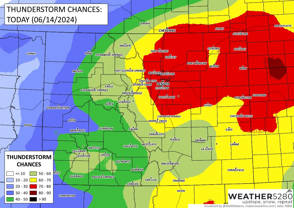
Here is the overall look at the odds of getting a thunderstorm today.
From that, the areas with the higher risk of damaging storms is here in the yellow shaded region, which does include most of the metro locations.
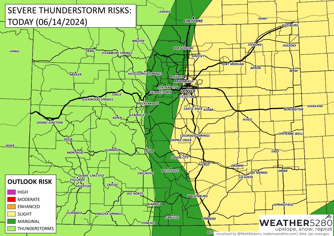
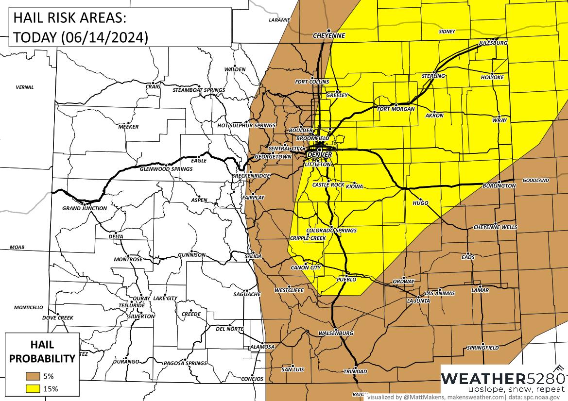
So, anyone east of the mountains may have a rather powerful thunderstorm today, but as far as the risk of hail, here are the odds of receiving some severe hail, the higher risk also covers most of the metro locations.
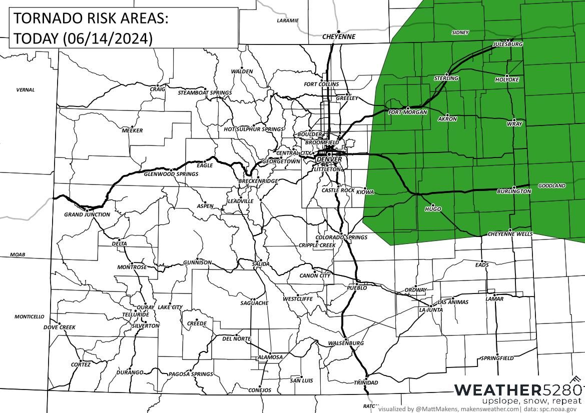
In terms of tornadoes, a 2% risk day (sounds low but isn't) covers those east of the cities.
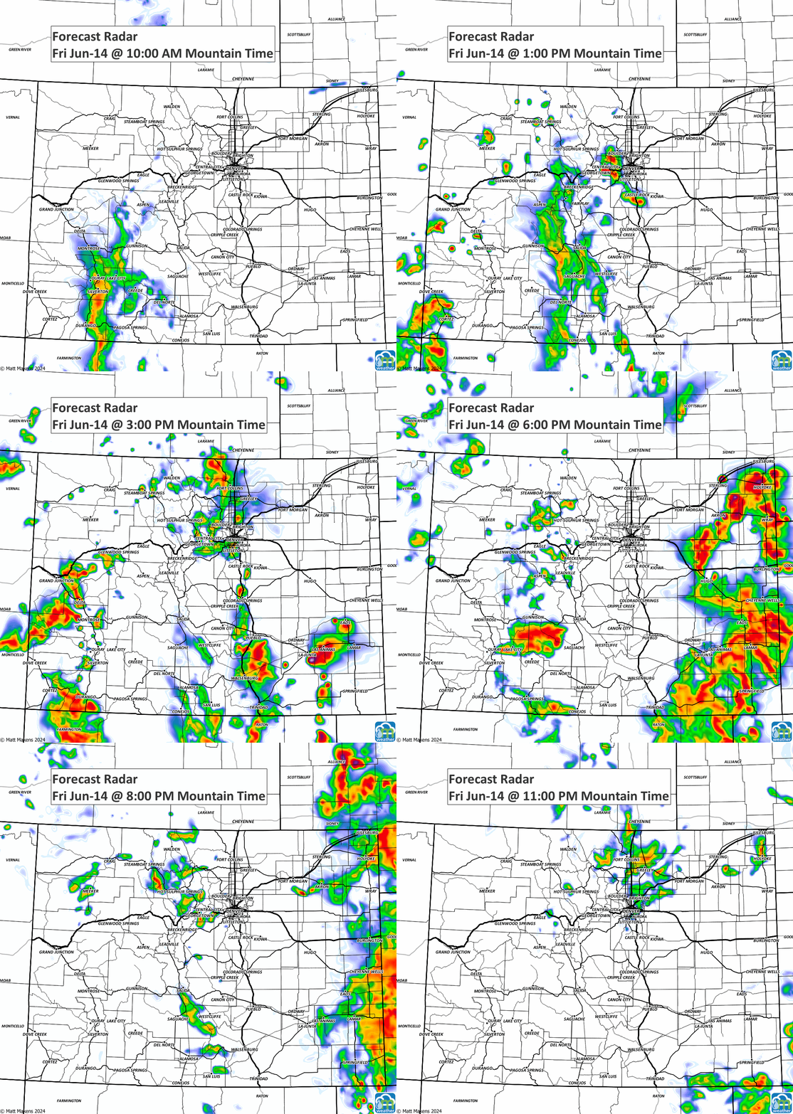
Okay, we are prepped for how strong the storms can be...when? Here's an animation walking you through the day. For Denver, we can see storms popping around and after lunch through the afternoon, plus a secondary batch of storms this evening is possible. I know, I know, the concerts tonight - hopefully the second batch of storms does not materialize.
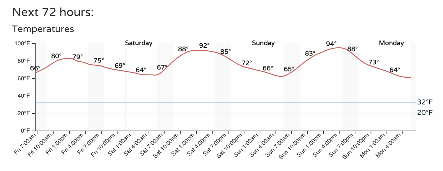
Okay, I'll wrap up with a mention about temperatures. Today we cool and stay in the 80s. Yesterday, Denver came close to a record high, and Colorado Springs set one by hitting 97°. We may be cooler today, but near record to record-setting heat returns this weekend. Here's a timeline:
Have a great Friday and weekend.
