
Denver weather: Severe weather develops, watch may be issued this afternoon

UPDATE: As of 3pm, thunderstorm development is increasing and there is consideration for a severe thunderstorm watch issuance for the metro areas. Conditions are being watched closely to see if any alerts need be issued.
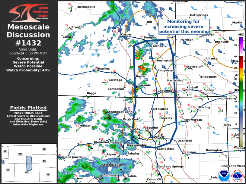
ORIGINAL POST: Tuesday hit 100°, the first triple digits since August 2022, but today cools slightly and you'll see more thunderstorms, some damaging with large hail, wind, and heavy rainfall.

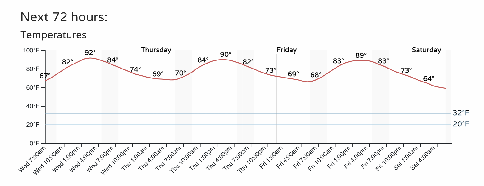
Today's highs will be closer to the lower and middle 90s. Here's an hourly timeline of the temperatures today through Friday which shows warm overnights near 70° and afternoons near 90°.
Now, let's take the same timeline but switch out temperatures for rain chances. You'll see an increase today, but a higher chance comes Thursday. Still, there's no guarantee you will get rainfall into your gauge, but you will see storms floating by.

Let's focus just today, and you'll see how Denver's lower chance for storms is unique to the Front Range and Plains, where we have higher chances for thunder today.
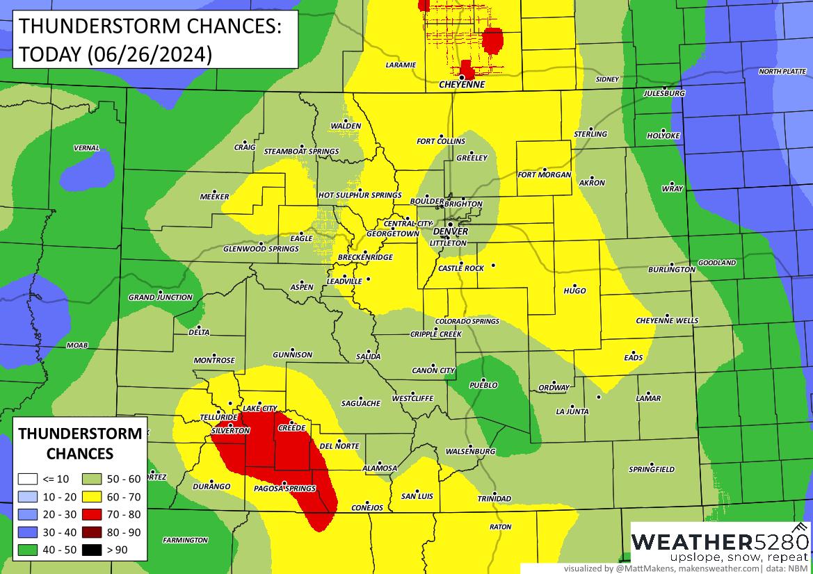
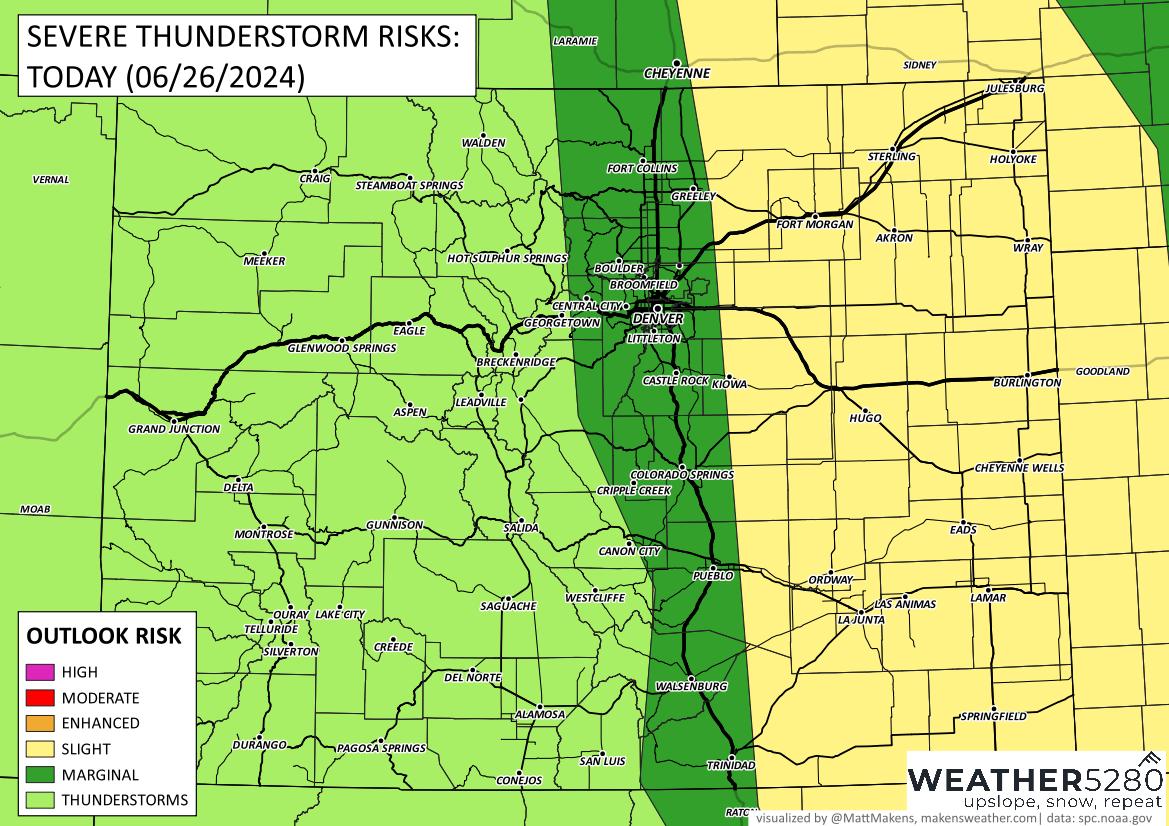
Of these storms, there are different risks. For the San Juans in Southwest Colorado, flooding is possible. Isolated flooding is possible for the metro area and Plains, too, but we have to worry about more than just heavy rain.
For those storms from the cities to the Plains, watch out for hail and wind! Isolated tornadoes are also possible today. Overall, the entire eastern portion of the state has a higher risk of seeing damaging weather today, especially as those storms roll just east of I-25.
Speaking of storms rolling to the east, here's an animation showing possible times/placement of today's rain.
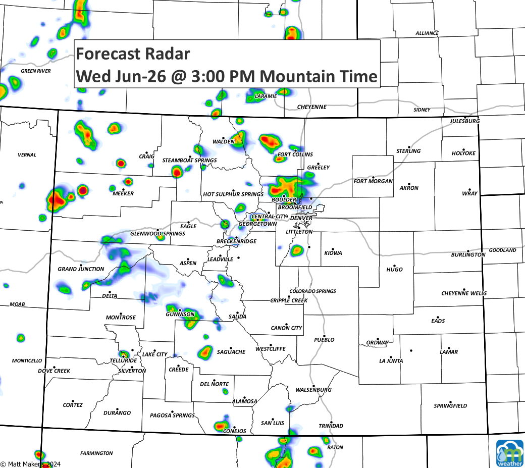
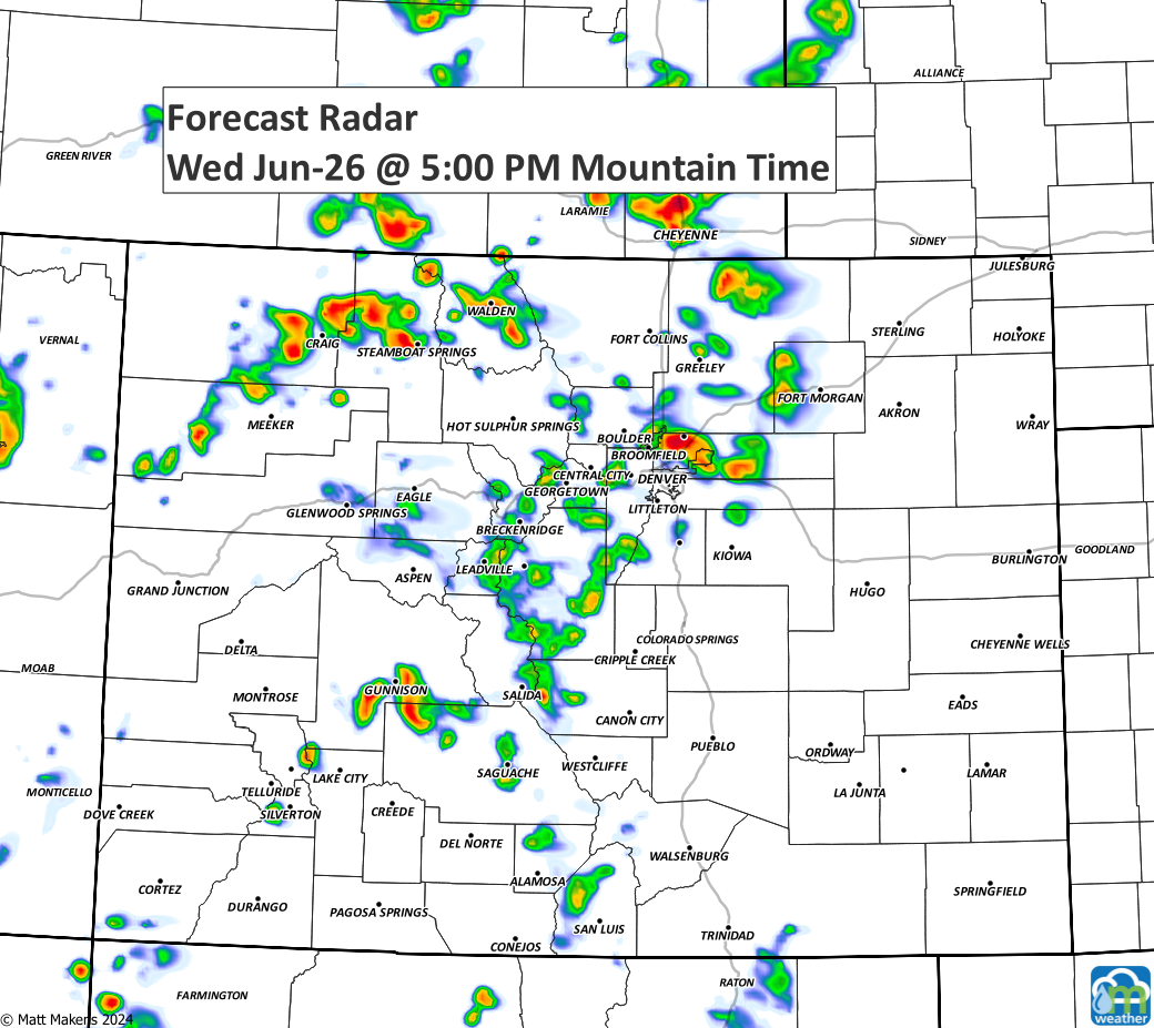
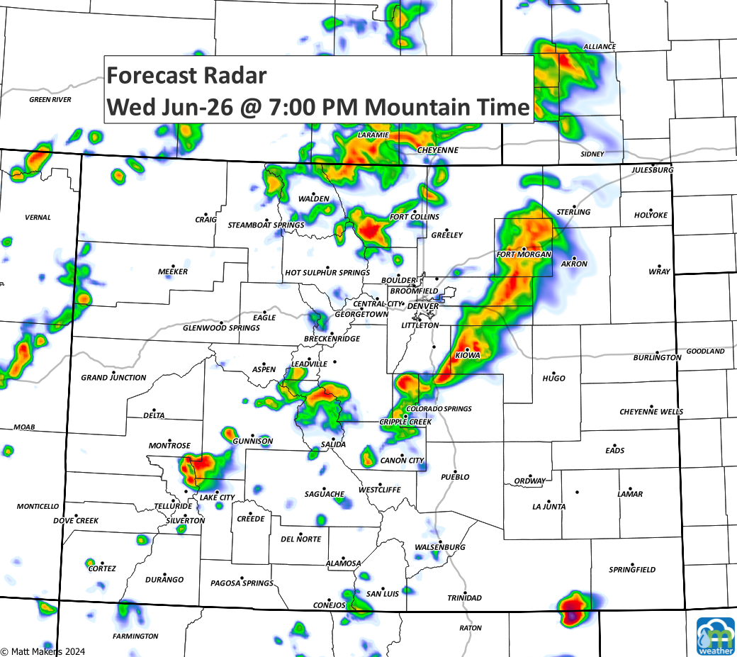
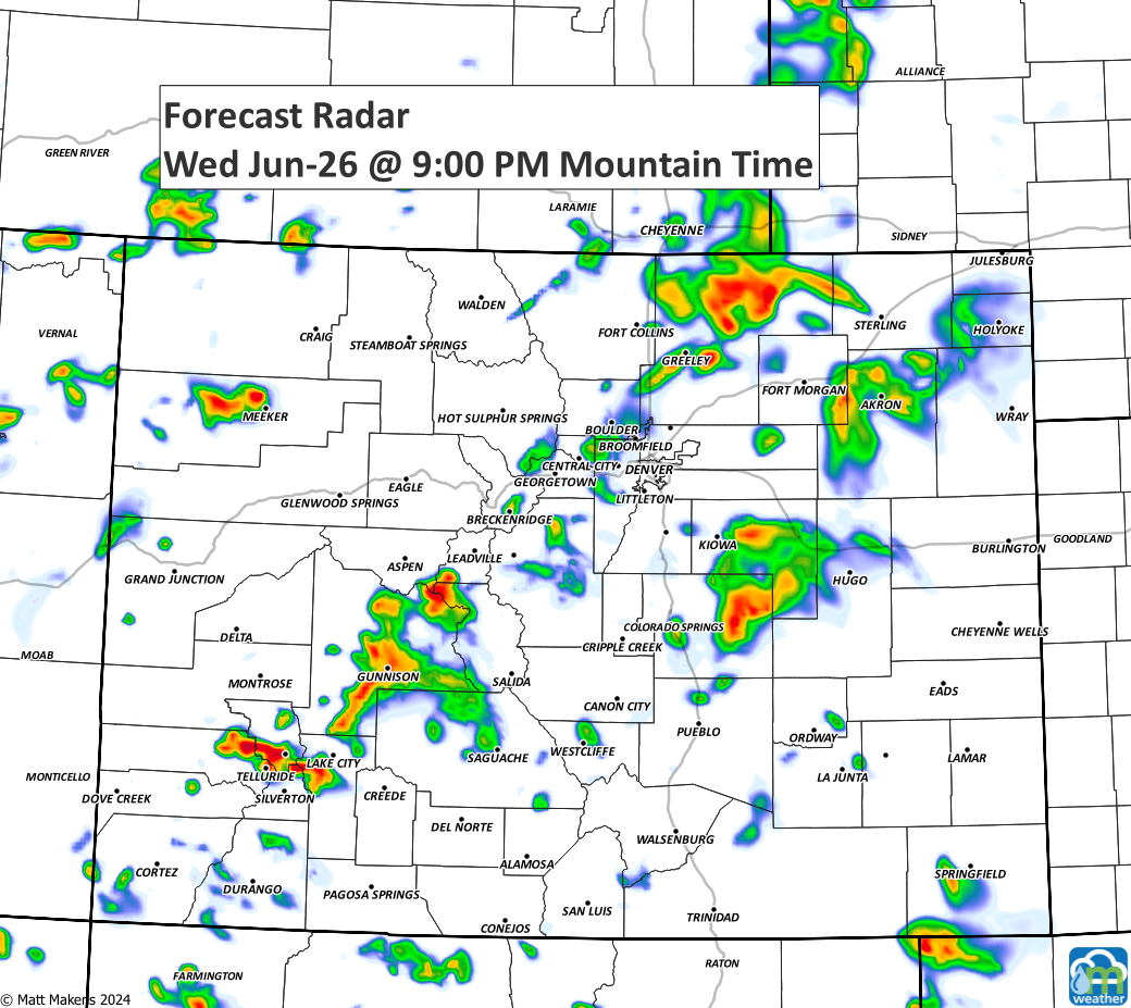
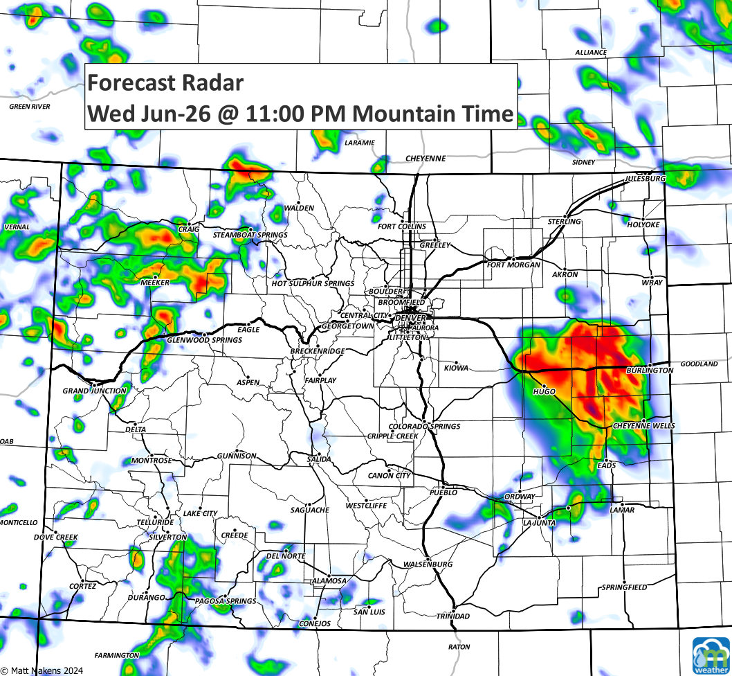
I'd be ready to cover your car and gardens anytime later this afternoon and evening. Keep the covers handy for several hours today, and you may need them again tomorrow.
Stay weather aware! Thank you. Let us know how your storms do in the comments below.
