
Denver Weather: Cooler and potentially wet with thunderstorm activity through Sunday night

Saturday had some impressively heavy rainfall on parts of the Front Range and elsewhere in Colorado. Weather5280 picked up 0.98" in 30 minutes Saturday night. There are additional storms carrying heavy rainfall expected today, plus Sunday will be a cooler day with only 70s for highs.
Let's do a quick visit at Saturday's rainfall totals. Two maps for you, one is the N. Front Range and the other is the state.
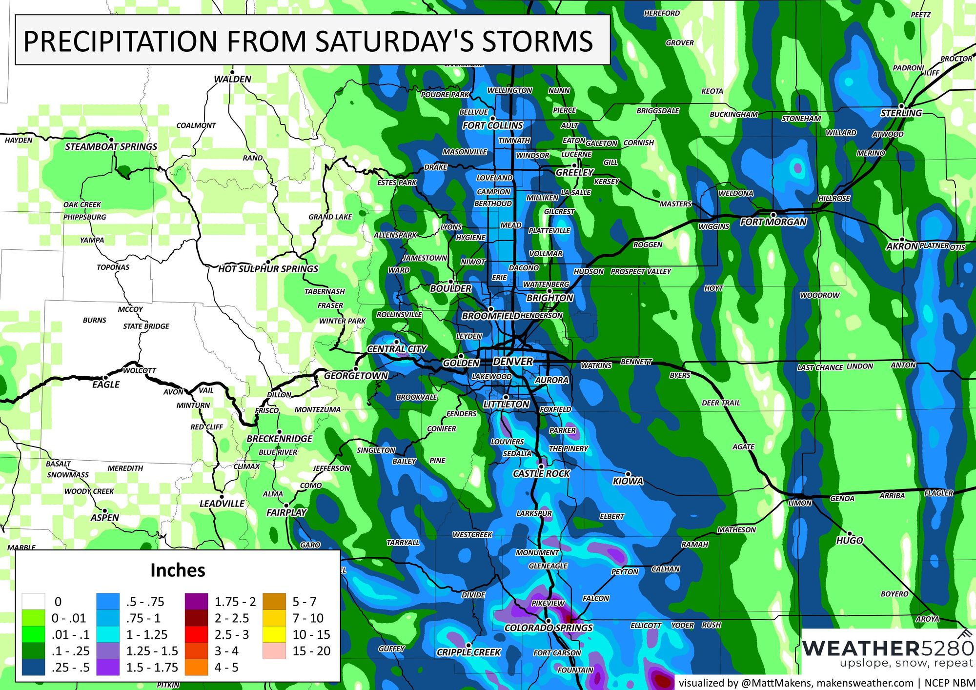
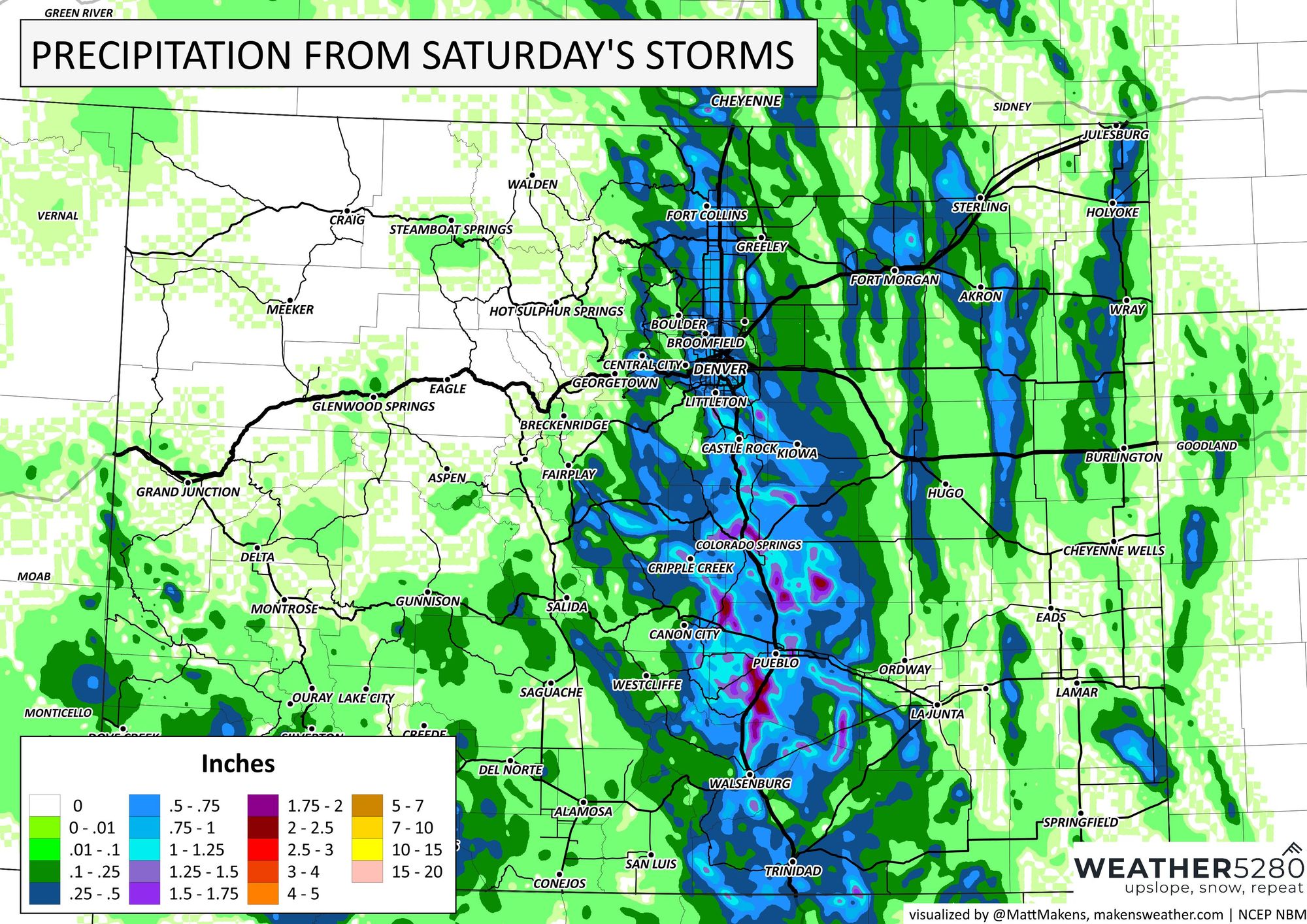
The heaviest rainfall in the Denver area was on top of Santa Fe between Chatfield/Highlands Ranch and Sedalia toward Castle Rock. For the state, heaviest rainfall was near USAFA and from the Springs toward Walsenburg - areas that picked up more than 1.5" in cases.
Now, onto today. Here is a look at the storm timeline for Sunday.
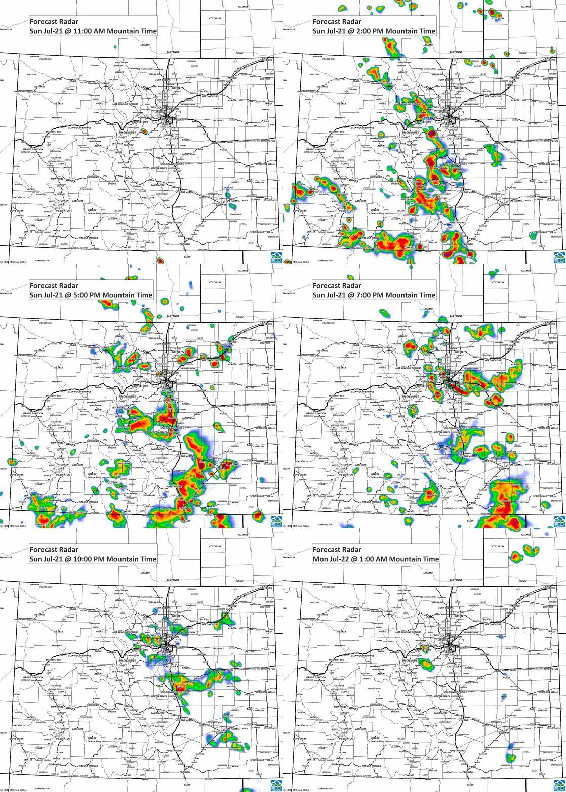
From that animation, many of us have storms to move over but the concentration will again be South of Denver much as it was last night.
In terms of severe weather, sure we could see some thunderstorm warnings for hail and wind albeit the overall threat level of that is lower today. We removed our hail covers from last night... they are nearby if we get a stronger storm, though.
From today's storms, let's assume you get hit by one, here is how much rainfall you can expect.
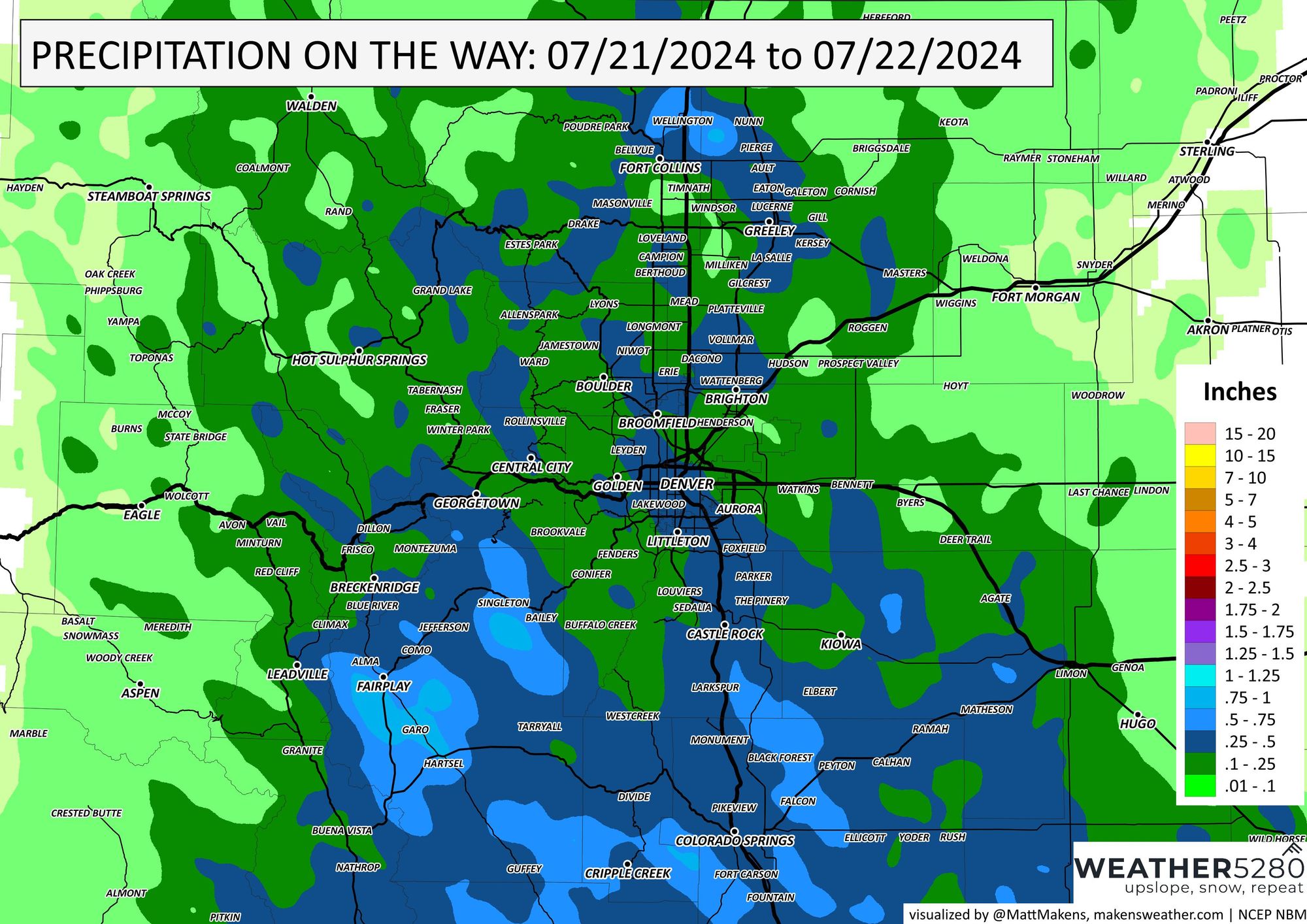
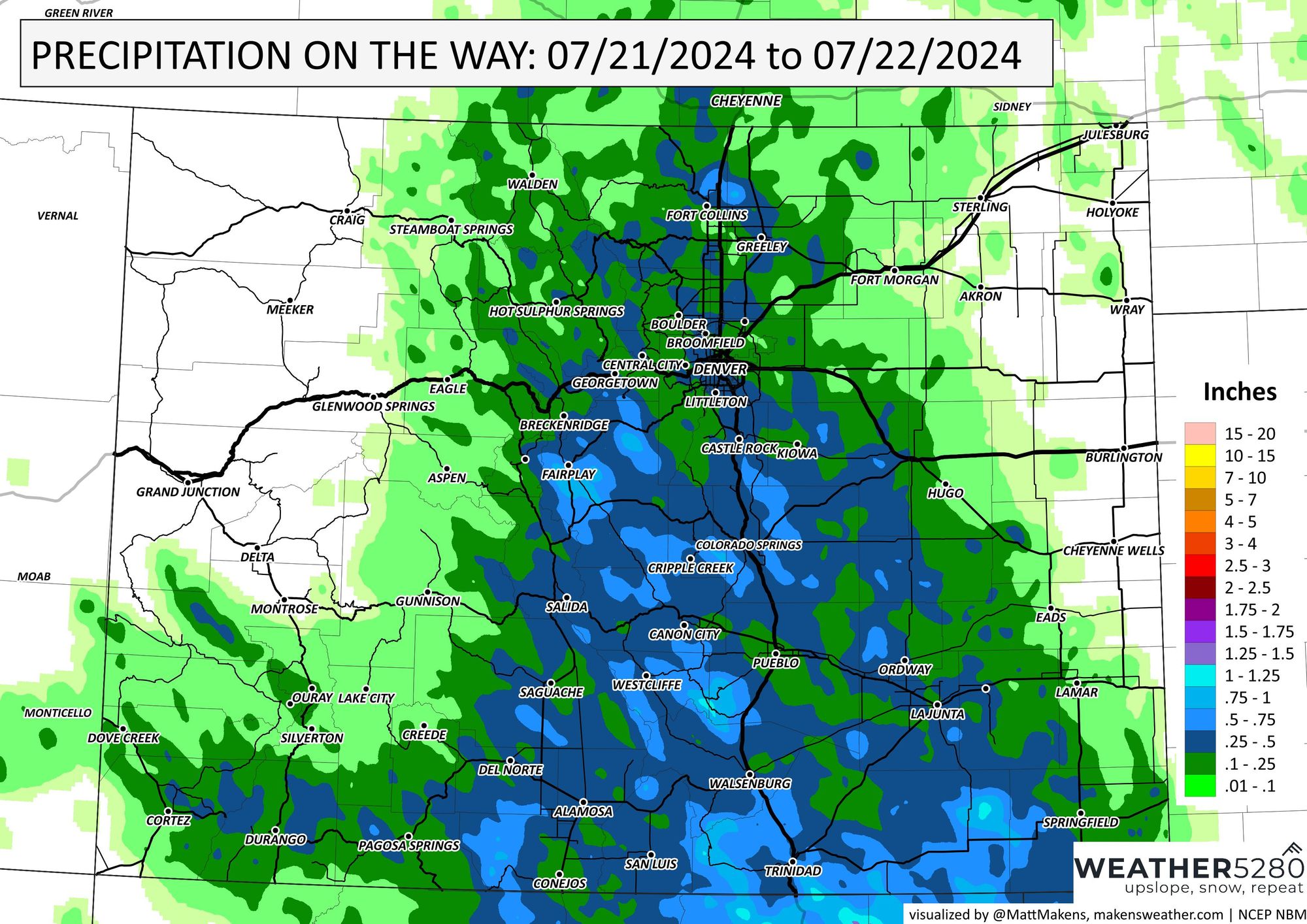
For the Denver metro area through Fort Collins we have the potential for 0.5-1" of rainfall, but those kinds of totals are more likely in the Central to Southern parts of the state, including Castle Rock toward Colorado Springs and southward.
We can summarize this for just Denver with the hourly timeline:
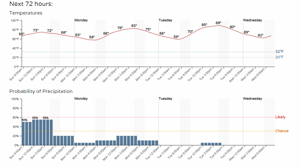
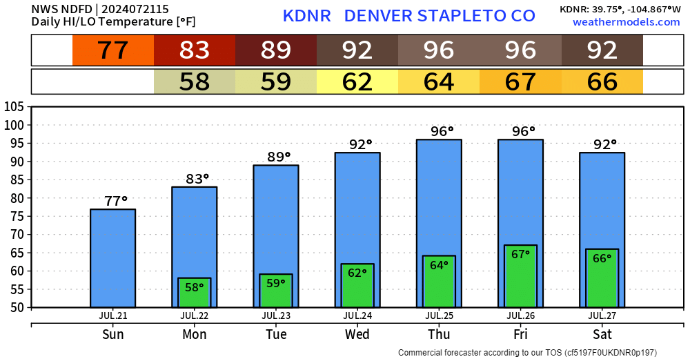
Notice the highest rain chances are today, tapering off to start the week. Also, notice that today's 70s warm into the 80s and potentially 90s by Tuesday. A quick look at the full week shows a hotter forecast with drier days and potentially seeing/smelling wildfire smoke until a bit of unsettled weather returns next weekend.
Have a great Sunday!
