
Colorado Weather: Fire danger spikes as near-record temperatures return to Denver area

The Alexander Mountain Fire reminds us just how dry and hot this summer has been, and although we hope this fire is quickly extinguished and no new ones ignite, the weather conditions are prime for that type of activity.
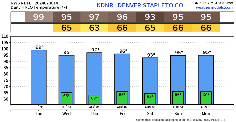
This week, near-record temperatures will be felt across the region, including Denver, with another potential 100° day on tap for today.
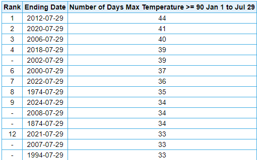
So far, temperatures have hit 90+ 34 days (three have hit 100+) this year in Denver. For perspective, that is the 9th most YTD for any year since 1872 on the Denver Area climate record.
The city has officially picked up 1.1" of precipitation this month, a total of 1.46" this summer - which is currently 23rd driest to date of any other year in the record.
Let's look across the state at the total precipitation in the past 30 days.
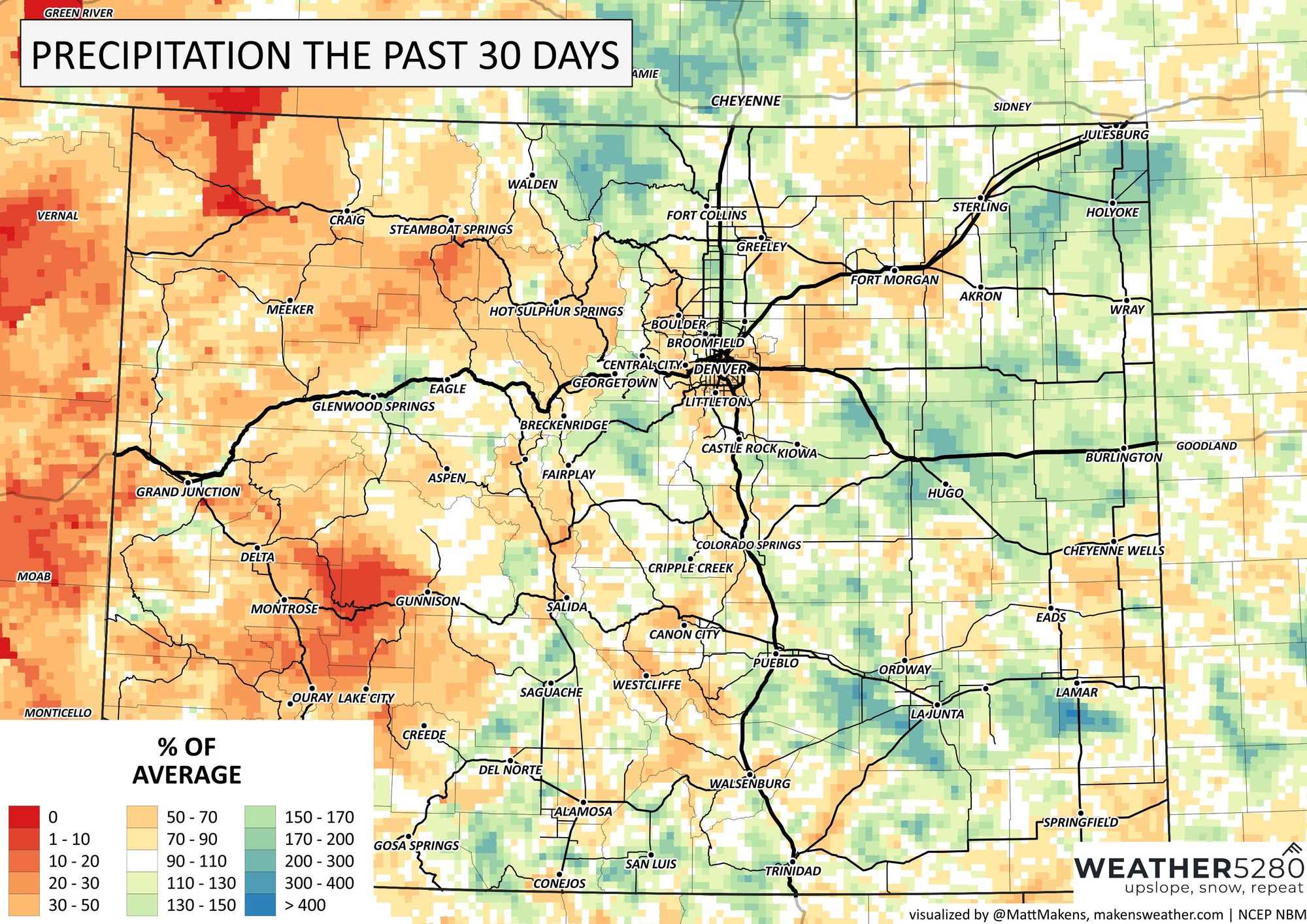
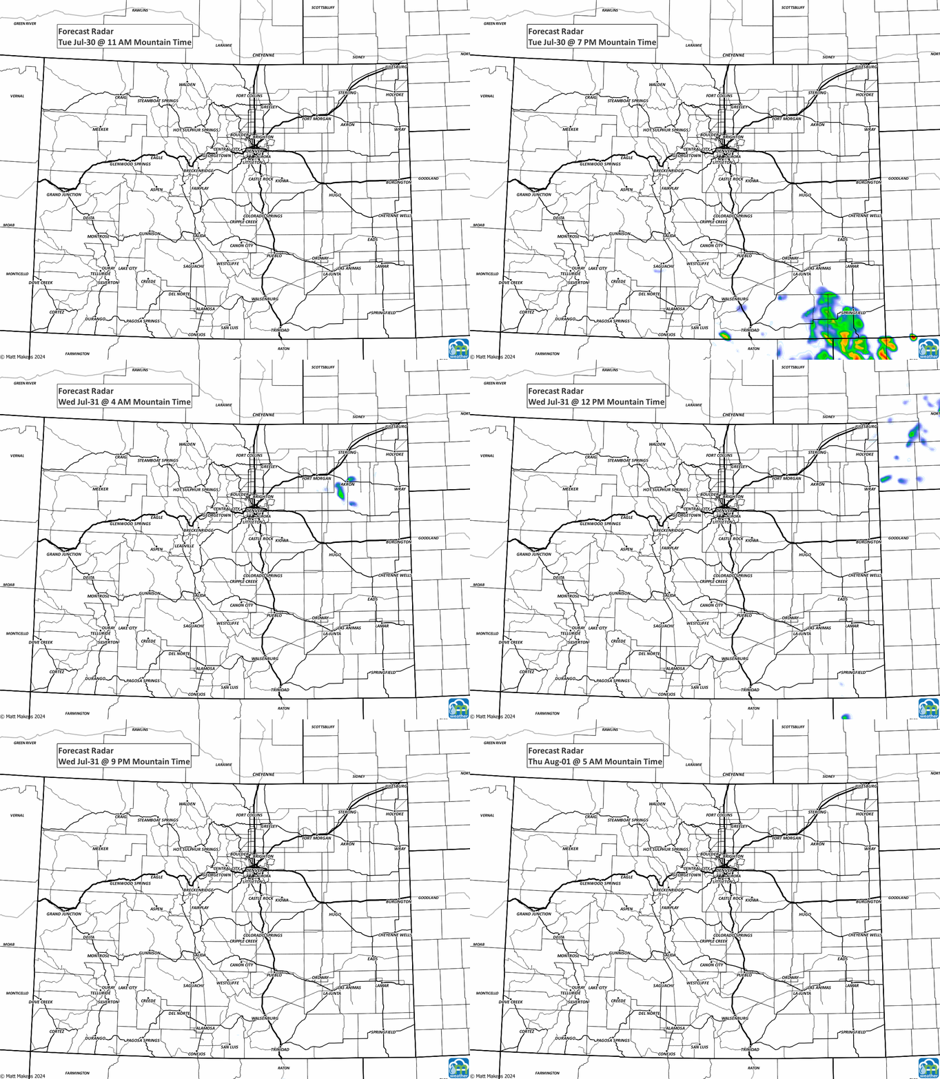
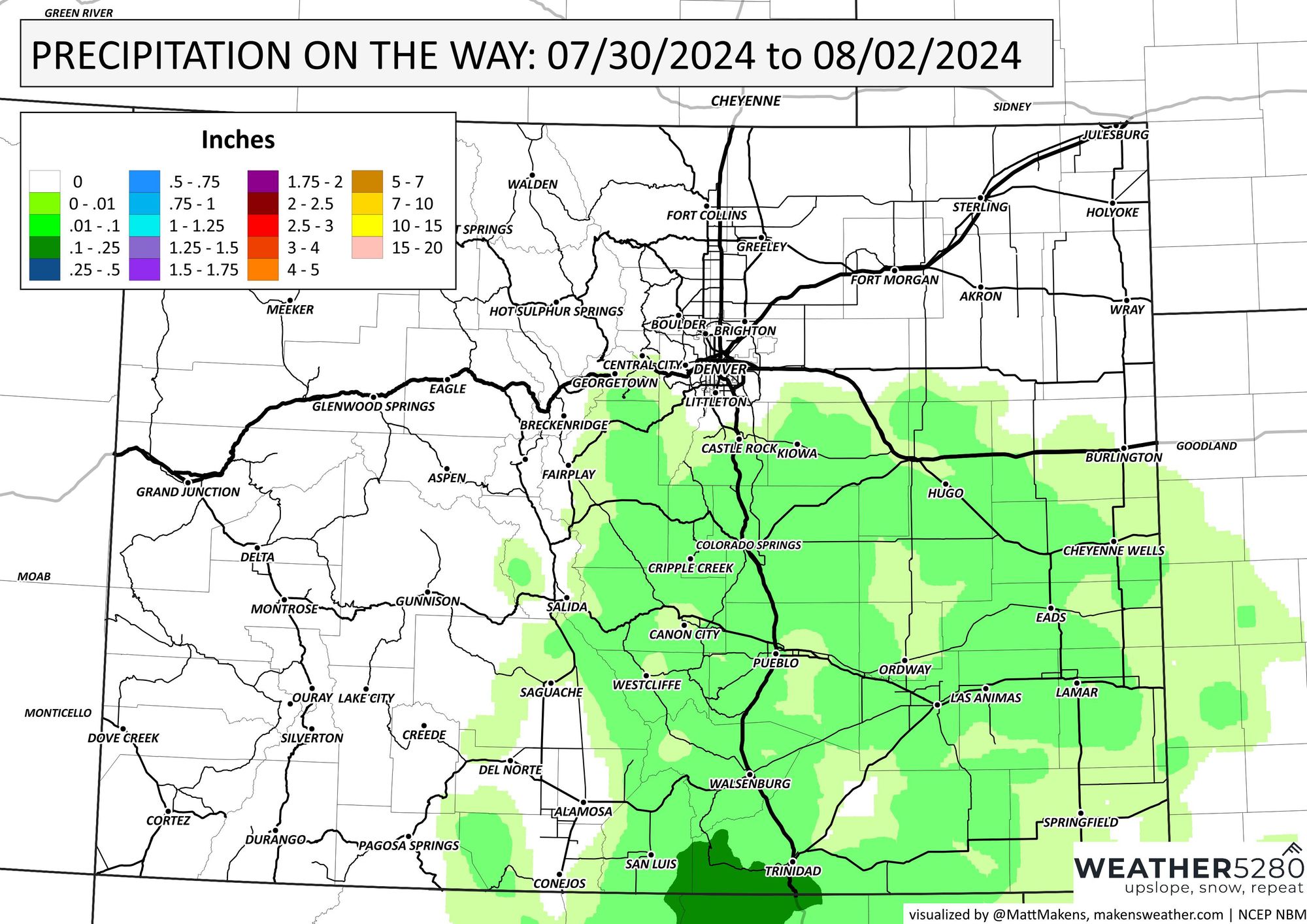
The deficits and recent heat add "fuel to the fire," as it were, considering our fire danger has increased recently, and during the next few days, we aren't likely to pick up much rainfall. An animation of storms first, then a look at an estimate of total rainfall for the next three days:
With that, we will have to be mindful about just how primed our fire danger is with this heat. Here are the alerts in place as of this post for today:
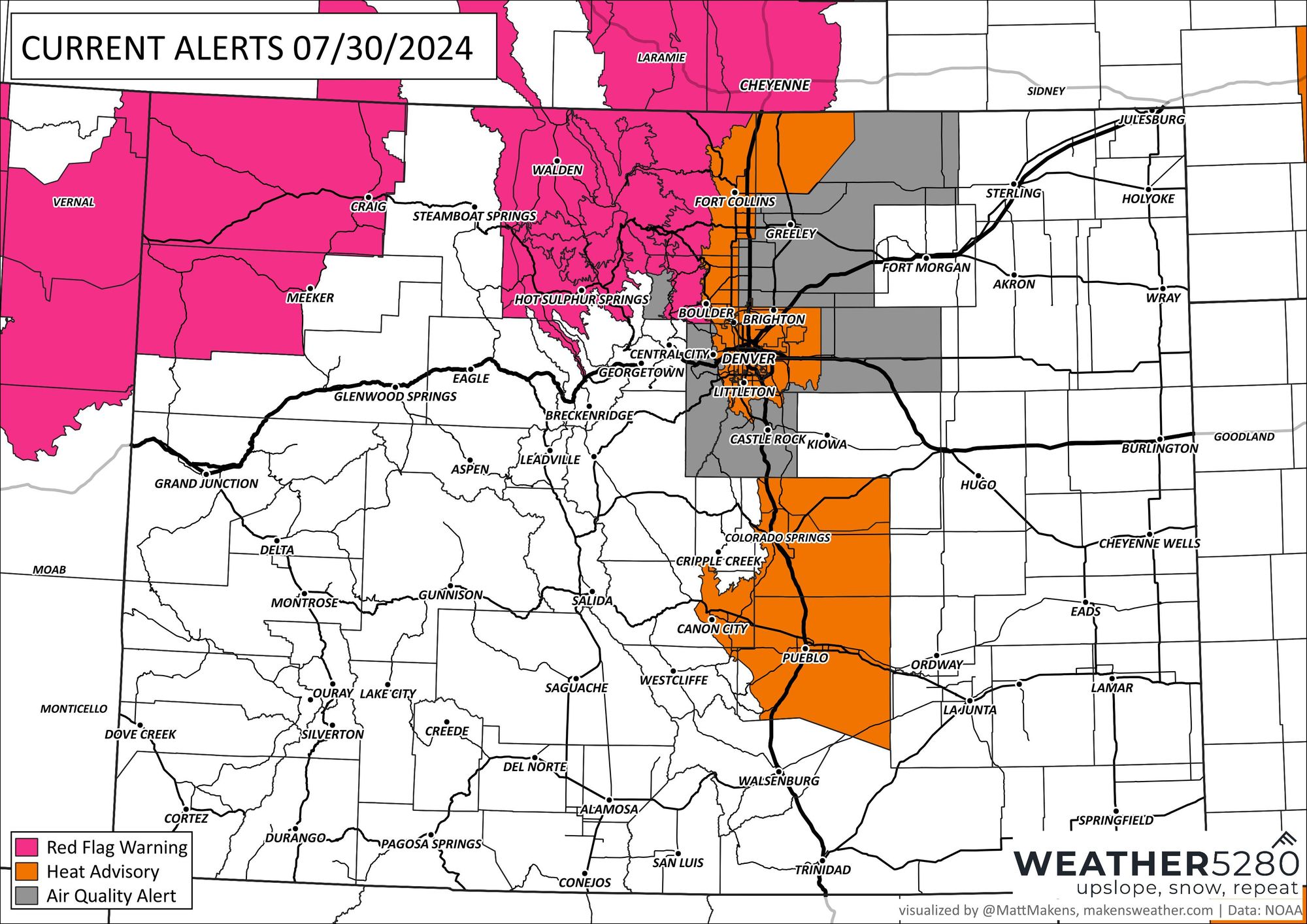
Fire Danger. Hot temperatures. Bad air. Three headlines that will be showing up frequently in your feeds this week.
We've discussed the fire danger; here is the heat as a forecast for Denver for the next seven days.
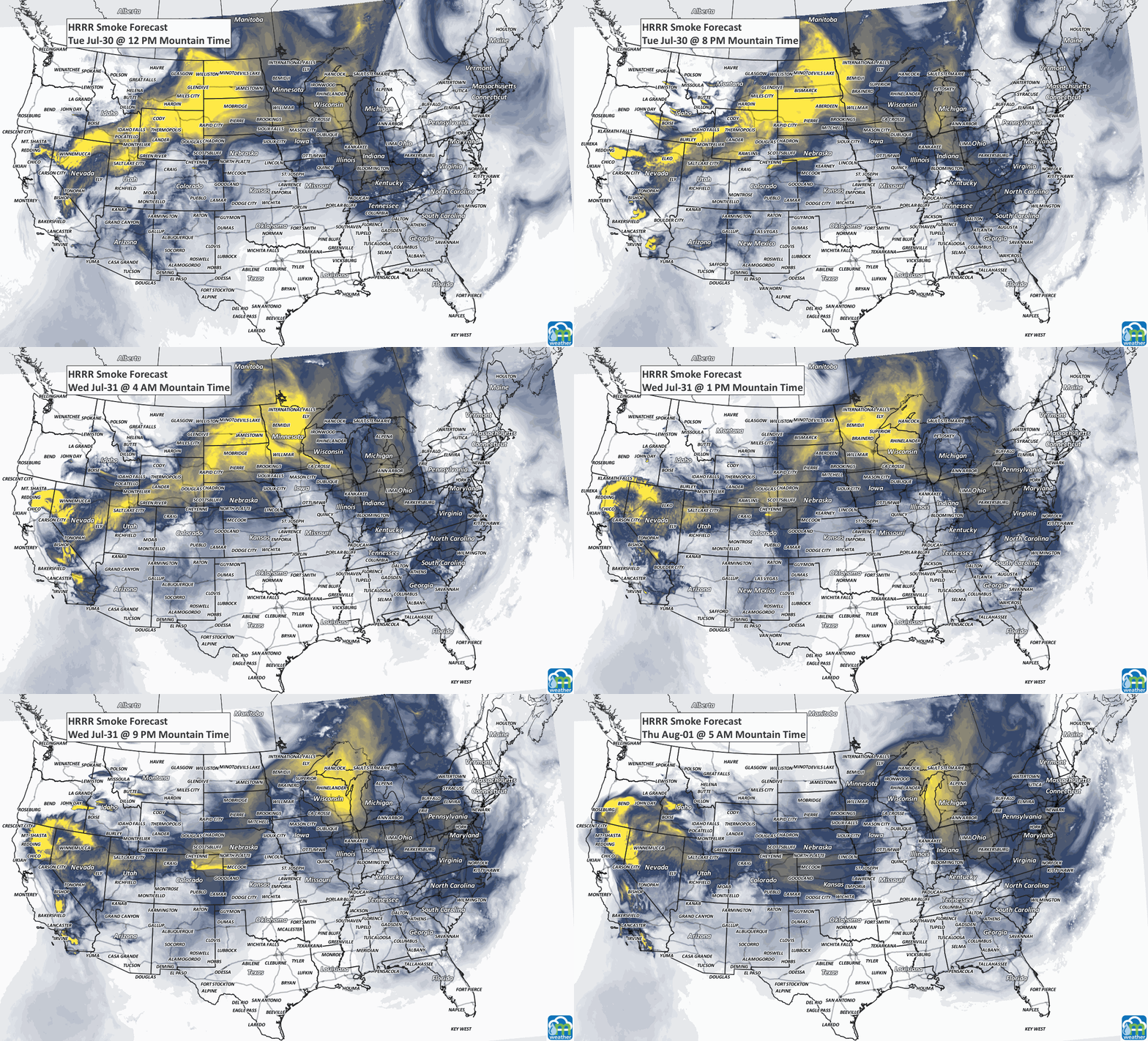
Now, onto the bad air. Ozone and our "usual" pollution problems will continue for the metro areas this week. Are we likely to add a lot more smoke to the air? Well, modeling indicates increased smoke for much of Colorado in the next couple of days.
Bottom line: Summer continues.
