Colorado weather: Hot and mostly dry conditions persist through the weekend; Will there be rain to help with fires next week?

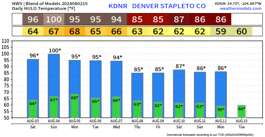
Not much relief from the heat in the immediate forecast as highs will stay in the mid to upper 90s along the urban corridor through the weekend at least.
The blend of models shows a forecast high of 100°F in Denver Sunday, which would tie the record for the date (1878). By the latter half of the week more seasonal, less extreme temperatures may finally return – but there's some disagreement in this in the guidance as well.
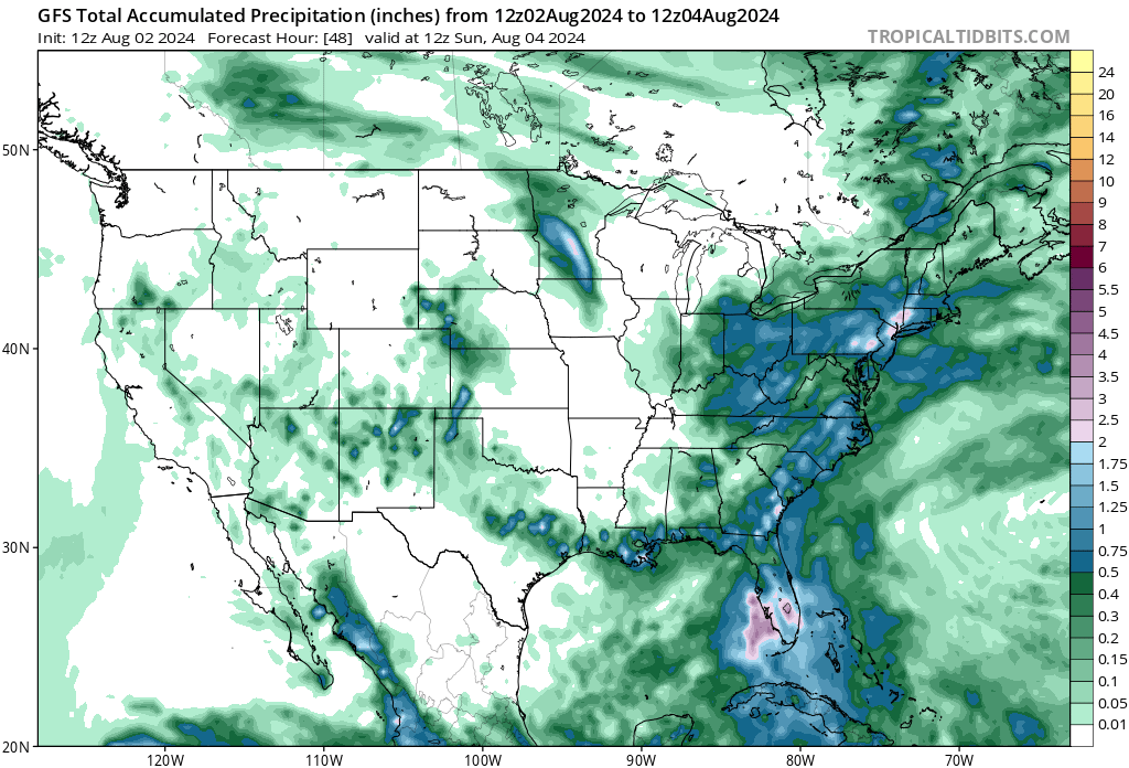
There will be a few isolated storms today along the Front Range, but not much in the way of precipitation is expected. For the far northeast corner of the state precipitation chances are a bit better.
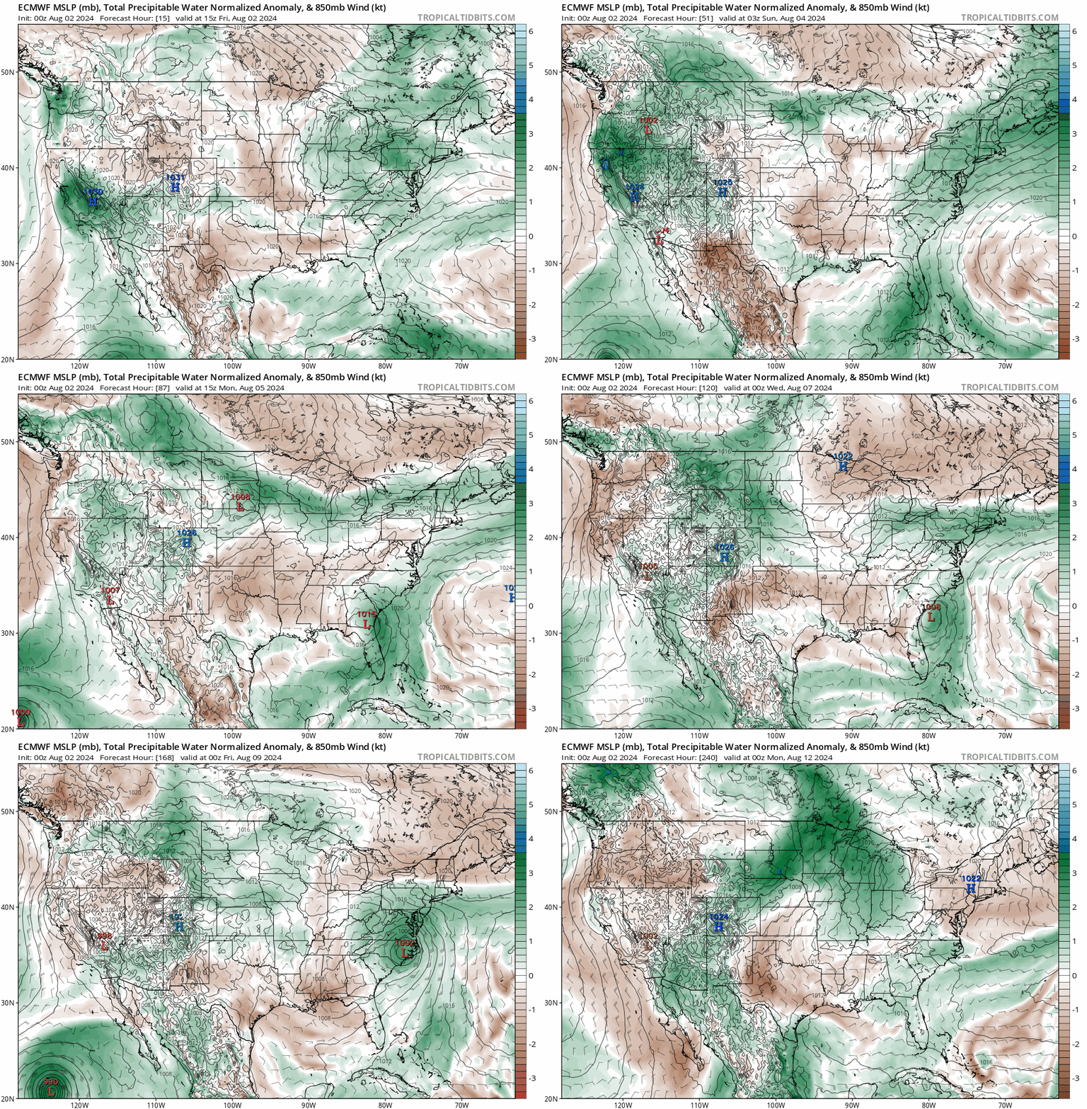
The overall dry weather we have experienced this week doesn't really start to kick until next week, and even then how much more favorable the pattern becomes for storms remains in question.
As you can see in the animation below, PWAT values (how much water vapor is present) remain anomalously low through the weekend. By next week, however, we start to see more greens – at times dark greens – over Northeast Colorado, indicative of more moisture to help fuel storms.
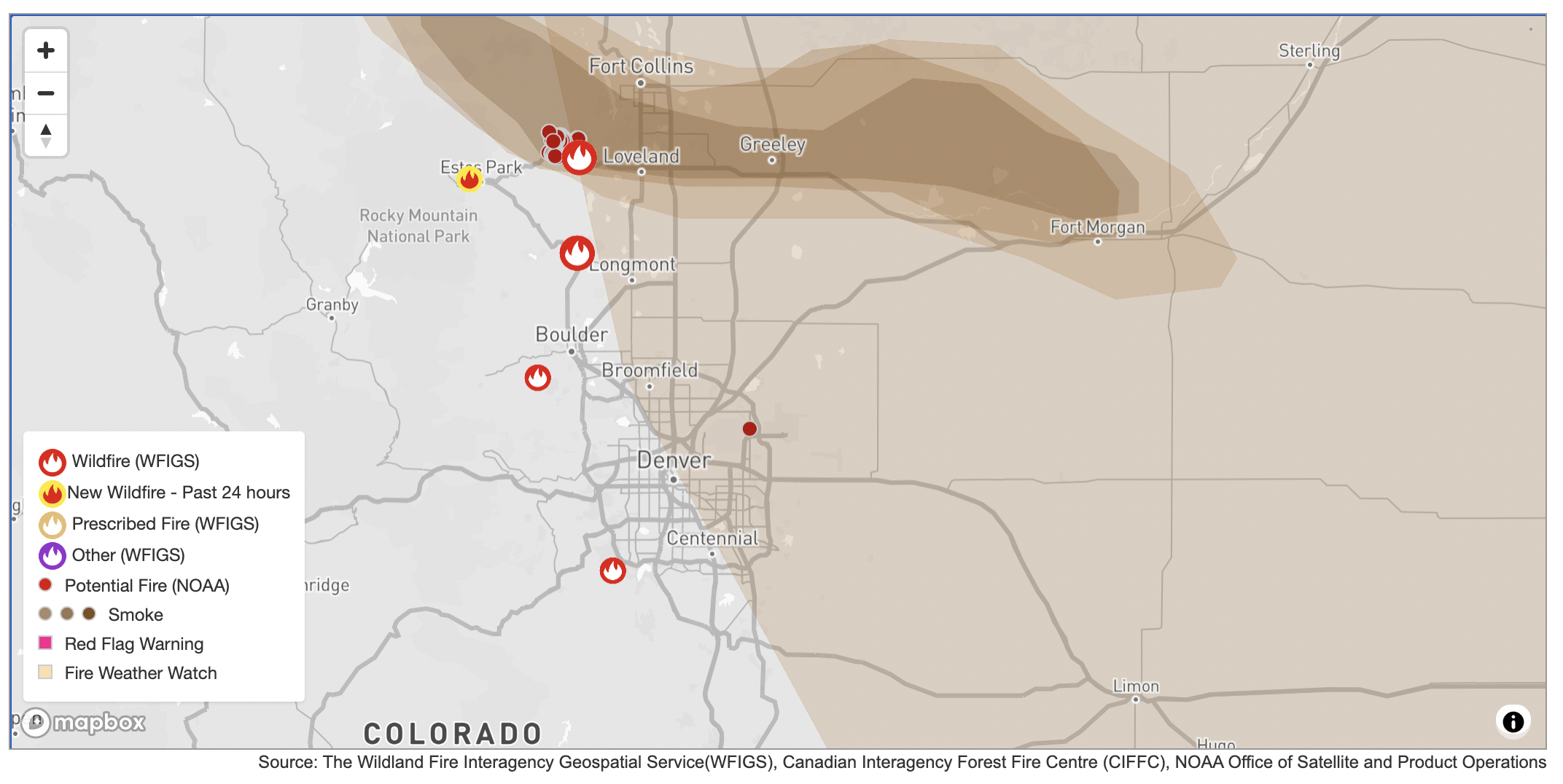
How much rain we can expect is of course the big question. We continue to have quite active fire activity across the region, including four ongoing fires along the Front Range without much immediate help on the way.

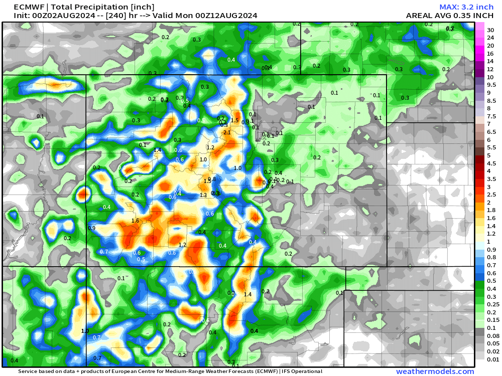
The 10-day precipitation forecast from the European model shows better precipitation coverage for the foothills by the end of the timeframe, but still pretty sparse along and east of I-25.
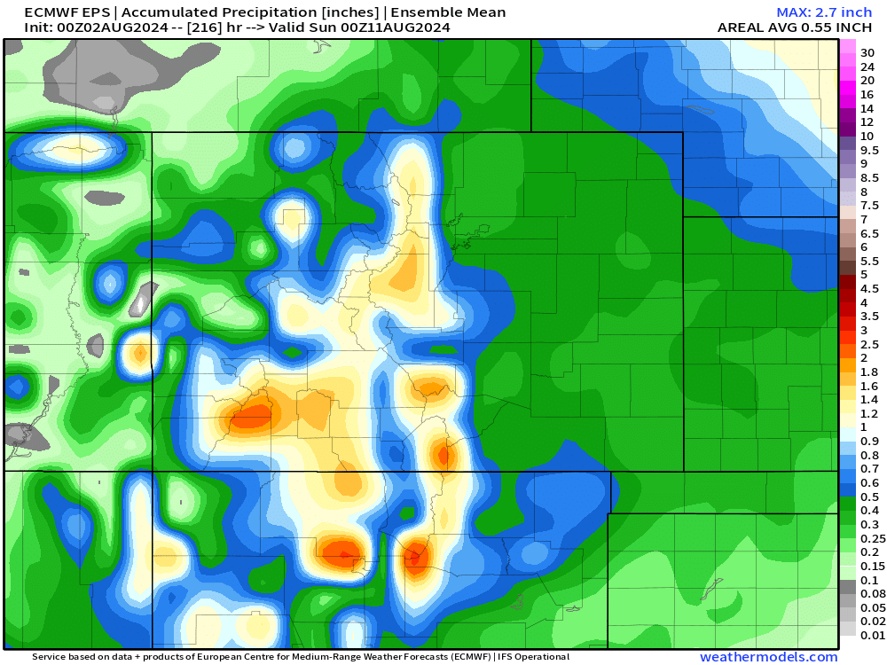
The ensemble model suggest there might be some more nuance to this, but still more favorable for heavier precipitation further west, vs east.
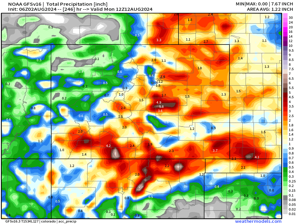
Other models, like the GFS, are much more bullish on precipitation over the same period. Here is its latest operational run from this morning – showing totals through next weekend:
The takeaway should be this...
- Hot temperatures with not much in the way of moisture through the weekend
- Better moisture availability returns next week, with perhaps better storm coverage across the state – especially by the middle to latter half of the week
- As we can see from the Euro, "wet weather" isn't a done deal, but there's at least something to watch and hope for as we move into the first full week of August.
PLEASE stay safe and smart! No burning this weekend as we continue to work through this exceptionally hot and dry period.
We'll be tracking next week... more to come.
