
Denver Weather: 25-degree drop comes with risk of heavy rainfall and flooding

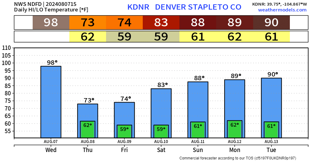
Today's storms will be scattered, with some at risk of becoming severe, but tomorrow and Friday's storms will be widespread, increasing the risk of flooding as temperatures drop more than 20 degrees in many areas.
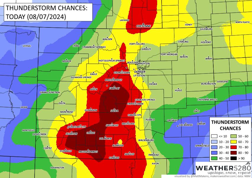
For today, it'll be a hot one with storm chances shown below. The more likely region for storms to become severe is across the Northeastern Plains.
Storm chances increase after today. In a glance, here is the hourly planner for chances for precipitation for Denver.

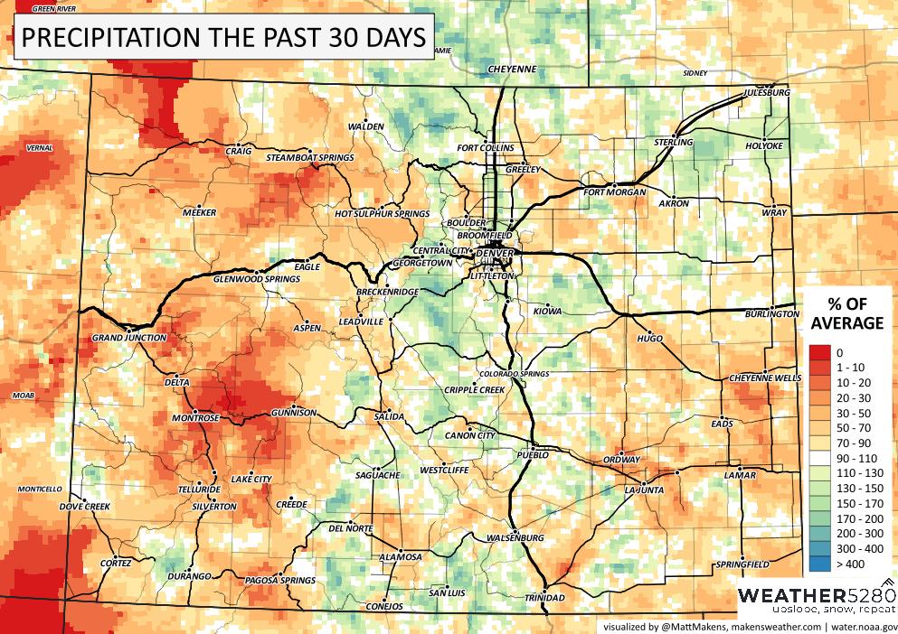
As of now, Friday has the highest likelihood for rainfall but the next three days offer us a high chance of receiving some much needed moisture to help curb the ongoing fire dangers/burn areas. Speaking of those dangers, you can see by the past thirty days how there have been a lot of counties with rainfall deficits, combined with heat and we have the heightened fire dangers plus new fires.
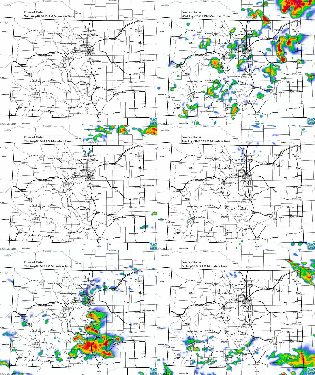
So, with a wetter outlook for the next couple of days, let's look at the storm animation.
From that, here is the estimated total rainfall we may receive throughout the week.
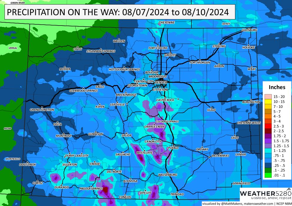
Note, this is not all the rain; we have several days with rain chances through the next week. So, in rough estimation, here is the total moisture you may receive through the next week.
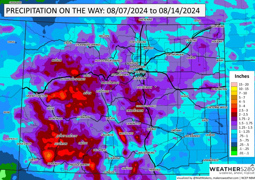
For Denver, there is the potential to exceed one inch of water. For the Foothills and Southern Front Range the potential exceeds two inches.
Notice that some of these totals will represent rainfall that may come too fast and furious so we will need to be mindful of flooding risks with these thunderstorms. The cold front that will push through will make temperatures drop quite a bit but we don't want that front to stall out and become a focus for storm training (repetitive storm impact on one area) or else we could face a much higher risk of flooding.
Check out the week's high/low forecast for more on the temperature drop.
I'm glad to see a cool-off coming, but I'm more excited about receiving some rainfall. In the comments below, let us know how the rainfall pans out for you.
