
Denver Weather: Although cooler today, not done with the 90s just yet, and who gets snow the first week of October

As we discussed in our last post, Thursday hit the 90s, a record-setting temperature for the date and the 8th latest occurrence of a 90° day on record.
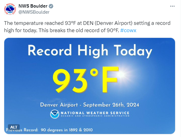
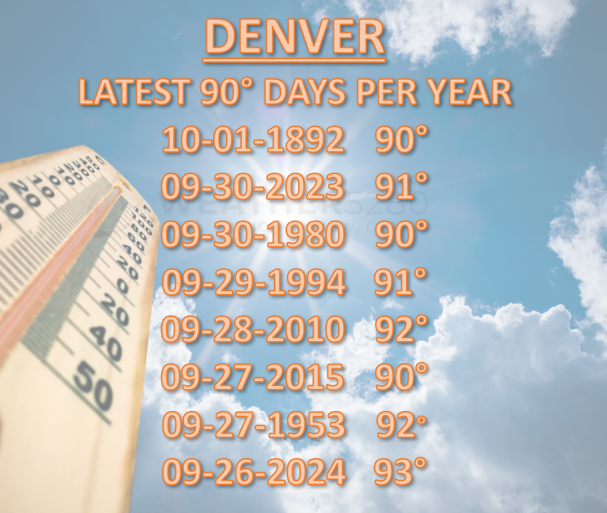
That record for the latest 90° days in a calendar year since the 1800s may see a very late 90° arrival this Sunday and perhaps the middle parts of next week, too.
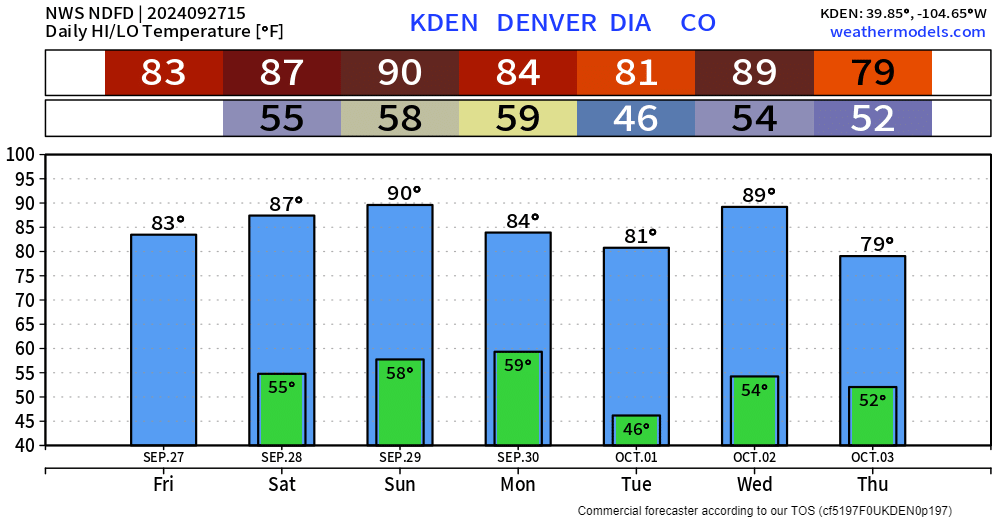
Although Sunday's forecast high of 90° will put us on the list for the fourth-latest occurrence, we may be able to hit 90°+ next Wednesday, which would be the latest 90° day on Denver's climate record.
We'll see if we can actually record that 90 next week; it'll be close. Here are the daily highs and lows throughout the week.
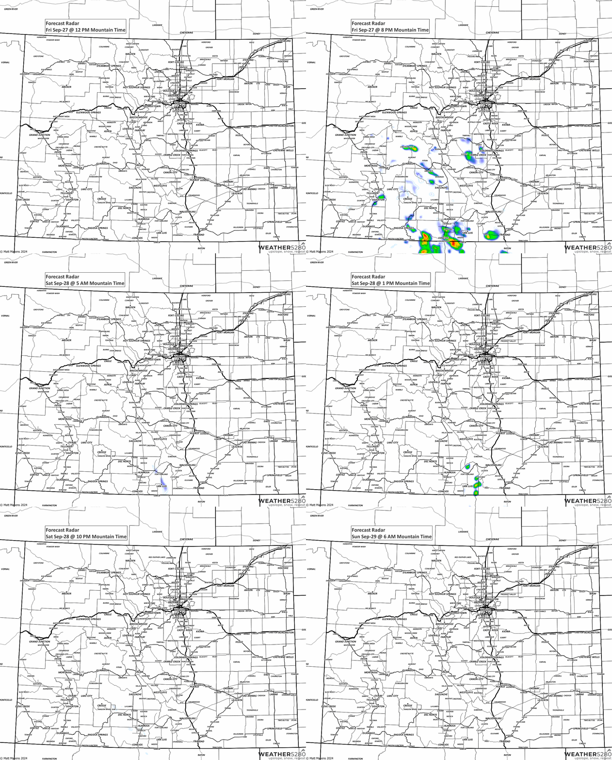
Although we stay mild across this stretch, it may not be totally dry for a few of us. There is a bit of rainfall coming today to the high country. Here is an animation of those thundershowers/storms.
Beyond this weekend, perhaps a hint of another fall-like weather producer next weekend, the 5th/6th, that can produce rain and snow and perhaps our first frost and/or freeze for many—probably not the city itself, although something to watch.
Just for kicks and giggles, here is the snowfall outlook way out there...
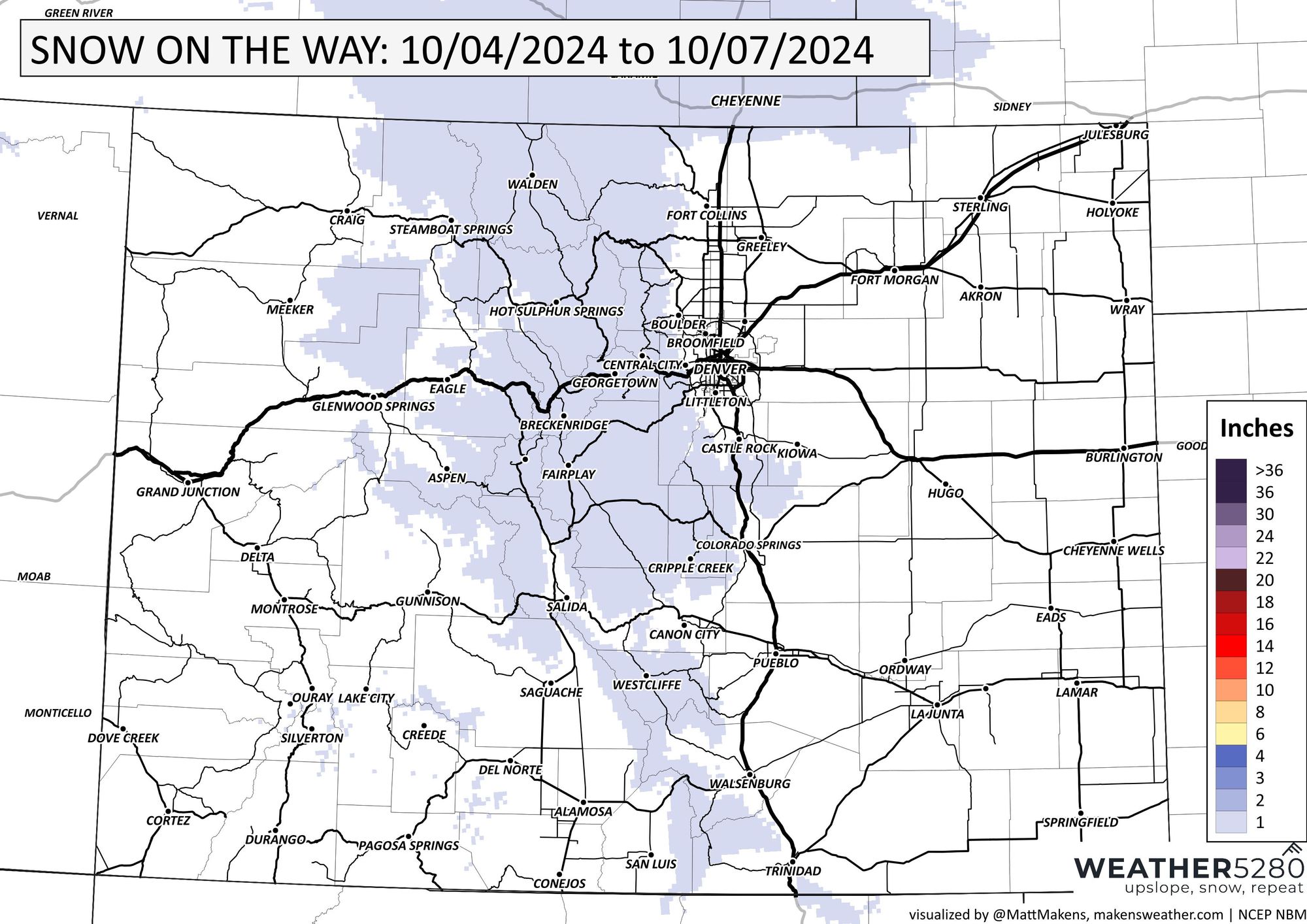
We know, we know...
We will keep you posted next week. In the meantime, have a great weekend - it'll be a beauty.
