
Denver Weather: Temperatures near record highs before a "classic" Halloween cooldown

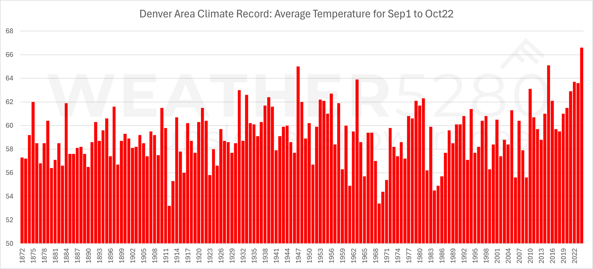
Denver's fall has been quite warm thus far; 1.5° warmer than any other period on record since the 1800s, and the warmth continues through early next week as daily highs approach records.
Here is a look at the city's average temperature from September 1st through October 22nd with the peak being 2024.
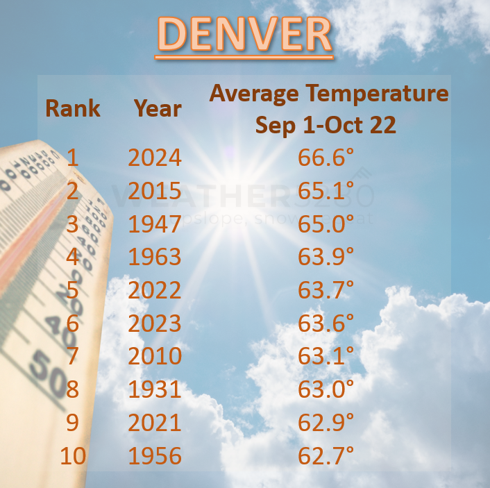
From that, here is a list of the top-10 warmest periods on record for fall to date.
The warmth ahead is up to 17° warmer than average for the time of year. Here is a look at those temperatures - the daily highs and lows.
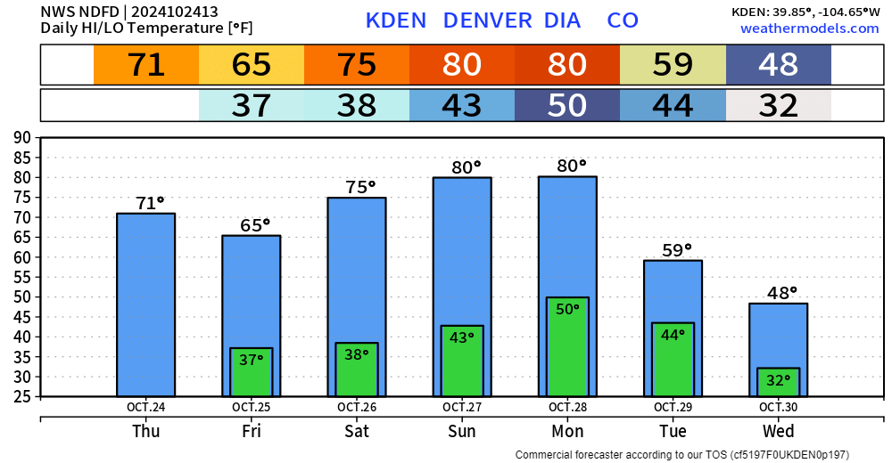
For Sunday and Monday, we near record territory. Those records are 83° and 82° respectively.
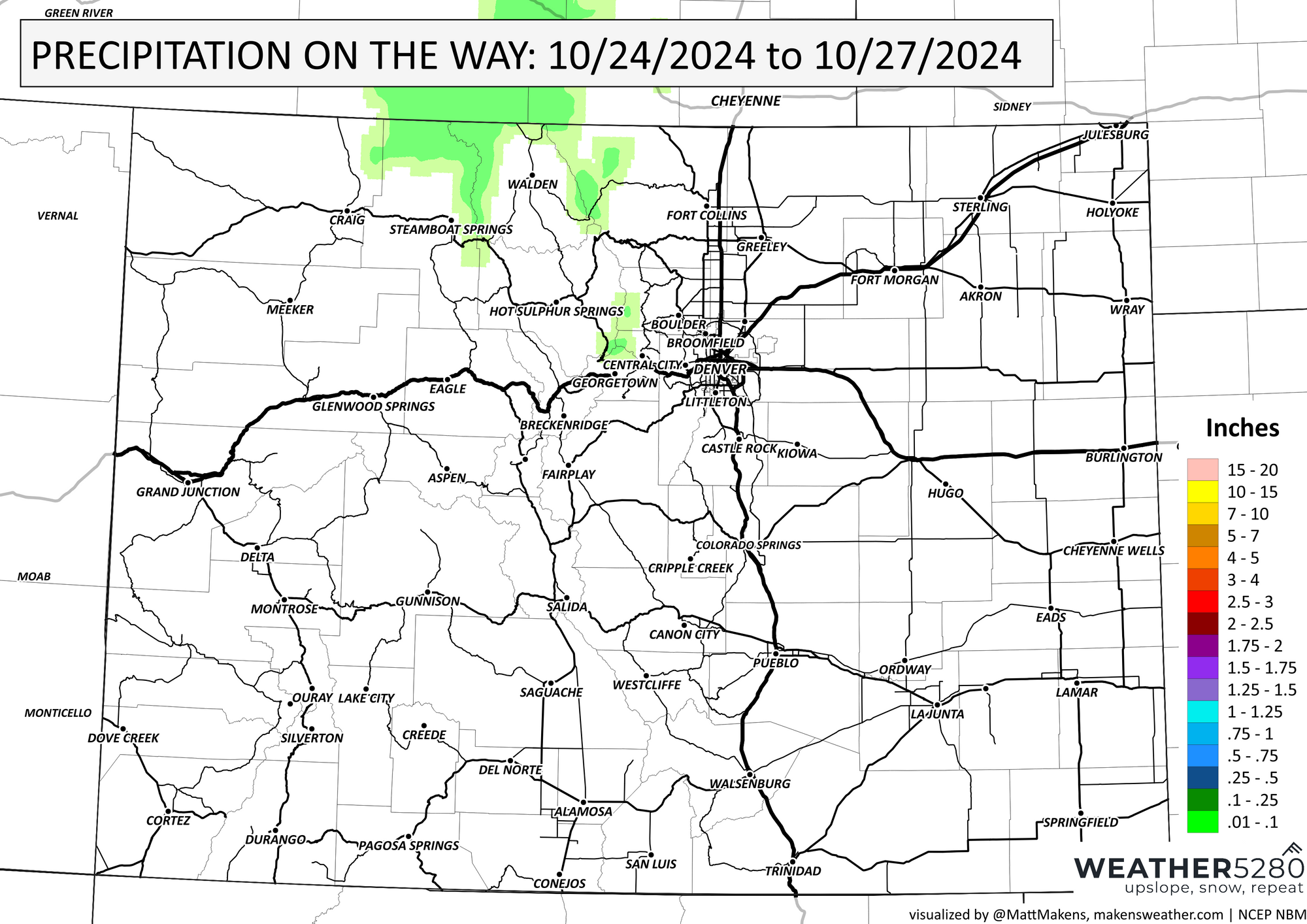
You may also see that there is a temperature dip coming to end this week. That's a little wave moving overhead that will switch wind enough (gusty at times, too) to push in slightly cooler temperatures but without much of a chance for moisture. In fact, here's the precipitation map for the next three days.
Now, go back to that temperature forecast and look at next Tuesday. See that temperature drop? Well, we have a (as of data through this morning) substantial trough to dig in across the Western U.S. This means colder weather and moisture can spread throughout the area - fitting for a Colorado Halloween, eh?
Luke writes more about next week's snowy impact for our Insiders here:

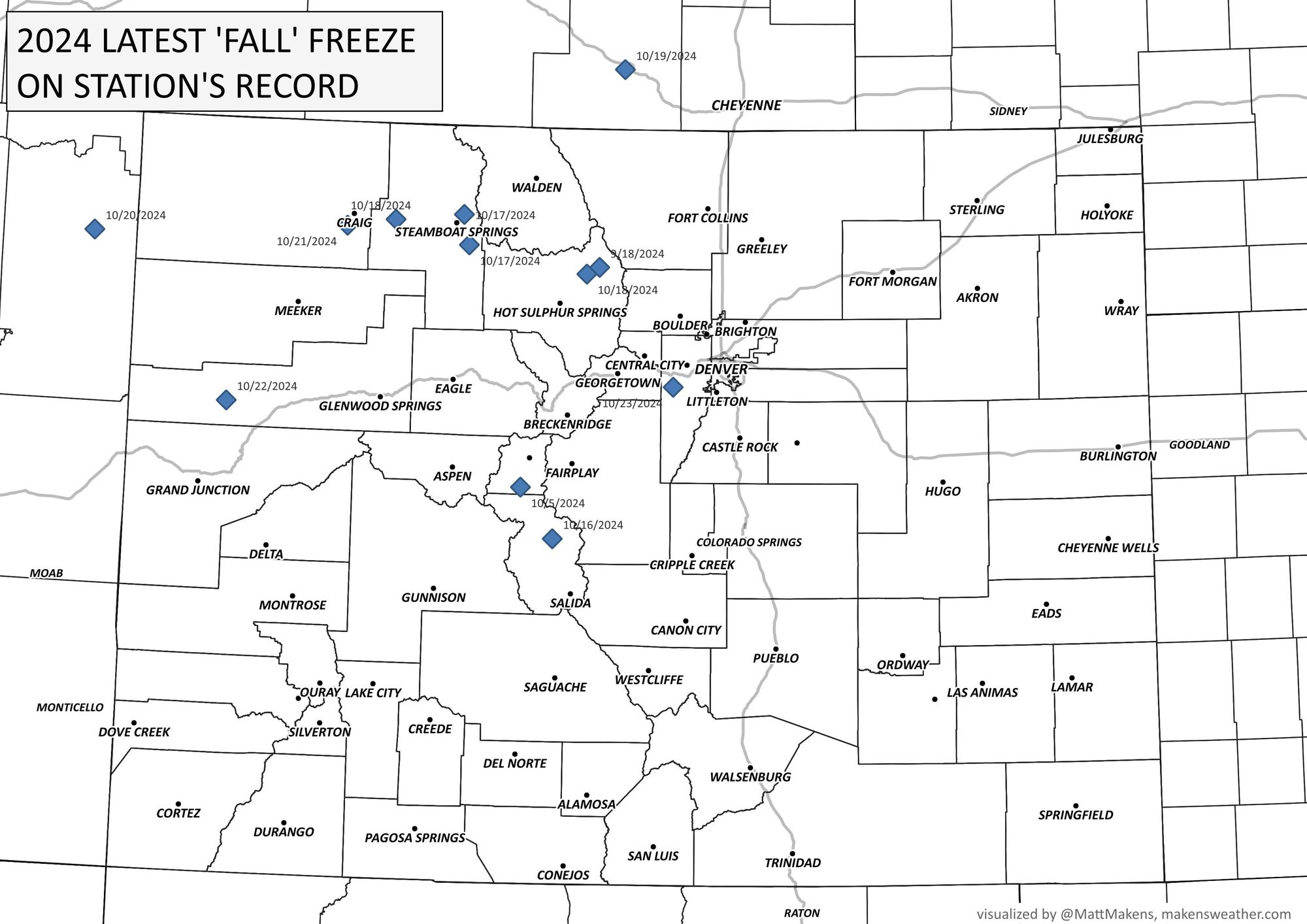
We are running stats on the latest freeze dates in the last 35 years, and we'll be back with a new post to talk through those later this week. For now, these are the stations that have already set their latest freeze since 1990 and many more stations, including the metro area, will likely be added to this before our first freeze hits.
This map represents data since 1990.
That data and an update on possible snow before Halloween coming your way next. Make sure you are on our list to get emails as we publish new content.
