Colorado weather: Cooling off for Halloween week; who sees rain and snow and how much

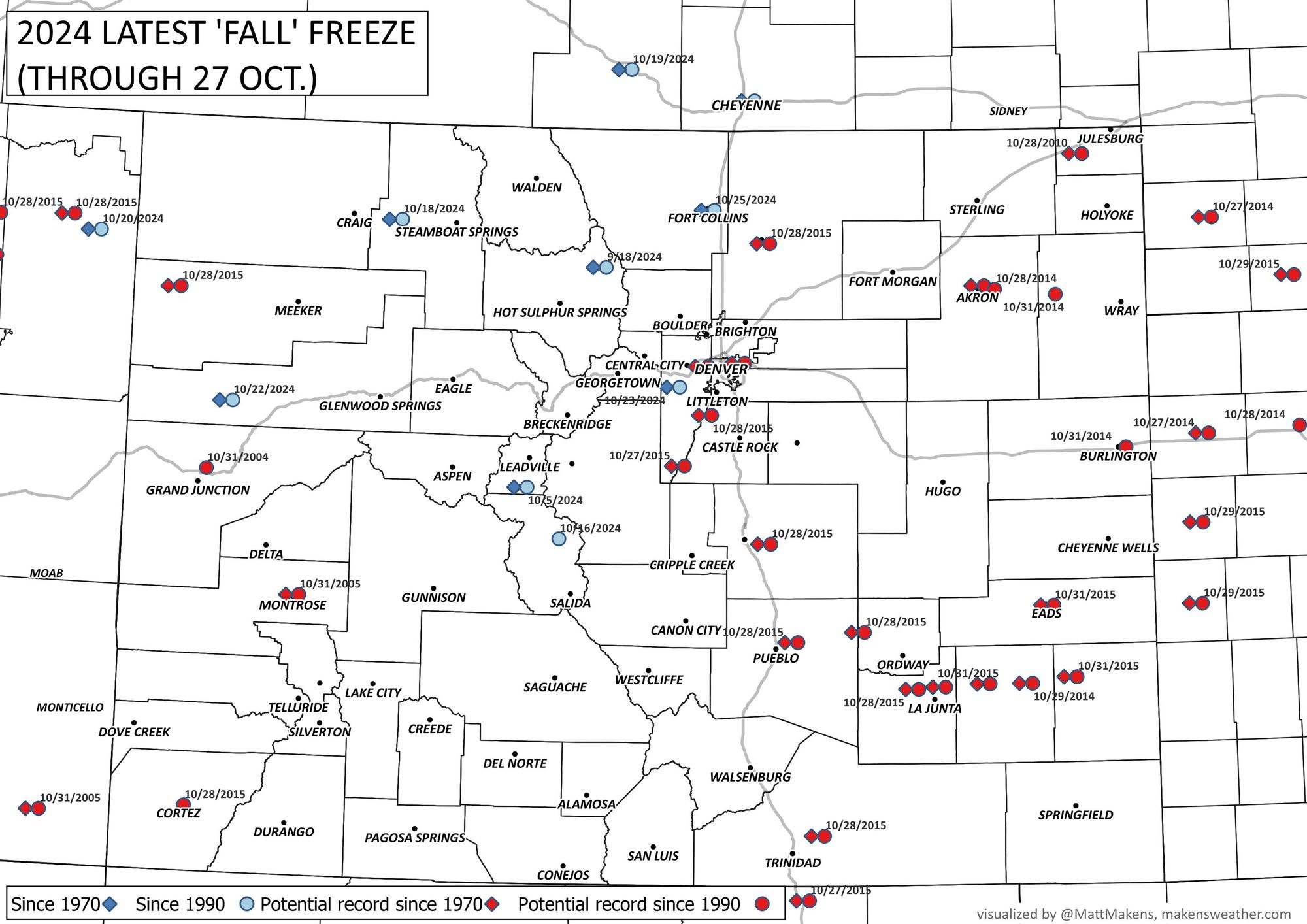
Denver finally hit the freezing mark on Friday, with DIA logging 32°F a good two weeks later than average for the first freeze for the city. Despite the warm start this morning, we've got a shot at a stretch of sub-freezing overnight lows on the horizon, and a potentially hard freeze by Thursday morning, so we hope your irrigation systems are ready...
Many locations have yet to freeze and this is pushing the limit for some stations in decades. We ran the numbers through 10/27 and here are those locations that have set a record latest freeze or potentially will this week in two different timesteps: Since 1990 and since 1970.
For today, another mild one on tap for the Front Range before we cool off about 1o to 15-degrees on Tuesday, then further yet Wednesday. This is thanks to an incoming storm system that will bring rain, snow, and cooler temperatures to the state for much of your Halloween week. We discussed this for Insiders last week.
The ridge in place over the weekend stays in place today, at least for the early part of the day, particularly for Eastern Colorado. For Western Colorado, expect to start feeling the impacts of this change later in the day today, with a Winter Weather Advisory going up for the high country west of the Divide this evening, extending through Wednesday morning.
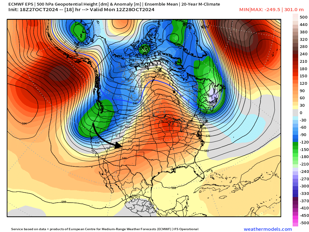
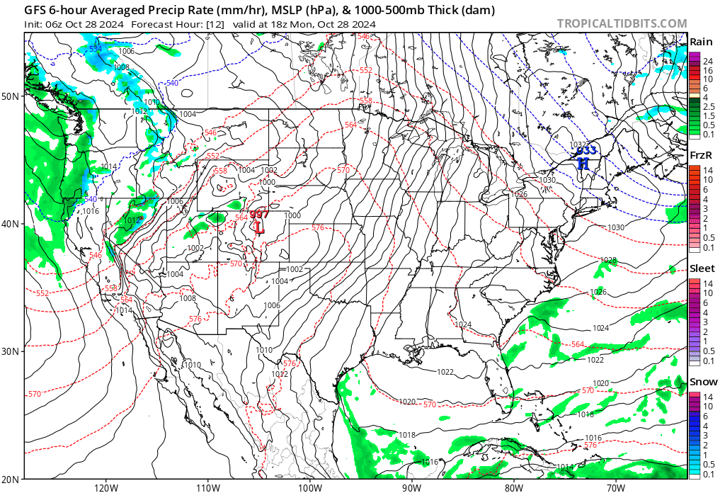
Here is the placement of the trough Monday morning:
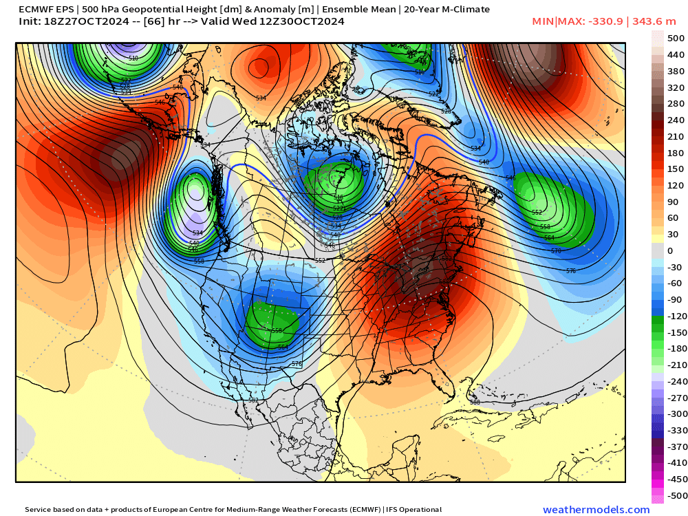
By Wednesday we see that trough centered over the Four Corners region, ushering in quite a bit of chilly air, and of course some rain and snow for the state.
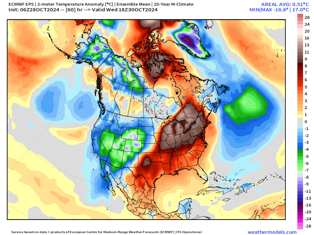
Surface temperature anomalies for Wednesday morning show temperatures well below average across the state, with the warmer than average anomalies parked on the ridge that builds in across the East:
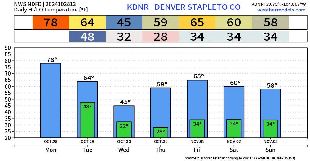
The forecast calls for a high of just 45°F on Wednesday in Denver, dipping into the mid to upper 20s for Halloween morning – bundle up! Some models keep overnight lows below freezing clear through the weekend, so we'll see how these current forecast lows hold up as we move through the week.
Of course everyone wonders if that midweek chill will bring with it rain or snow, and how much of that would linger into Trick-or-Treating on Thursday.
We'll answer the second question first. That is, it looks like whatever wet weather we manage this week east of the hills should be wrapped up by Thursday. Highs will be in the 50s, so a chilly day, particularly as the sun sets Thursday evening, so plan accordingly!
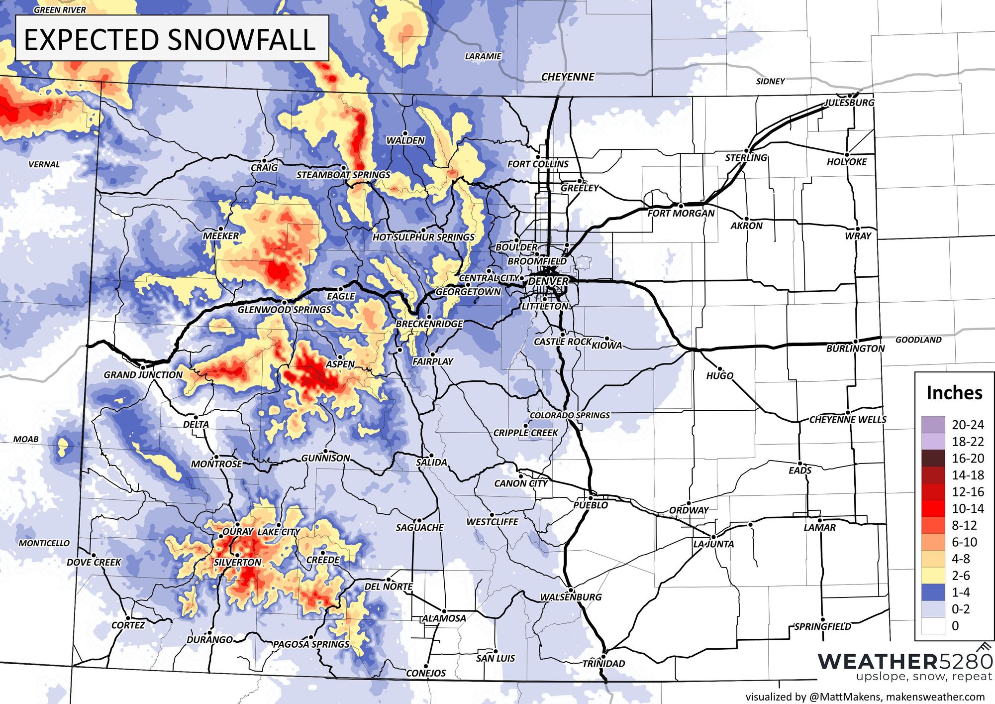
As for the first question... well, the track will be pretty good for some snow at higher elevations over the next few days. As we mentioned above, a Winter Weather Advisory goes into effect this evening, with some locales likely to see upwards of a foot of snow before all is said and done Wednesday evening.
As you can see below, only minimal precipitation makes it east of the hills, mainly Wednesday morning. A few models show at least a brief burst of snow pushing across the urban corridor Wednesday morning, we'll need to keep an eye on that potential. The greatest potential to see some flakes looks to be along the foothills adjecent to Denver, and the Palmer Divide. Little accumulation, if any, is expected at this time.
Here is the snowfall forecast through Wednesday:
In short
Much cooler weather on the way after today, with the coldest day being Wednesday. High country snow kicks in tonight, and continues through Wednesday, with upwards of a foot possible for the highest terrain.
Halloween is looking cool, but mostly dry across the state.
Long range
As we discussed last week, this system will be followed by another as we move into the first days of November. There's a lot to come together for this next system, so plan to keep an eye on the forecast as we head later in this week (sign up for email alerts) in case we finally manage to piece together a storm. Not convinced just yet, but about as much potential as we've seen yet this fall. I know that doesn't mean much! 😆