
Denver Weather: Weather planning for your week

Happy Sunday. It's been a gorgeous weekend, and quiet weather will be here – for the most part – this week. Tuesday may see some quick showers trying to pass by, with mountain snow.
First, more on the snow. The white stuff will be falling in parts of the mountains Monday and Tuesday, albeit not that much. Some of those showers will try to sneak into the metro areas Tuesday.
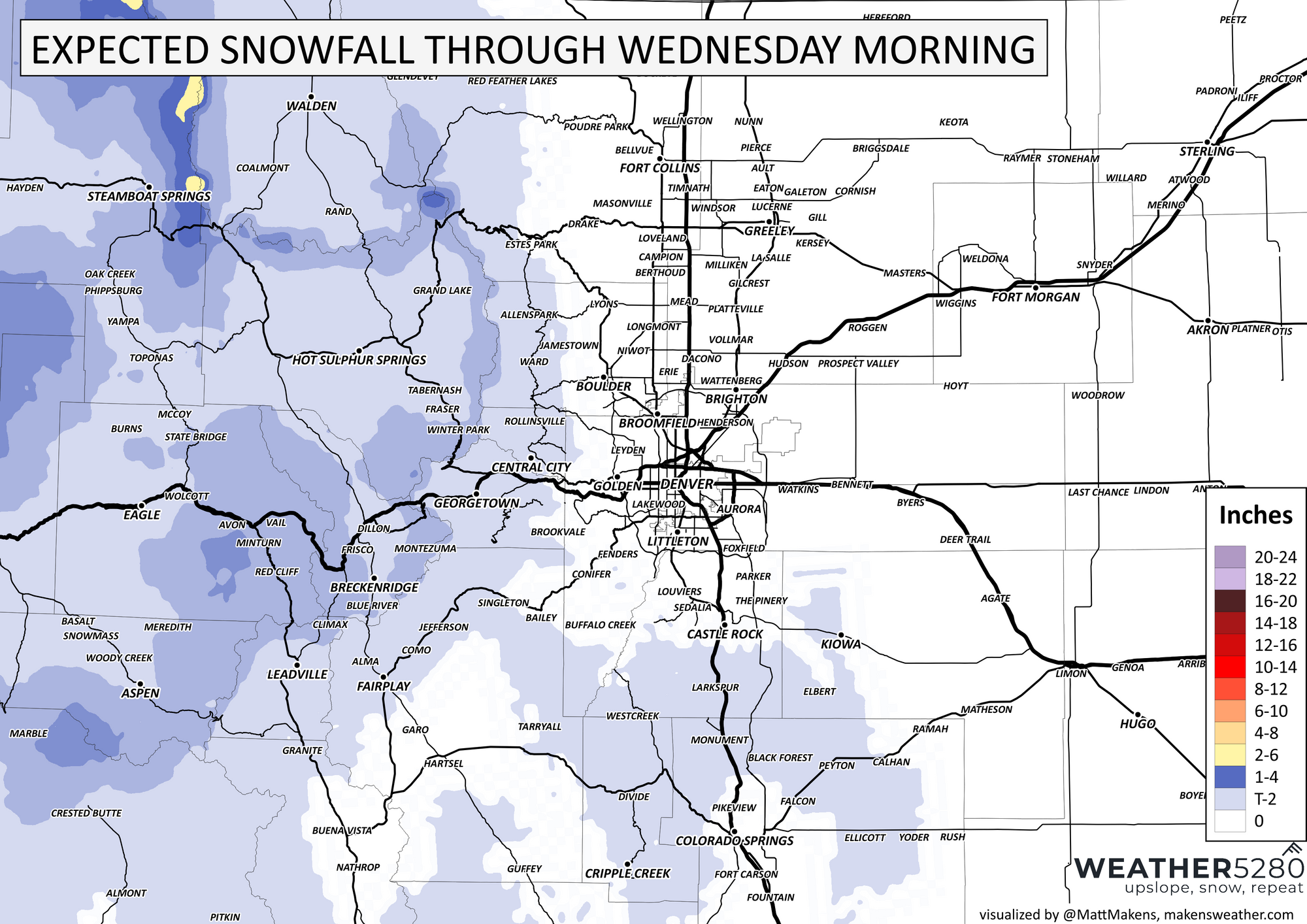
Here are the totals expected:
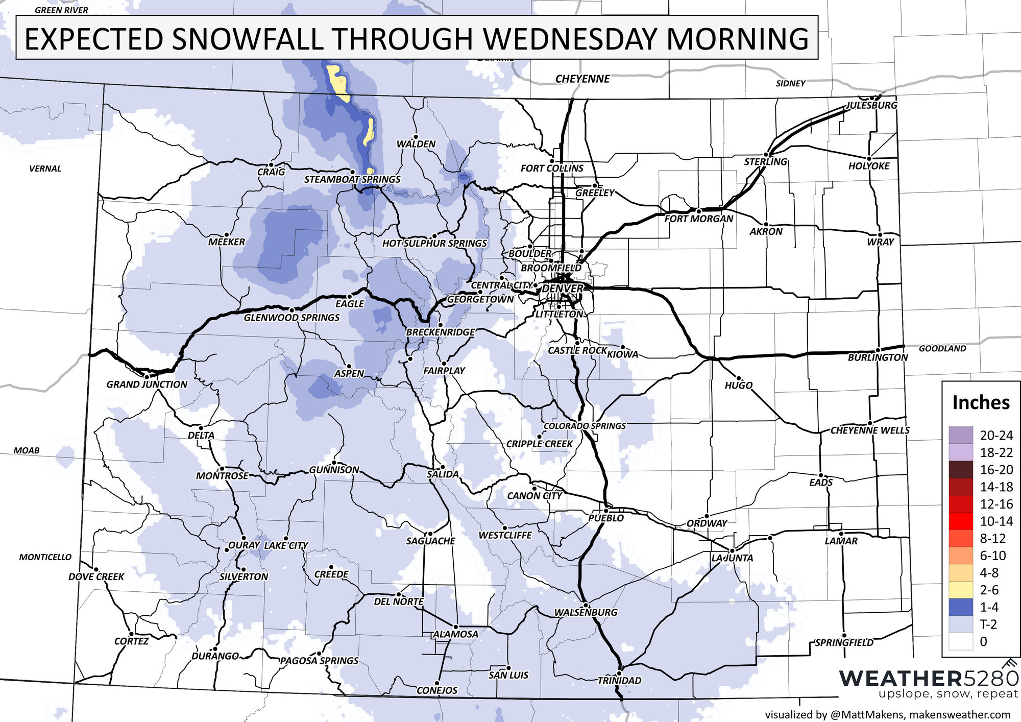
There's a hint of snow possible on the Palmer Divide and north/west sides of Colorado Springs.
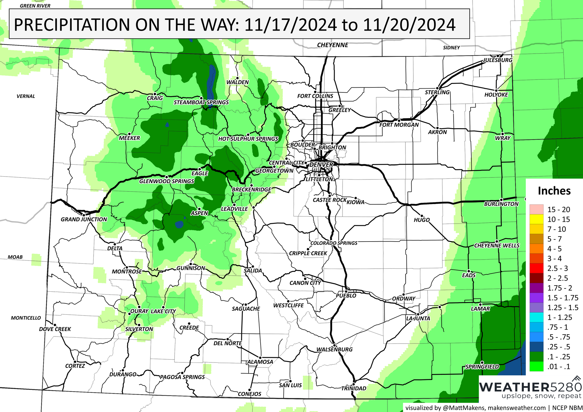
All in all, though, that's not much water. If we look at just total precipitation, it's a dry system, relatively speaking, with exception for some spots in the mountains that may come away with 0.25-0.5" of water.
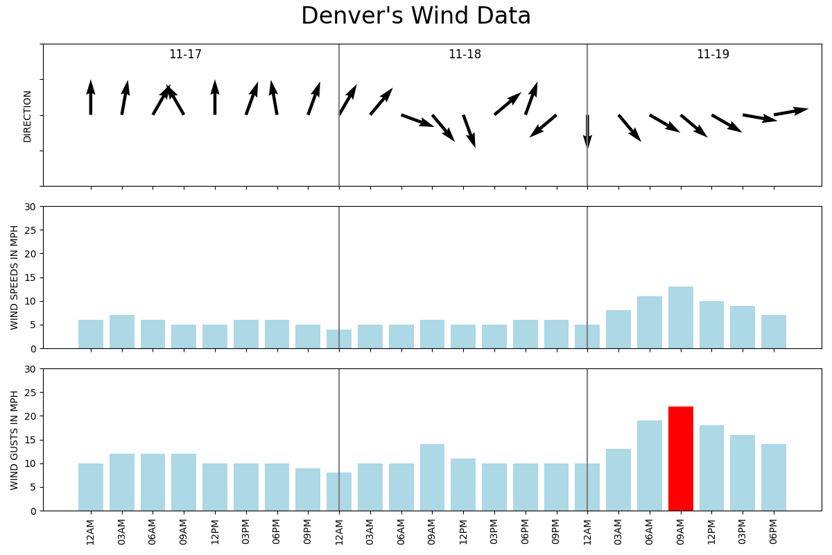
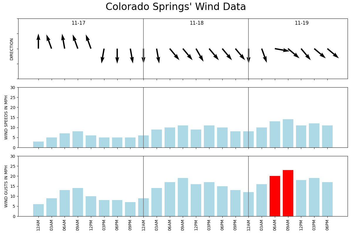
With the passage of this little ripple, there may be some gustier wind to add a cold bite to the air Tuesday. Right now, it looks like Tuesday morning will be the windiest and may be stronger on and south of the Palmer Divide for Colorado Springs versus Denver here on the north side.
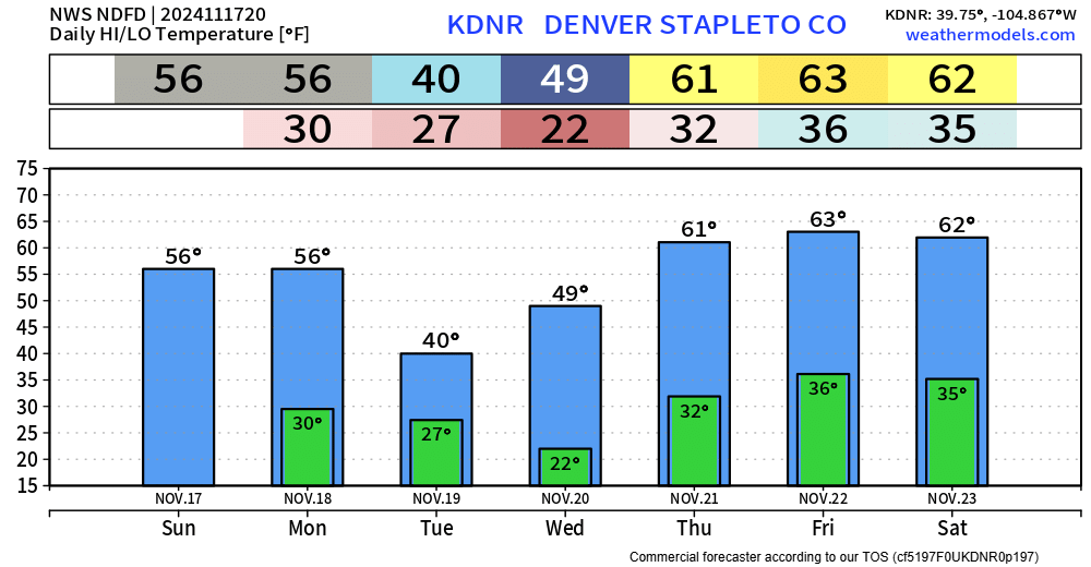
As this system exits, we likely warm to well-above normal temperatures - some 60s later this week. Here is the daily breakdown for highs/lows expected.
Beyond this week, we clearly enter a busy holiday period for Thanksgiving. There is currently a slight chance of receiving heavy snowfall in the region between the 23rd and 27th. History suggests that moisture will stay in the mountains as analogous weather patterns usually leave the Front Range drier, but we will be watching that for you and will pass along updates later this week so you can begin travel adjustments if needed.
