Denver Weather: Considerations for rain and snow heading through Thanksgiving travel days

Some of us woke to a quick skiff of snow from overnight, the first of two chances for moisture before Thanksgiving. The next chance for rain and snow will be late Tuesday through Wednesday with travel impacts expected.
Here's a quick look at the snowfall from last night.
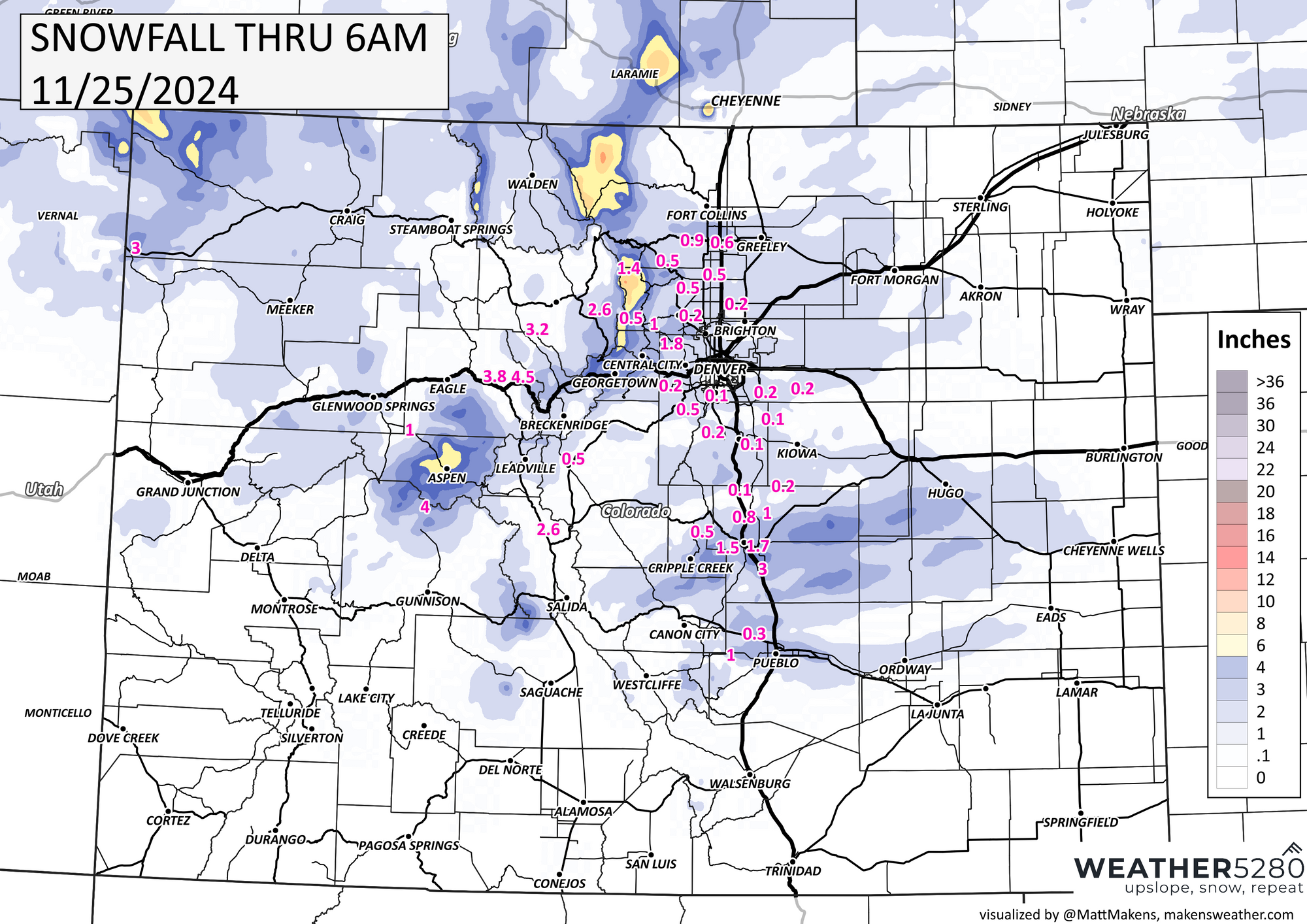
Colorado Springs had the most of the metro area locations.
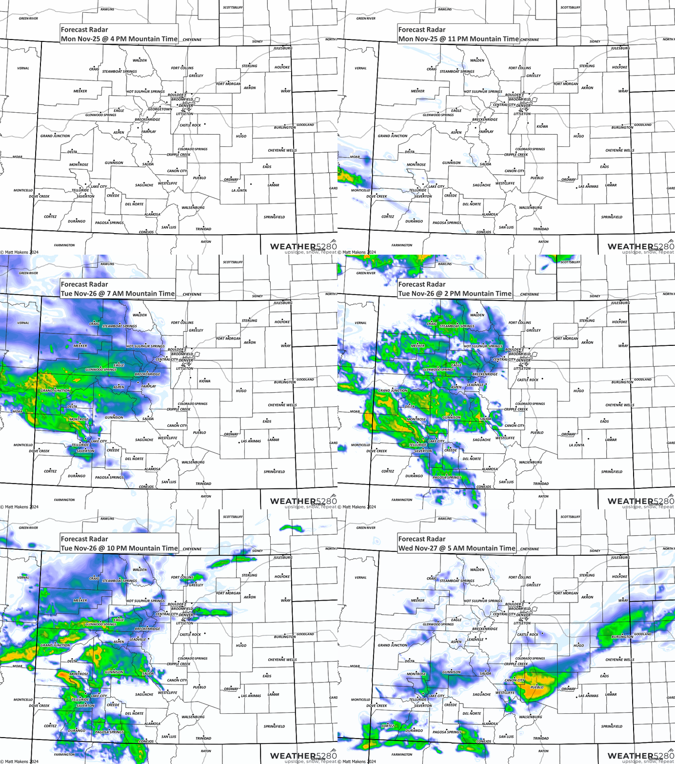
Now, let's turn to the timeline showing the chance for precipitation into Thanksgiving.

Note, the steady climb of chances into late Tuesday (this will be a rain and rain/snow chance), with the peak of chances coming early through midday Wednesday (this will be snow chances).
We will need to be careful about icing by Tuesday evening, any wet pavement can obviously freeze as soon as we hit the evening. This initial chance for rain may also limit some public works departments from pre-treating roads for such ice.
Here's an animation walking us through the showers as they arrive. Notice how these are covering the mountains quite well, but only scattered for the Front Range and Plains, so you aren't necessarily guaranteed moisture if you are in the metro areas. The Foothills and Palmer Divide definitely carry the higher chances again this time.
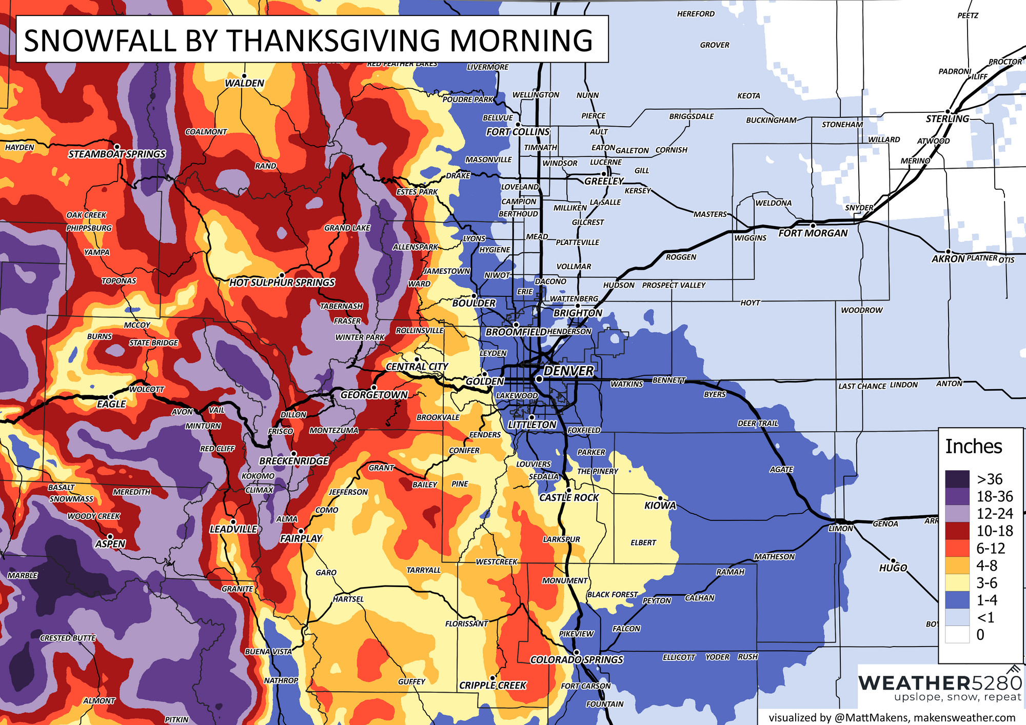
As far as totals, it feels like these may be a touch high on the Palmer Divide, but generally speaking here is a snowfall outlook through Thursday morning. I will add some caution when looking at this forecast...there easily could be a narrow band (talking just a few miles wide) that forms somewhere between Fort Collins and Downtown Denver (another possible on top of Colorado Springs). That snow band, if formed, could deliver several inches of snowfall that isn't accounted for on these two maps.
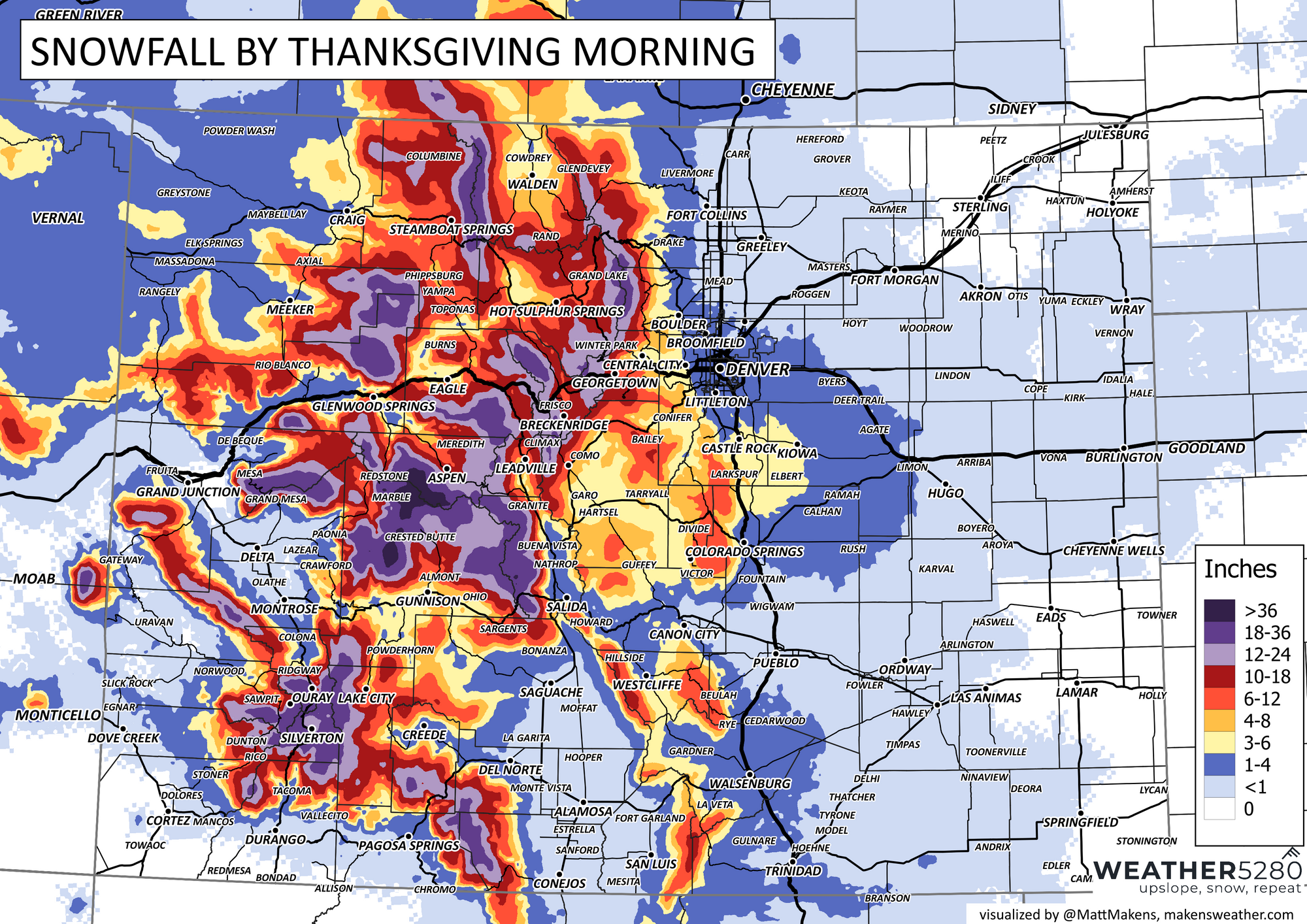
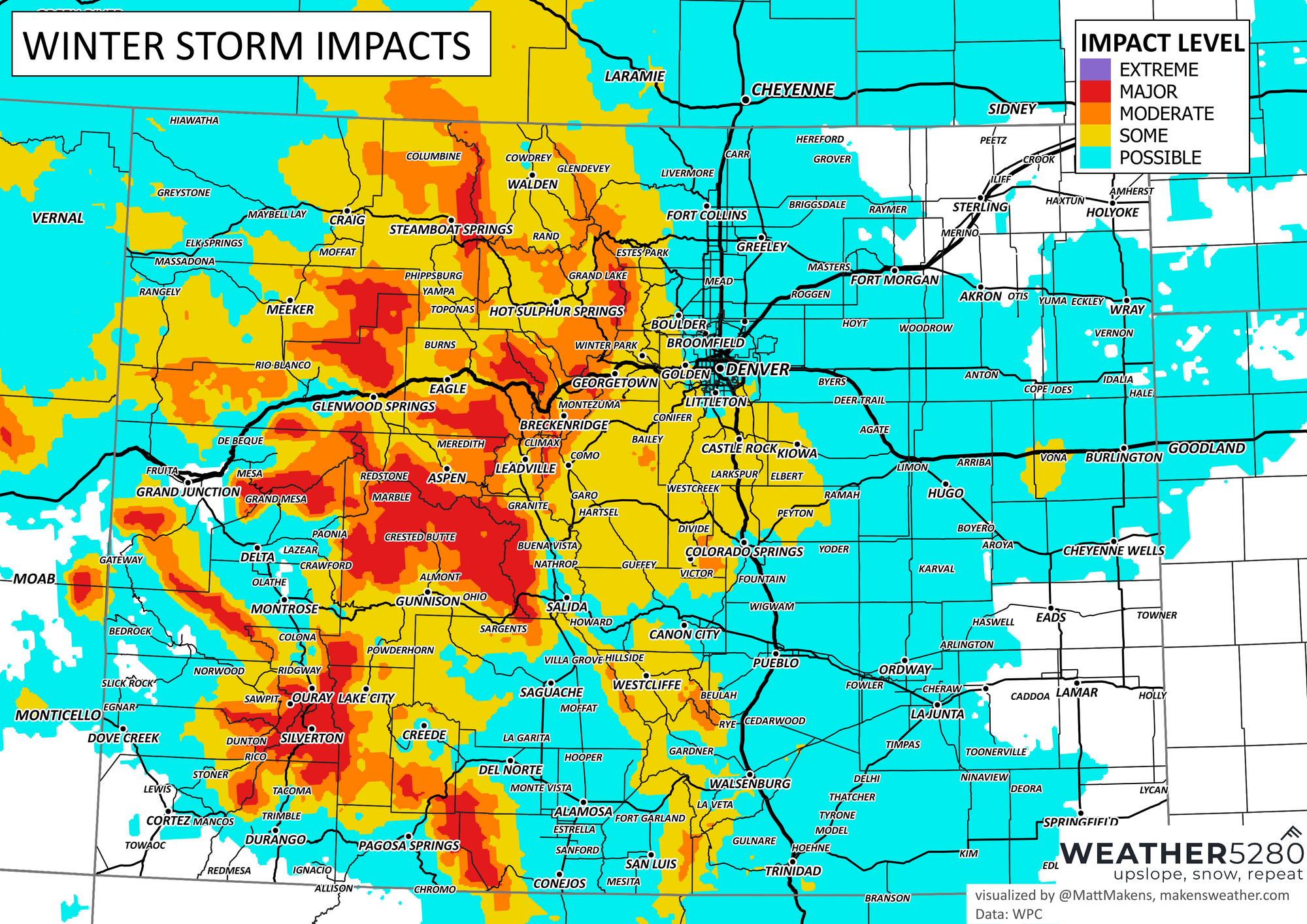
This can lead to travel issues, especially those going through the mountains or those headed south to New Mexico. The travel impact will be significant though for the mountains.

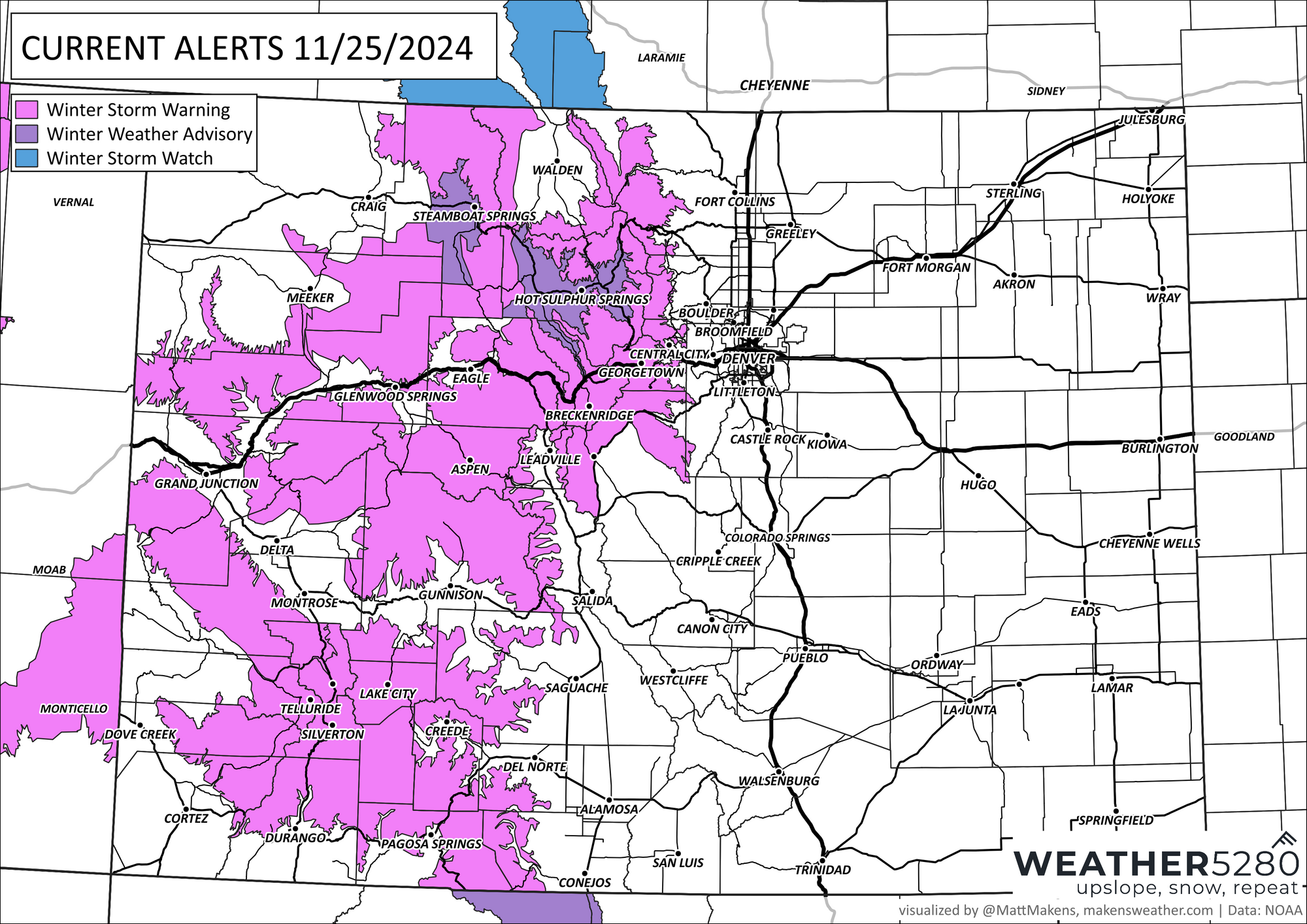
This impact of 12 to 24 inches of snow is why we have a number of alerts issued for the high country (enjoy that fresh snow to ski on though).
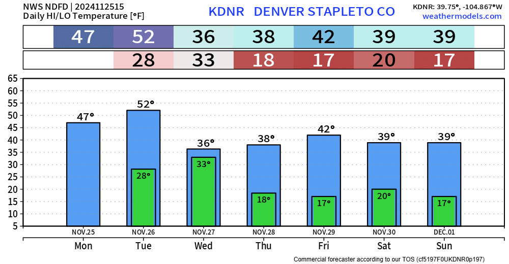
By Thanksgiving, however, this system will clear out and leave us with a calmer Thursday, albeit chilly. In fact, it stays cooler through the weekend. Thankfully from a travel perspective, we have an easier drive for the weekend with dry weather expected through Sunday.
If you missed it, we posted earlier this week about the winter outlook and trends as it pertains to La Niña. Here is that article:
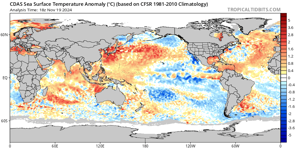
And, if you are still wondering what in the world El Niño and La Niña are and why they matter, check out this explainer:
We hope you have a great Thanksgiving and safe travels. We will be here passing along forecast information to get you through. Subscribe today for our emails.
