Colorado Weather: Beautiful weekend leads to Monday snow for some

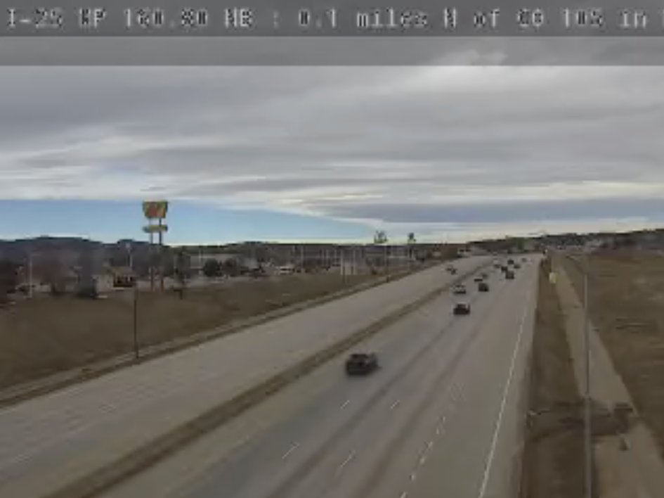
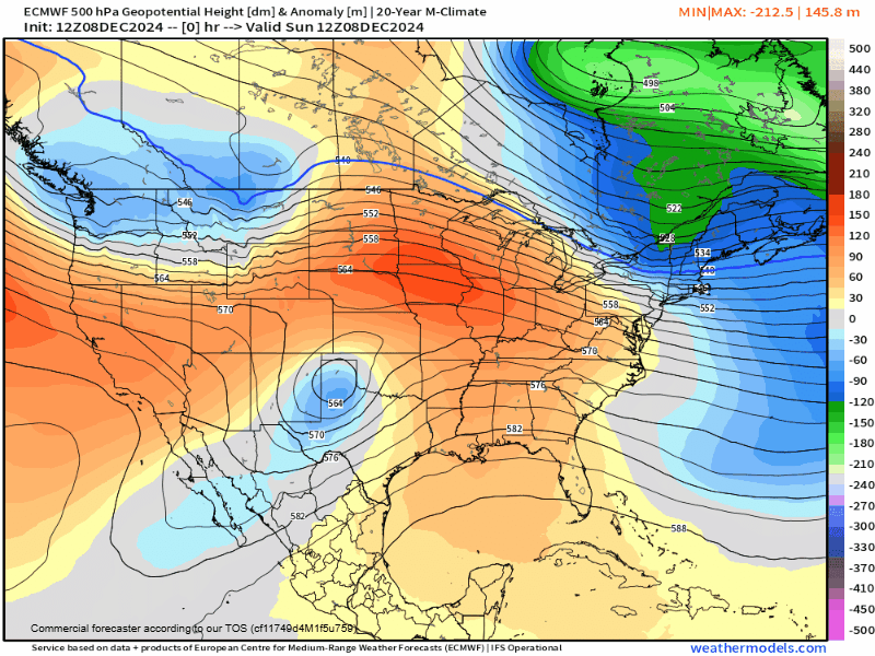
What a December weekend out there! Plenty of folks in the 50s and 60s for both Saturday and Sunday. Today, we're starting to see the change in the weather pattern ramping up – we've got a really neat mountain wave cloud that's setup across parts of the I-25 corridor as we turn the page into Sunday afternoon. That's the first signal that we've got some changes on the way.
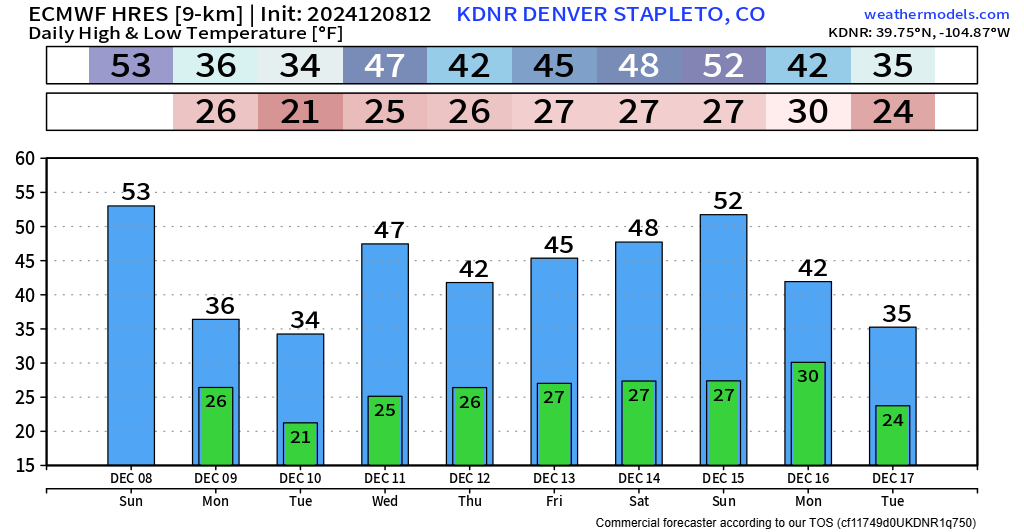
We're expecting a pretty fast moving cold front to kick through Monday morning, with temperatures not expected to make much of a recovery from what low temperatures end up getting to.
We're expecting most folks along the front range to only see highs in the 30s and low 40s! Get the jackets ready!
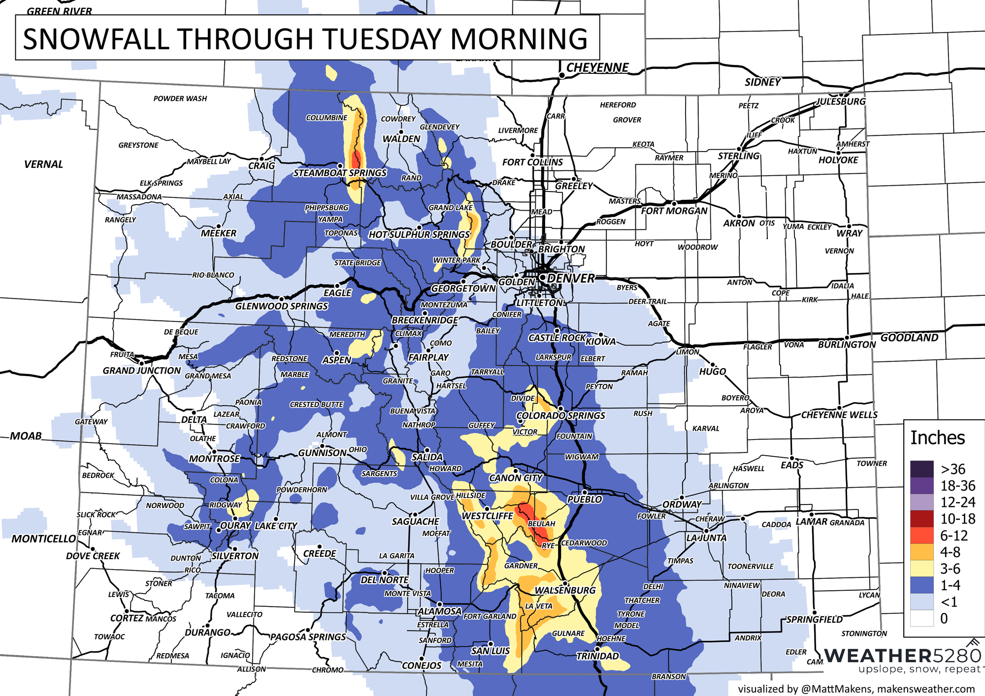
We also touched on some snow potential last time... unfortunately we didn't make much head way for the northern front range, once again... At this point, it seems like best snow chances for I-25 will be from Castle Rock and points south. Some snowfall could be heavy for Teller County, and areas near the hills further south (Wet Mountains/Sangres). In Colorado Springs, some sort of 1-5" smorgasbord is expected – looks like heavier amounts would end up on the west side of town.
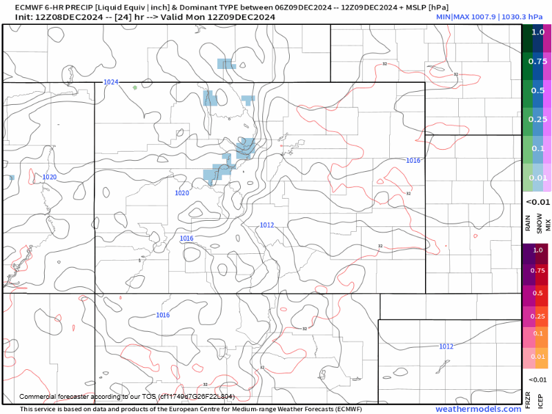
As for Denver, the northern front range and the foothills... a couple brief snow showers aren't impossible tomorrow, but we're not expecting accumulations.
Here is a map of potential snowfall totals throughout the day Monday, ending Tuesday morning. Mountain travel could be a bit tricky during this time... but definitely not anything impossible if you're prepared.
Should be another cold day on Tuesday with a bit of a rebound into the close of the week. Seems like we could be on our way to another quick moving storm system at the beginning of next week, but for right now, nothing is set in stone just yet.
Stay tuned with us... we're thinking we keep the activity up and going through the end of this month – whether or not we get something to stick... that's a different story.