
Denver & Colorado Weather: Snow this weekend mostly trapped in the high country

Snow will fall on some of the mountains later today with the first of several weak storm systems that will pass through the region – for Denver, some wind and temperature changes are ahead.
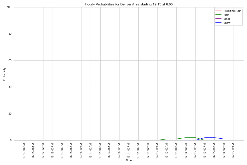
With that said, it is theoretically possible for the Denver area to see some precipitation Sunday into Monday, albeit a very low probability. To visualize that, here's an hourly timeline for rain/snow chances in Denver this weekend...that green and blue line (symbolizing the chances) barely budge.
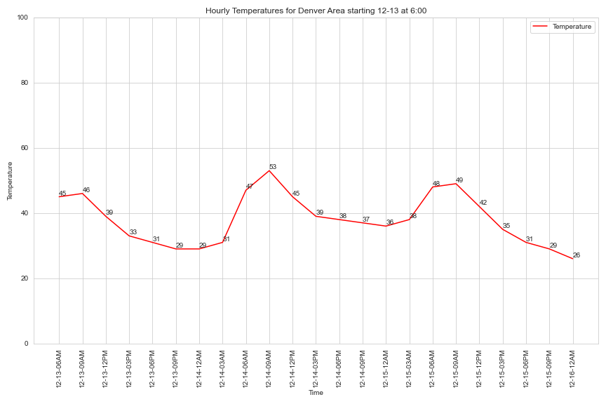
And while I have the timelines plotted, here is the one for Denver's temperatures through Sunday night. 50s Saturday and mostly 40s Sunday - both above average for the time of year.
Okay, so where is the snow and how close does it get to the cities? First an animation, a slow start until we get into the afternoon when you'll see some showers popping up. Kind of a snooze though...
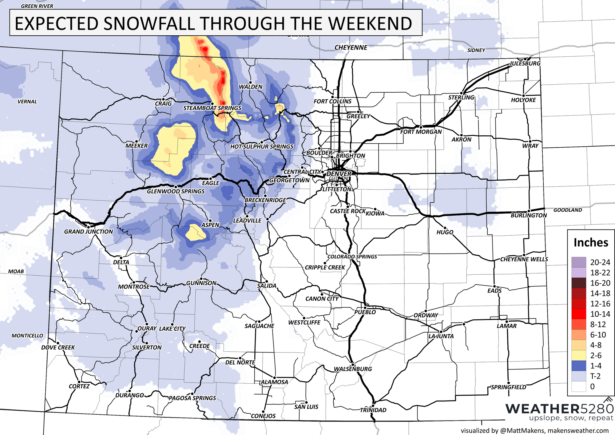
Here is the total snowfall that will be possible through the weekend, not gangbusters and unless I'm skiing at Steamboat Resort - meh.
Getting to the mountains may have some slick travel on the passes, but nothing widespread of concern for this weekend. Speaking of roads, should the metro locations in fact catch some moisture late Sunday... sure I could see some glazing of ice on the pavement so be careful in that remote case.
So, yes there is moisture this weekend but it isn't too much and isn't much of a travel concern. For the cities a warmer than average pattern continues. Into next weak there are other weak systems to move through, and as it stands now that is the case through Christmas week also.
What gives? The atmosphere has swung fully into La Niña (strongest atmospheric signal since early 2023) for the time and that will limit our White Christmas prospects for the cities. Need to know more about La Niña? Here you go, some weathernerd time: