
End of 2024 blows: the wind to be dangerously strong to end the year

You may have noticed the wind picking up speed Sunday, well the strongest is to come and will become dangerous for travelers for two reasons - first high profile vehicles it goes without saying, but blowing snow and heightened avalanche risk for those in the mountains.
Here are the alerts as of 2:30pm Sunday:
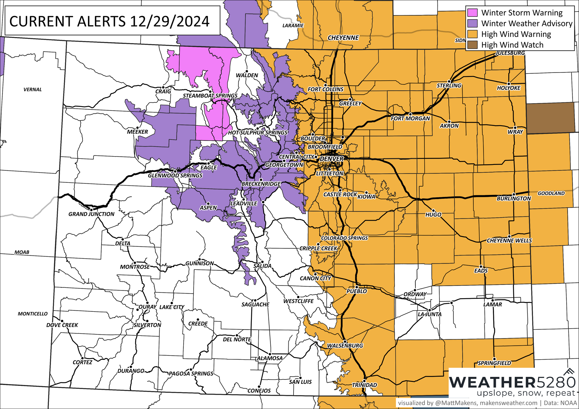
That's a lot of wind for the Front Range and Plains. The strongest wind is expected between 5am and 2pm Monday. That wind is going to be 30 to 40 mph overall, but gusts can reach at least 60mph. Those classically windier places, Boulder we are looking at you and Golden, can reach wind gusts stronger than 75mph.
Similar speeds are expected around Colorado Springs, but they'll be windiest for a longer period; starting tonight from 11pm through 5pm Monday.
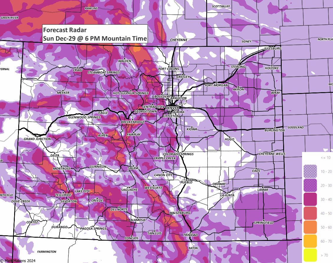
Here's a timeline of the wind.
In addition to the wind, there are areas of new snowfall in addition to blowing snow. Totals through the next three days look like this:
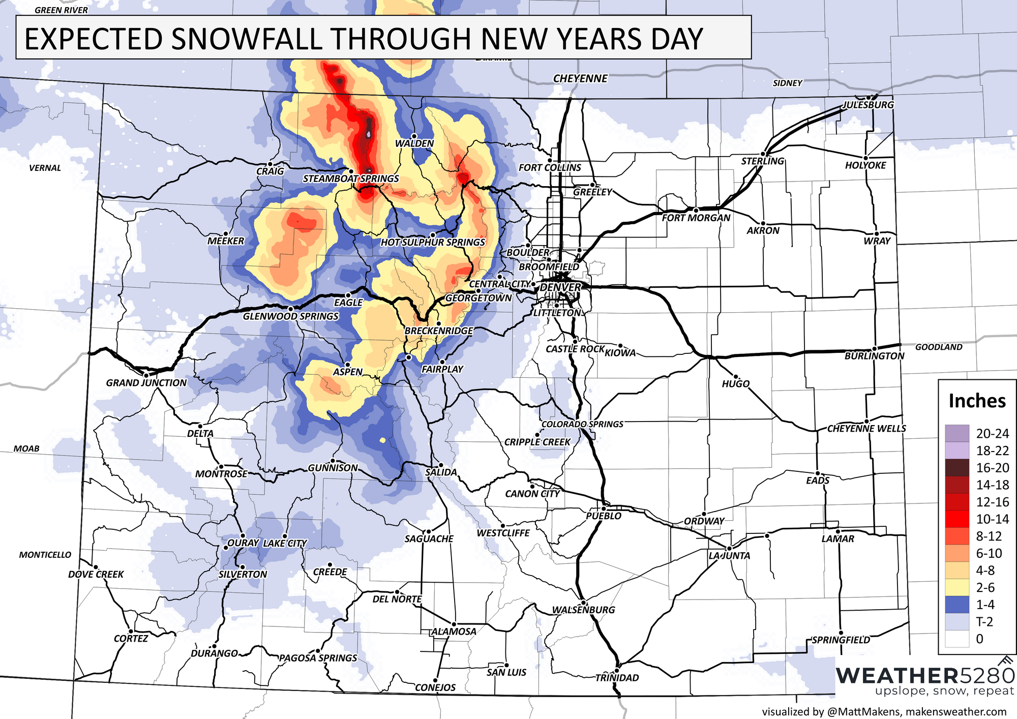
Yes, that's mostly - MOSTLY - confined to the mountains but don't be shocked if a rain or snow shower should pass by anyone along the Front Range. Here's a timeline of shower activity. For the most part, the windiest times are the driest and we have an increased chance for showers prior to and after the strongest wind.
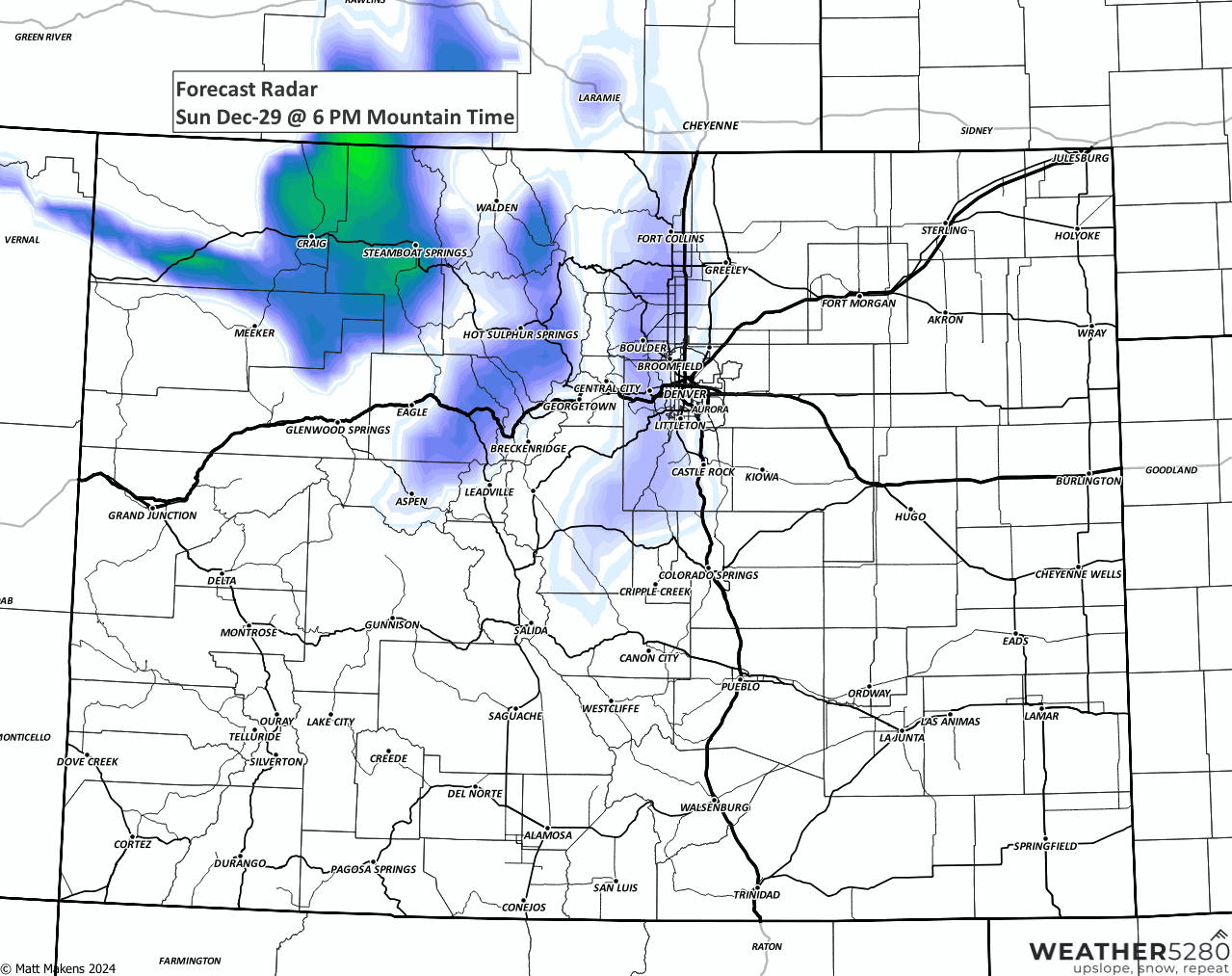
Or, if you prefer the hourly format. Here we have the precip chances.
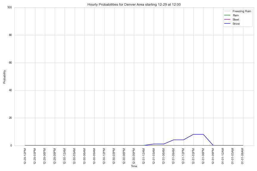
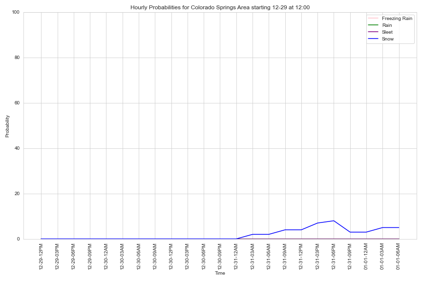
For both Denver and Colorado Springs, that is a very slight increase in snow chances for New Year's Eve.
If you are wondering if this wind pushes in cooler weather, yes, and lasting a bit longer than the wind this time too. In hourly form through the New Year, here are hourly temperatures for Denver and Colorado Springs.
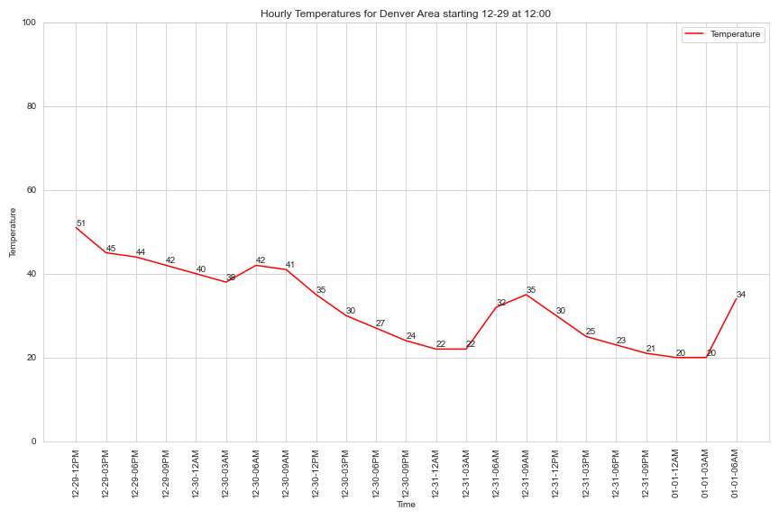
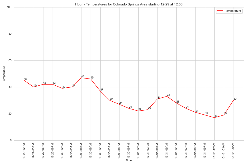
Although the wind won't stick around, the cooler pattern will through mid-week.

Happy New Year!