
Cold start to the New Year for the Eastern U.S., what this might mean for Colorado

Happy New Year everyone! We hope you all had a happy safe evening celebrating, and how about the sneaky snow bands that delivered a bit of snow to a few lucky ones as a final goodbye to the year? CoCoRaHS reports show about 0.2 to 0.4"on the south side of Denver, with a narrow 0.5" to 1.8" north of the city.
Cold coming?
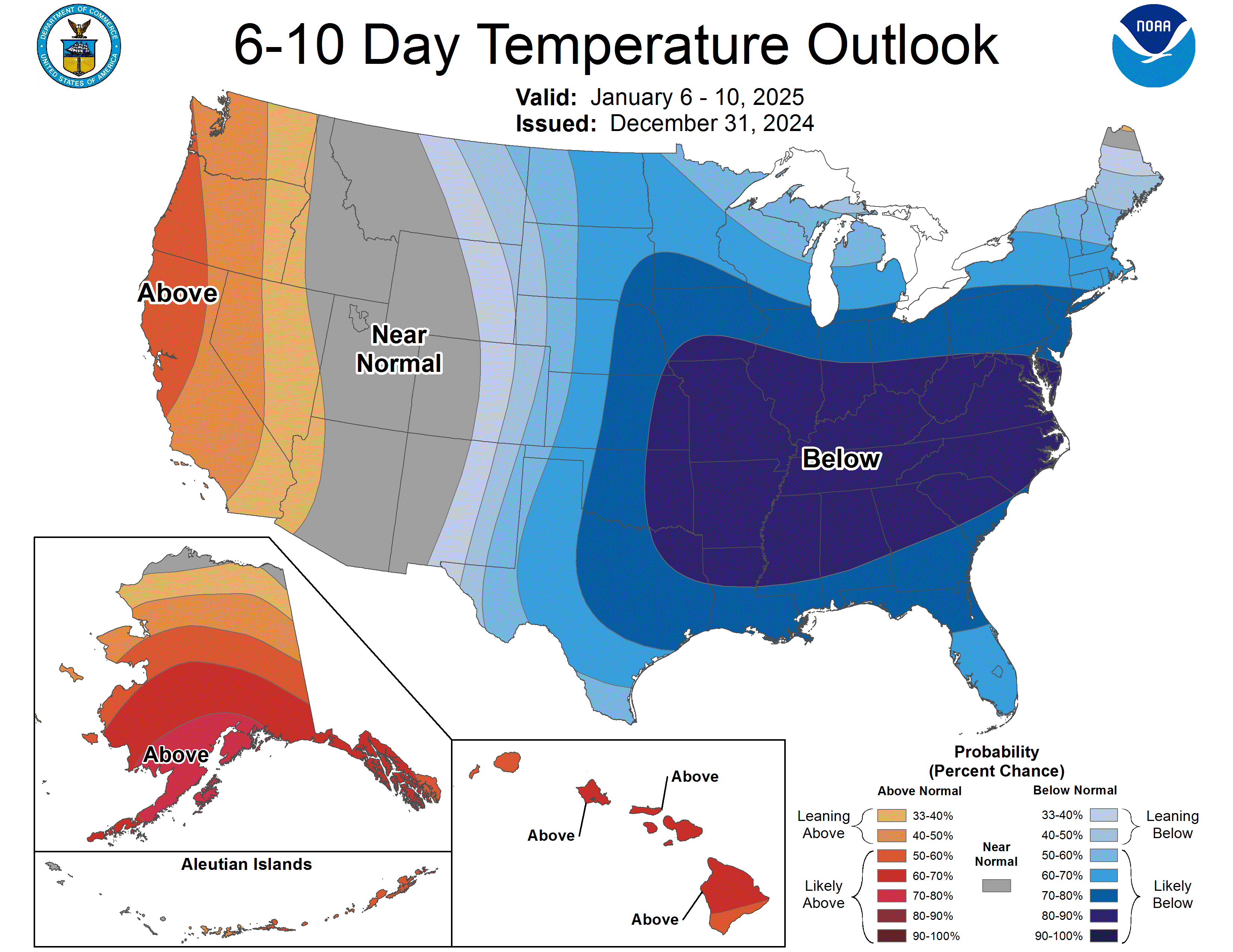
The pattern appears ready to unleash some pretty impressive cold to start the New Year, particularly so across the eastern third or two-thirds of the U.S. Below is the outlook from the NWS for the 6 to 10 day period, showing pretty high confidence in those below-average temperatures across the Midwest, Southeast, and on up into the Mid-Atlantic states and New England.
The 8 - 14 day period looks similar, with perhaps a bit more anomalous warmth building into the west, and the core of the cold shifting a bit further east.

What you'll notice in both outlooks is Colorado's split. Average to warmer than average more likely west, with a colder than average bias east. Fairly typical for this setup.
The question is, does eastern Colorado see some of the more impactful cold over the next couple of weeks, or does it end up just a hair east of us?
Well, the truth is, it's a bit hard to know at this point. Good confidence in a number of waves of cold air pushing south in to the CONUS over the next two weeks, but the devil is in the details, especially for us.
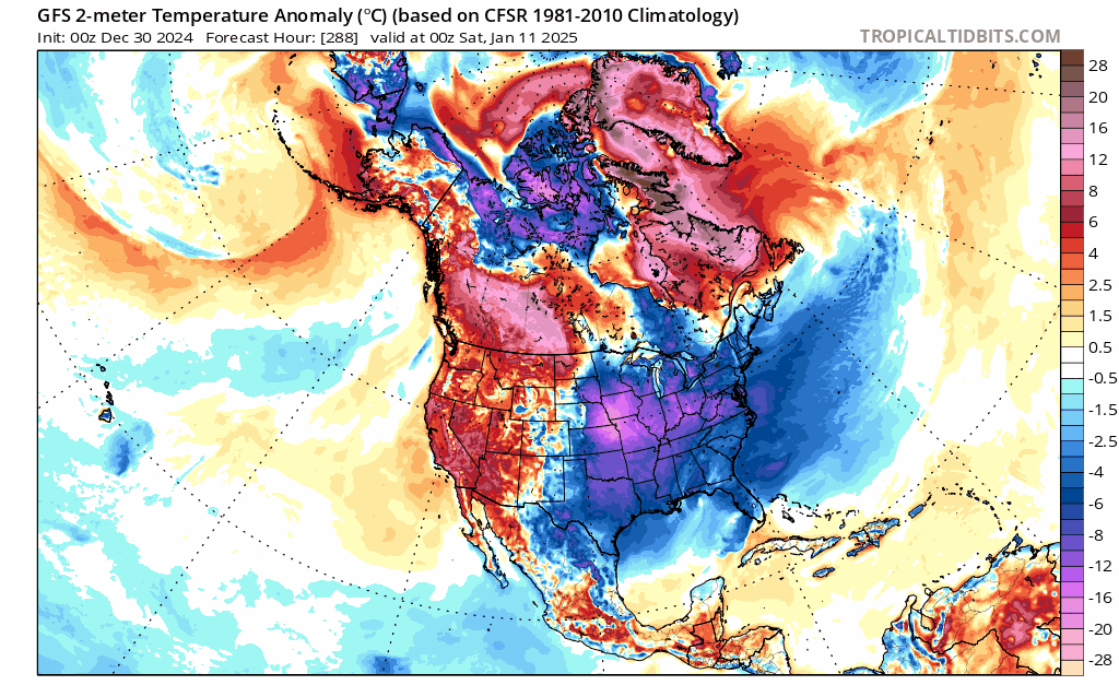
One of the colder periods looks to come around January 6th - 12th. You can see in the GFS below that each of its last 10 runs have that cold, but placement and severity changes quite a bit. A couple of these solutions back the cold right up against the Rockies, while others are a bit further east with even some downsloping (warming) for the Front Range.
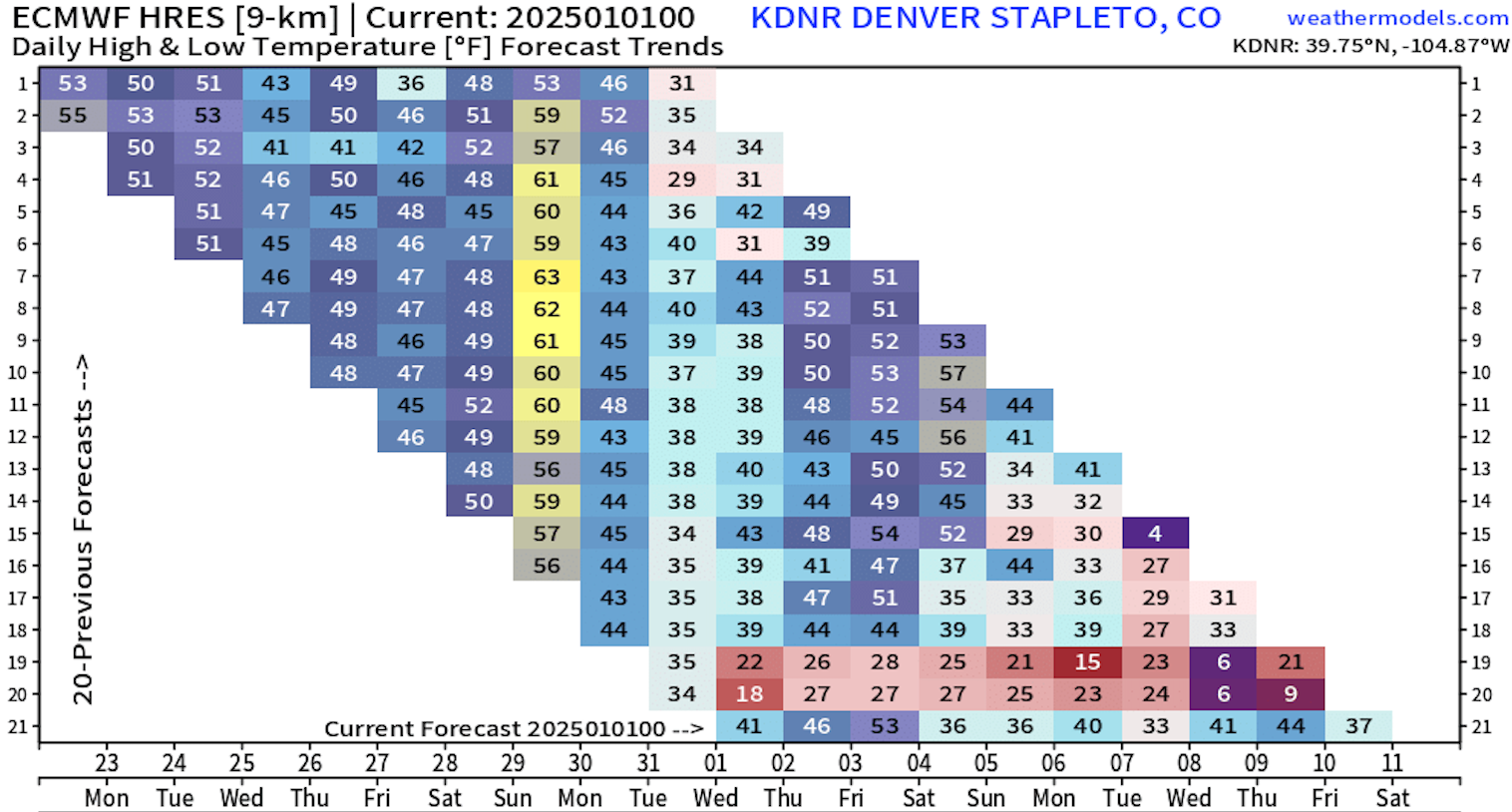
The European model shows a similar volatility to the forecast for our area. The most recent run was quite mild, overall, with temperatures around the 8th - 10th in the low 40s, while the prior two runs had 20s and single digit temps for the same period!
For now, best to just keep an eye on things. Nothing too, too crazy in the forecast for us, but the potential is there for one of these cold shots to hug the hills and deliver a pretty good blast of arctic air.
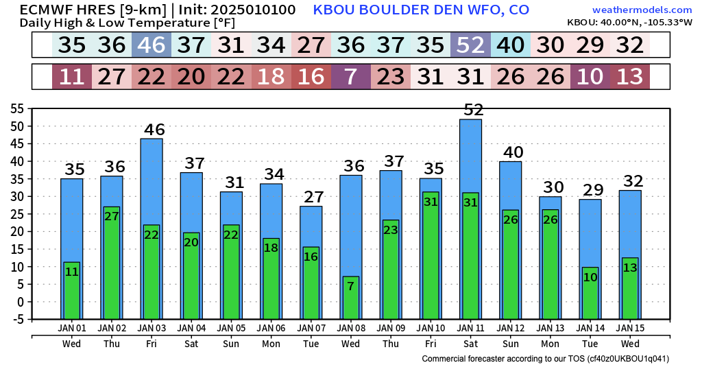
The temperature outlook to start the year from the latest GFS and Euro are similar at this point, a bit of warmup to end this week, then we start a bit of an up-and-down period as cold begins to push south in waves. From late this weekend through much of next week looks to feature generally below average temperatures for our area. The cold front expected Sunday could pack a bit of a punch, and it's possible we see a reenforcing shot of cold arrive Tuesday into Wednesday:

And how about snow?
Hard to be overly excited about snow prospects through the period, but definitely a few chances along those cold fronts discussed above. The next best shot for snow for lower elevations along the Front Range looks like it may come around Tue the 7th (you'll note a cold front showing itself in both the GFS and Euro temperature outlooks above at that time). Not a zero chance the late-weekend cold front could produce some snow showers as well, but for the moment anyway most guidance isn't showing much outside of the mountains.
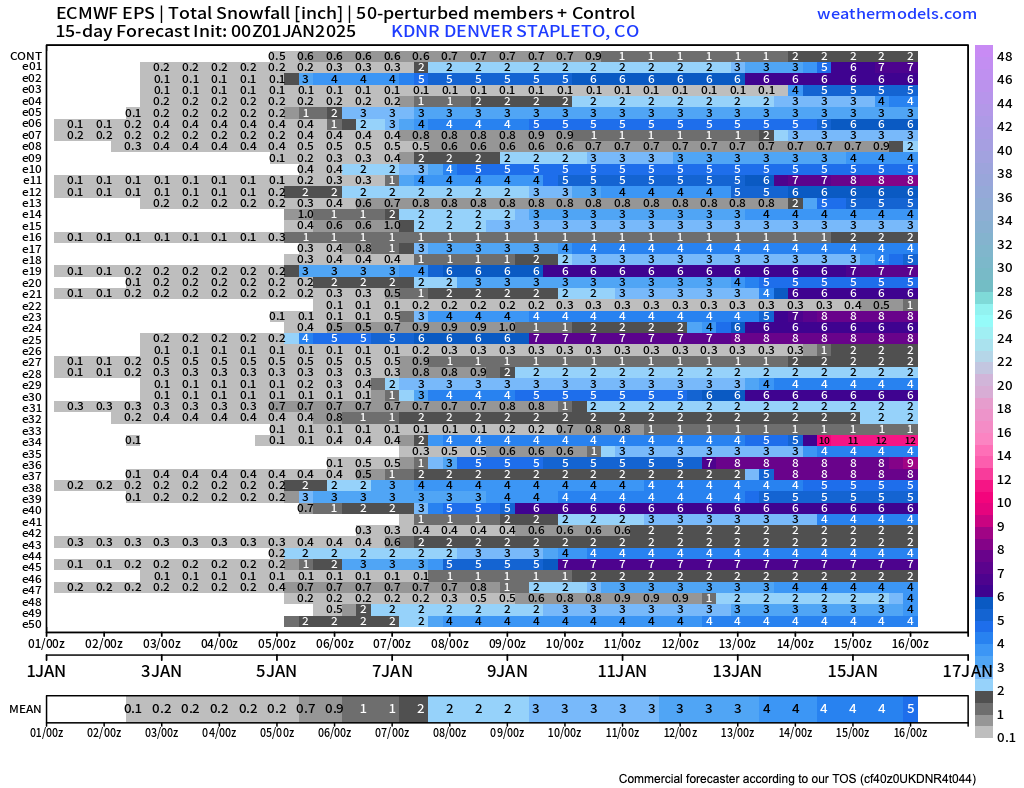
While the Euro (below) is showing just about 2" in the means through next week, it's worth watching just in case. A few models, at times, manage a bit more snow than this for our area, and any snow coupled with arctic air next week would have things feeling very wintry around here indeed.
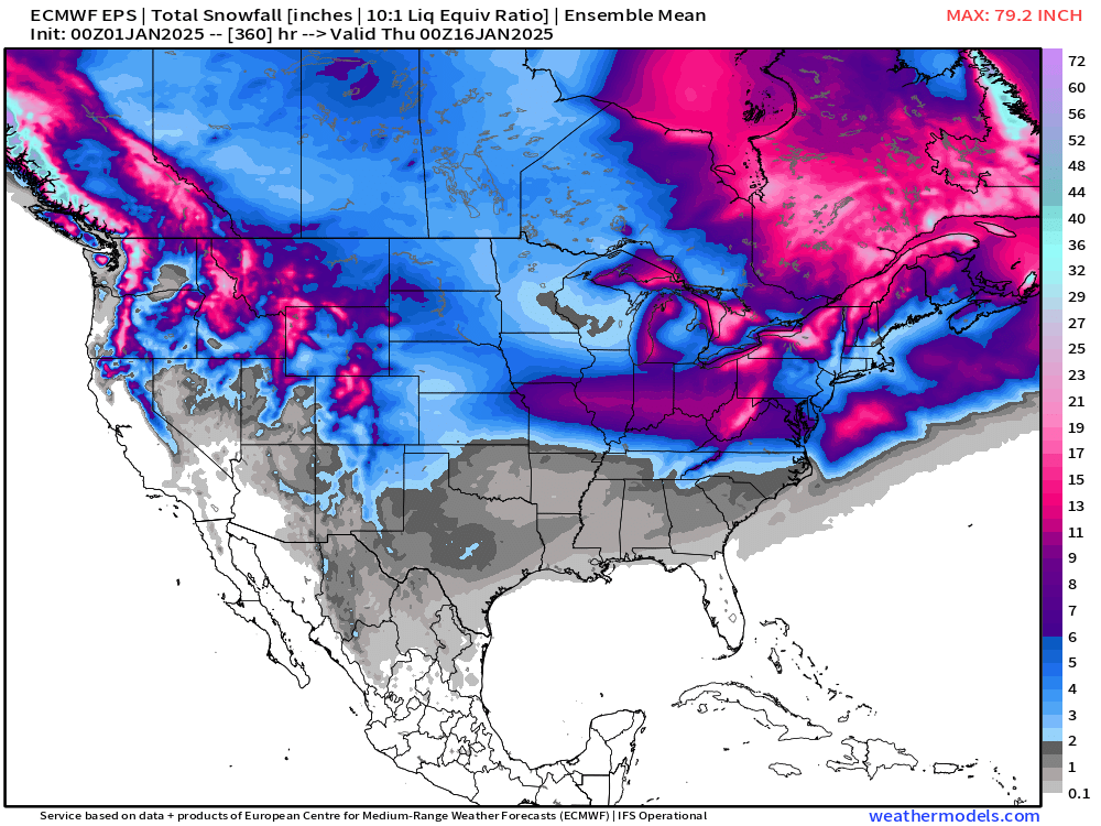
The overall look for the CONUS isn't too bad for snow lovers either, with a couple of impactful snowstorms expected across the Central U.S. over the next 15 days, and the Euro showing snow potential for every state in the lower 48 over this period!
For Colorado, a pretty snowy pattern for the northern mountains over the next two weeks, with some potential east of the hills depending on the details on just how the cold ultimately sets up over the coming weeks.
Stay tuned, and... Happy New Year!