Denver Weather: Snow, for some, comes this weekend, windy at times for now

Although warm to end the week, and windy at times too, there will be a quick system to spread some impact onto the metro areas this weekend. This system will cool us down a touch and spread some snowfall.
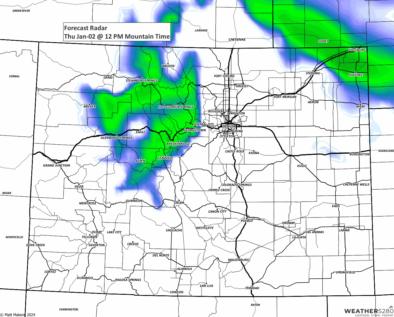
Until that system reaches us, the mountains will hold onto the snow. Travel over the passes may be tricky to slow due to strong wind blowing snow plus additional accumulations today.
Rabbit Ears Pass is snow-packed, but otherwise calm as of this snapshot Thursday morning, but conditions may degrade periodically throughout the day.
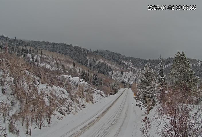
Rabbit Ears isn't the only pass with winter driving, most of those through the Central and Northern Mountains will have travel impacted.
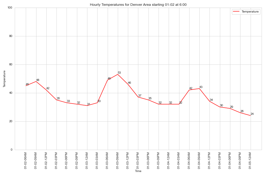
Other than some strong wind gusts, topping 65mph in the foothills, today and early tomorrow, Friday is the calmest day; Denver may not have much of that wind anyway.
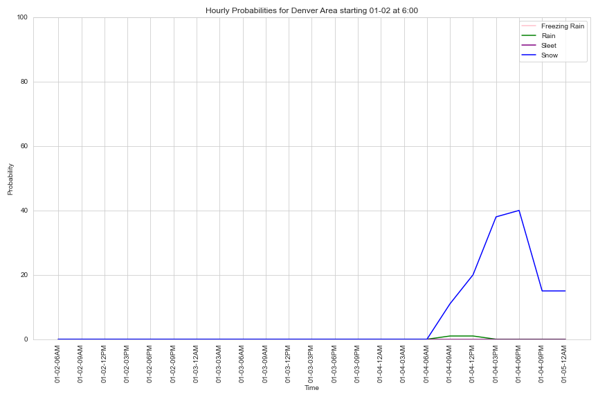
By Saturday, an impulse moves through and drops temperatures along with some snow. Here is a timeline, both hourly and mapped.
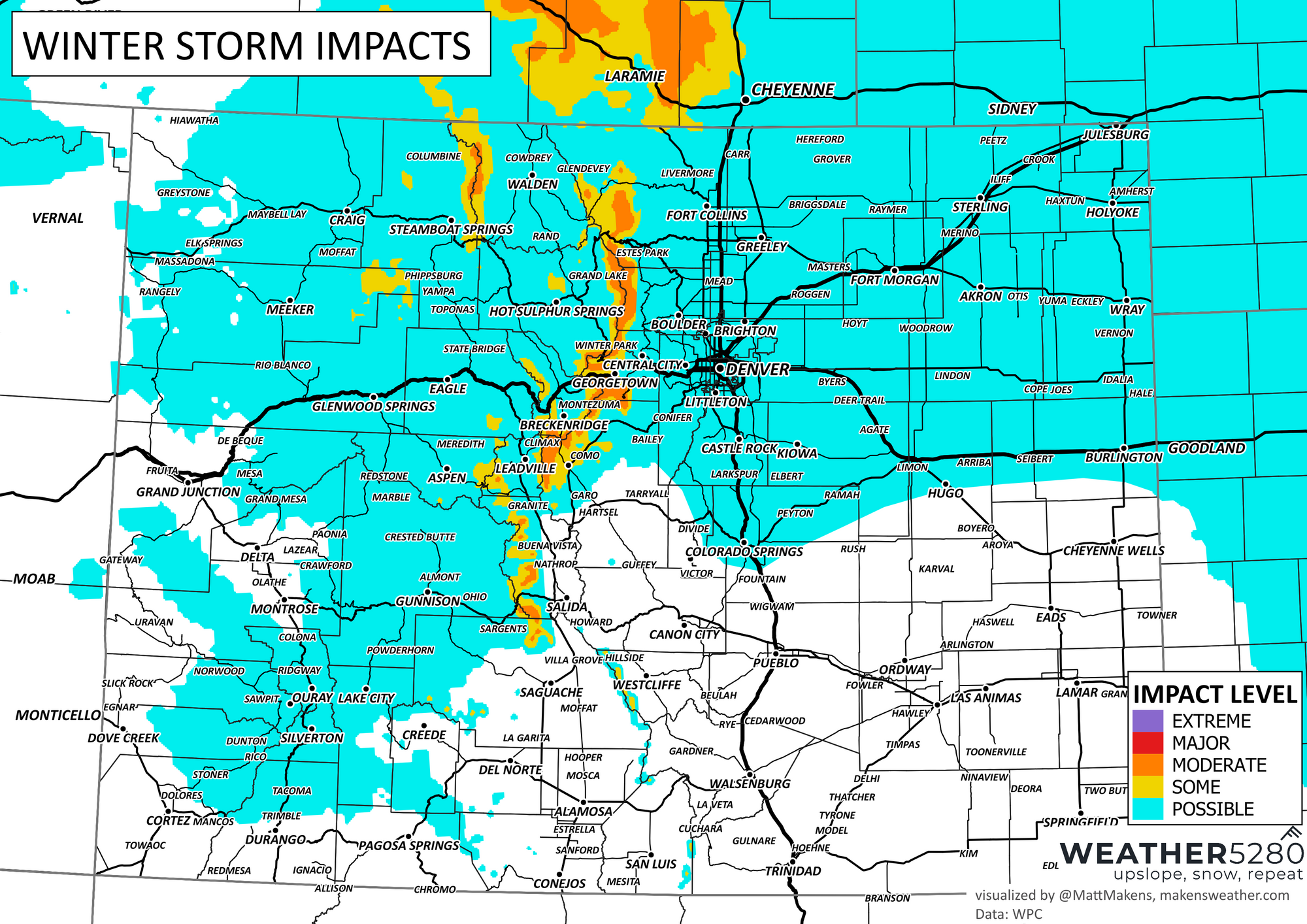
Here is the snowfall map through Sunday.
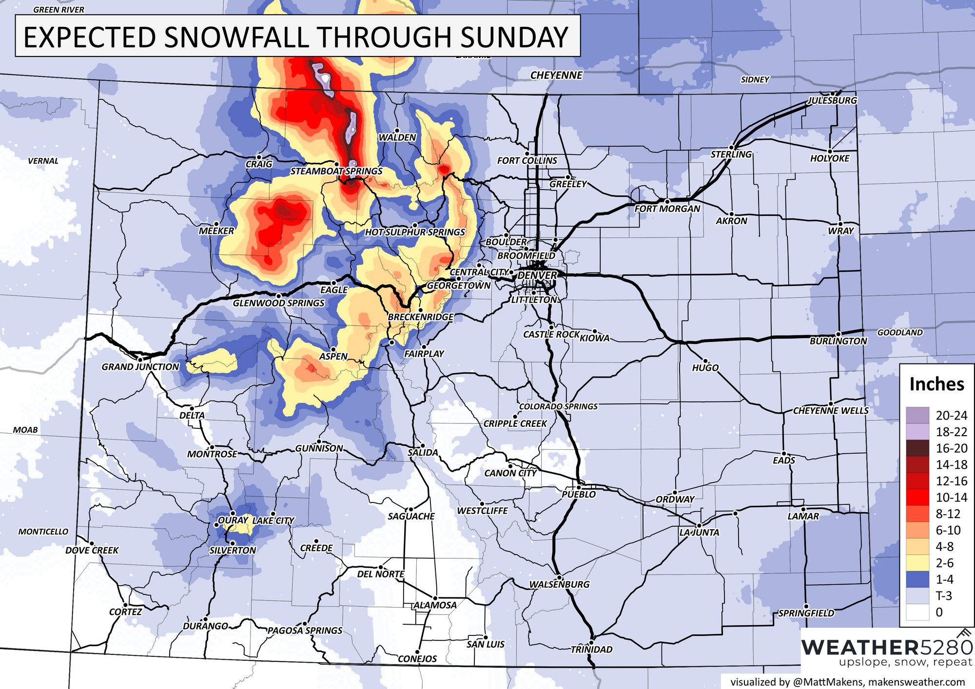
No, it doesn't look like a lot of snow for the metro areas, but icing can be a problem based on the snow falling as we transition from from the 40s prior to snow to the 20s by Saturday evening. The travel impact is shown here.

For this next batch of snow, Colorado Springs is on the edge of impact as this system will focus more on those along and north of I-70, plus a bit for the southwestern to central ranges.
There will, however, be BIG changes statewide by Tuesday and Wednesday.
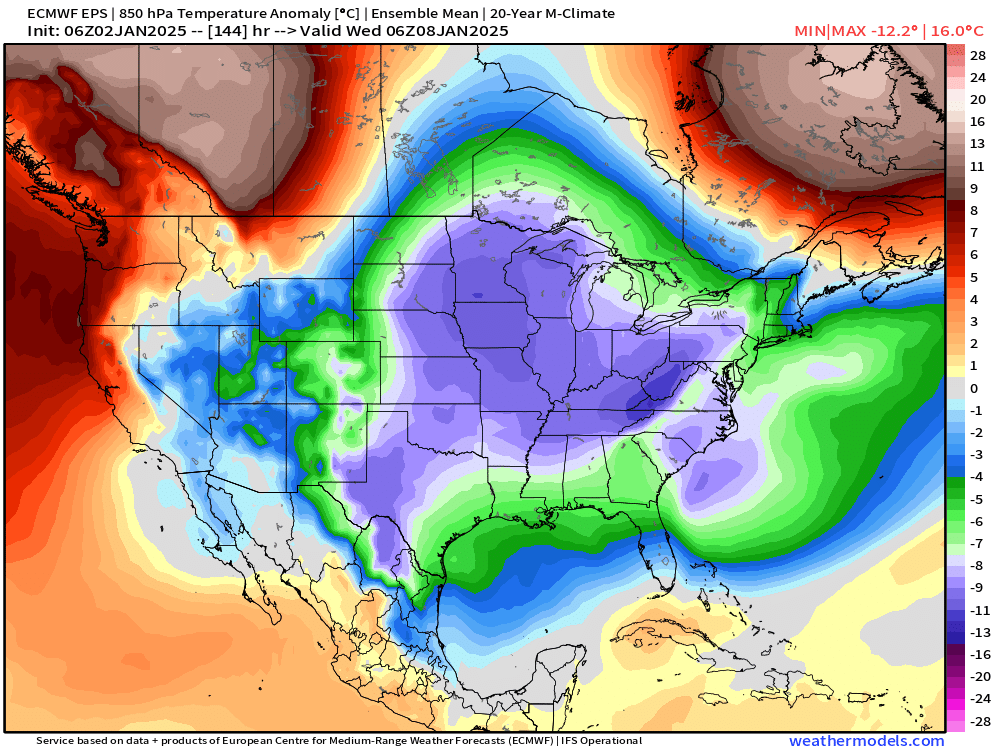
This will come along with the nation's first true arctic air outbreak of the winter as seen in the map above. Largely, it seems like the coldest air of that push would stay to our east, but we'll definitely get in on some of it. Some snow with that too?...
For now, plenty of time to track that one, so we will be in touch.