
Denver Weather: Foggy start, some icing, snow nearby this weekend

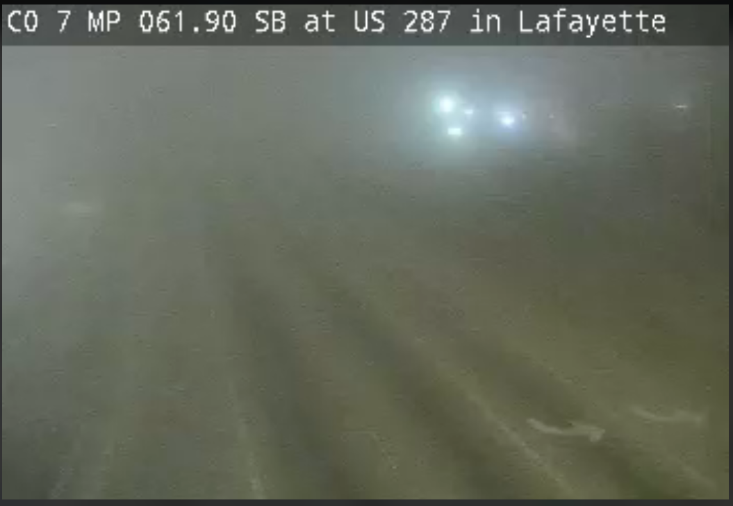
Saturday morning had a foggy start for much of Northeastern Colorado including parts of the metro areas, especially Denver to Fort Collins and Greeley. The thickest fog posed an icing threat on many surfaces.
Fog in Lafayette Saturday morning:
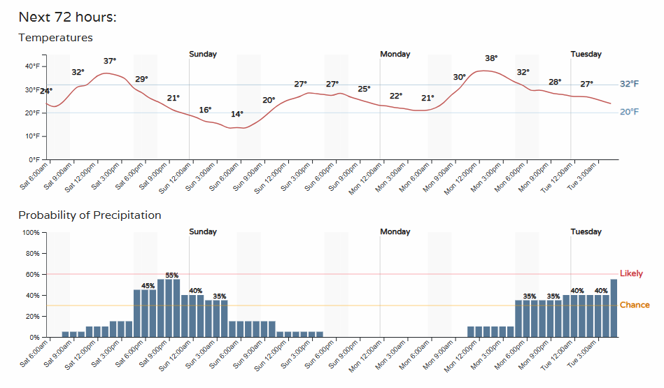
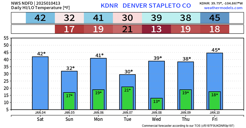
As fog dissipates, temperatures will remain cool today and we will be watching for snow showers to potentially move through. Here is a temperature and snow chance timeline which is similar between Denver and Colorado Springs:
Anyone traveling should know that snow will be heavy at times in the mountains, and we will see snow develop late covering parts of Northern and Eastern Colorado. Anyone traveling east through Kansas better hurry before they get stuck.
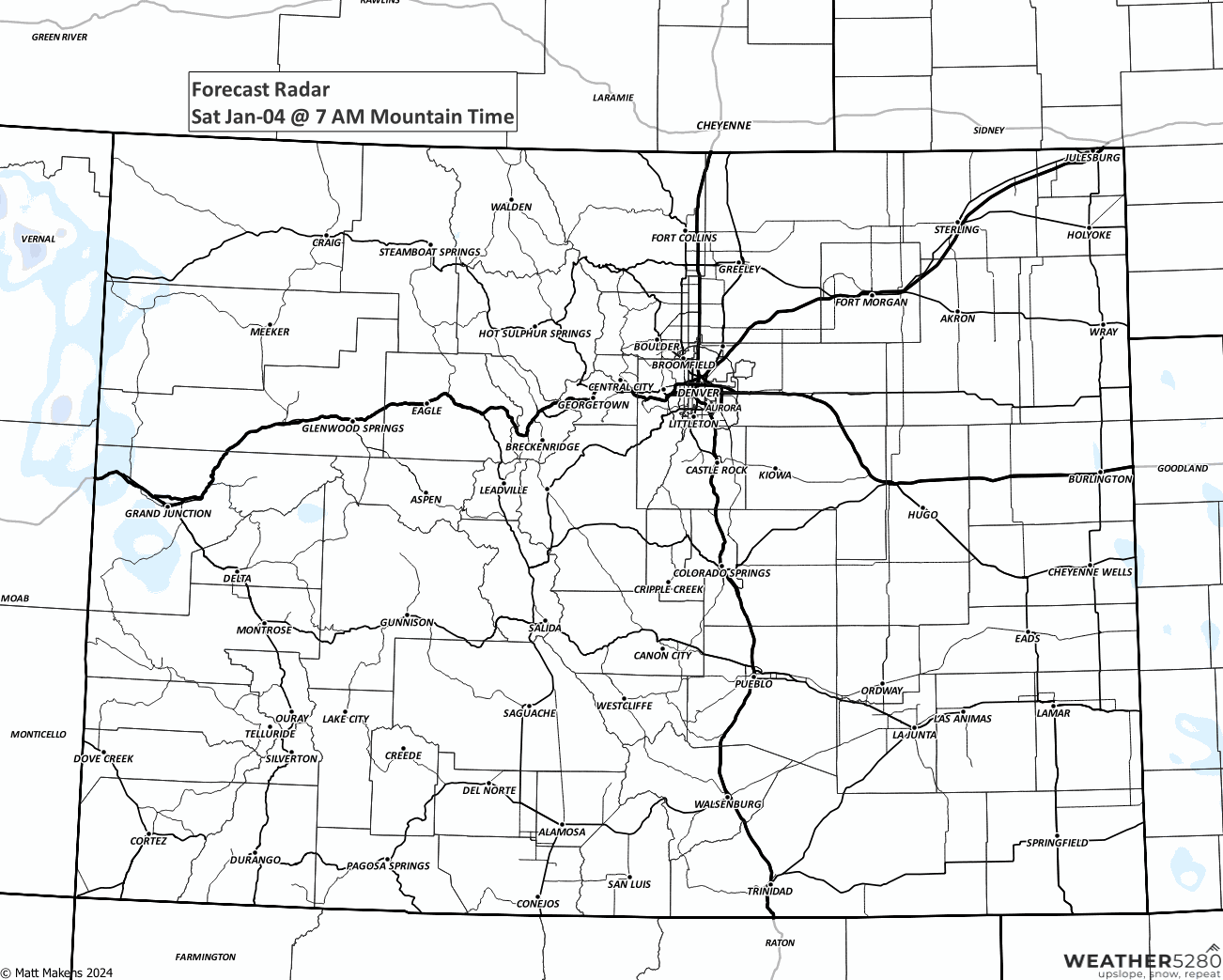
Here's an animation showing the showers.
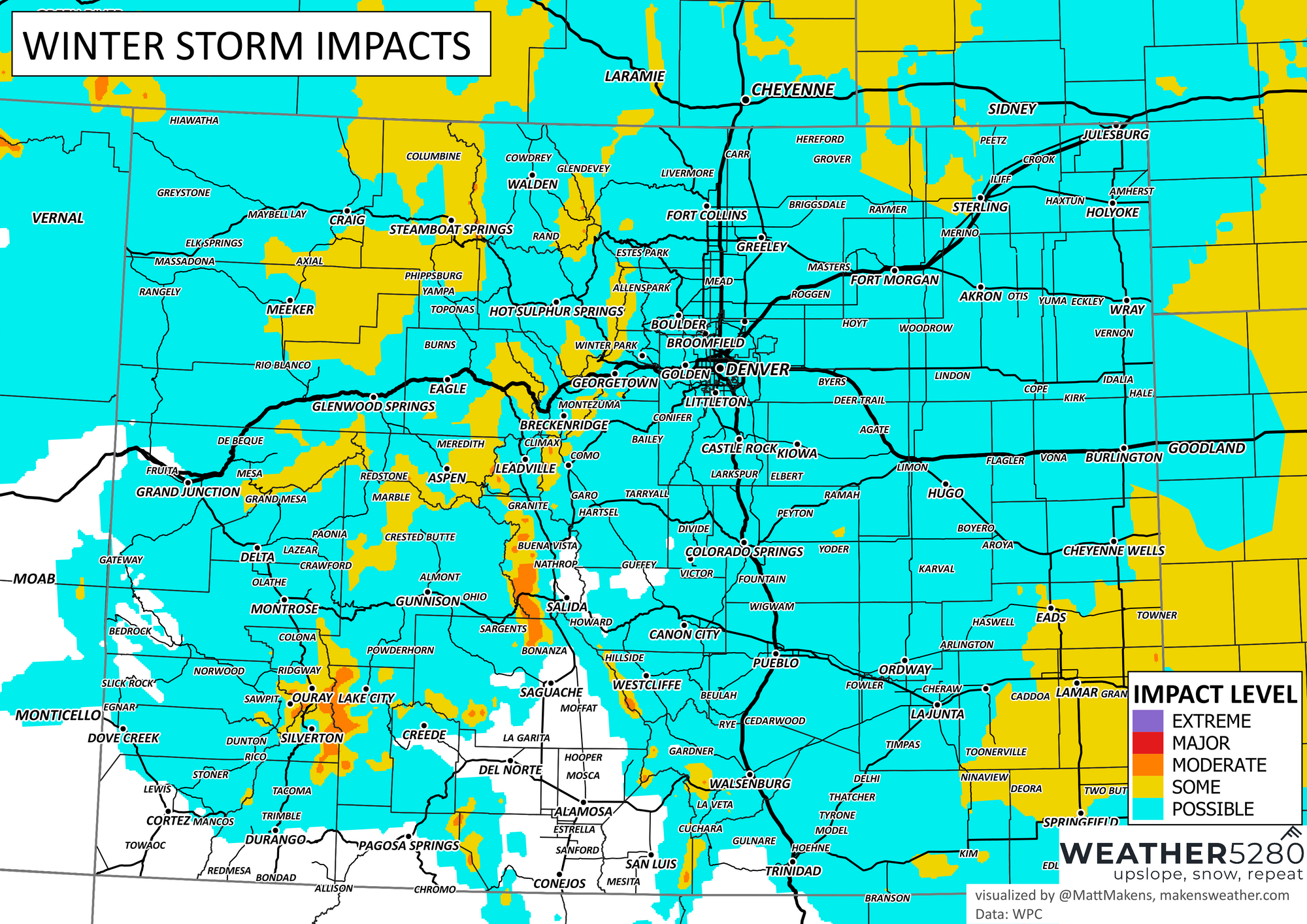
With that, here is a look at the snowfall expected through the weekend.
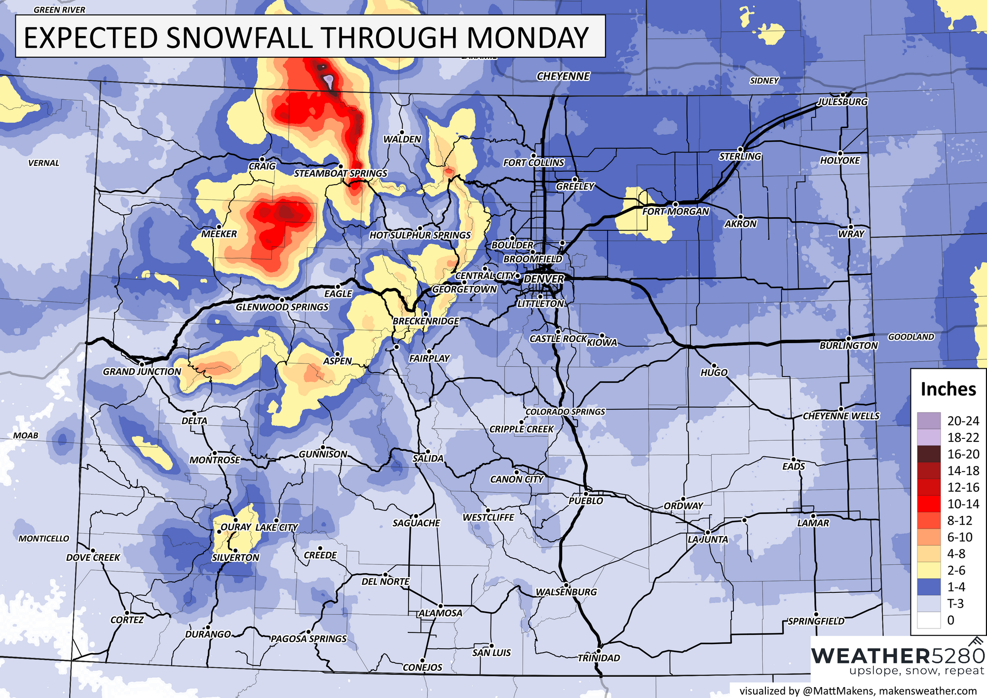
For Denver and Colorado Springs, sure we can see some snow but the highest probability for any impactful accumulation is to the east of I-25.
For the Front Range and cities, most of us fall in that Trace to 3" range but likely looking at the low end of that span. Nearer Fort Morgan is where we can find some heavier snow.
We should be mindful of the potential for some ice on metro area roads if snow does materialize, but the increased travel impacts will surrounding the metro areas.
Beyond this weekend, we have additional snow chances arriving this week, by Monday into Tuesday. And, albeit cooler relative to where we have been, not what I would call a cold week.
We will have more on the snow chances for the week coming your way.