Colorado Weather: Snow impacts Monday and Tuesday, winter-like cold this week

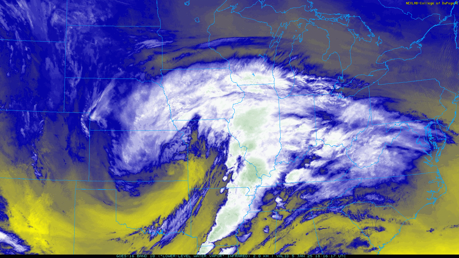
Hey all! Pretty impressive storm system over the center of the nation right now – it was responsible for the freezing fog reports over much of eastern Colorado yesterday.
Other than that and the cold air that it's drawn in, much of the state was spared from major impacts which are being felt in the form of a blizzard over central Kansas, and a major sleet and freezing rain storm for areas around and south of St. Louis, MO.
This compact, bowling-ball type system is going to race eastward quickly, mostly out of the picture by Monday morning.
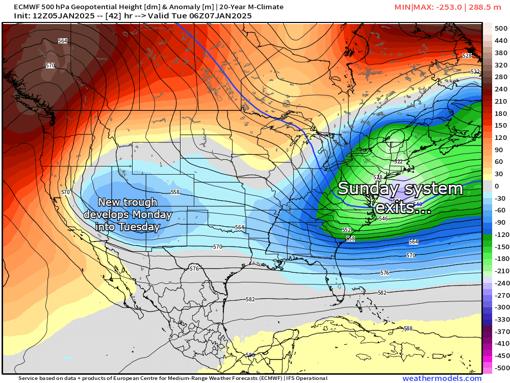
Quickly on the heels of that storm departing, forced by some impressive ridging over western Canada, we're likely to see some additional troughing develop over the four corners regions throughout the day on Monday.
With lingering cold air from this first storm and just a bit of moisture to work with, we're likely going to get some accumulating snow for the mountains and some snow possible for the front range. Based on snow timing, we could see some minor to moderate impacts for the Tuesday morning commute.
CHILLY MONDAY, NIGHT SNOW POSSIBLE INTO TUESDAY AM
Let's kick things off with temps and a look at radar starting tomorrow morning:
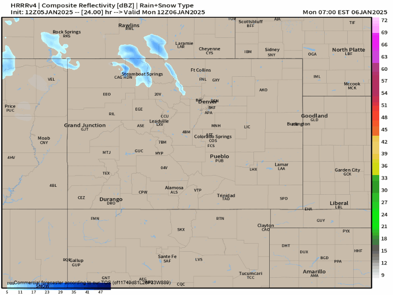
There will be some mountain snow showers over night and into tomorrow morning, however, as energy to our west becomes bit more organized, we should see snow showers become more numerous over the mountains through lunch Monday, with some snow showers attempting to break out as early as 3-5pm for Larimer county. We may also see some convective snow showers break out around Teller and El Paso counties in the afternoon as well.
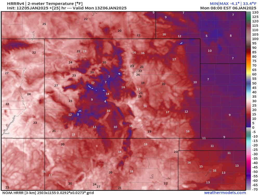
In terms of temps, most highs will get above freezing for eastern Colorado tomorrow, but that should change quickly once cloud cover starts to build further past lunchtime. The mountains will stay in the 10s, 20s and 30s.
At this point in the day, we should steer clear of the impacts, but watch how the radar shifts Monday evening into Tuesday morning:
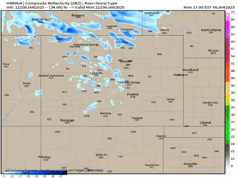
Not a bad little band of snow, for sure! We'd likely see snow start to ramp up a bit more for Larimer county and northern portions of the state around or just after the evening commute, with metro Denver seeing snow increase after 7 or 8pm.
This would be a 4-6 hour band of snowfall which could definitely leave a mark on the Tuesday morning commute, especially for folks who get out before sunrise.
Where the timing could be even more of a problem is for places like Colorado Springs and the Pikes Peak Region – snow will likely still be falling at a decent clip there, which could really slow things down Tuesday AM.
We don't see much of a recovery as this front will bring a reinforcing shot of cold air. We likely won't get out of the low to mid 20s for most Tuesday which could prolong road issues for places that don't get a ton of sunshine.
This front should get through pretty quick, most accumulations are done for eastern Colorado come Tuesday evening.
Snowfall totals will be enough to cause issues for some, but we're not expecting anything major. The map below also takes into account a 10:1 snow ratio – I'd lean more towards a 15:1 to in some cases 20:1 ratios. That means the numbers on the map could be multiplied by 1.5 or in some cases 2 to get potential snowfall.
Considering that, the 1-3" map totals for the Denver metro and northern front range may be closer to something like 2-5" of total snowfall.
And the general 2-4" map totals you see in El Paso county may actually equate to 3-7" of total snowfall.
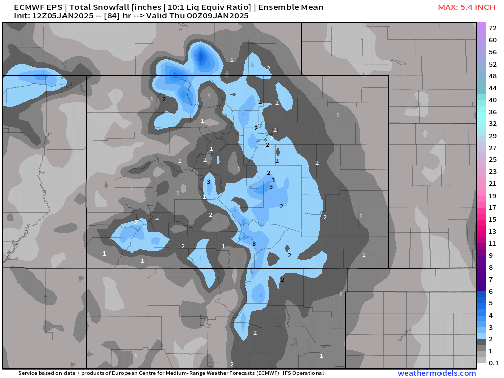
At this point, the agreement between models is pretty solid, and I'd say that this map is a good starting point after adjusting for what will likely be higher snowfall ratios than typical.
To sum it up: Travel probably gets tricky from north to south Monday evening and overnight between Denver and F0rt Collins with some lingering morning impacts, snow likely continues for the morning commute in Colorado Springs probably creating bigger issues for Tuesday morning there.
Beyond that, it's going to be chilly, folks! Check out projected temps for Denver and Colorado Springs this week and beyond:
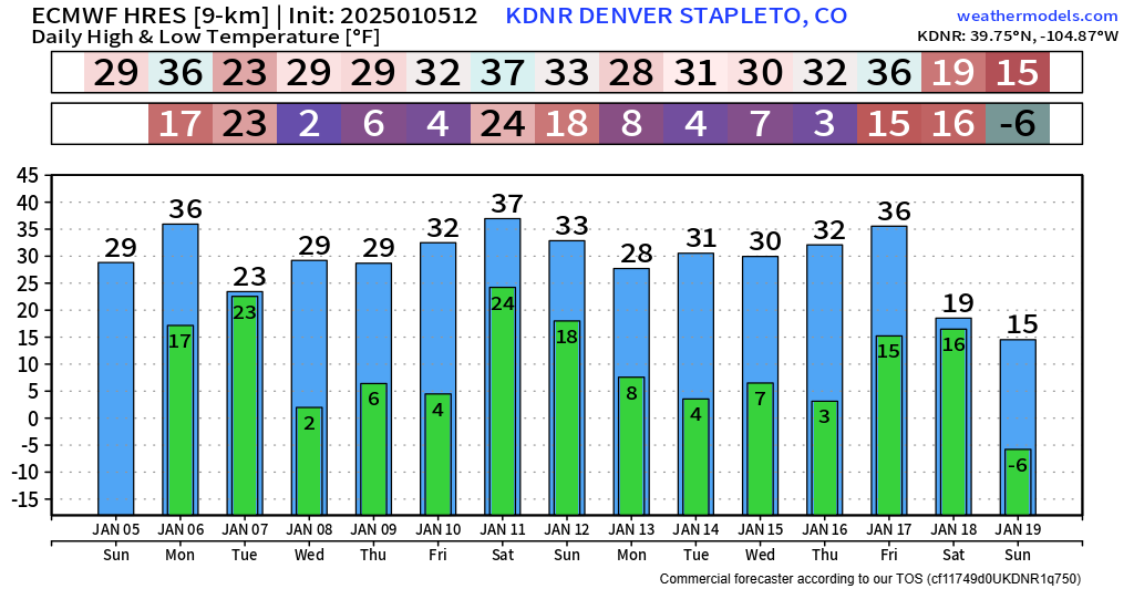
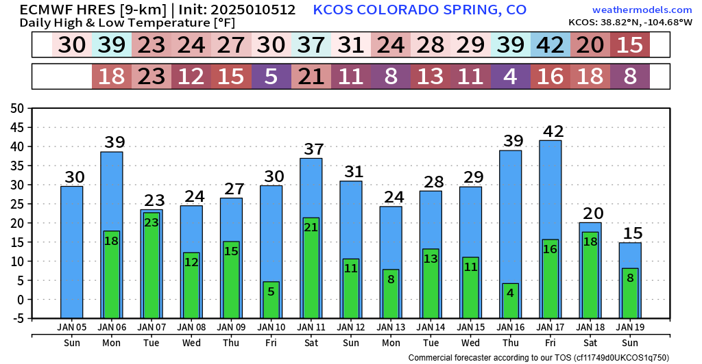
Yeah, probably our chilliest stretch this year. By no means are we talking and arctic outbreak, but it's definitely a VERY wintry-looking 10 day look at temperatures. Will that coincide with more snowfall down the line? Perhaps... You'll just have to stick with us to find out.