
Snow has ended, frigid night ahead, active pattern continues?

Well, even though there wasn't a ton of snow, the cold air kept the roads nasty for much of the morning and early afternoon out there, and the night ahead will be cold!
A bit of a ho-hum storm overall for totals, especially where the bump up to a Winter Storm Warning for parts of southern Colorado with meager totals to show for it. While most areas managed to fall within our forecast range along the urban corridor, many folks ended up on the low end. It happens.
This was kind of fun!
A rare snow tie this event between our office and the Denver airport. Looking for additional reports see here: https://t.co/chqKngmZzi
— NWS Boulder (@NWSBoulder) January 7, 2025
You can always send us your snowfall report by providing your closest major intersection and town/city. ❄️ #COwx pic.twitter.com/9MrVRtgED9
Totals were generally on the order of 1-4" for pretty much everyone along the I-25 corridor, with some isolated amounts that made it to 5". We haven't seen many other reports, so make sure to comment those below if you saw anything different!
Following some fresh snowfall, clearing skies and light winds temperatures will plummet tonight. Here's a look at how cold temps are expected to get:
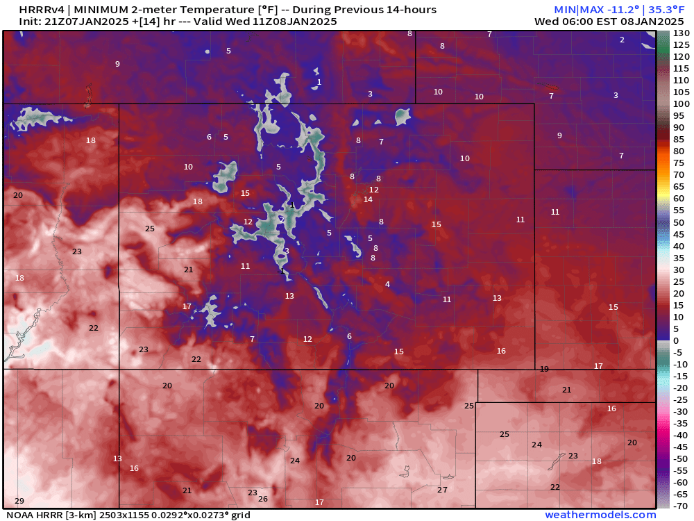
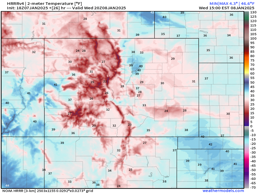
Plenty of folks in the 10s and single digits, especially for rural, low-lying areas. The good news is that we're on the mend for Wednesdays; a pretty decent rebound looks to be in store. Plenty of upper 30s and some folks kissing 40 according to the HRRR projection.
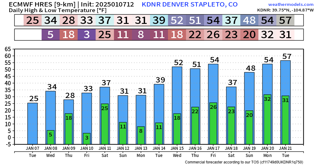
We're going to stay locked into this cold pattern through the weekend and early next week – in fact, we may see additional on and off snow chances too. Looks like we'll have to watch Thursday into Friday for some light stuff – and perhaps another chance Sunday & Monday.
For now, we don't see any reason for big snowfall at this point, but enough to keep that winter feel around. We'll likely give you another update on the end of the week snow shower chances sometime tomorrow. Until then, stay warm and watch out for lingering slick roads tonight and tomorrow morning!