
Denver Weather: Snow overnight, advisory issued to the east and south

Snowfall will focus on the southern metro areas through Thursday morning as a quick system drops snow and increases the wind. The result? Potentially a slower morning commute in some cases. I'd watch for C470/E470, I-25 from DTC to Monument, 86 east of Castle Rock and I-70 east of Watkins, and Hwy 24 east and west of the Springs to have potential issues.
I'll get to the totals in a moment, but first the alert. The areas of highest impact are highlighted here in this advisory.
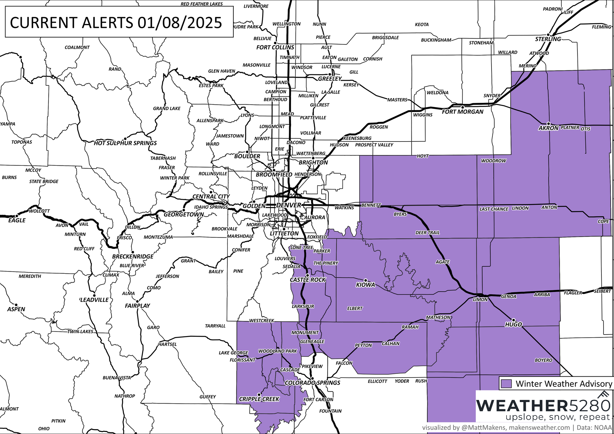
The details from the National Weather Service for the highlighted areas:
* WHAT...Snow and blowing snow expected. Total snow accumulations 1 to 3 inches. Winds gusting as high as 45 mph.
* WHERE...Palmer Divide and adjacent plains of east central Colorado, including I-70 east of Denver, Castle Rock, Byers, Limon, Southern Lincoln County, and Akron.
* WHEN...From 3 AM to 5 PM MST Thursday.
* IMPACTS...Plan on slippery road conditions and poor visibility. The hazardous conditions will impact the Thursday morning commute. Snow and blowing snow could create hazardous travel conditions, including I-70 east of Denver.
Note that wind! Gusts to 45mph will have a bit 'ol bite to them considering the chilly air.
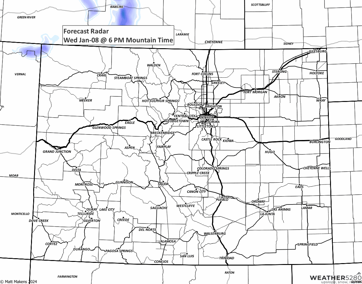
Here we can watch the snow as it moves through.
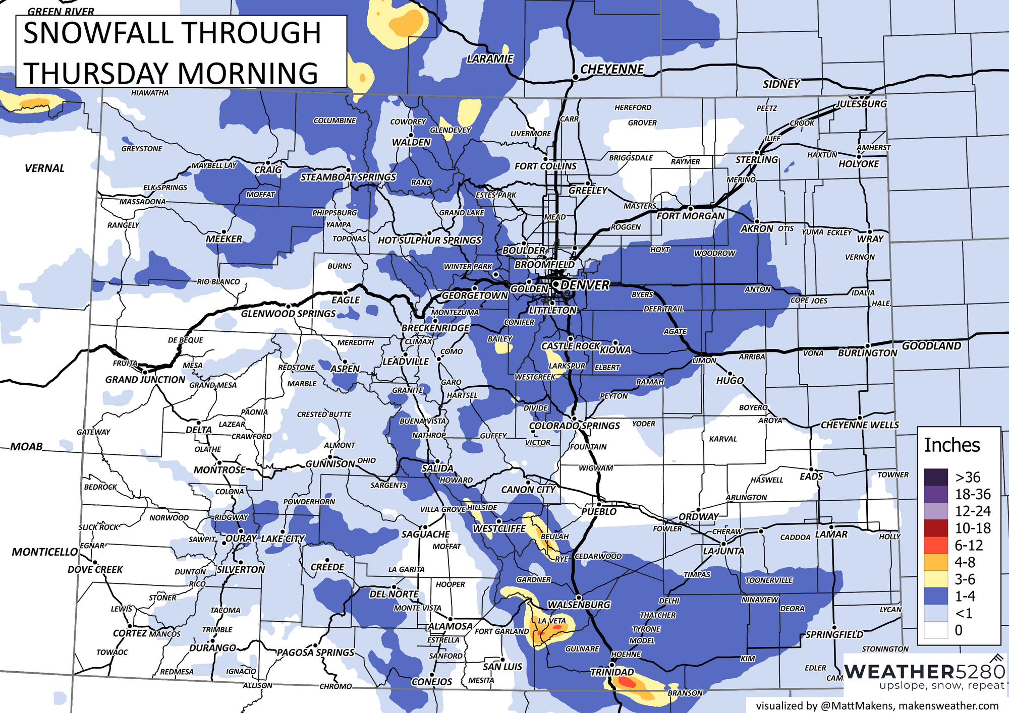
And, onto the totals that are possible with this system. Not much north of the city, a bit for the mountains, but a focus on the foothills west of the city, the Palmer Divide and the Raton Mesa.
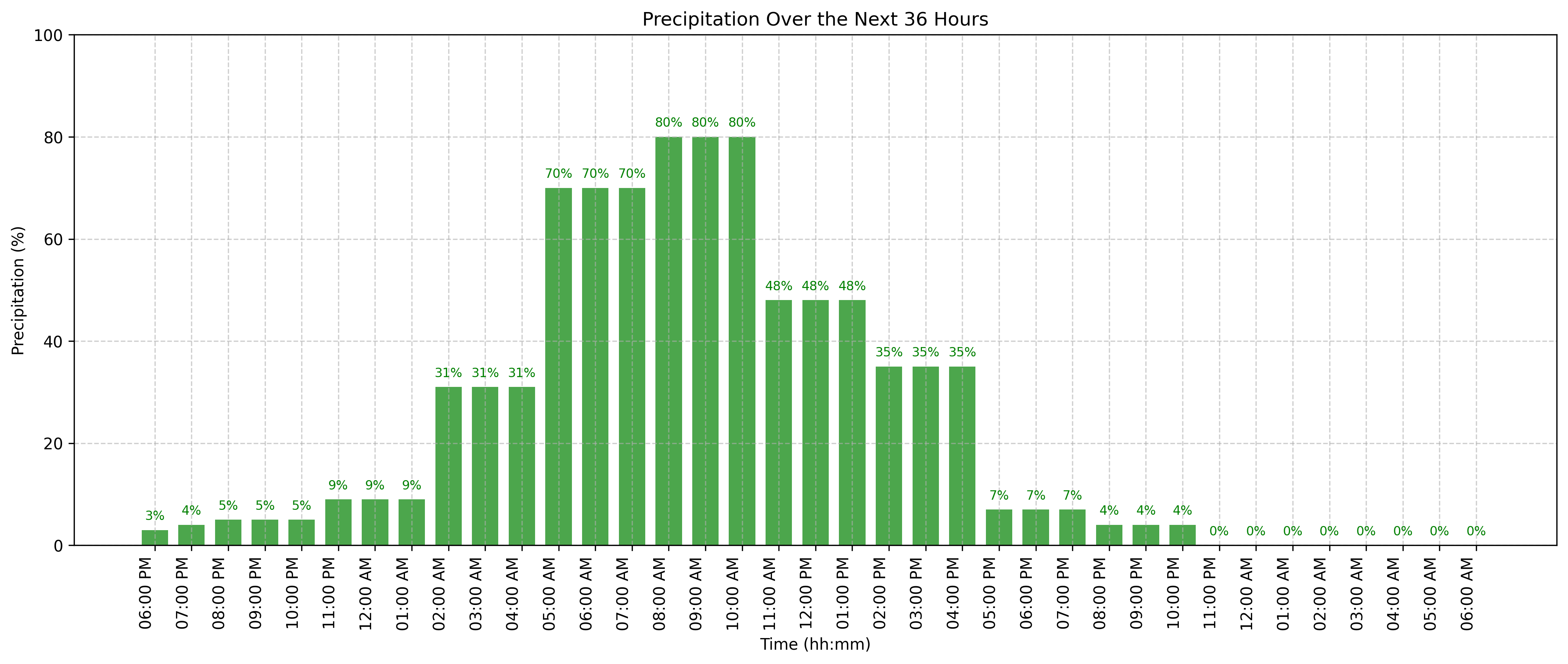
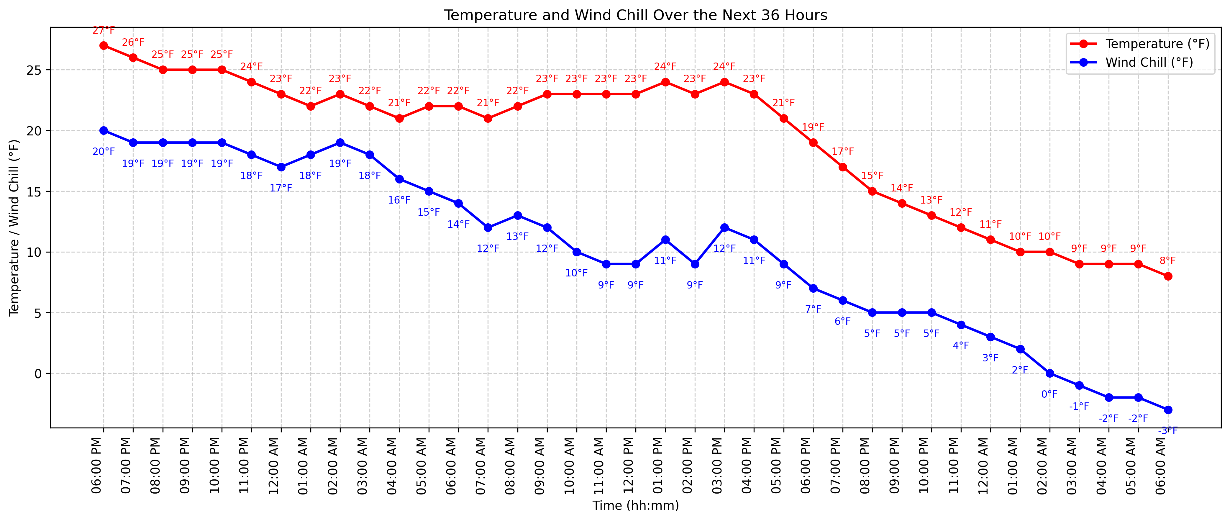
Since Castle Rock is one of the focus points, here are hourly planners for Castle Rock for the next 36 hours. First precipitation chances, then temperatures/windchills.
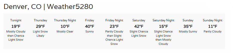
A quick hitter in terms of snowfall, but with a cold bite lasting into Friday. Here's Denver's forecast:
Oh, there'll be another snow chance this weekend - more details on that in a future update, make sure you are on our email list so you keep tabs.