Colorado weekend weather: Additional snow chances, more cold air

Following Thursday's amped up cold front that brought a lot of folks near-blizzard conditions around the Palmer Divide, we've calmed down quite a bit here on Friday to close up shop for the week.
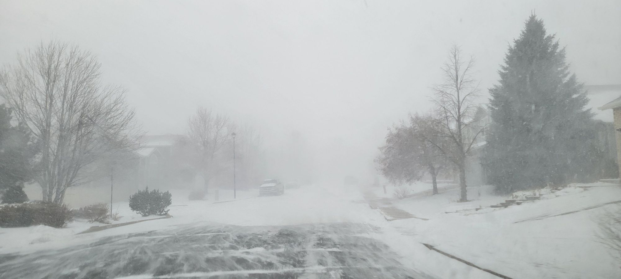
Those were scenes from northern Colorado Springs Thursday morning while I was out and about – needless to say it got a bit rocky at times...
Looking ahead to the weekend, another area of troughing will develop over the western US and eventually cut off over California. That type of pattern will keep us CHILLY for the weekend. Don't expect highs to get much out the 30s for most of the urban corridor.
To go along with that, we could be dealing with more snow... for some. Right now the setup is a bit wonky and the exact placement of snowfall totals looks most certain up against the hills, especially for the foothills/mountains south of the Palmer Divide. We're also watching for the potential of heavy mountain snowfall for a lot of the resorts, especially those north of I-70. We'll dig into the details below ⬇️
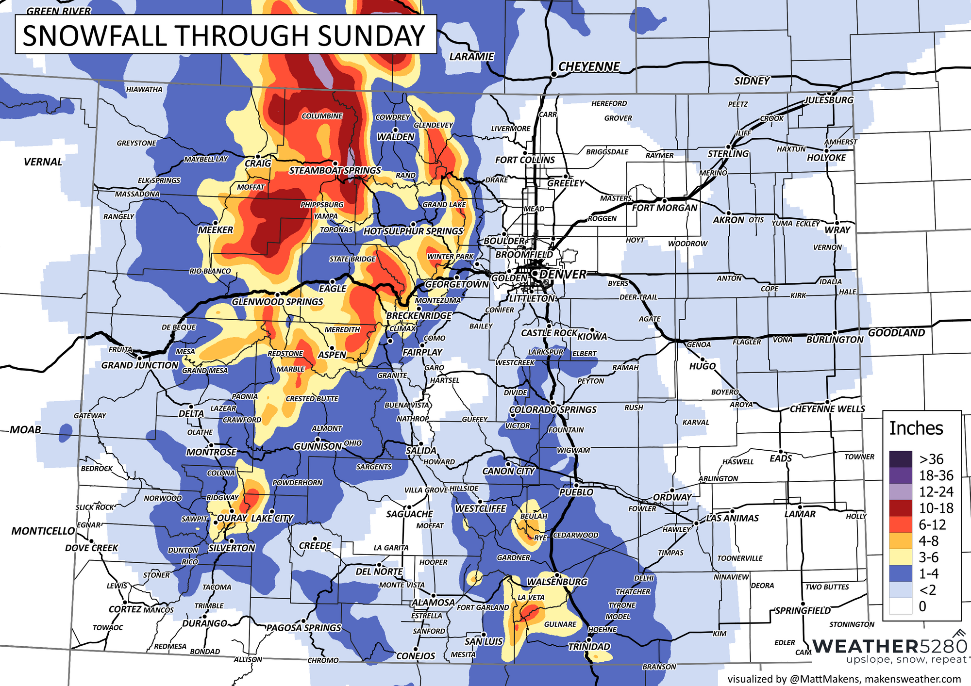
Breaking Down Snowfall Potential
Good news is that most model data is painting a similar picture. The radar loop below is starting late tonight and goes through early Sunday morning.
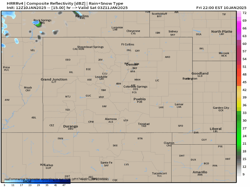
You can see snow breaking out in the northern mountains before sunrise tomorrow. If you're planning on heading to the resorts early tomorrow, be ready for tough winter driving conditions. If you can, head up there before midnight tonight.
Clouds will gradually increase throughout Saturday morning into the afternoon for the front range and urban corridor. We look to see snow showers breaking out around 2-4 pm tomorrow. It will likely be a brief burst of rain turning to snow for Denver, with snow expanding south over the Palmer Divide and then stretching south into Colorado Springs after 5pm.
Below is a rough sketch of what snowfall totals will end up like:

I'd say at this stage, Colorado Springs is probably our most uncertain area for how much we see. Generally 1-3" probably covers it, but some convection may amp up a few spots closer to the Ramparts and on the Palmer Divide.
Winds will get a bit gusty at times, but not as bad as Thursday, likely in the 20-30 mph range.
Snowfall will end after midnight on Sunday for most folks... with Sunday dry, but still cold with plenty of 30s.
Active January Continues?
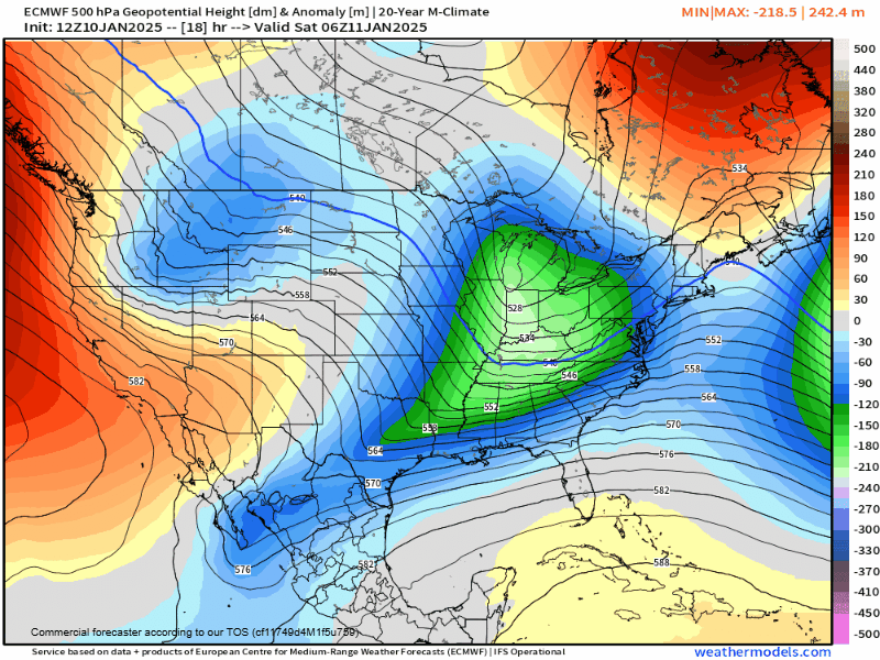
After the weekend, it looks like we'll rebound throughout next week. EURO paints a pretty decent picture of 40s and 50s for many of us... but then our next wrinkle in the matrix shows up:
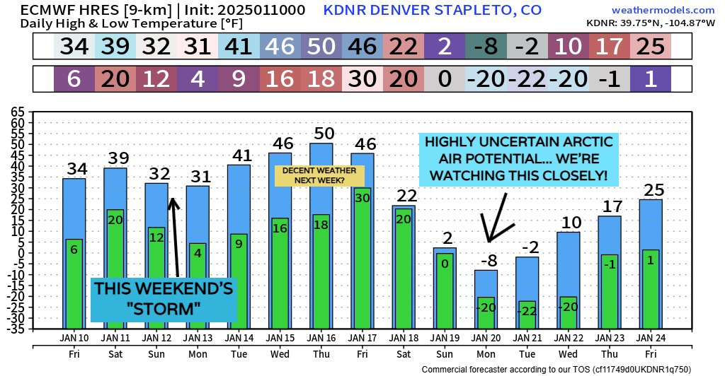
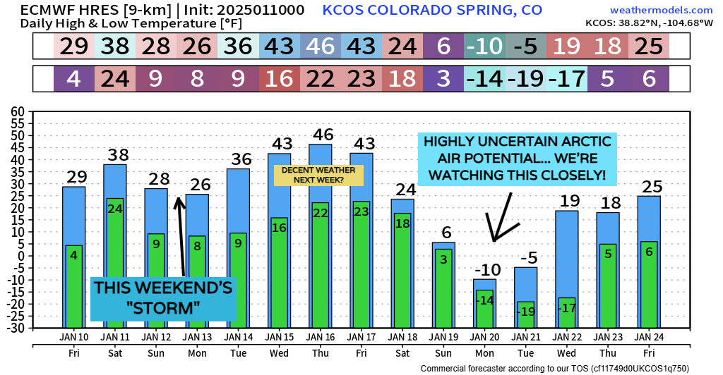
As you can see in the charts above, we have the potential for a pretty significant arctic outbreak around January 20th.
Sometimes you can brush off something 10 days away as a one-off, but this has been a pretty consistent signal in the long range weather pattern for quite some time now... and most global model data is pinning down some sort of bitter cold air intrusion SOMEWHERE in the U.S. around this time frame.
For now, it's on our radar, but exact temperatures... snowfall potential... and others... are to be determined. You'll want to stick with us for sure!
Have a great weekend all, and if tomorrow (Saturday) ends up getting turned up in someway, we'll give you an update... stay warm out there!