
Colorado Weather: Cold weather, snow, after a warm week

This week, overall, looks quiet with warm days and lots of melting of that recent snow now ice. By the weekend, however, a whole new ballgame - snow then cold...potentially very cold.
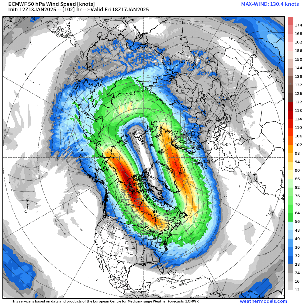
Luke Victor talked at length to our Insiders with a more technical look at the setup driving Arctic temperatures toward the U.S. and how they'll likely be closer to home this time. Here is that post:
For most of us, a quietly warm week:
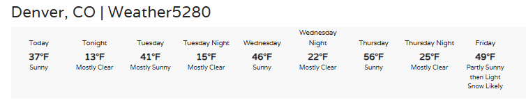
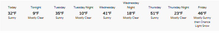
... for Colorado Springs:
From that, Thursday looks like a winner for warm weather fans. This weekend into next week, however, will be a contender for cold weather fans as snow returns and then cold. How cold? Potentially well below zero. Note Monday morning's low of -9° from one particular forecast product.
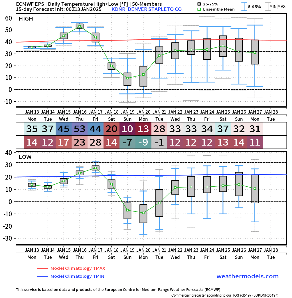
I'm sure your iphone has shown you the cold ahead, or a social media post or two, or three hundred ;-) but as of now here's a look at very general temperature possibilities into next week. Any modeling that you see someone post must account for that models' biases and also skill score this far out in a forecast, but as Luke's post points out, models have been consistently cold amongst several.
He also mentioned snow to the insiders, and yes it looks like this weekend could potentially drop several inches of snowfall. It's common to produce at least some snow when a large cold airmass arrives but this has consistently shown signs of producing quite a bit of snow for the foothills and an impactful amount for Denver to Colorado Springs also.
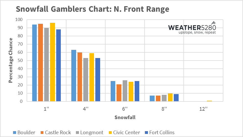
This morning's gamblers charts show a potential for a four to eight inch range, but let's not get ahead of ourselves as snow total this far out can be whacky.
We know it's being talked about and yes we see the likelihood for some rather cold weather with snow arriving this holiday weekend. That's why we will keep tabs on the data and keep you posted this week. Sign up for our emails by clicking this sentence.