
Denver Weather: It's here, you'll feel temperatures plunge and snowfall increase

Midday Friday and you can see it in the air with the poor air quality, the cold air is driving in. Our thinking since yesterday has not changed, so, here is a quick look at the hourly planners, travel issues, snowfall totals, etc.
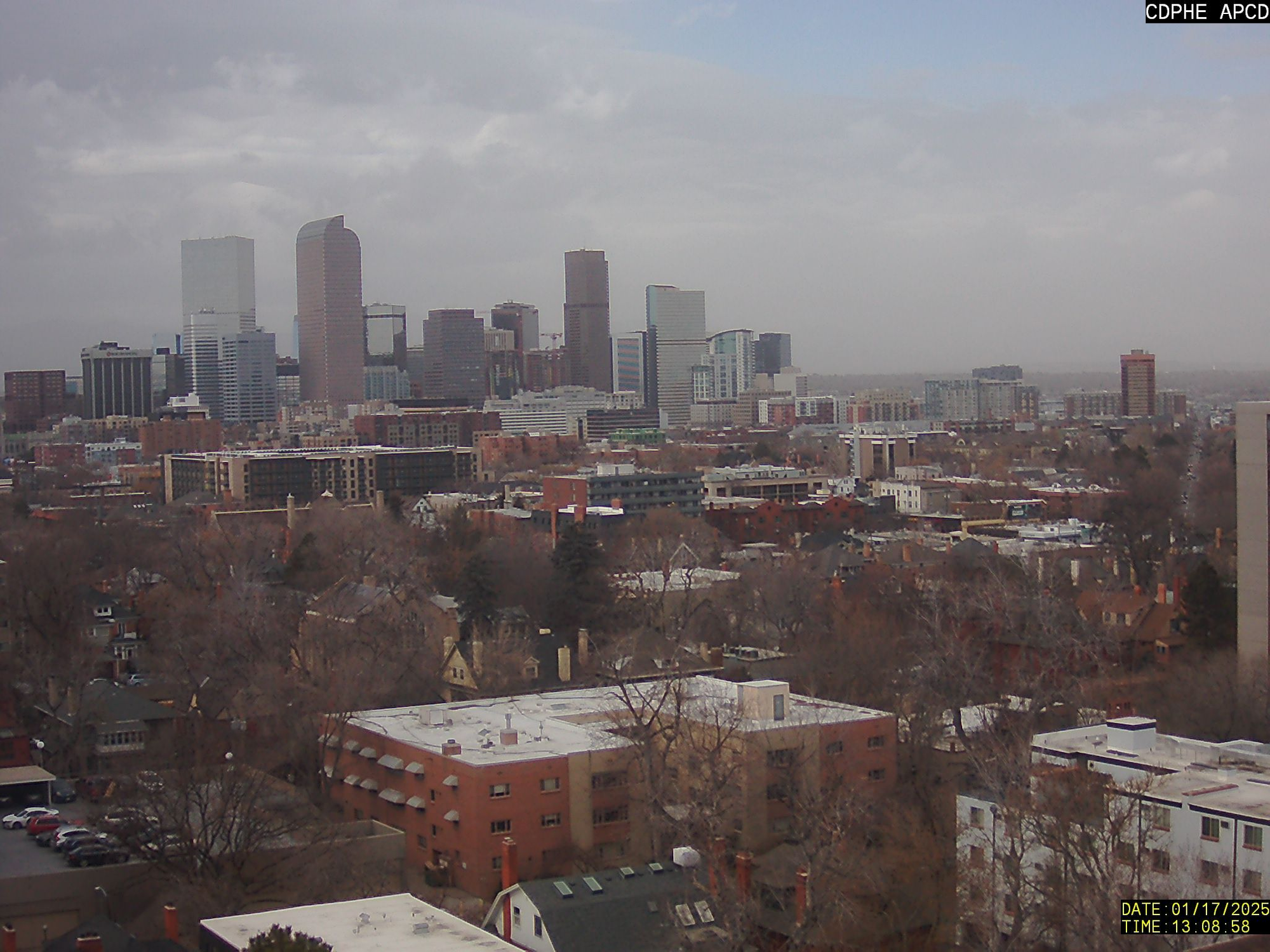
Oh, you won't miss this arriving... the wind has been howling in many areas (faster than 50mph across Northern Colorado through this morning). Plus, the air isn't the cleanest, peek outside if you haven't already.
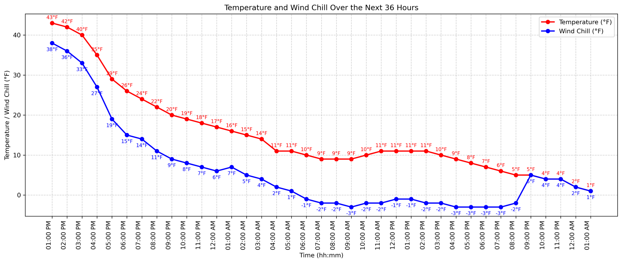
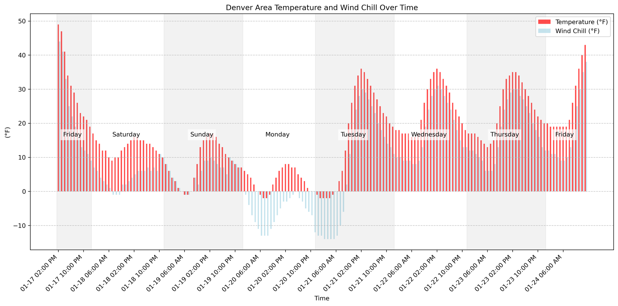
We've reached our high and now temperatures are dropping:
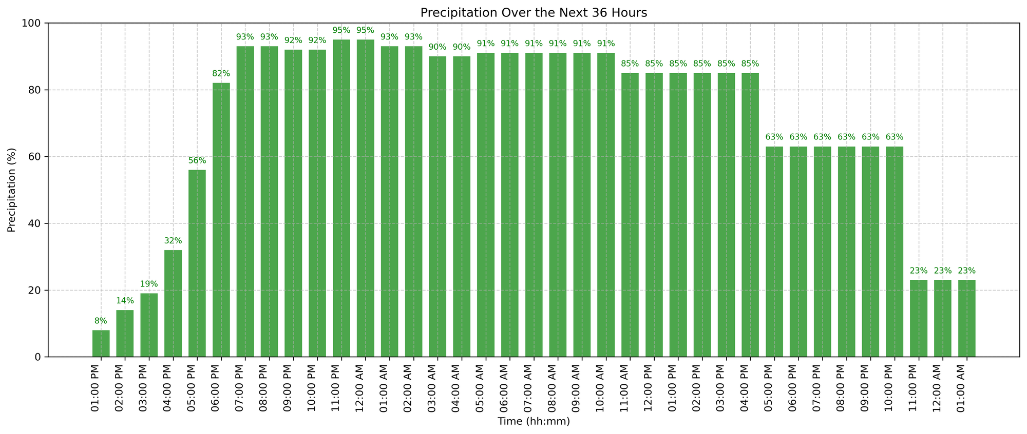
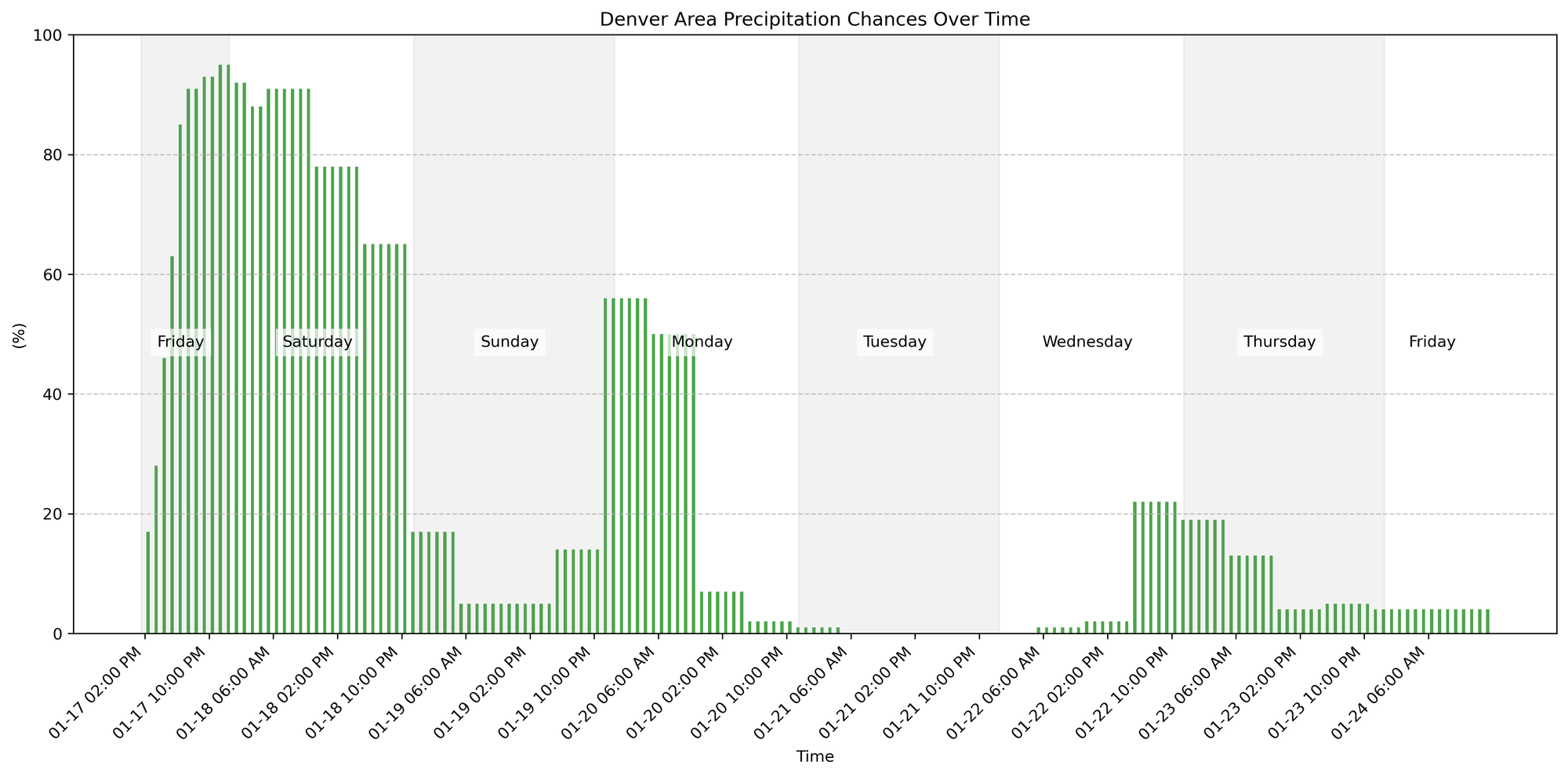
As those temperatures drop, clouds will increase and snow will be flying. This is the hourly chance for snow.
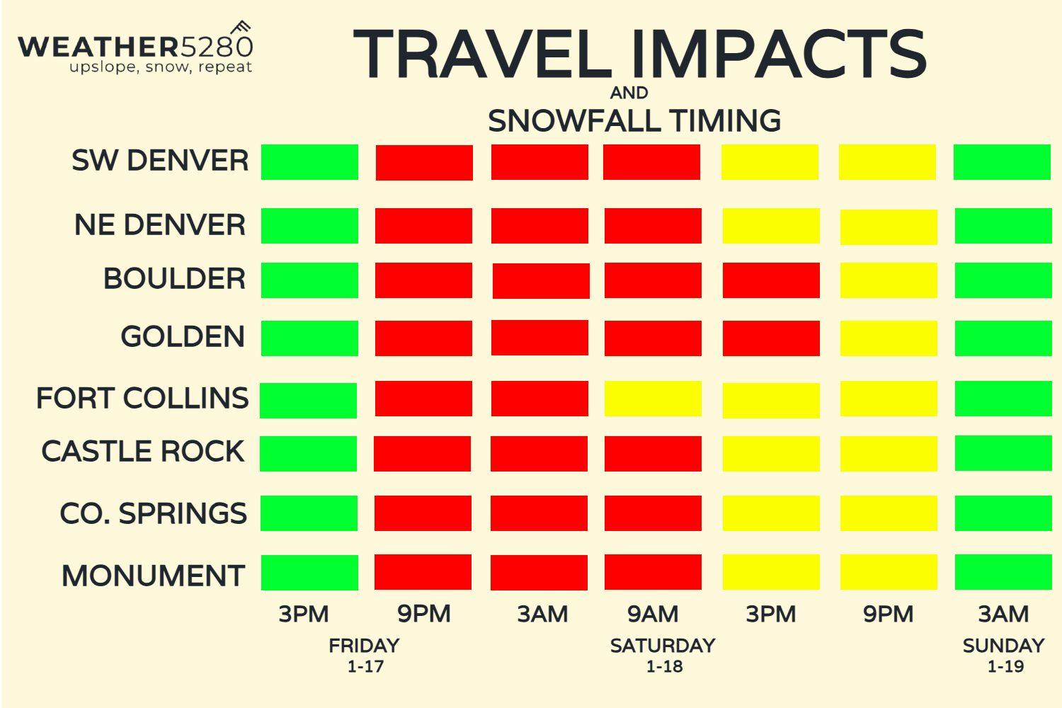
Due to the rapid drop in temperatures during the snowfall, there's potential to really get icy and quickly on the roads by this evening. Here's a timeline of greatest impact. Keep in mind though that even though we show green by Sunday morning, that doesn't mean all snow or ice is done - we could still be getting those tiny icy snowflakes falling that make things very slick if you haven't kept your driveway or sidewalks clear.
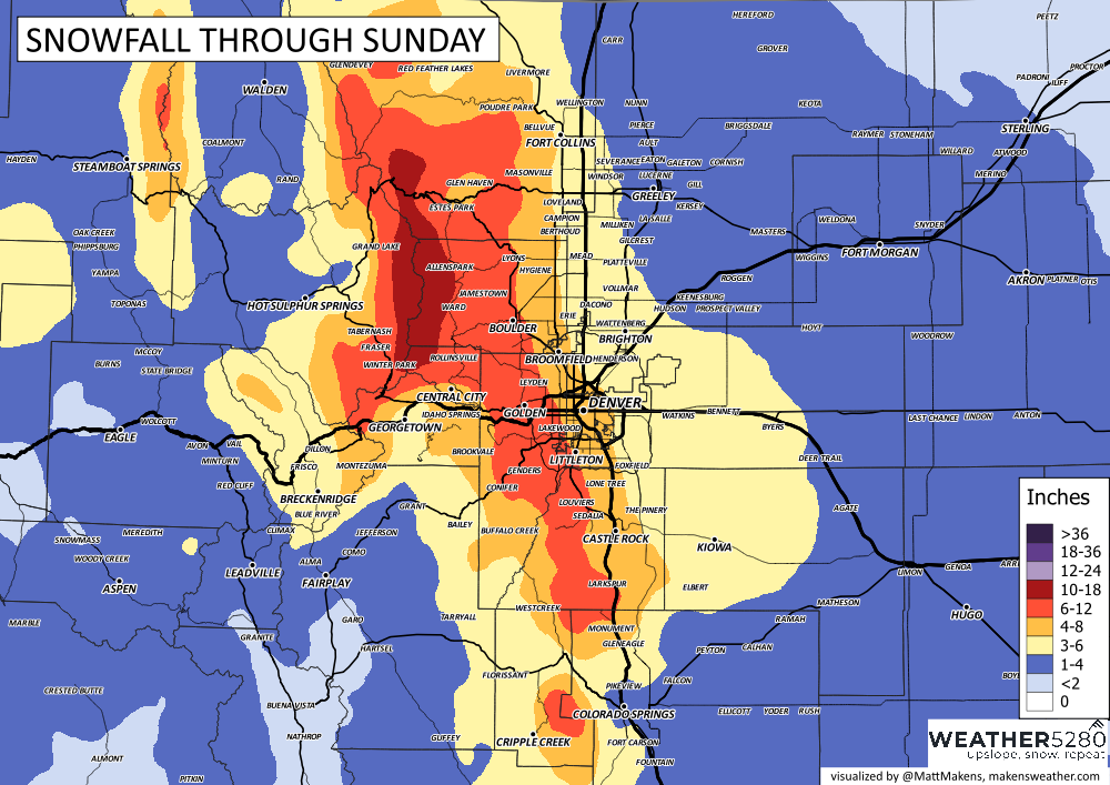
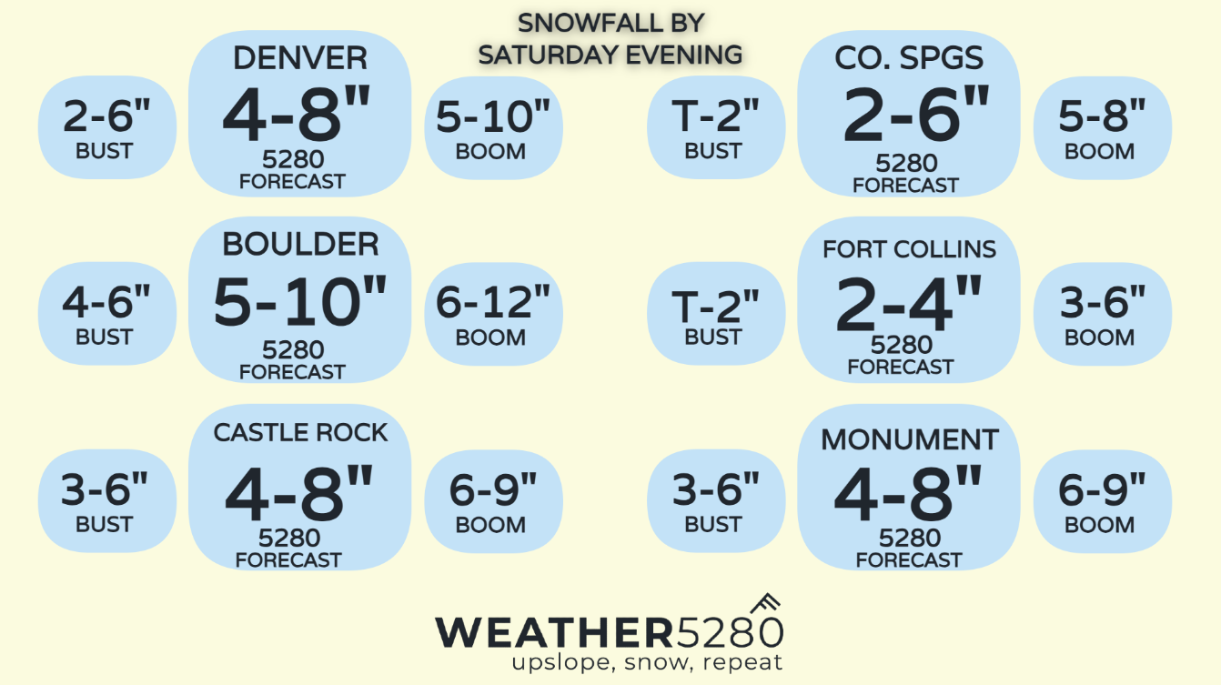
We are still thinking this in terms of snowfall:
Again, with the cold stretching into Tuesday morning, roads and any icing that occurs throughout the event will not have chances to improve/melt until the middle of next week.
Given the coverage of our past blogs, we don't want to waste your time giving you the same information in each - so if you feel like something or someone was missed you might look back over the week's worth of posts.
I will give you this updated timeline of temperatures and precipitation, though.
So, yep it'll be cold and snowy. Enjoy! Please keep us posted with how much snow you have in the comment section below.