Another quick shot of snow along the Front Range, cold night ahead for Denver

We hope everyone is staying warm! A quick post this afternoon to update you on the current cold spell and a mention of a quick chance for snow tonight into Monday morning.
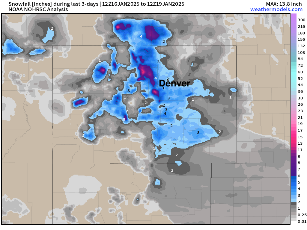
First, a quick look at snow totals from the last couple of days. Overall it looks like most locations managed at least the low-end of our snowfall forecast, but certainly some winners and loser from round one. DIA picked up 2.4" of snow, with the greatest totals hugging the hills west of I-25 and the Palmer Divide.
Very cold
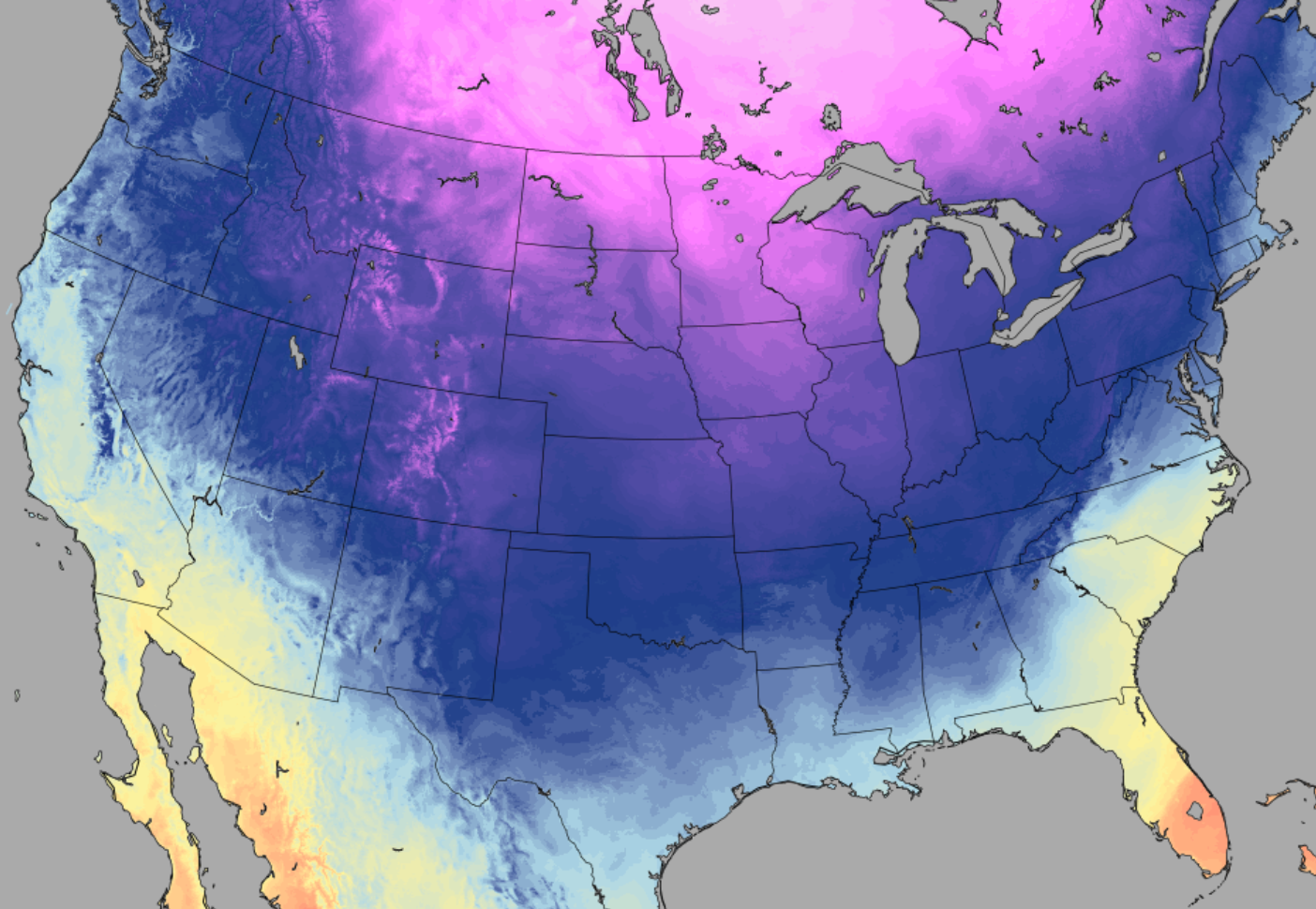
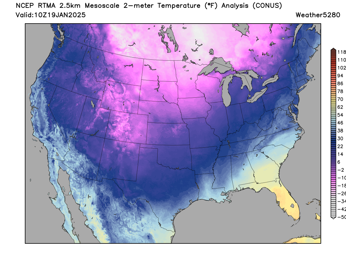
It looks like Denver (DIA) bottomed out at -10°F this morning! We've since "warmed" in to the mid teens around town, but we aren't done with the cold yet as the bitter arctic air will stick with us through Monday. Check out this rather icy looking temperature map from early this morning across the CONUS, with the January freeze in full effect across the High Plains.
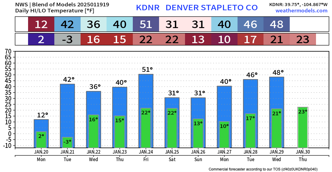
More cold weather to go as the latest blend of models shows a high of just 12°F in Denver on Monday, with overnight lows Monday into Tuesday again below zero before we finally climb back above freezing again on Tuesday.
While current forecasts call for lows in single digits tonight, and single digits below zero on Monday night, wind chills will be much colder than that, especially Monday night.
Cold weather will continue thru Monday. Monday night will be the coldest with temps below zero and wind chills down to -25F over the plains and -35F to -50F for the mountains and mountain valleys. #cowx pic.twitter.com/fepCV9C1Z2
— NWS Boulder (@NWSBoulder) January 19, 2025
With all this cold in place, no real shocker that we have multiple cold and wind chill advisories in place across the state through Tuesday morning. For Eastern Colorado that's a Cold Weather Advisory. From the NWS:
...COLD WEATHER ADVISORY REMAINS IN EFFECT UNTIL 9 AM MST TUESDAY...
WHAT...Temperatures from 10 above to 10 below zero with very cold wind chills as low as 25 below zero expected.
WHERE...Portions of east central, north central, and northeast Colorado, including the Denver metro area.
WHEN...Until 9 AM MST Tuesday.
IMPACTS...The dangerously cold wind chills as low as 25 below zero could cause frostbite on exposed skin in as little as 30 minutes. The coldest conditions will be from late tonight through early Tuesday morning.
Another round of snow, too...
Happily Monday is a holiday for many folks as we expect a bit more snow to move through tonight into the morning hours. While we aren't talking a ton of additional accumulation, with the cold temperatures in place roadways will again become snow covered and icy with any snow that does fall.
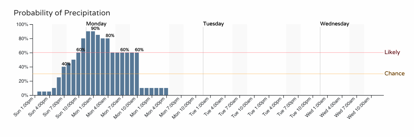
Here's the hourly planner for Denver, with that chance ramping up later this evening, and then dropping off again by midday Monday.
How much snow to expect? Well, probably not much, but another 1/2" to 2" looks doable for most locales, especially for the Denver metro area and Palmer Divide.
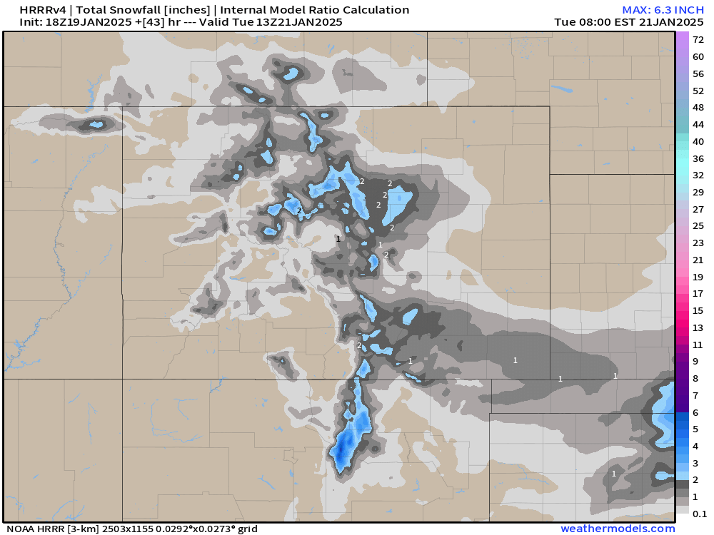
The latest HRRR (below) shows perhaps a spotty 3" total here or there, but for the most part just a Trace to 2", with little to no accumulation from this model north of the Denver area.
As mentioned above, the snow will clear Monday before the cold does. Expect a very cold Martin Luther King Day on Monday, before temperature moderate a bit for most of the remainder of the week.
We'll still be under the influence of a northwest flow aloft at times in the coming days, so perhaps a bit of cooler air is possible Wednesday along with a few snow showers, but nothing too dramatic expected.
The next shot of snow after tonight for Denver looks to arrive next weekend. We'll see.