
Friday warm up before another cold shot and snow this weekend

It's been a CHILLY one for much of January. After last week's arctic weather, we've kind of recovered. Here on Friday, we'll get another tiny break with 40s and !50s! making a return... before another strong cold front sweeps through for the weekend. This will bring more snow to Colorado as well.
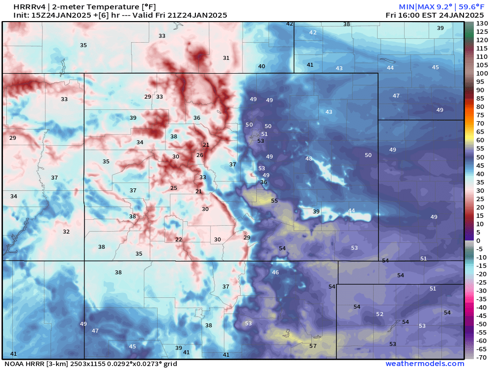
First: the good stuff! Enjoy today, got real nice stuff out there compared to much of the last week or so! Below are about as warm as we get this afternoon... we'll take it!
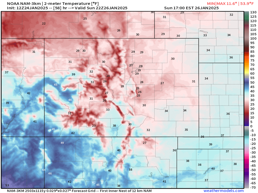
Sorry to burst your bubble... below is what we've got temperature wise Saturday... pretty sharp cold front for sure! 10s and 20s lining up the urban corridor.
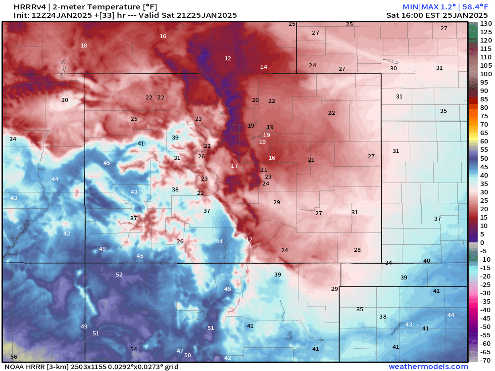
This will also be one of those fronts that hangs out along and east of the mountains... check out the temperature difference between southwest Colorado and I-25!
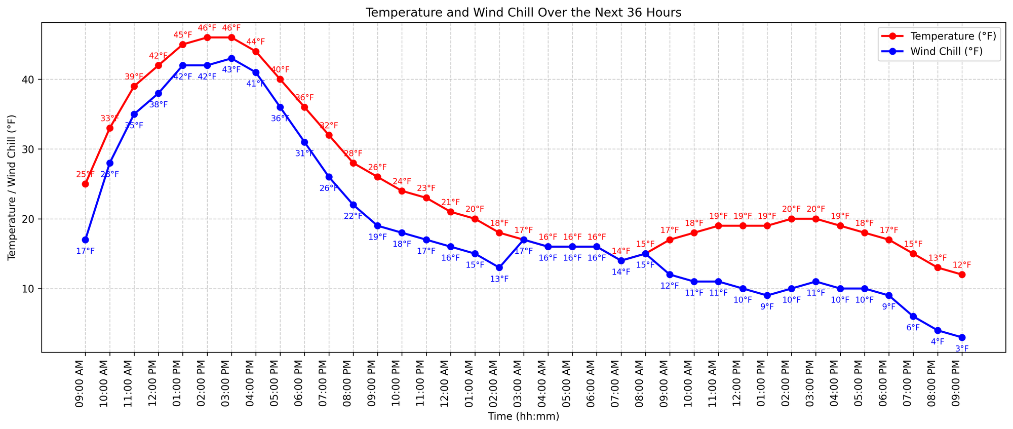
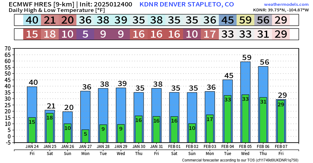
And the trusty graph looks even worse in my opinion... We drop to the teens around midnight tonight in Denver, and we might not make it to 20 the rest of the day Saturday.
The next big question to answer is our snow prospects.
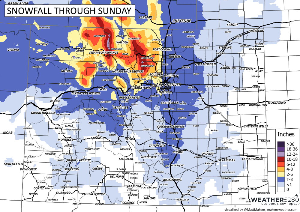
At this point, it does not looking MAJOR for the front range, but potentially enough to cause a few issues. Where we likely run into bigger problems is in the northern mountains, and along and north of I-70.
Right now, timing of snow begins late tonight through sunrise on Saturday. Snowfall will likely taper off mid-afternoon Saturday for the urban corridor, but continue for the mountains until the evening hours. Some lingering snow showers for dinner-time around the Pikes Peak Region too.
Snowfall amounts look FAIRLY minimal, but timing of heavier bursts of snow Saturday morning, especially in Denver, could cause some trouble.
Below is what we're thinking for snowfall totals:
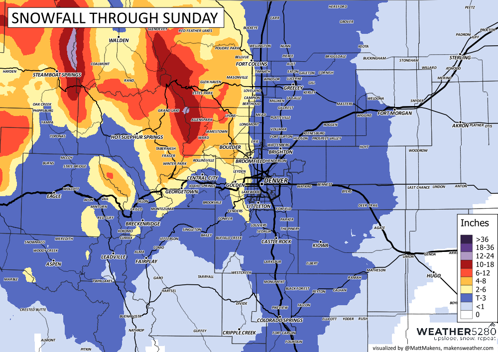
Mountains will get hammered for most of the day tomorrow, so if you're looking to get up there, we'd suggest doing so tonight! Snow picks up in the hills ~2-4am Saturday.
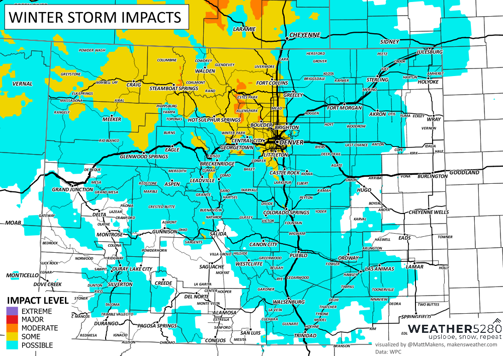
The trusty Winter Storm Impacts chart tells a good story in our opinion... Nasty mountain travel, with some minor-to-moderate impact potential between FOCO and Denver around sunrise tomorrow.
Most snowfall will taper off Saturday and then we'll just be plain cold... temps will fall into the teens for the most part.
For Sunday, not a whole lot of good news if you're sick of the cold. Pretty sure most folks are still stuck in the 20s.
And... for the longer range... it's a little tough to find a nice January thaw, but there is potentially some hope in the pipeline for early February! The EURO is pretty insistent on keeping things chilly for much of next week... but at least we're in the ball park of AVERAGE temperatures, and in some cases, the EURO is probably undershooting those temps. I think we could run low to mid 40s for much of next week if we can get enough clear sunshine. Maybe that 59 ain't a fluke either... near 60 would feel like a heat wave for sure.
Thanks for hanging out with us on your Friday or if you're reading this Saturday morning, enjoy the cold and the snow if you're a fan! We'll give you an update tomorrow if needed.
Luke