
Denver weather: Chilly Sunday, milder this week with two snow chances

Cooler temperatures remain Sunday following Saturday cold front with snowfall that behaved well to our forecast, except near El Paso County which was a bust...they got too much snow, Mother Nature ignored us.
Here are the observations since Friday morning:
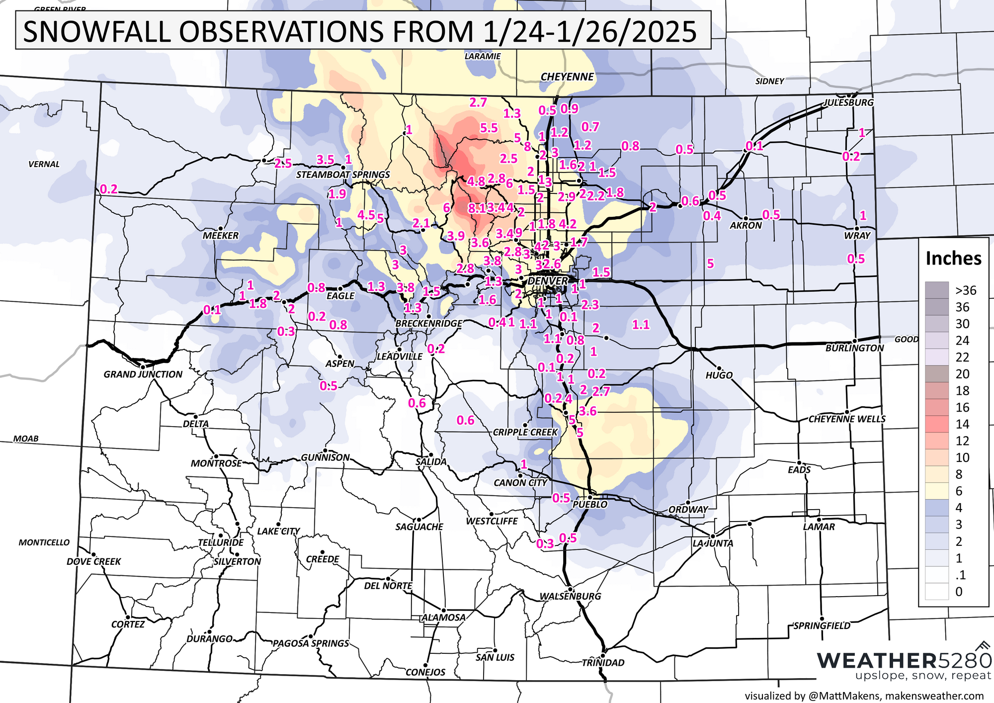
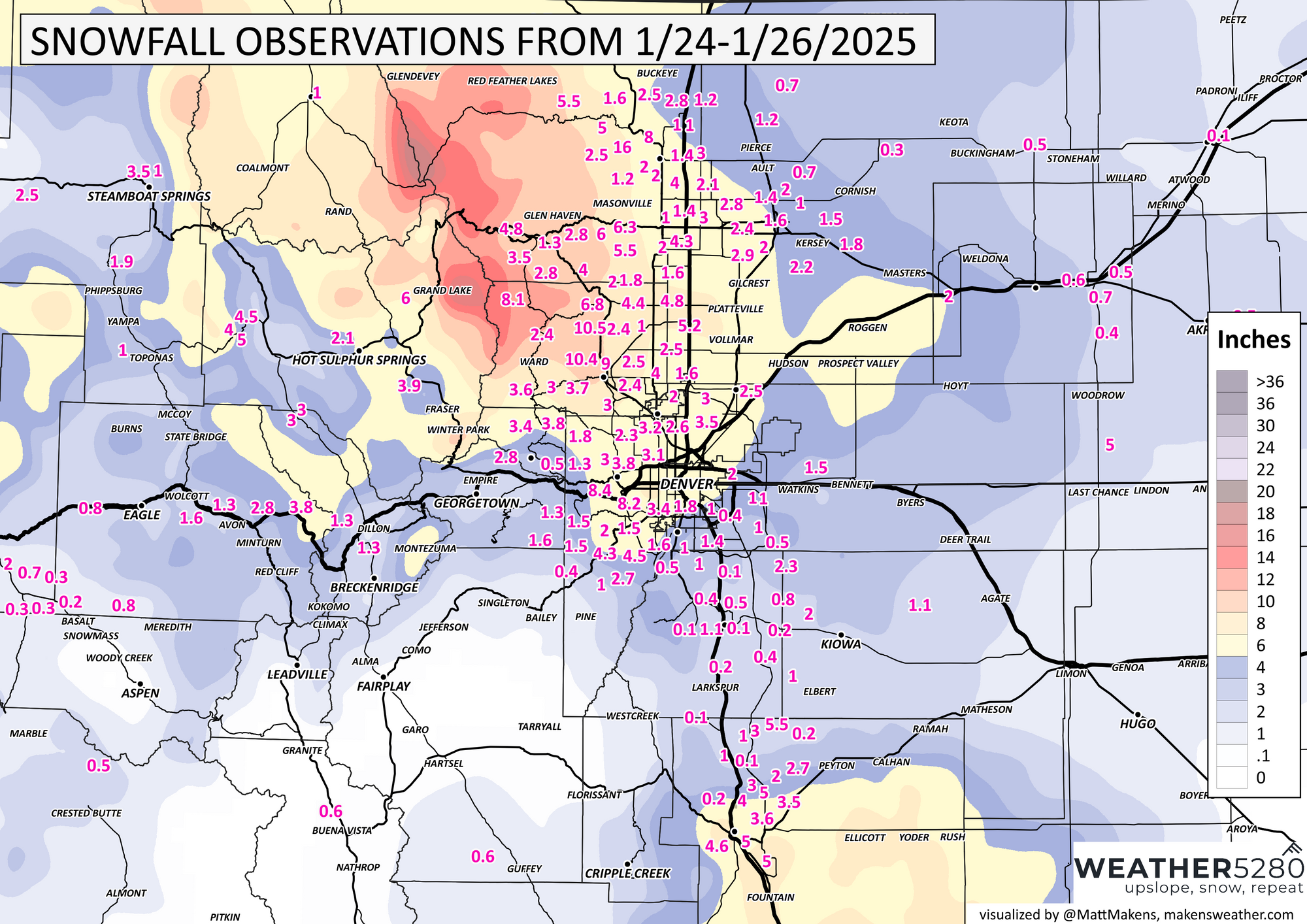
As the snow passed through Denver Saturday morning, a band of increased snowfall rates was indicated on the radar. The cold air's interaction with warmer air just off the surface created areas of enhanced lift. This resulted in some deeper snowfall along I-76 by midday but this mechanism also increased lift from El Paso into Pueblo Counties where deeper snow also resulted.
For today, the chilly air will remain although we will see increased sunshine. Hourly temperatures through the next 36 hours:
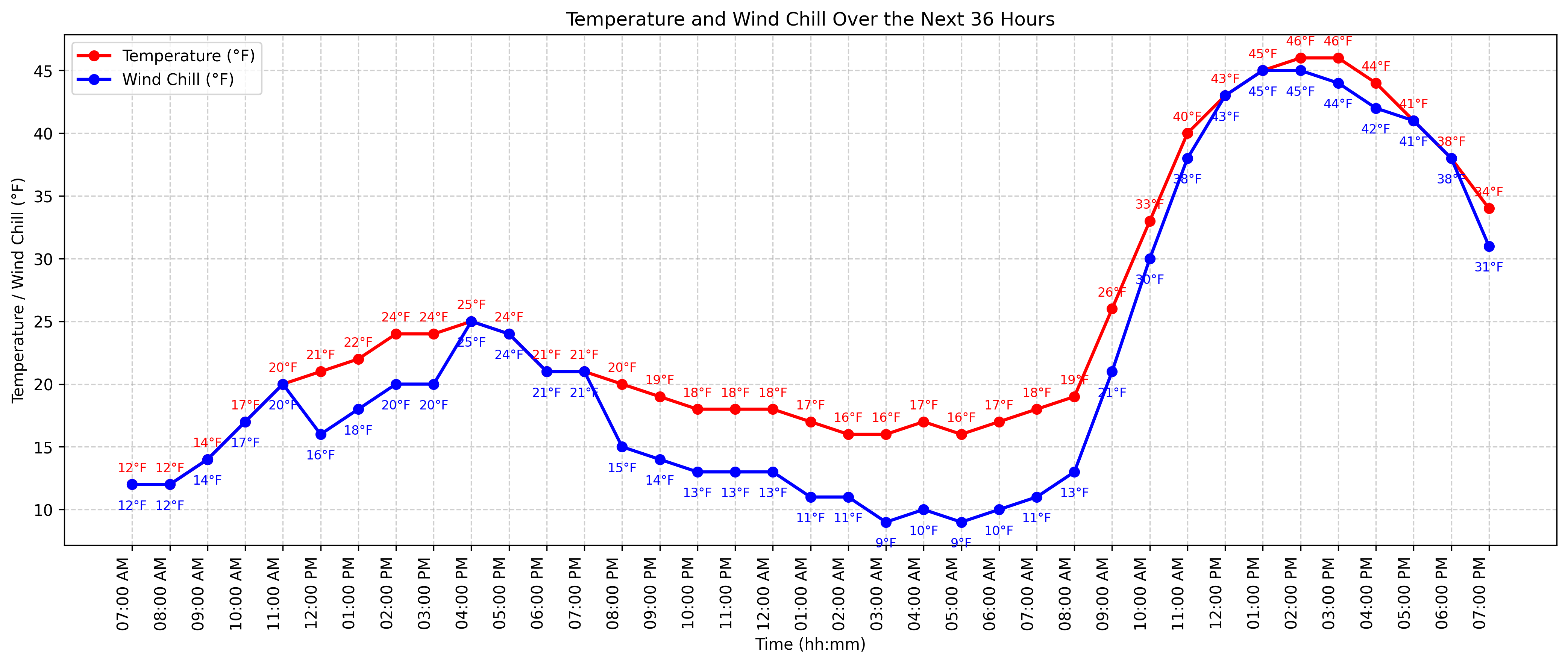
Today we stay sub-freezing, but that's a nice climb into the 40s for Monday. If we expand that to look at the week, the daily temperatures peak in the 40s.
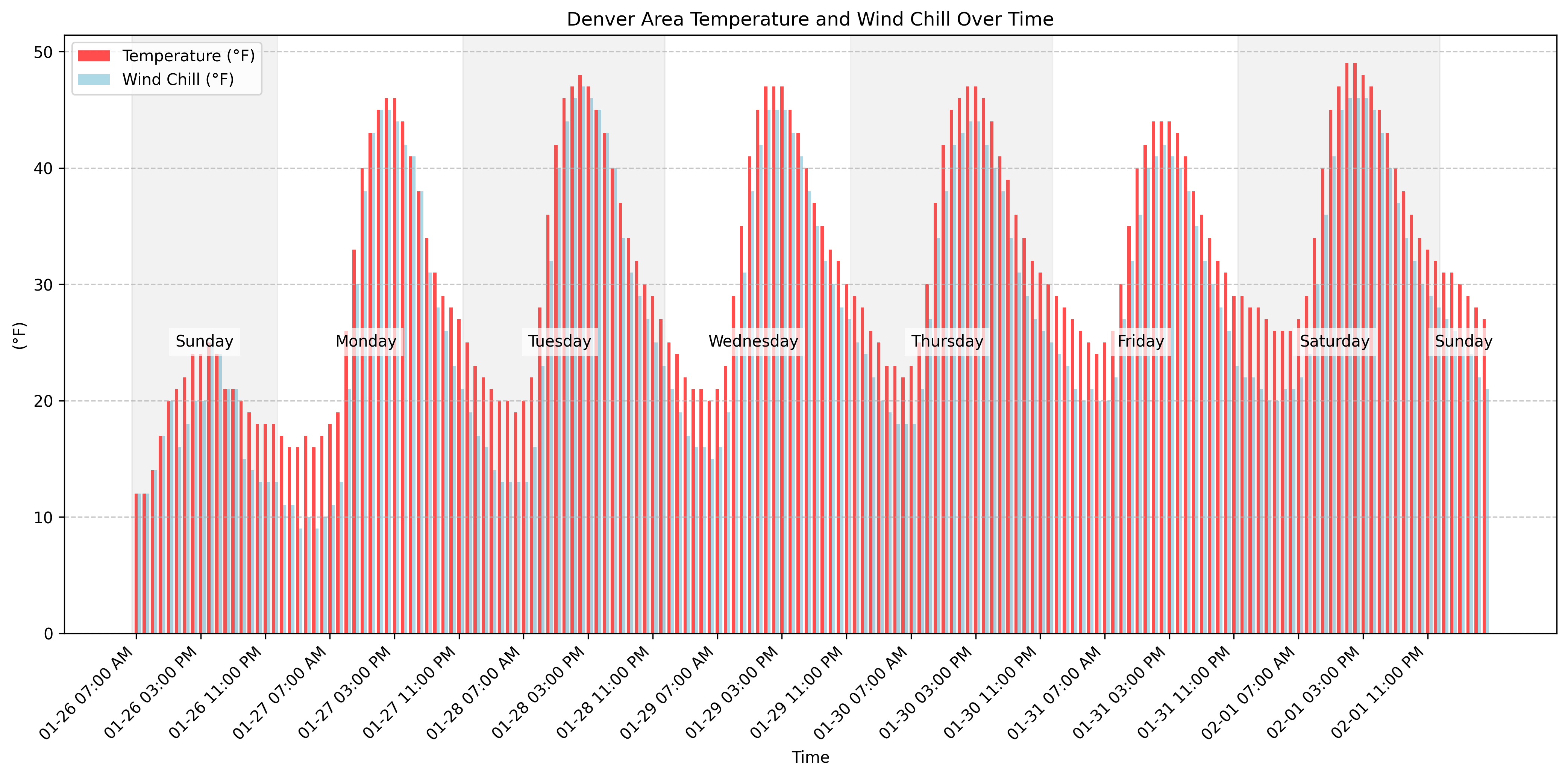
Although the early part of the week has sunshine, we do see a couple of chances for snow to come through.
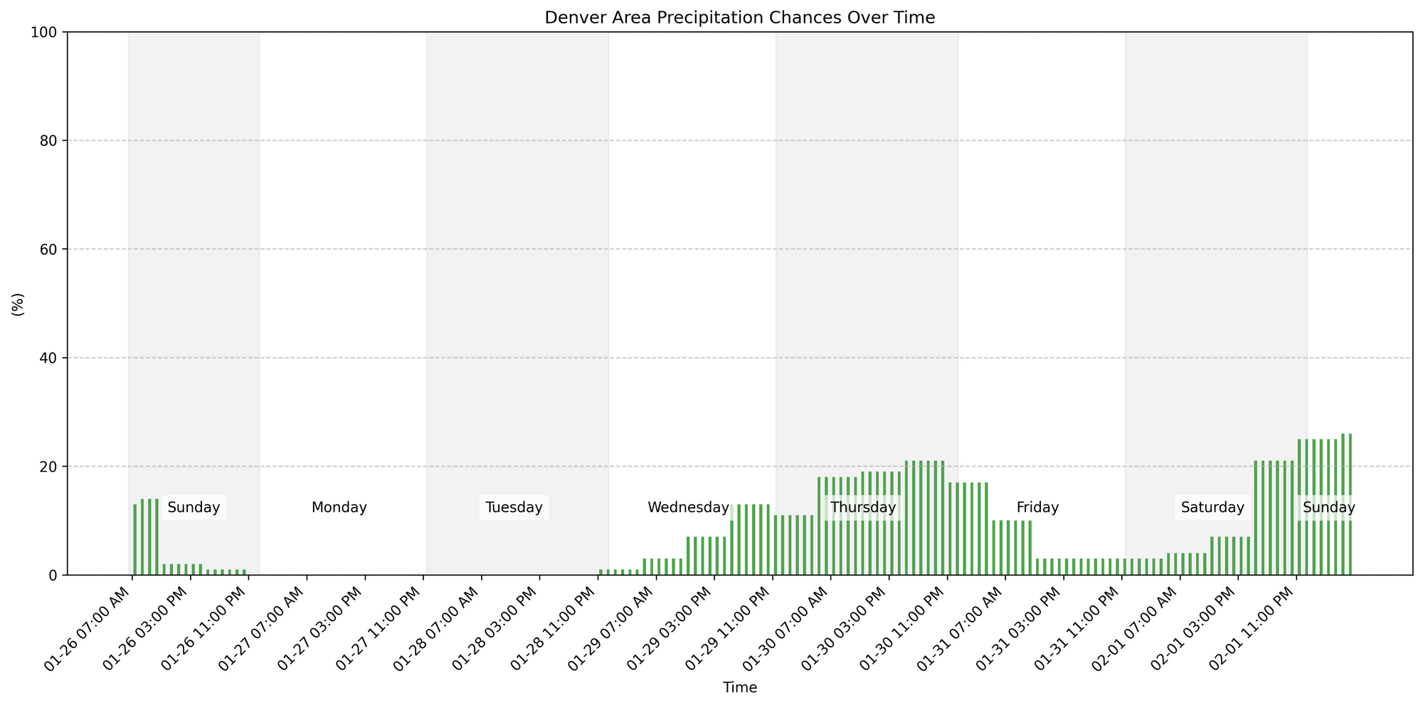
No, those aren't stellar peaks in snow chances, only getting up to 20-25% or so as of today, but if they materialize we could be looking at more accumulation in the city. Something to watch this week as we get closer.
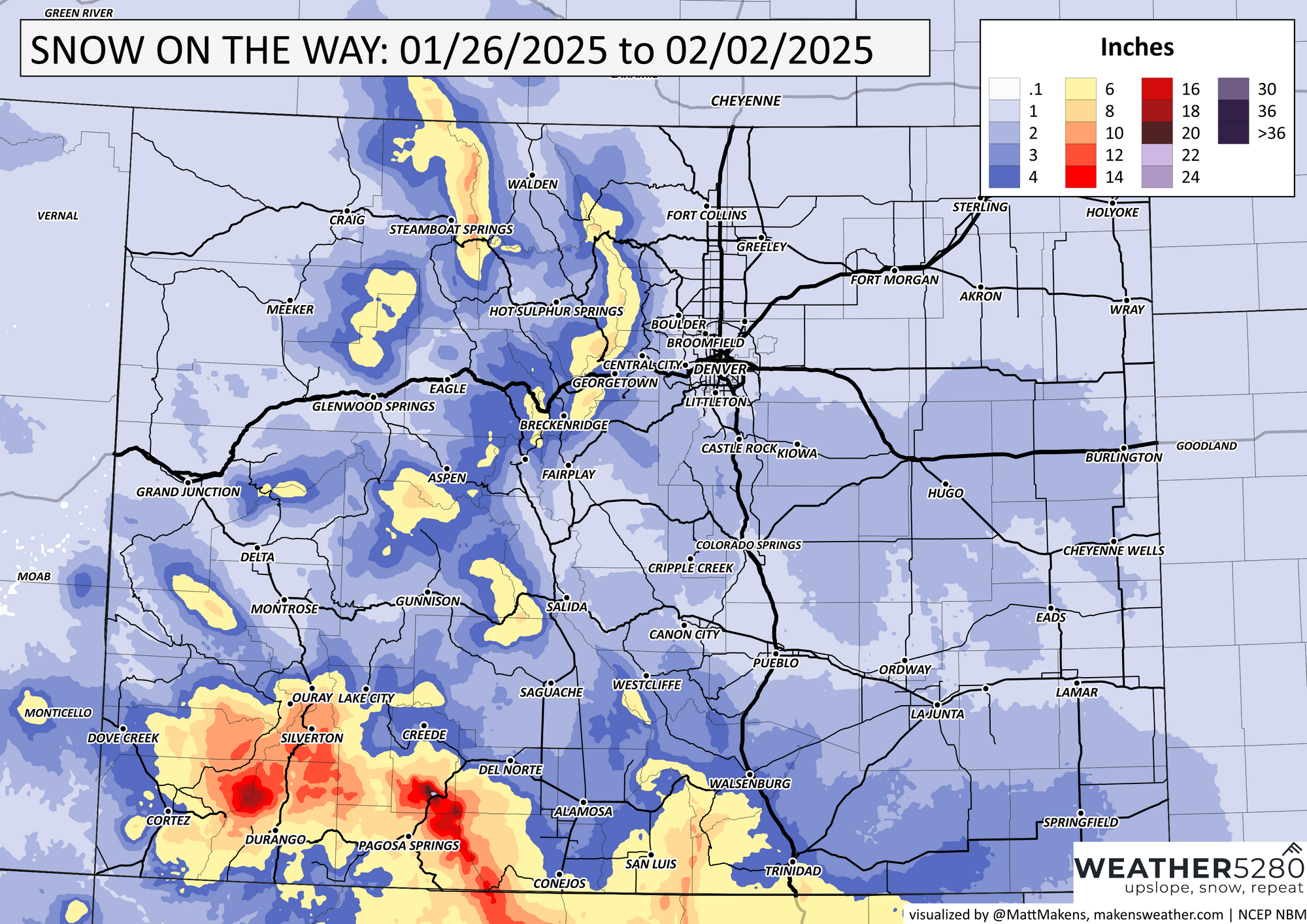
Through the week there will be additional snow in the mountains, here is a look at the possible totals this week. Most notable will be some totals reaching the San Juan Mountains in the Southwest. The same system will deliver deep snows in parts of California, Arizona, and New Mexico.
Looking well down the road, after next weekend it is possible we see another shot of cold. You may hear headlines from Alaska this week about very cold weather hitting them, well some of that cold will try to reach the States. Right now it appears a lower impact than the cold we have already felt in January, but we will keep tabs on it.