Cutoff low creates big problems for some Thursday, Big warming trend ahead

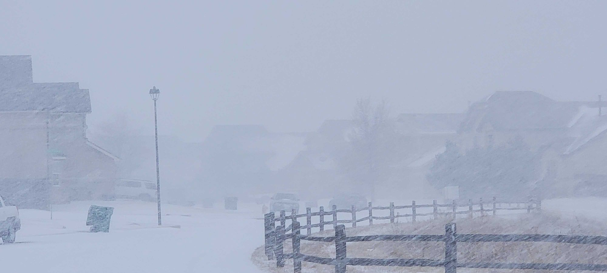
While the Denver metro and points north didn't see a ton of snow yesterday it was a vastly different story for the Palmer Divide and Pikes Peak region where in about 4 hours Thursday morning, 6-10" of snow fell. The snow was accompanied by 30-45 mph winds creating whiteout conditions for most of the first half of the day.
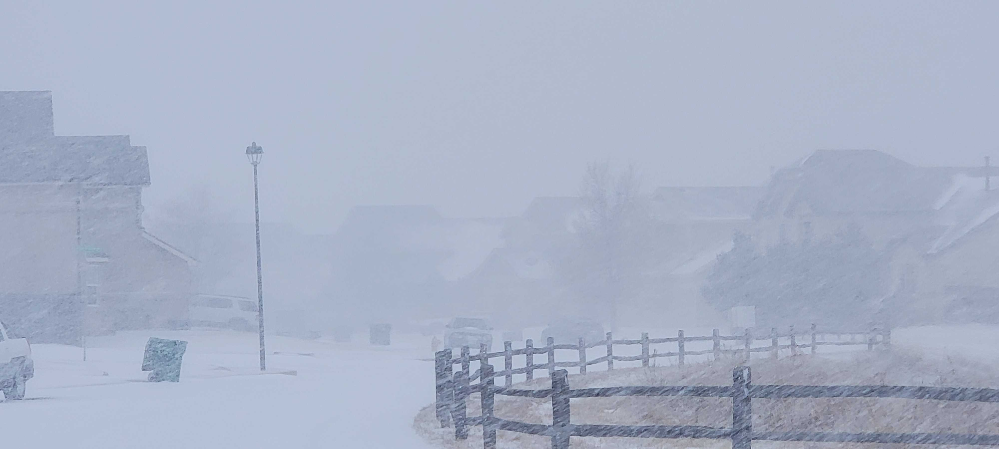
It was a bit of an unusual set up, because typically a strong north wind will lead to drying and downsloping in the Pikes Peak Region, but it was a unique meteorological setup that created a rare heavy snow and north wind combo.
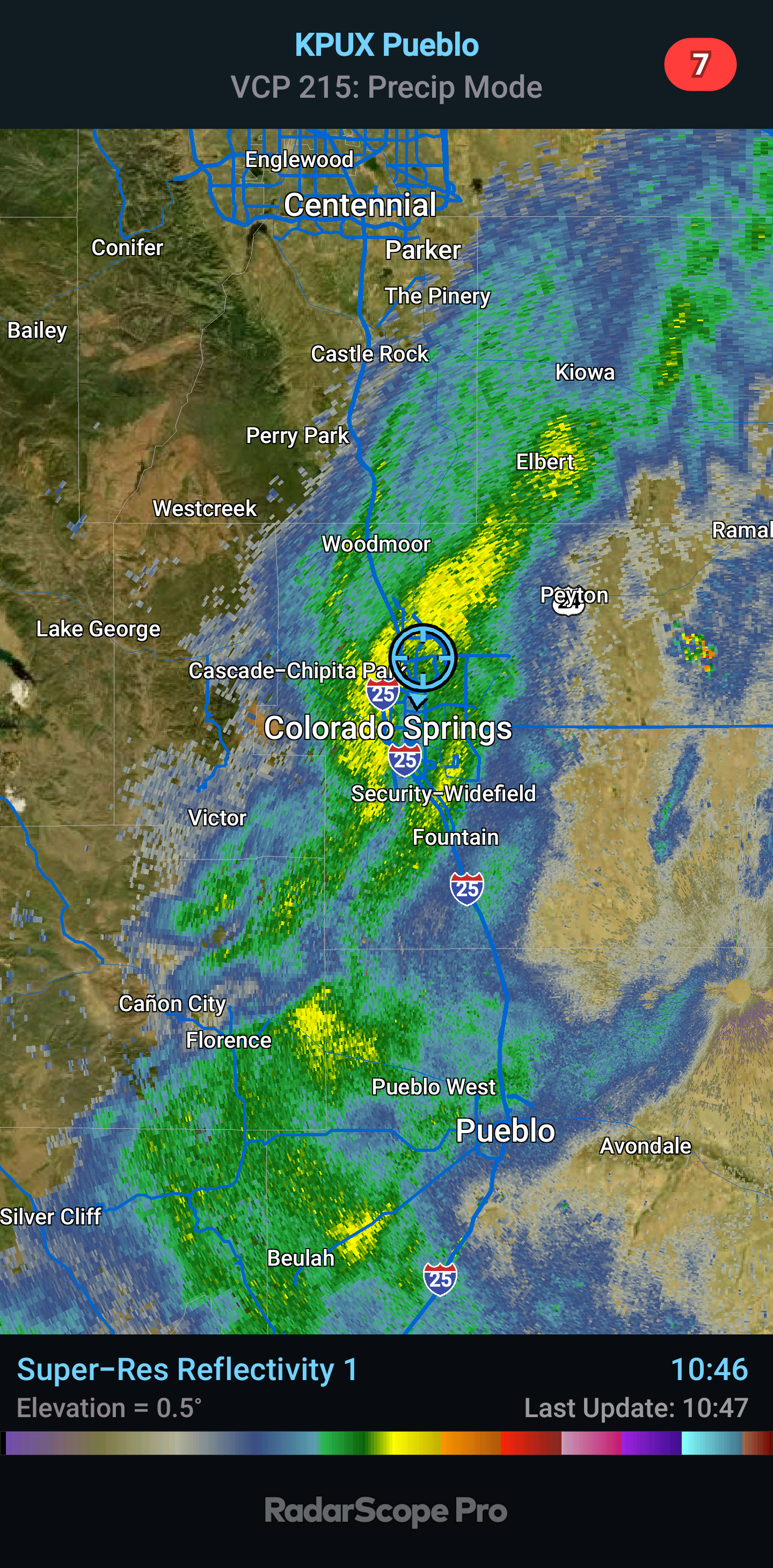
Thursday's snow was driven by something called a "cutoff low" which had an associated TROWAL (abbreviation for TROugh of Warm air ALoft).
Essentially instead of drying things out, this setup actually helped enhance snowfall.
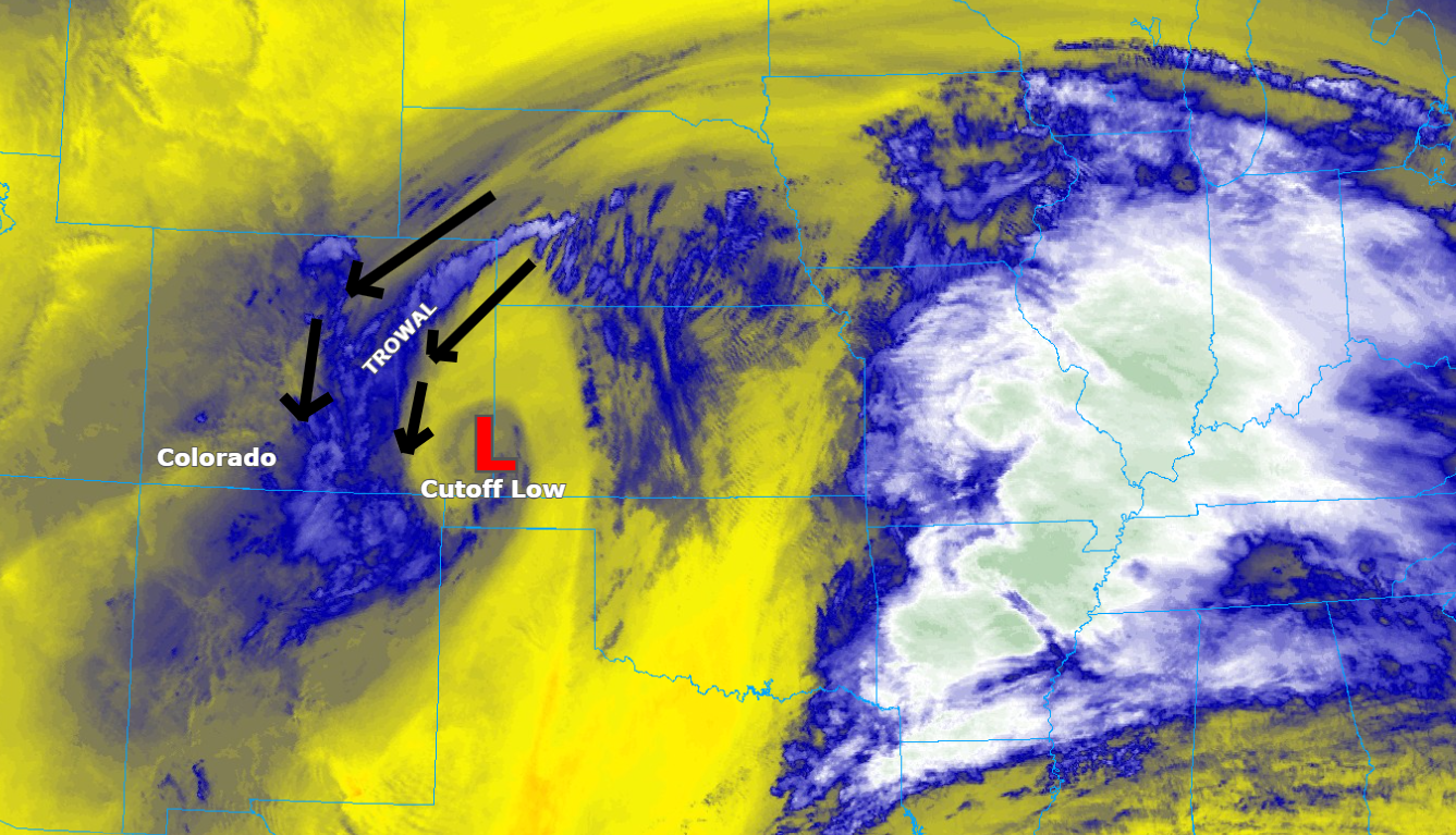
A cutoff low is a storm system that gets separated from the main jet stream, allowing it to linger and spin in place. In this case, it positioned itself perfectly to pull in moisture from the south and wrap it back around into Colorado.
The TROWAL on the northeast side of the low acted like a conveyor belt, lifting that moisture over the colder air near the surface. This led to steady, heavy snow, even as strong north winds pushed through—something we don’t typically see on the southern half of the Palmer Divide.
It was an unusual but powerful combination, and a great example of how Colorado’s weather can still surprise us!
So... what's next? Well, we're already feeling it here on Friday! A much deserved warming trend! Check out temps for Denver and Colorado Springs a la the EURO through the next 10 days... we don't have to talk about the back half of that forecast – but... it's still February.
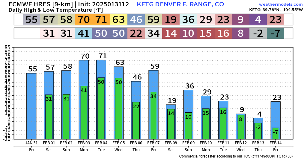

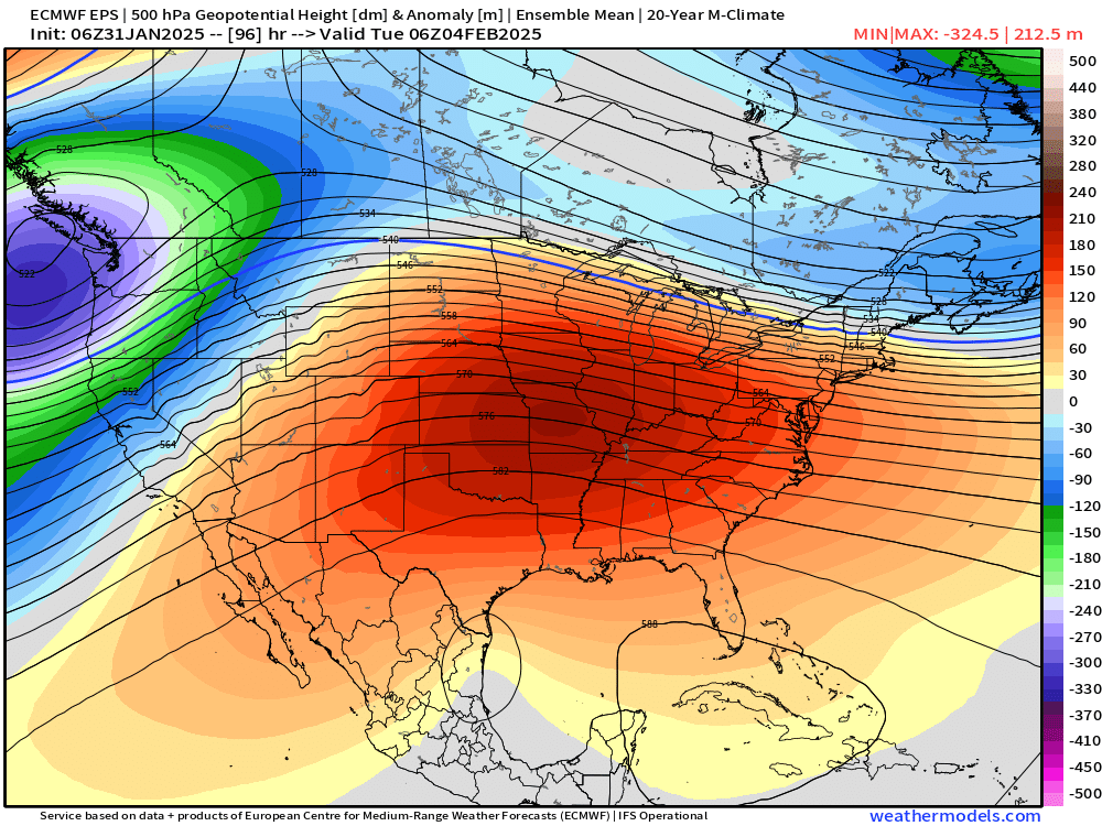
Below is a good look that big ridge of high pressure set to cover most of the eastern 2/3rds of the nation by Monday and Tuesday of next week – gunna be a nice break from the cold for many folks!
As you can all see on the temp charts... probably going to see another significant revert back to colder temps after early next week's warm up... just more stuff to talk about when we finally get there. For now, enjoy the warmth!