
Colorado weather: Warm Friday gives way to a colder pattern beginning this weekend

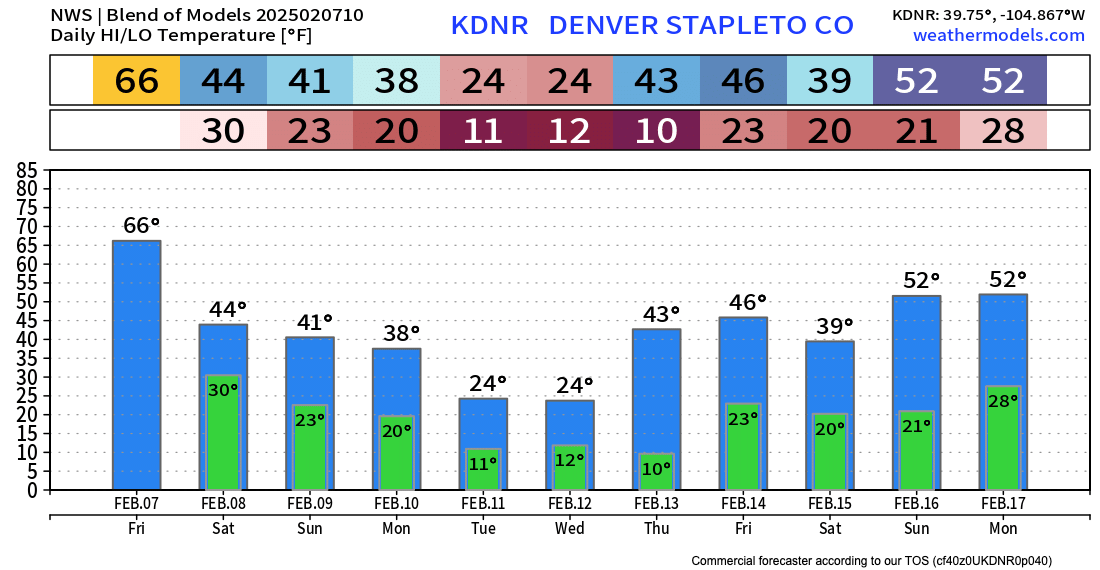
Get out and enjoy the day! Highs in Denver are expected in the low to mid 60s today, with anomalous warmth expected across the state today ahead of a shift to cooler and more unsettled weather as we head into the weekend.
Saturday will be some 20-degrees colder across Northeast Colorado, with highs in the 40s both Saturday and Sunday along the Front Range. A reinforcing shot of cold air arrives early next week which could mean a couple days with sub-freezing high temperatures for the metro area.
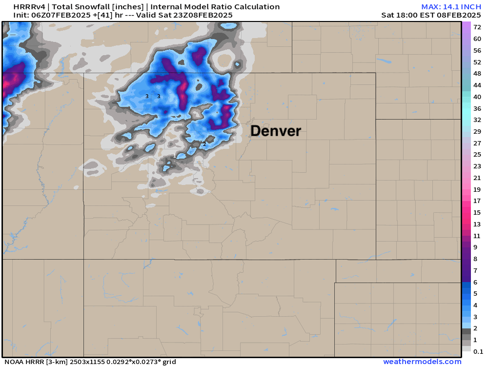
The weekend weather shift won't equate to much in the way of rain or snow across the lower elevations, but some showers are possible. Heavier snowfall is anticipated in the High Country where a Winter Weather Advisory is in place for the northern and central mountains tonight, with 4 - 8" (locally higher) of snow expected.
Here's the latest HRRR snowfall forecast through Saturday. A nice round of snow on the way for the northern mountains, but not much to speak of outside of that.
For the cities – Denver to Fort Collins – the main impact will be the cooler temperatures arriving later today. That and the wind!
Today we get southwesterly winds, gusting to 30 mph at times, which will warm us up, but those winds shift out of the northwest tonight and will make for a rather cold, blustery Friday night and Saturday.
Might we see a few rain or snow showers peel off the hills along with those winds? Perhaps, but we don't anticipate them amounting to much. The most bullish models show a quick 1/2" of snow under the heavier showers this weekend at lower elevations, but these are pretty isolated, and not all that consistent in the data either. For Denver that's about a 20% chance of occurrence, and perhaps a bit higher up north for Greeley, Fort Collins.
Next week
We continue to track a bit better shot at some snow for the lower elevations for the first half of next week. Timing of the cold air and snow amounts vary by model and run, but most guidance shows a pretty good shot of cold nosing its way into Eastern Colorado by Monday night, and lingering for a day or two, with perhaps a reinforcing shot of cold Tuesday into Wednesday.
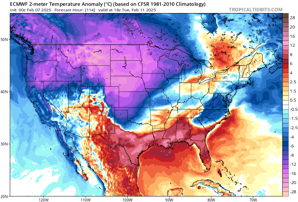
Here's the temperature anomaly from the European model for Tuesday morning, indicating temperatures much below average for our area at this time, and the cold front on the march through the Texas/Oklahoma panhandles:
With the cold we should see some snow. Most guidance is in agreement that snowfall will generally be light along the Front Range and adjacent plains, but some enhanced banded snowfall will be possible from time to time Monday evening through Wednesday which could enhance totals in spots. That, along with a bit of a prolonged period of off and on light snow could mean several inches accumulate for cities along the urban corridor next week.
Model guidance shows anywhere from 1 - 2" on the low-end to 4 - 8"+ for areas that end up under heavier snow bands. The European ensemble mean shows a broad-brushed 0.25 to 0.4" of liquid along the Front Range, indicative of upwards of 3 - 5" of snow should this come to fruition. Again this is between Monday and Wednesday night, so a bit of an extended period we are discussing here.

Time will tell!
For now, plan on a cooler weekend statewide and winter driving conditions in the High Country, especially from later this evening through Saturday morning.
Colder air arrives later in the day Monday, with the chance for snow off and on in the forecast really from Monday evening through Wednesday along the urban corridor. Details on how cold we get, and how much snow we should expect can be ironed out as we get closer, but good accumulation or not keep those jackets handy as early to mid next week looks... cold!