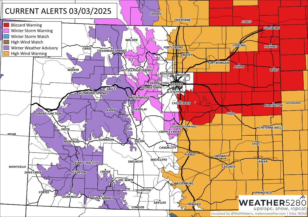
Spring storm update: Blizzard Warning expands for Eastern Plains

The graphic below shows where the current Blizzard Warning is located. It essentially encompasses the Palmer Divide, I-70 Corridor east of Denver, and parts of the east/northeast Plains and northeastward.

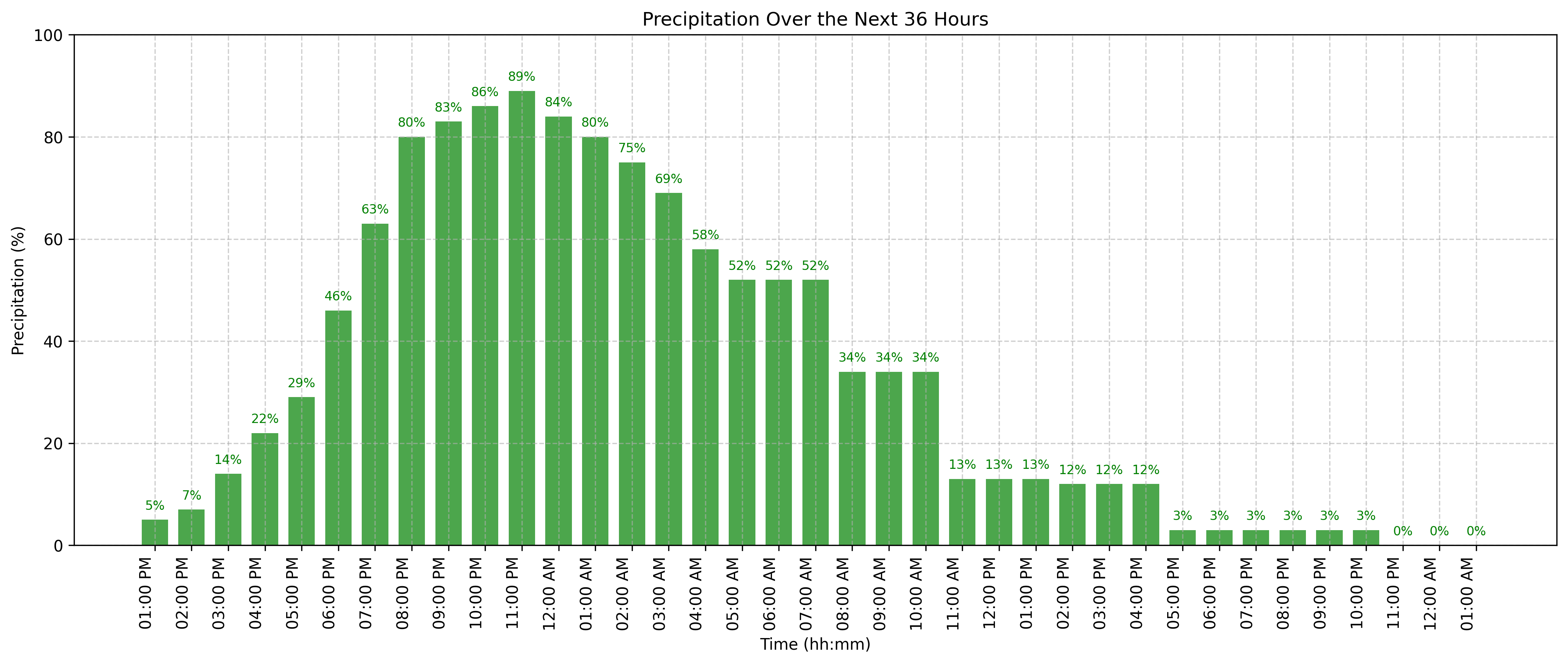
There remains a great deal of uncertainty as to how much snow will fall Monday night into Tuesday. However, we continue to stress this message...you won't be able to measure it, and it won't take much snow at all to cause blizzard conditions. Why? Because we know for certain that the wind is going to howl... Here's the quick and dirty breakdown:
The latest "future radar" animation from the HRRR model starts tonight at 6 PM and ends Tuesday at 6 PM:
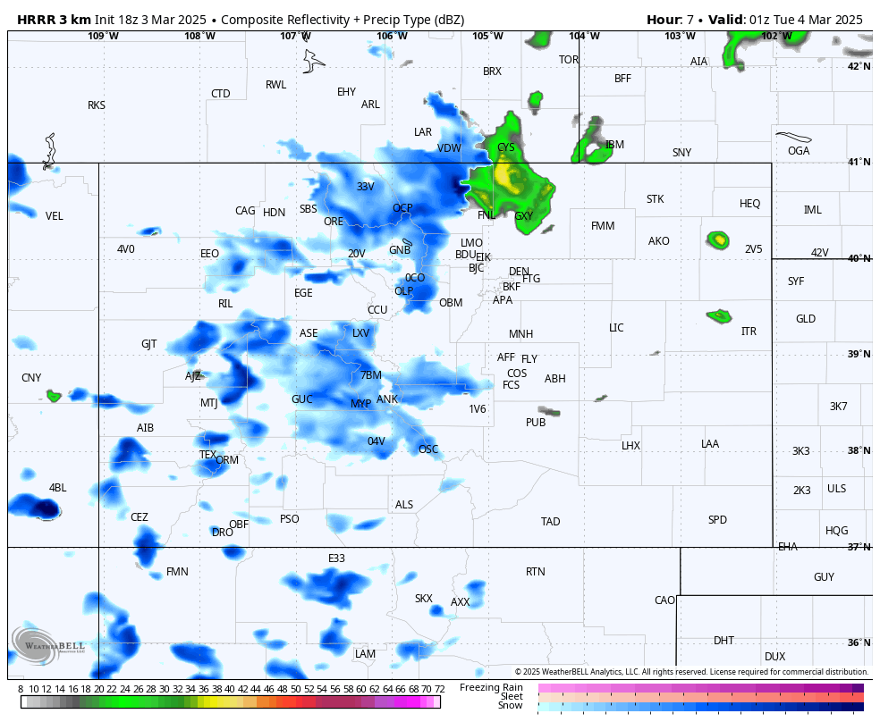
You can see the rain (maybe even some thunder) develop early this evening along the northern Front Range and adjacent Plains. That rain changes to snow this evening and overnight, as colder air moves in on that strong north wind. Folks on eastern Plains have to wait a bit longer for the cooler air to move in, but any left over rain should being changing to snow early Tuesday morning. While this likely isn't a perfect depiction of how things unfold (rarely ever is), it should serve as a general idea of what to expect.
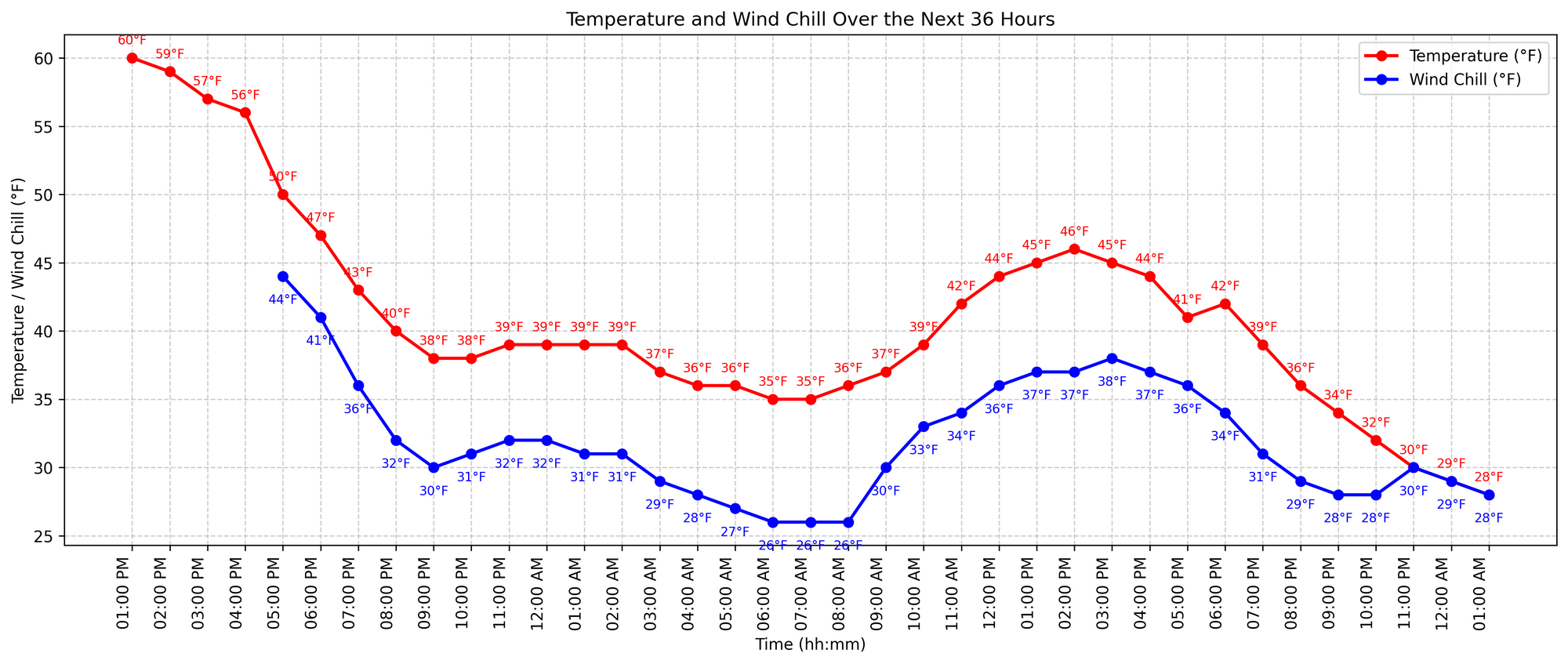
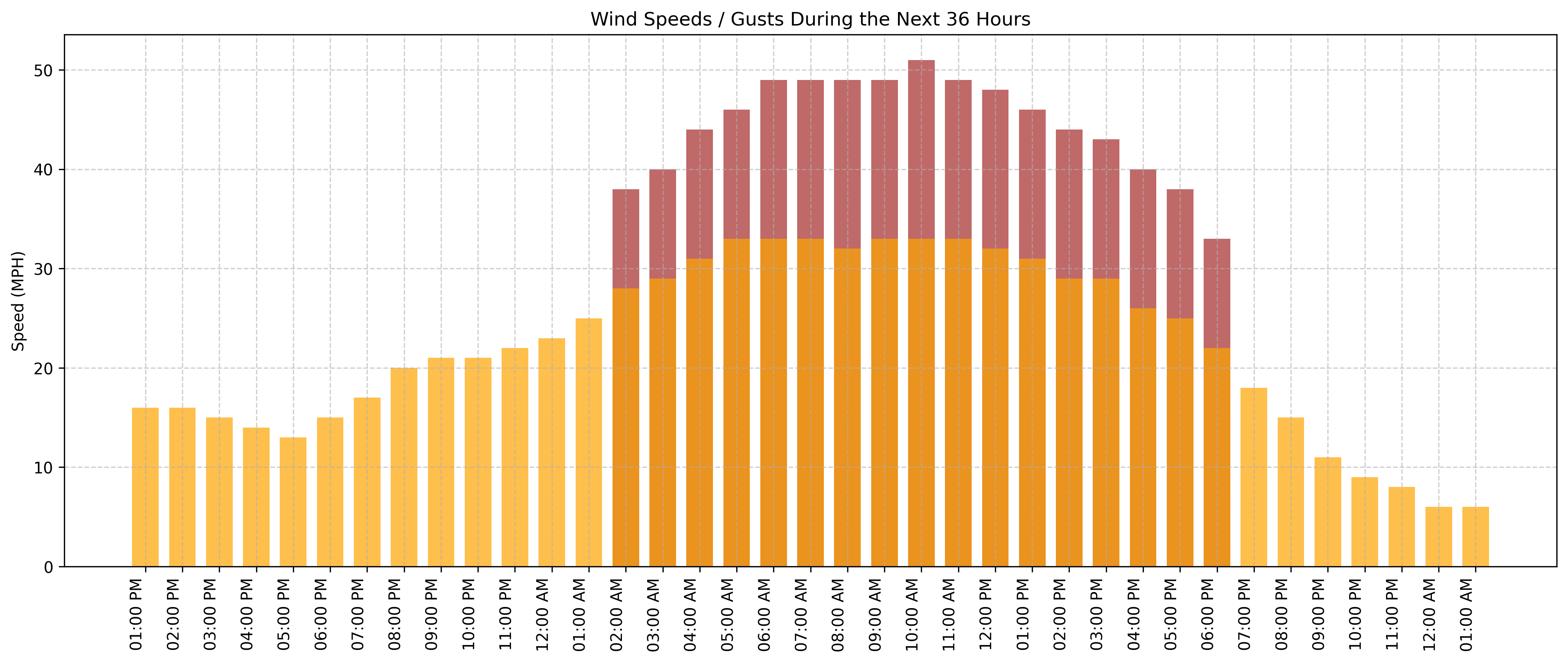
Wind Gust Forecast Tonight, 6 PM MST - Wednesday, 6 AM MST
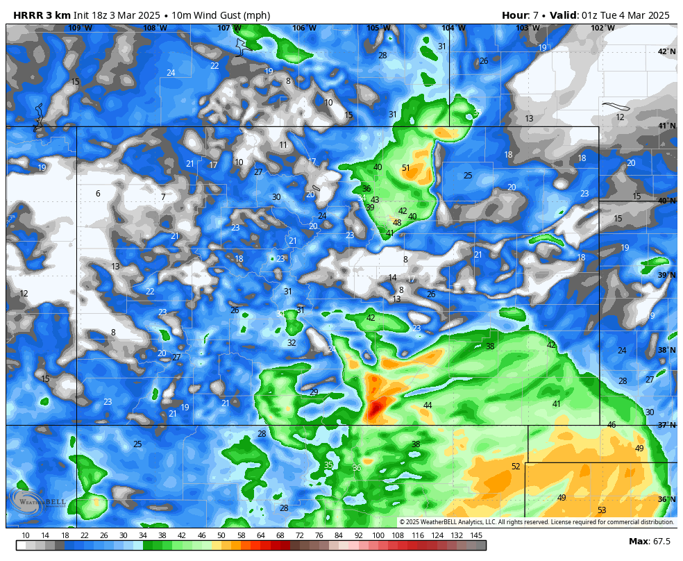
With the wind gusts shown above, it's easy to see why it won't take much snow to create blizzard conditions. Whether you see snow or not, the message is pretty clear that everyone along and east of the mountains will see some very strong wind. Some gusts will likely be in excess of 70 mph in some of the favored areas of eastern El Paso county and Lincoln county. Because the wind won't subside on the eastern Plains until early Wednesday, there will likely still be ongoing blizzard conditions for the areas that see significant snow, until the wind dies down Wednesday morning.
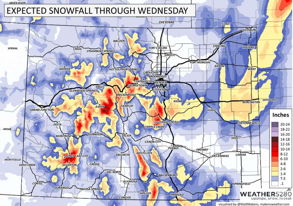
Snowfall Potential Ending Tuesday PM
This is the real trick, because like I said early on...it really isn't the main story here. The impact of even just a couple inches of snow with the wind will result in a blizzard, and I really think that is the thing to focus on.
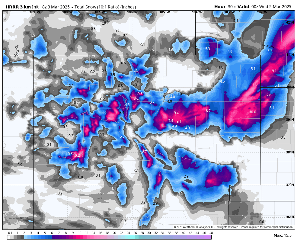
Different models have different solutions, and I don't want to overload you with a bunch of model images. So, I'll give you three...
EURO Model
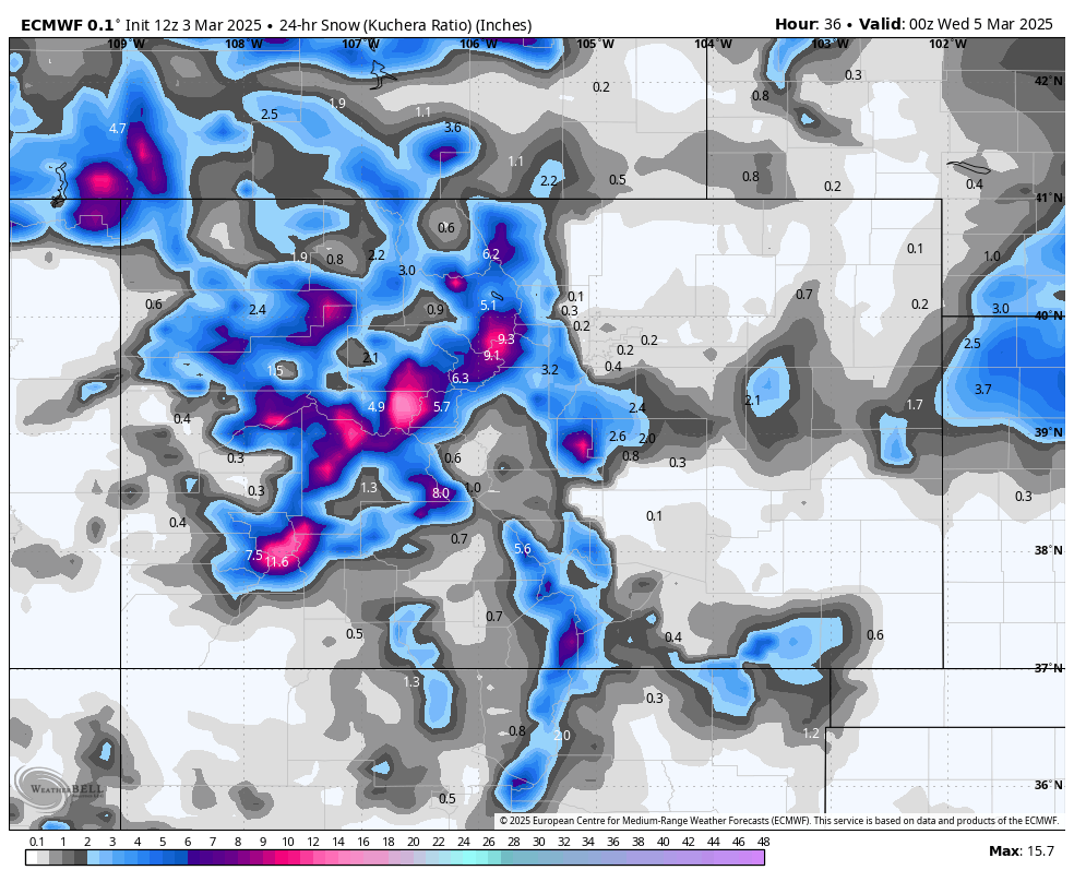
HRRR Model
National Blend of Models
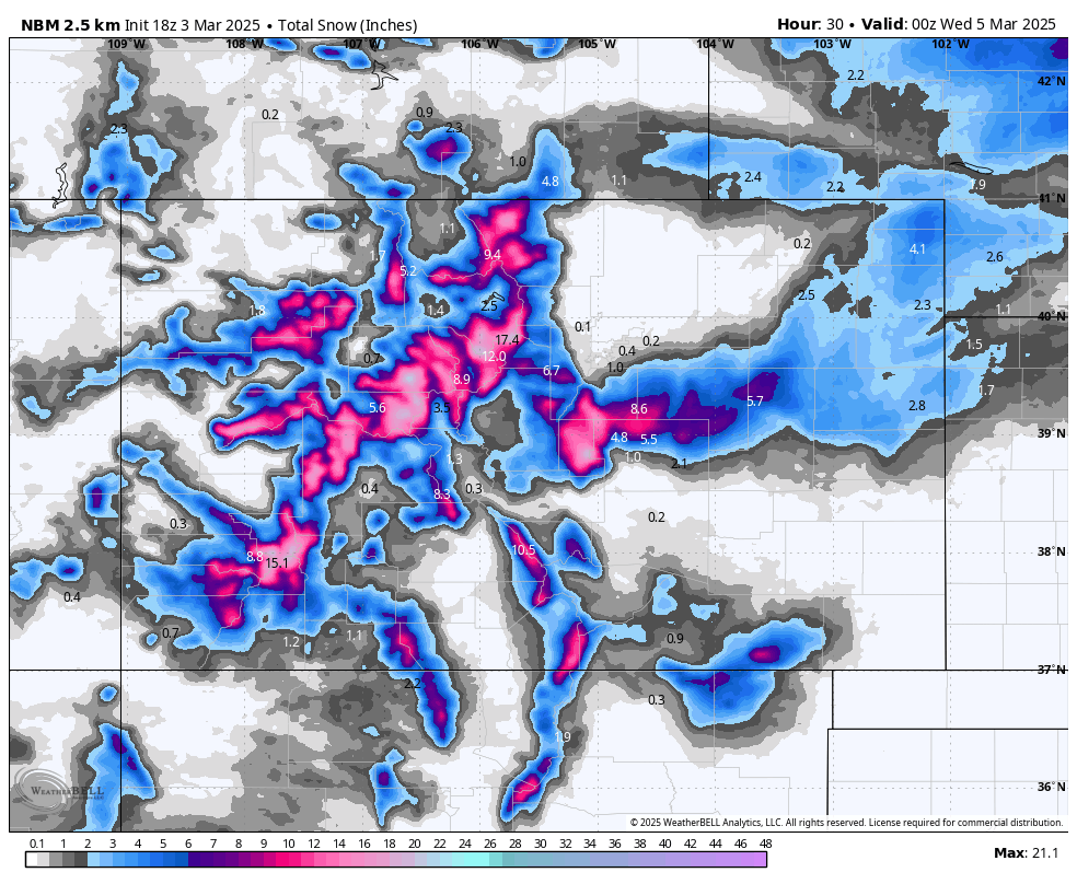
Pretty wild the differences, eh? The EURO was the first to catch onto the fact that this storm could end up as a "bust". The HRRR model continues to be a "boom" for some areas, but certainly not all. The National Blend of Models is somewhat of a compromise, but certainly leans more toward the HRRR model for some areas.
While we are unsure of amounts, we tend to think the following: The Palmer Divide, I-70 Corridor east of Denver, and parts of the east/northeast Plains (especially along and north of I-70) will likely have the highest impact from this storm. And as I said earlier in this article, that is really the thing to focus on...NOT exactly how much snow will get blown into a drift.
Our snowfall forecast:
Denver still is in the running for some surprises... but most guidance shows little snow accumulation in the city, given both a lack of precipitation with downsloping winds and relatively warm temperatures meaning some of what we do see may be rain. We'll see if that trend changes as we head into the evening.
I also want to stress that computer models often struggle with resolving the finer details of a rapidly intensifying storm like this one. So, it is very important to be prepared, just in case you have to change your plans. It's March and this is a strong storm. They always have a few last minute curveballs.