
Colorado Weather: Possible Bomb Cyclone and a Lunar Eclipse

IMPORTANT TO NOTE: There are a few factors which we'll discuss here that should prevent significant front range, I-25 and plains impacts like we've seen with bomb cyclones in the past.
A lot to talk about today so let's get right into it!
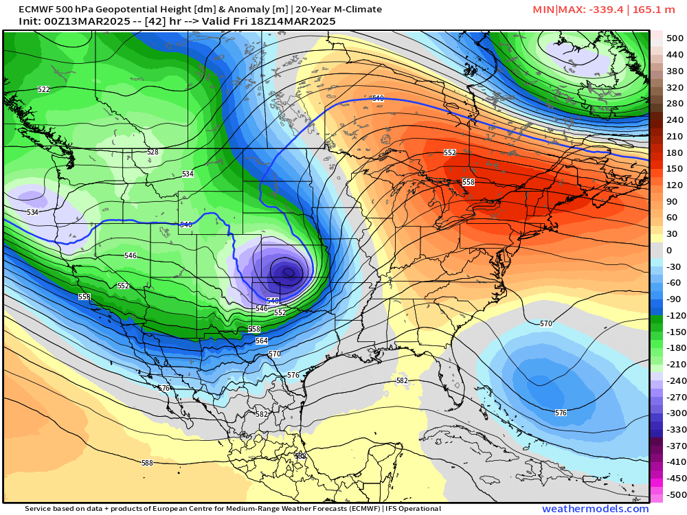
We are still looking at a rapidly developing storm system for Friday over the central high plains. This storm system has the potential to drop from ~1000mb, to 976mb, over a 24 hour period, which would constitute a "bomb cyclone".
Essentially, we are seeing an area of low pressure rapidly strengthening in that period, meaning rapidly changing weather conditions. After a week like we've had with a lot of 60s and 70s, these changes will be a bit jarring.
FOR THE MOUNTAINS
This area of low pressure will be moving from southwest to northeast across Colorado, meaning the western slope, and the San Juans will see the greatest potential for snowfall out of this system initially.
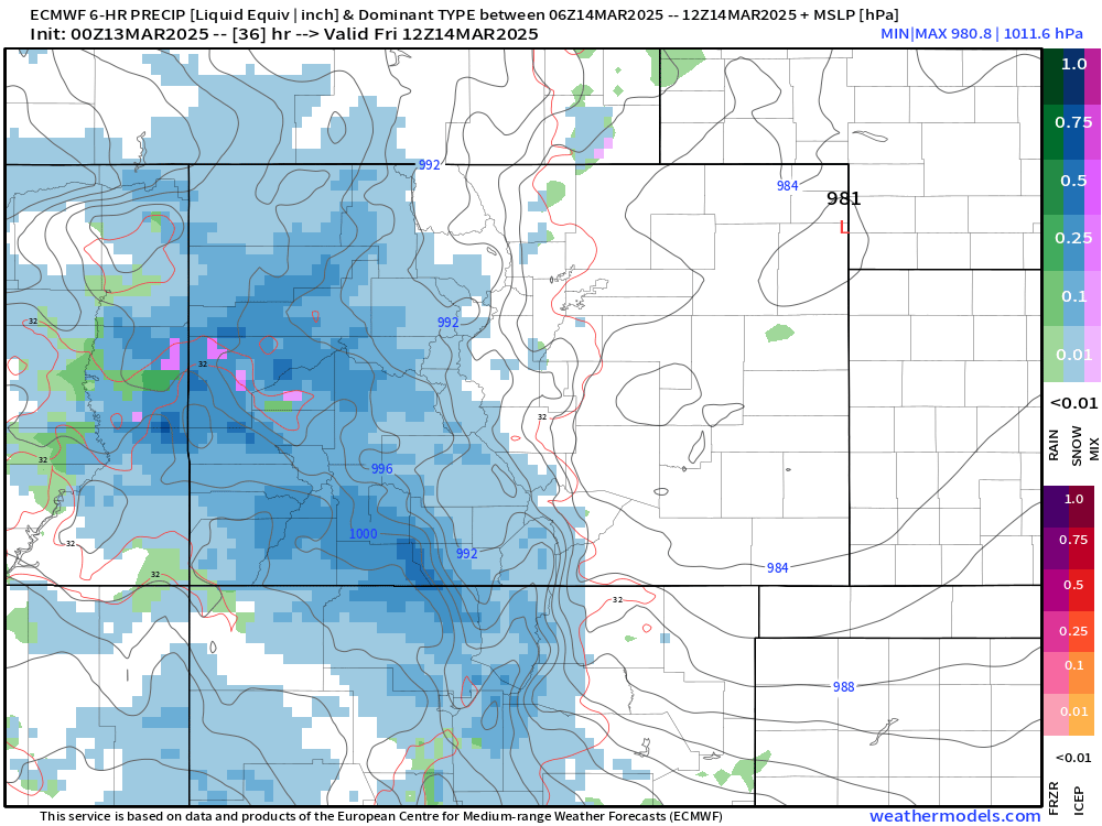
This snow will pick up late Thursday afternoon, being at its most intense Friday morning, and slowly tapering to light, lingering snow showers by Friday night.
Mountain travel, especially Friday morning, is likely going to be rough – we'd suggest you restrict travel until Friday afternoon or evening.
FOR I-25 AND THE PLAINS
Fast forward to Friday afternoon, the surface low begin to spin up over southeast Colorado and rapidly strengthen. Notice on the northwest side of the low how broken up the moisture is.
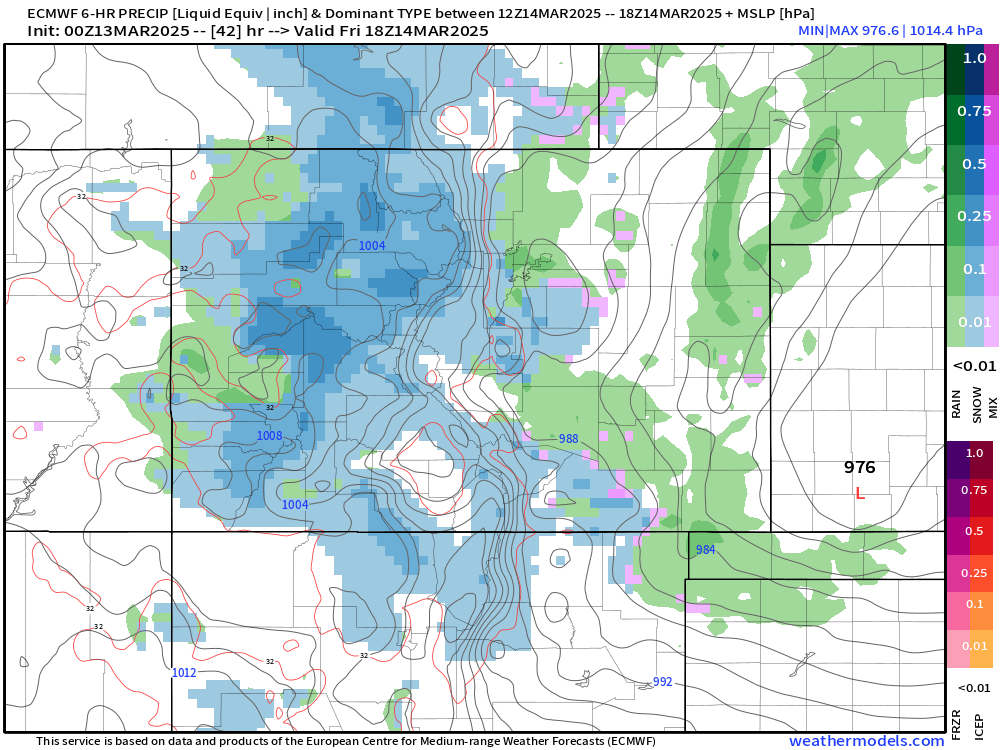
While this system has a lot of OOMF to it, it is going to STRUGGLE in the moisture department. It is one of the main reasons we're not going to see MAJOR impacts in terms of snow for areas east of the hills.
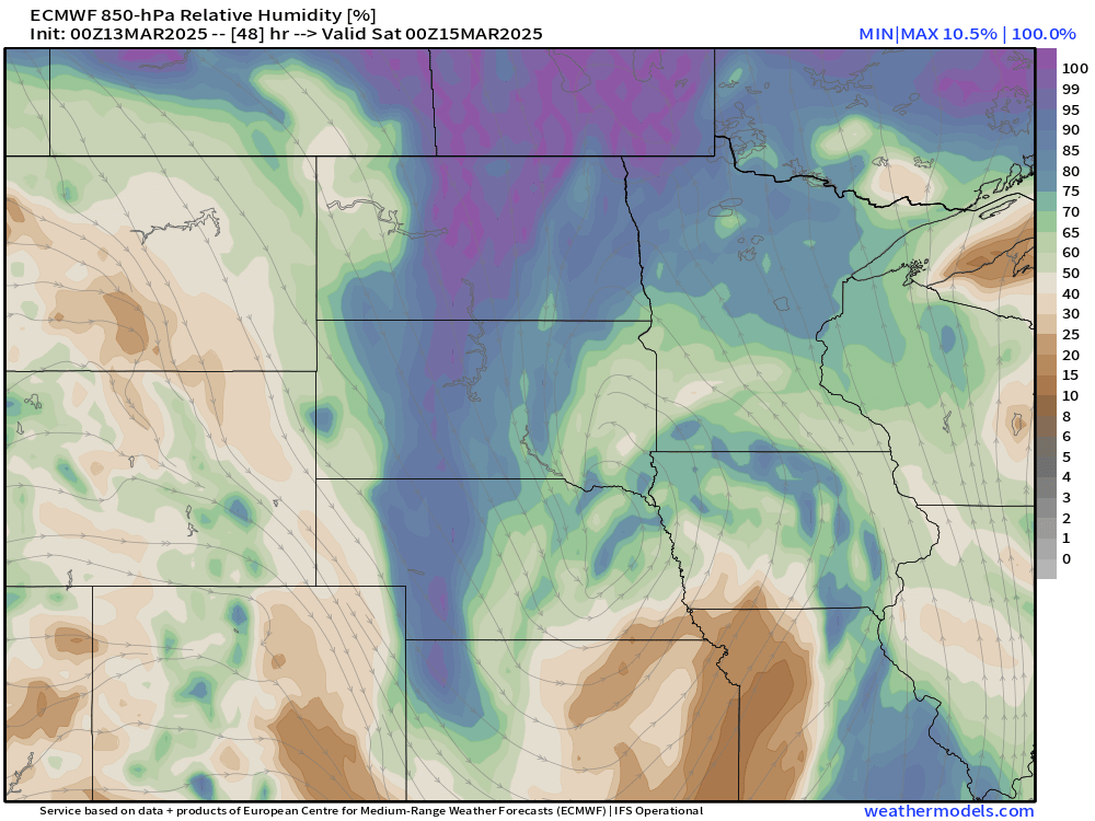
Check out this low-level moisture chart:
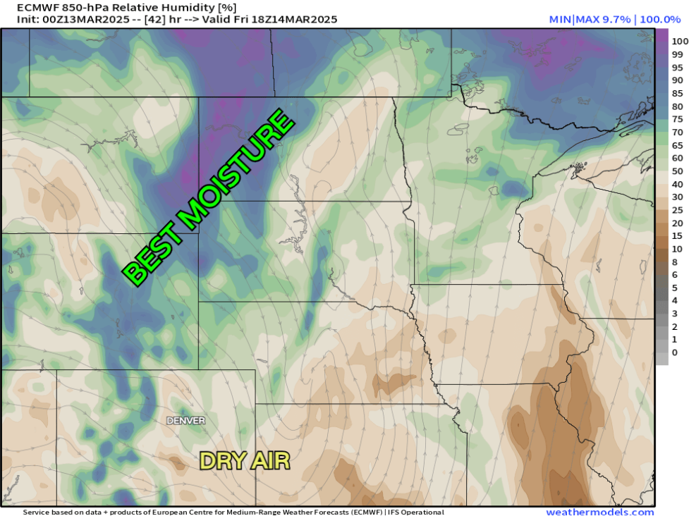
That's for Friday afternoon as the low pressure system is ALREADY getting east of us. Check out the rich moisture WELL off to the north of Colorado. We don't see much of ANY of that get south until... Friday evening, as you can see in the chart below. That moisture rich air is well into Nebraska and Kansas by the time it starts to wrap around the center of low pressure.
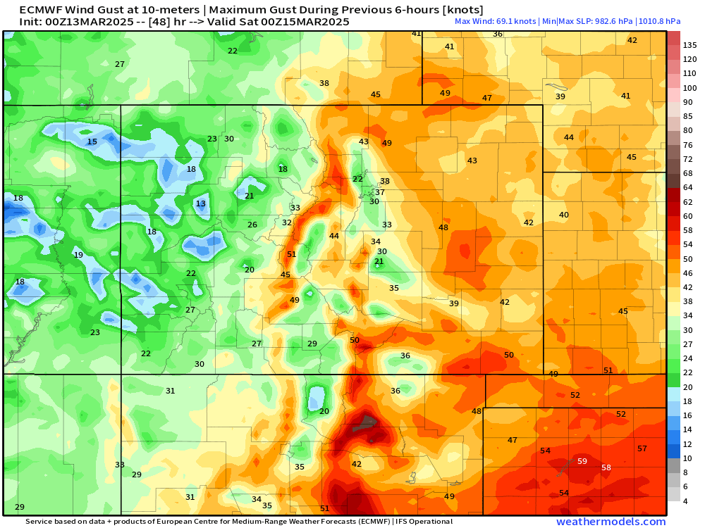
OK... so, for the front range, significant moisture impacts certainly look off the table at this point, but wind "don't need no moisture."
Below is a look at wind gust potential Friday afternoon. Many locations are going to see 30-50 mph gusts as this low begins to wrap up and move east. BUT! NOTICE... the minimums (greens/lower winds) around Denver and Colorado Springs. Since the winds will be coming out of the NW around the low, Longs Peak and the surround mountain range will likely act like a barrier to protect the immediate and western Metro Denver from the stronger wind gusts – and in the same fashion for folks immediately southeast of Pikes Peak in southern El Paso County.
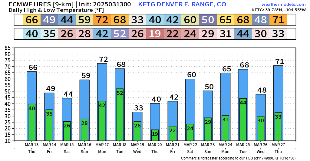
Not a ton of cold air to work with for this system either due to the speed, location and moisture of this storm. We'll see a breezy mid to upper 40s around Denver Friday, while remaining cool Saturday. Another quick ramp up is expected Monday and Tuesday ahead of the next system on Wednesday.
As you can see we have PLENTY to talk about, even if Friday's possible bomb cyclone isn't going to deliver impacts like we've seen with bomb cyclones in the past. It's always a delicate balance when making a forecast!
We'll let you know if there are any other updates needed but for right now, this should cover it!
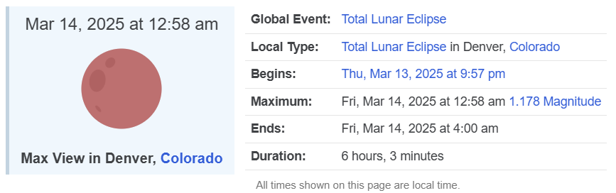
LUNAR ECLIPSE THURSDAY NIGHT
ALSO for skywatchers! Some cool stuff happening in the night sky (if we can avoid the clouds...) You can view this eclipse in the southeast sky Thursday night, starting at 9:57PM, but becoming maximized 3 hours later, at 12:58am rolling into Friday morning.
 timeanddate.com
VISIT THIS WEBSITE FOR MORE INFO, IT'S SUPER HELPFUL!
Have a good weekend and send us eclipse photos if you can snap em!
Luke