
Denver Weather Guide: Warm weekend followed by rain and snow

A quiet and sunny start to the weekend will give way to a much wetter and cooler pattern across the Denver metro area and the Front Range early next week. The long and short of it is a very wet forecast on tap for early next week.
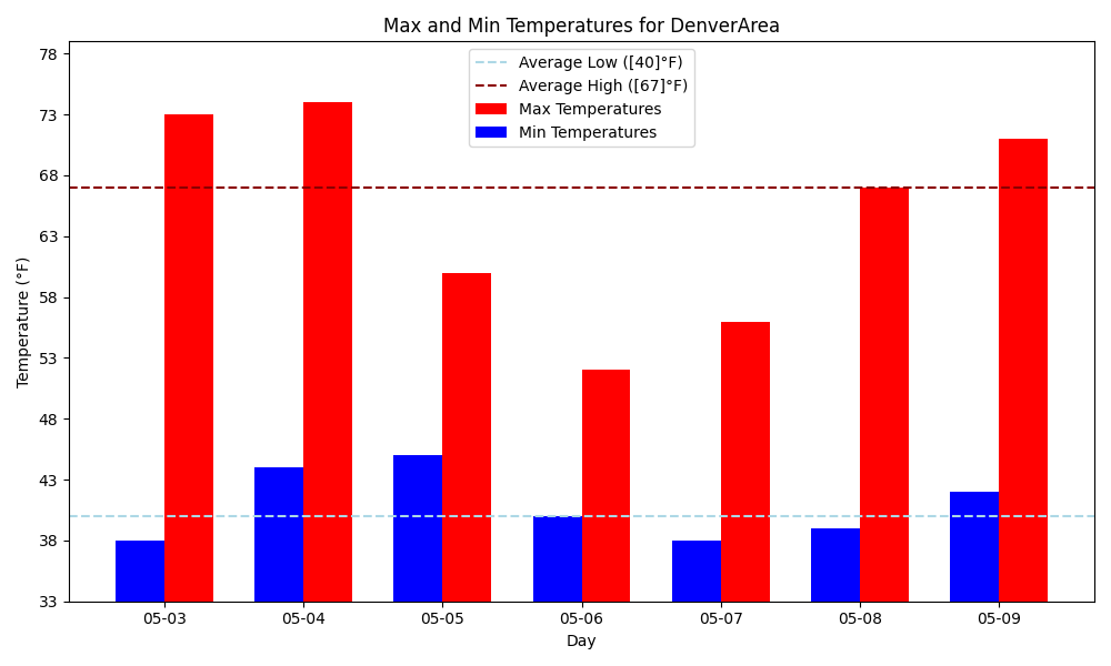
Here's what to expect the overall temperatures to be.
Let's walk through the weekend and early next week
☀️ Saturday: Warm and Dry
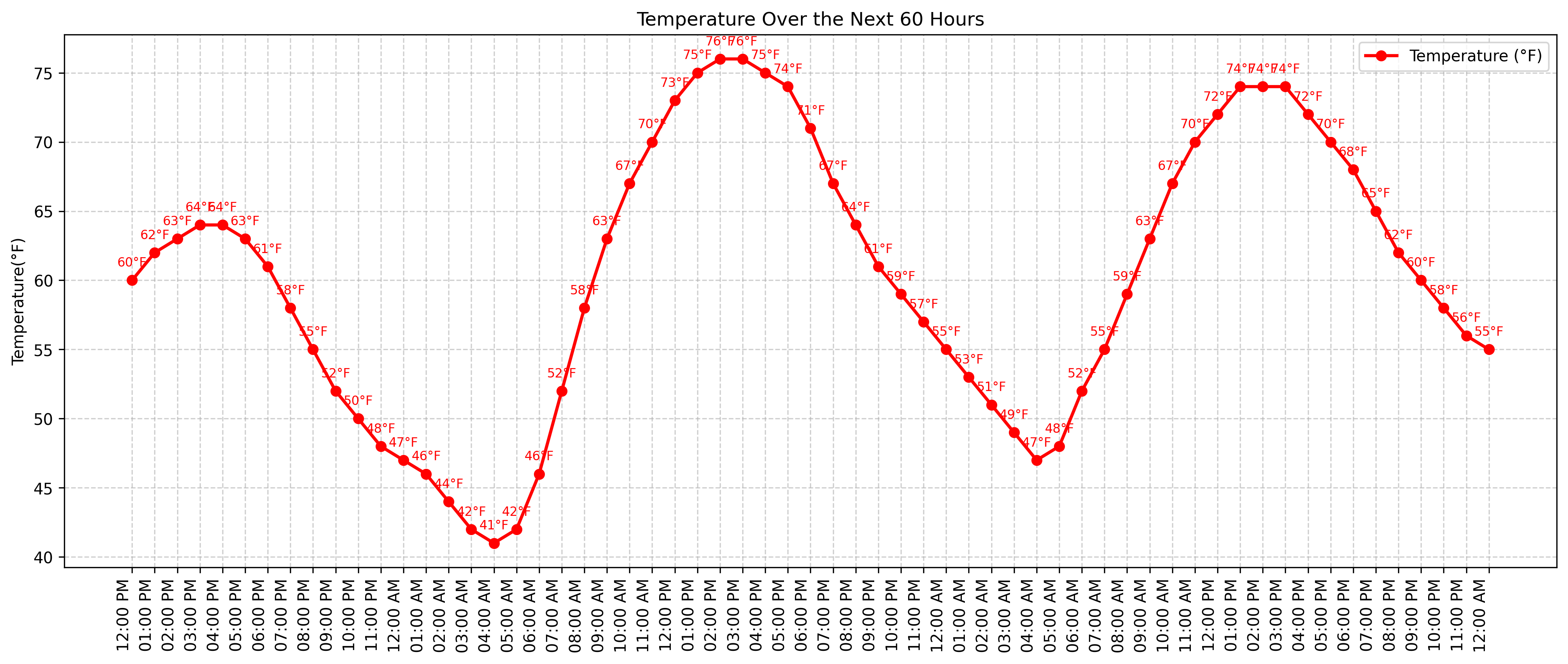
Saturday will be even warmer than Friday, with highs reaching the mid-70s, dry, making for great conditions for outdoor activities.
🌤️ Sunday: Breezy with a Chance of Afternoon Showers
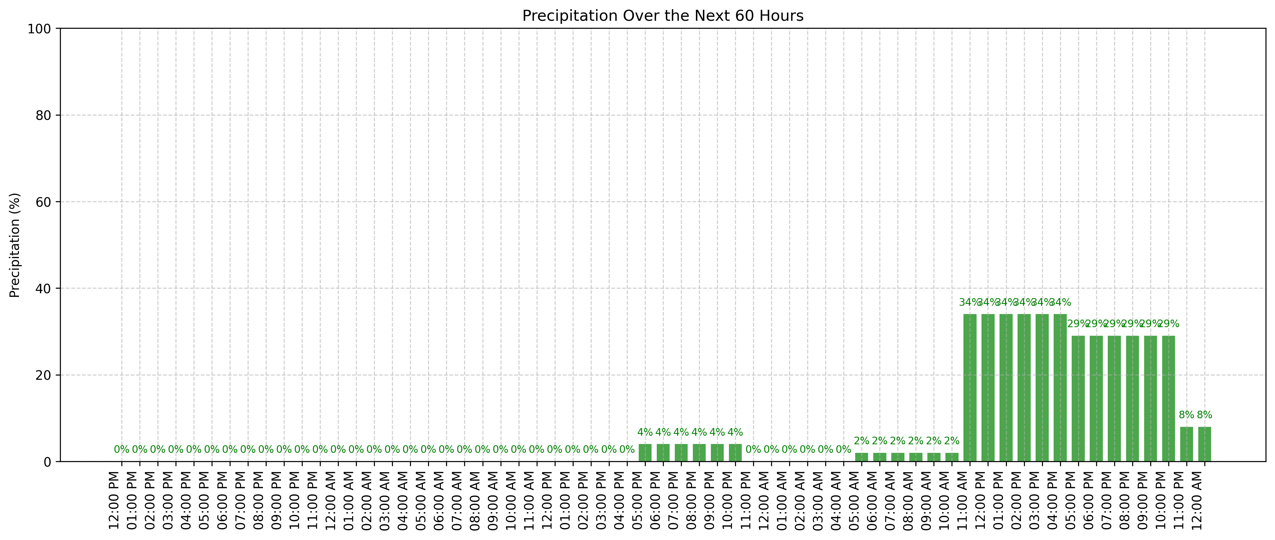
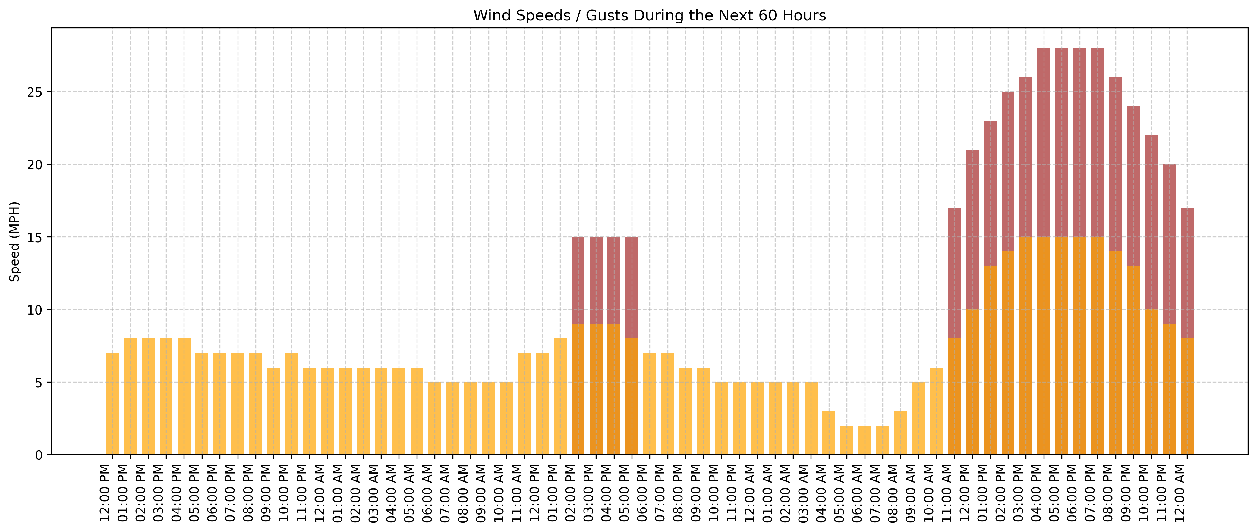
Sunday will start off mild and dry, but by afternoon, there's about a 30% chance of showers and thunderstorms in the city, with showers in the mountains and western Colorado. Highs will be in the mid-70s, but expect it to be breezy.
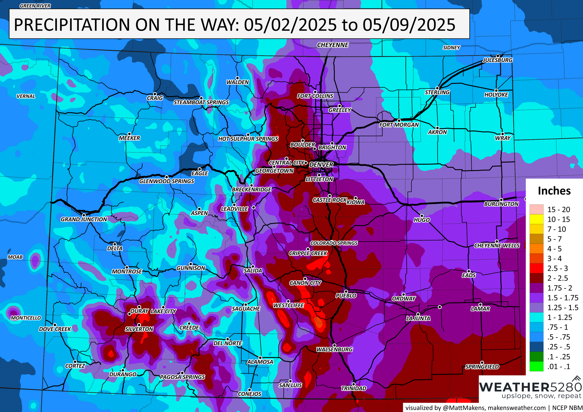
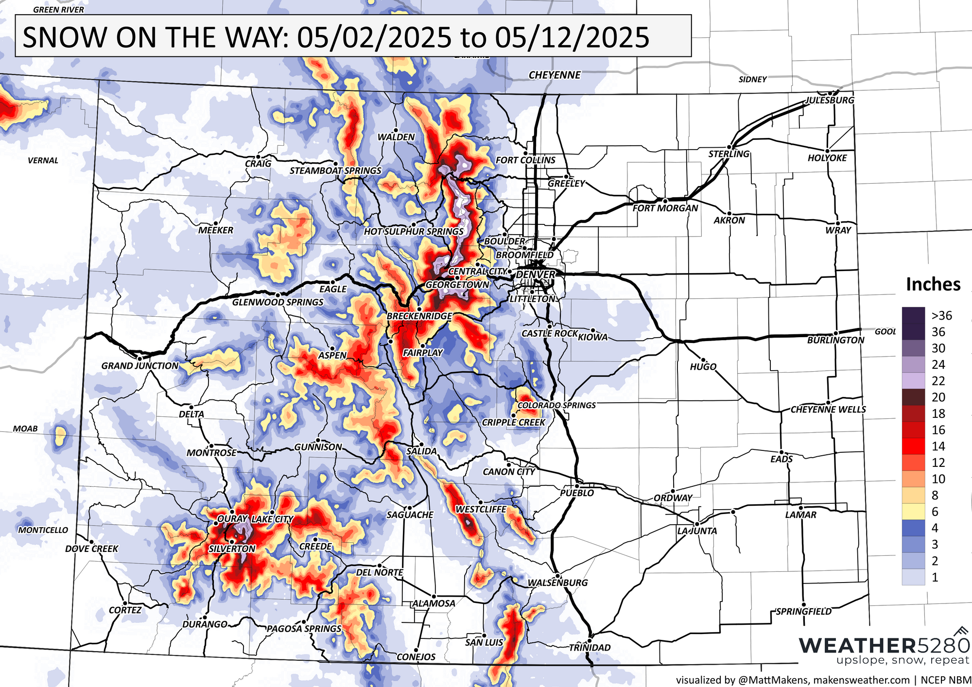
🌧️ Monday–Wednesday: Soaking Rain and Mountain Snow
A significant spring storm system is expected to move into the area starting Monday. Showers and possibly a thunderstorm are likely after lunch, with highs in the lower 60s. The rain will continue into Tuesday, with highs dropping to around 50. By Tuesday night, colder temperatures could bring a rain/snow mix to the lower foothills and possibly the Palmer Divide. The heaviest precipitation is expected on Tuesday, with snow levels dropping and potentially heavy accumulations in the Front Range Mountains and higher foothills above 6,500ft. The system is expected to move out by Wednesday, with lingering showers and highs in the mid-50s.
🌦️ What to Watch For
Weekend Plans: Saturday looks ideal for outdoor activities. Sunday afternoon may see some showers, so plan accordingly.
Early Week Commute: Expect wet roads and cooler temperatures Monday through Wednesday. Allow extra time for your commute and be prepared for changing conditions.
Mountain Travel: If you're heading into the mountains, be prepared for snow and potentially hazardous driving conditions, especially Tuesday and Wednesday.
Stay tuned to Weather5280 for updates as this storm system develops. We'll keep you posted on any change to that snow level!