
Colorado weather: Soaking rains and snow behind us, days ahead bring the heat

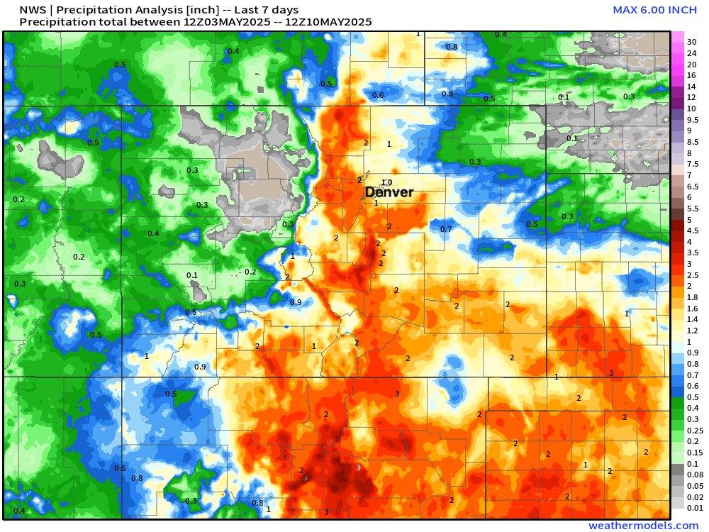
In the end, a pretty fantastic week for precipitation across the urban corridor and much of southern Colorado, as soaking rains and heavy snow brought (as always) much needed moisture to the region.
At Denver International Airport roughly 1.0" of rain was recorded, with upwards of 1.5" of precipitation for many areas along and west of I-25! Across the forever-dry Southeast Plains, widespread totals of 1 - 2" of rain – amazing.
Snowfall totals were equally impressive, with some locations picking up more than two feet of snow this week!
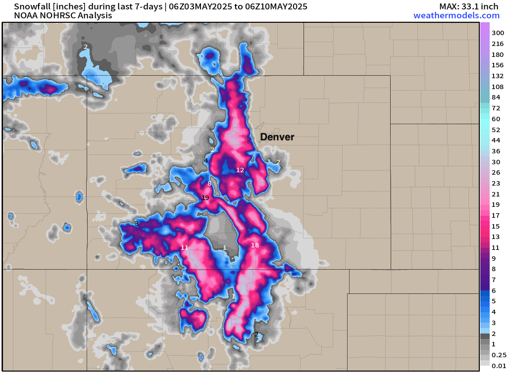
Trenched through over 20” of fresh snow above 11,000’ near Chief Mountain just after sunrise this morning. CO-193 was a bit rough but melting fast. #cowx @BianchiWeather @NWSBoulder pic.twitter.com/a86uhS12uW
— Roddy (@JJProwe) May 8, 2025
Still buried this morning up on Pikes Peak after more than 30" of snow fell this past week!!#cowx pic.twitter.com/Jh54e58u5X
— Alan Rose (@AlanRoseWX) May 9, 2025
A warming trend...
Snowfall will be hard to come by in the coming days as temperatures will soar into the mid 80s for the metro areas. For Denver, highs on Monday and Tuesday will be near record setting for the dates, before we cool off for the latter half of the week.
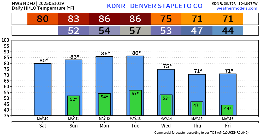
Will we see record heat? Perhaps not, but it'll be close. The NWS has a high of 87°F for Denver on Tuesday, with the record for the date being 90°F set back in 1915. The record high for Wednesday is 87°F, but it looks like we should cool a few degrees by Wednesday afternoon.
As for precipitation... it looks mostly quiet over the coming days. We'll see about a 20% chance for a few popup showers or thunderstorms on Sunday before turning mostly dry across the region Monday and Tuesday. By Wednesday storm chances increase a bit again once more as temperatures cool back into the 70s.
Happy Mother's Day! We hope you have a good weekend, and stay... cool!