
Pattern Shift Brings Cooler Temps, Breezy Winds, and Weekend Storm Chances to Denver
In brief:
After a 'hot' Tuesday, a cold front Wednesday brings cooler temperatures and slight storm chances to the Denver area, with possible weekend showers ahead.
In detail:
In the next 48 hours
After a toasty Tuesday across the Front Range, with highs pushing into the upper 80s and possibly hitting 90 — especially on the plains — we’ll start to see some changes in our weather pattern midweek. Denver's record high for today is 90 in 1915, and 84 in 1941 for Colorado Springs where a breezy high of near 82 is expected today.
Wednesday brings a noticeable shift. A cold front will slide through during the afternoon, bringing cooler temperatures and gustier winds. Expect highs to top out in the mid-70s, with clouds increasing by lunchtime.
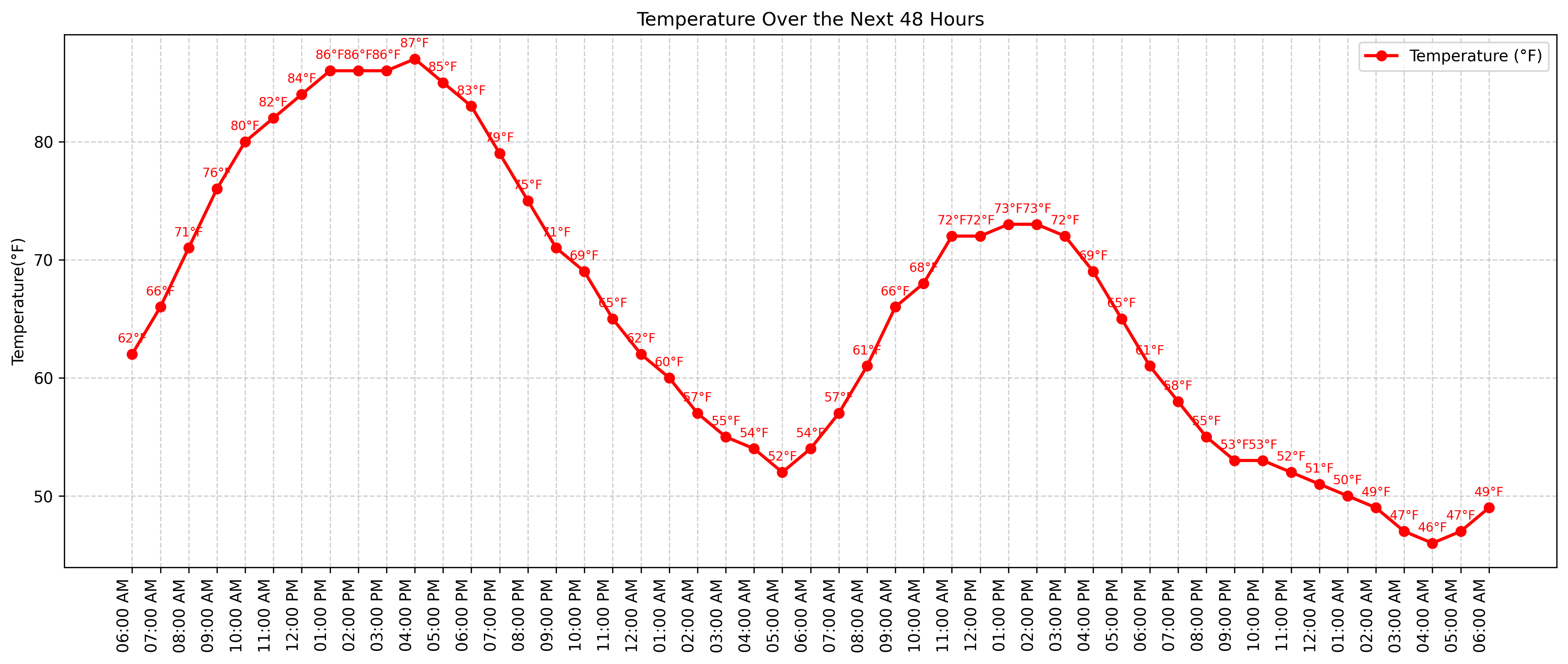
Here is a look at the hourly temperatures:
There’s a slight chance for a few showers or thunderstorms later Wednesday, mainly after 3 p.m., especially north and east of Denver. Any storms that do form could produce brief wind gusts, particularly over the northern plains.
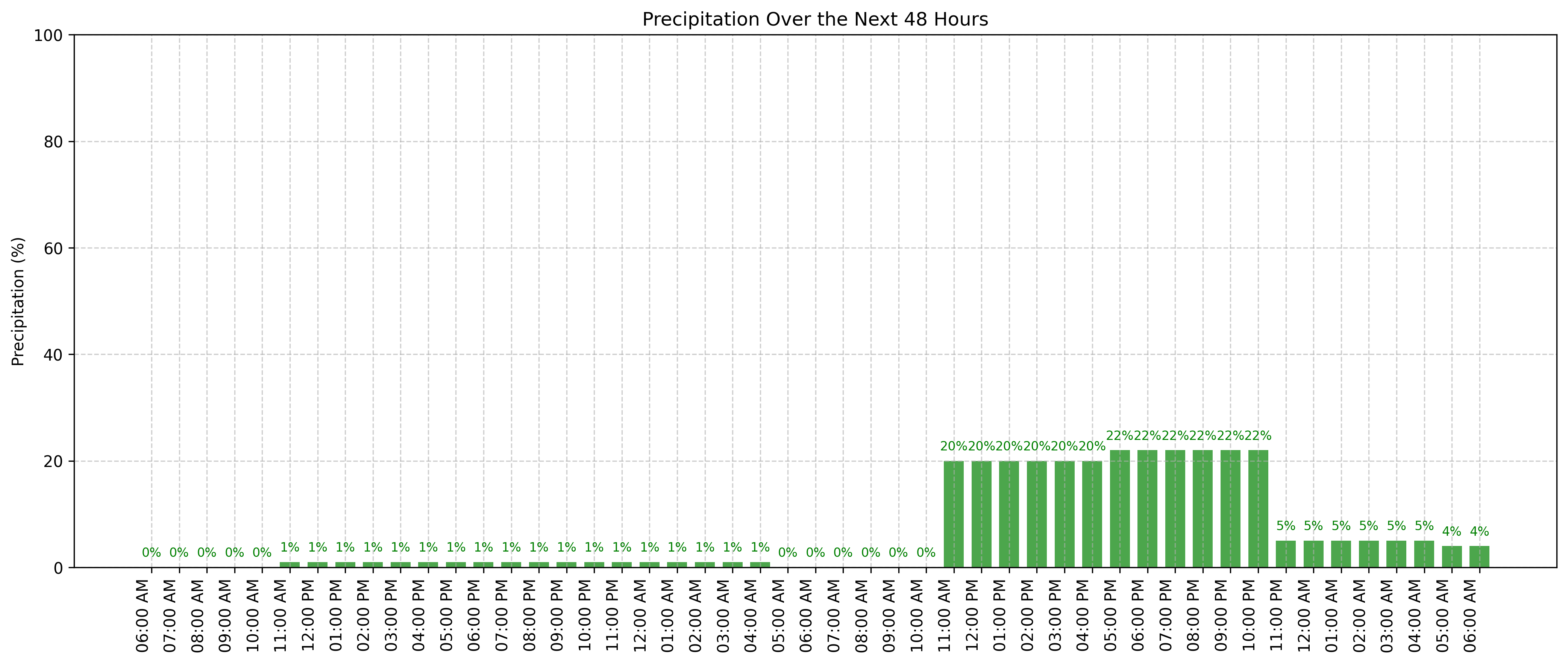
Here is a look at the hourly precipitation chances:
For the late week and weekend
Thursday continues the relatively cooler trend with highs around 70. Another slight chance of afternoon showers or a weak thunderstorm could pop up, but most of us will stay dry. Winds will be a bit breezy again.
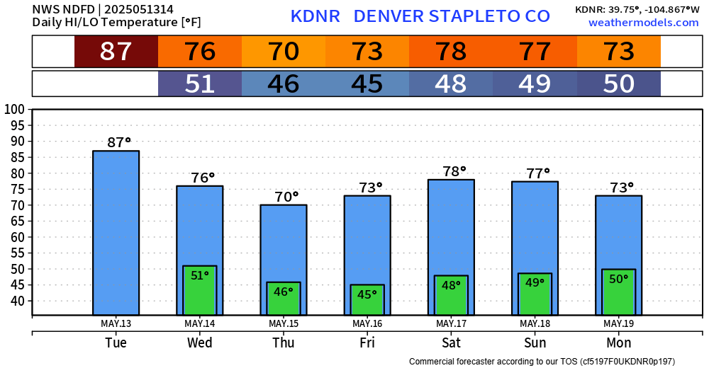
Temperatures for the week:
Friday and Saturday look pleasant, with temperatures gradually warming back into the low to upper 70s under mostly sunny skies. Just a small chance for a stray afternoon shower or storm Friday, but overall it's looking great for outdoor plans.
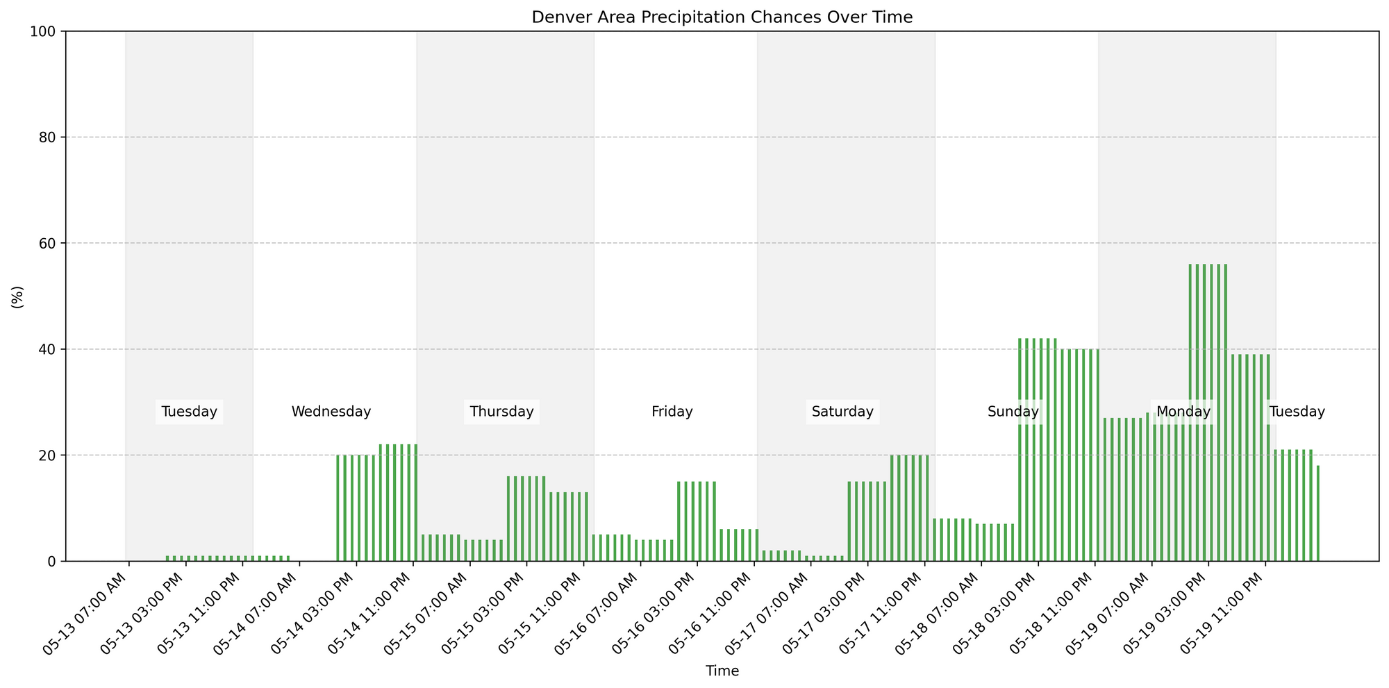
Precipitation chances for the week:
By Sunday into Monday, a more unsettled pattern may return. We'll see a better chance for scattered showers and a few thunderstorms both days, with highs in the 70s. Keep an eye on the forecast if you have Sunday plans.
Around Colorado
Strong southwest winds are expected today, with gusts up to 50 mph in valleys and across southern Colorado, especially in the San Luis Valley and southern I-25 corridor. Wind Advisories are in effect, and where vegetation is dry, localized critical fire weather conditions are possible. Temperatures will run 10–15 degrees above normal.
Wednesday and Thursday will bring a cooldown, along with mountain rain and snow showers—mostly above 10,000 feet, with less than six inches of accumulation expected. Fire weather conditions remain a concern into Saturday due to gusty winds. Each afternoon from Wednesday through Saturday may see isolated showers or storms, particularly in the Central Mountains. A more unsettled and wetter pattern is likely to develop starting late Sunday into early next week.