Denver Weather: Cool Start to the Week with Afternoon Showers, Then Warming Up
In brief: Scattered showers and a few storms linger Monday, but Denver and the Front Range will warm and dry out through the week. A few weekend storms return.
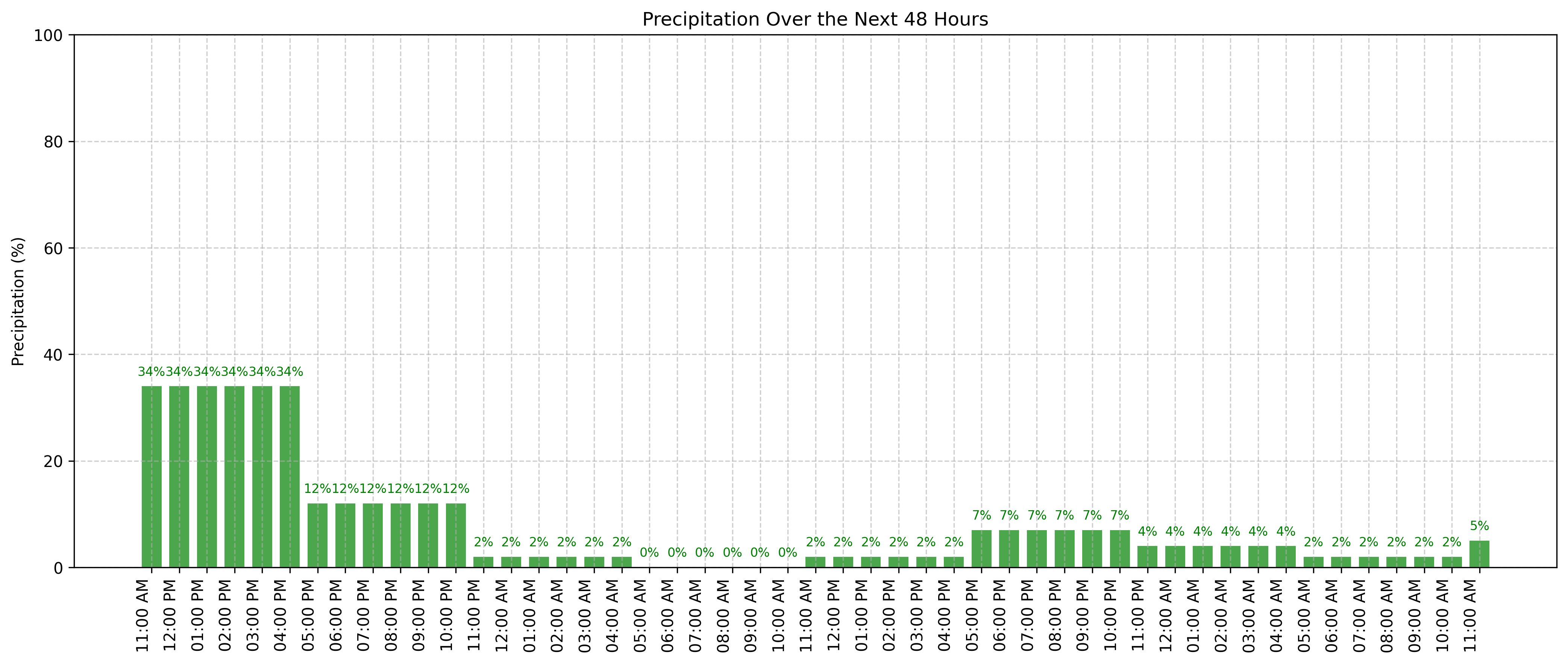
Details: After a cool and unsettled weekend (see some of the tornado pictures below!), Monday brings more scattered afternoon showers and a couple of isolated thunderstorms, especially south of I-76 and along the Palmer Divide. These will be mostly light, with little risk of severe storms, but keep an eye out during your afternoon plans—especially after lunch and into the early evening.
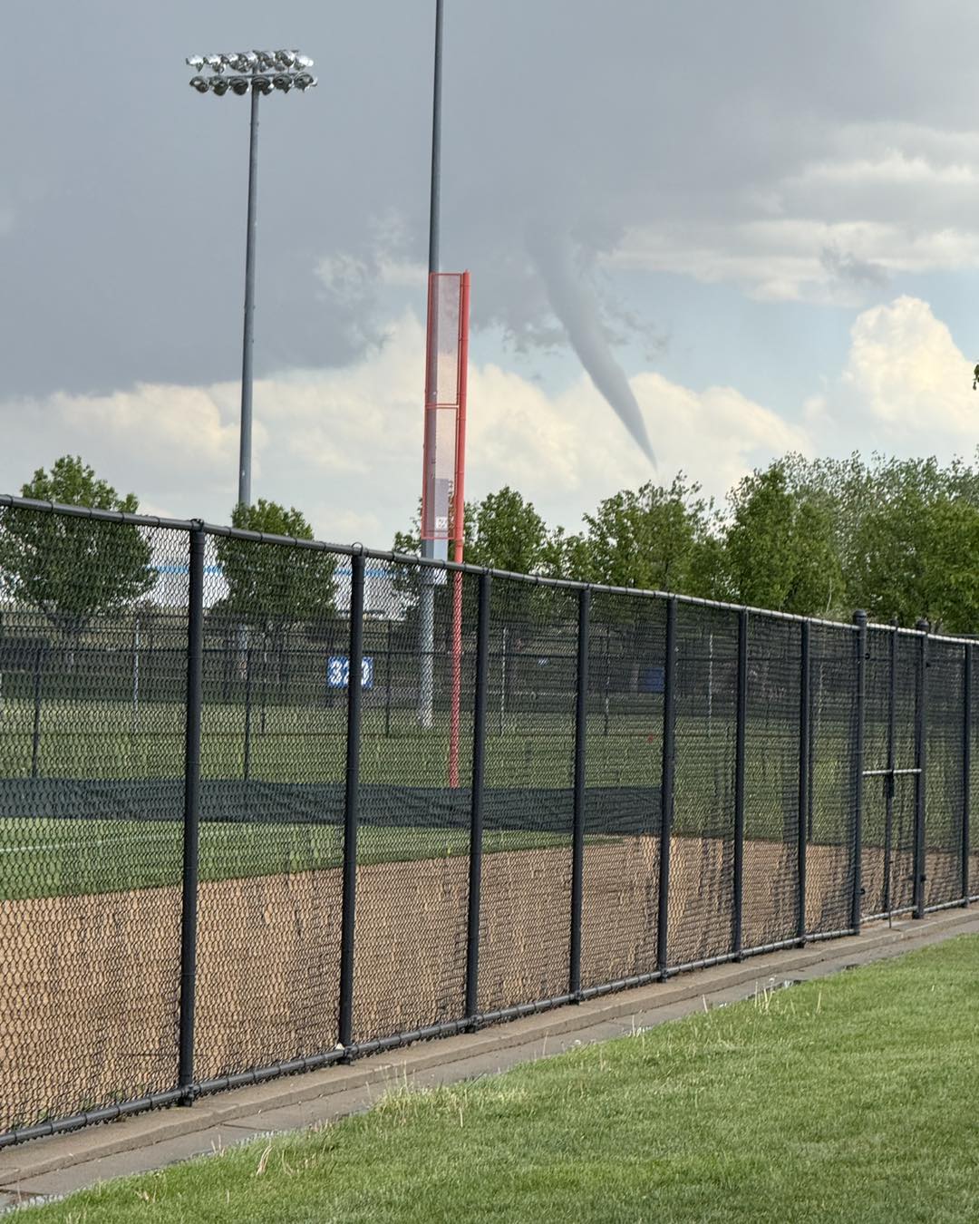
A few Sunday tornado pics:
https://x.com/MattMakens/status/1924189560898244703
https://x.com/rohnez19/status/1924187108224512476
https://www.facebook.com/share/p/19GRtauuBa/
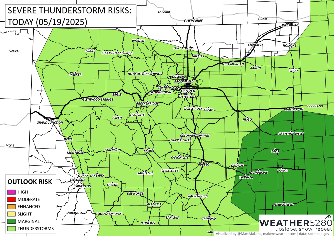
Today's risk of severe weather is highest over the southeastern corner of the state.
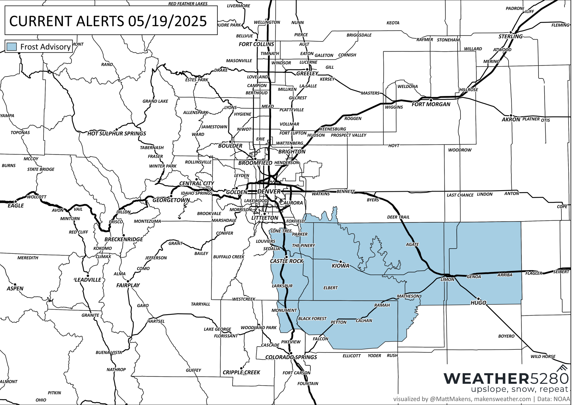
Skies will clear overnight, and by Tuesday we're back to sunnier skies and warmer temperatures. Gardeners beware, we do have the potential for frost on the Palmer Divide as skies clear off tonight:
Highs will climb into the low 70s Tuesday and near 80 by midweek. The mornings will still be on the cool side, with overnight lows in the 40s. Winds could be a bit gusty at times, especially in the afternoons.
The dry and warm trend continues through Friday, with pleasant conditions for any outdoor plans during the workweek. Highs in the low to mid-80s will feel more like early summer, especially on the plains.
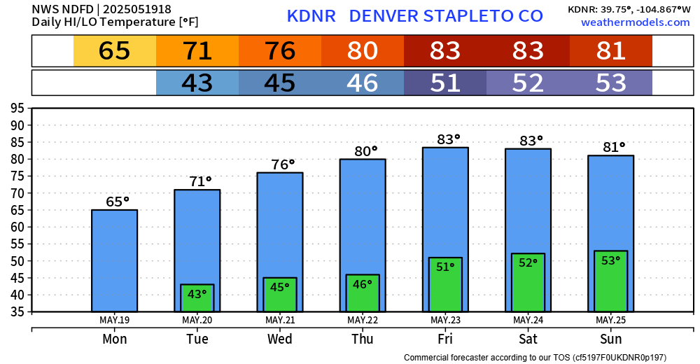
Looking ahead to the weekend, there’s a small chance of afternoon and evening thunderstorms returning Saturday and Sunday. Right now, coverage looks limited, but we’ll keep an eye on how that evolves.
Overall, it’s a nice stretch of spring weather after today’s lingering showers—time to dust off those sunglasses! 😎