Colorado weather: Strong storms Monday, cool and wet start this week

The weather has had a bit of an identity crisis in Colorado the last couple of weeks.
There's been some warmer days, there's been some cooler days, heck, there's even been some severe weather – but outside of the Elbert County tornado on May 18, it's been tough to find other standout weather.
That's not always a bad thing! Freakish hail events, May blizzards, heat waves... the list can go on and on this time of year.
So what do we have coming out way this week?
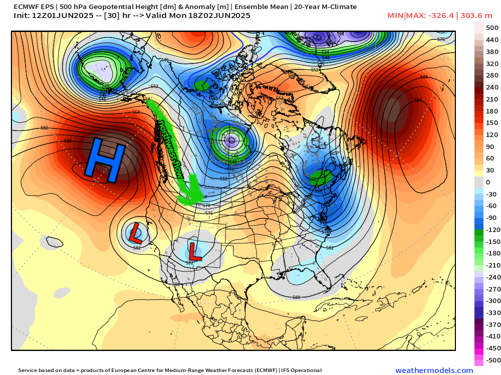
This is the main weather pattern as we go into Monday and Tuesday this week. A few things to note – the H over the Pacific, which is locking in the coolest air to our north. This persistent ridging has left Colorado in a predominantly northwest flow pattern. That can commonly lead to daily afternoon shower and storm chances like we've seen much of this week, especially around the Palmer Divide and southeast Colorado.
Some changes work in with the two upper level lows on that map. Those two systems will swing by over the next 3-4 days, and that should assist in bringing cooler than average temps, and steadier rain chances for a larger portion of the stay, especially on Monday into Tuesday. Initially on Monday, expect it to be warm and breezy, likely seeing 70s and 80s for much of the front range.
This will be as the low passes overhead and a cold front swings through at the surface. We should see our most widespread rain pick up around sunset Monday and continue through the Tuesday morning commute.
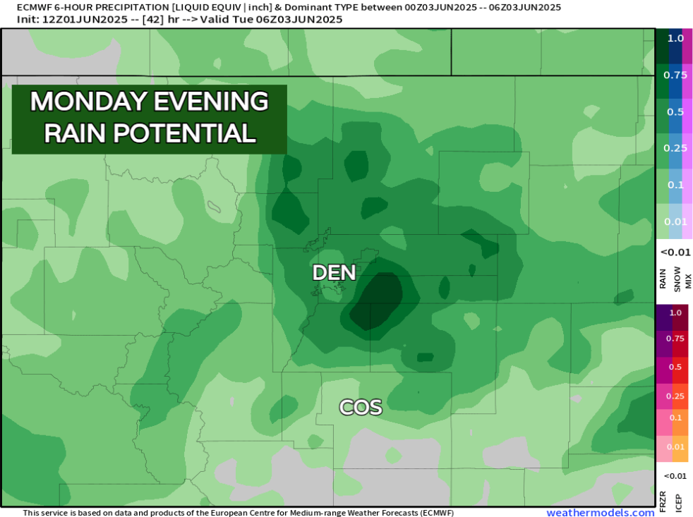
There's been some back and forth with respect to HOW MUCH rain might fall. Earlier this weekend it seemed that heavier amounts might prevail, but latest modeling has backed off a touch... We'll have to watch the progression of this system closely, but for now, meaningful moisture is still on the table. We'll also have to be on the lookout for some nocturnal severe weather with this set up, so make sure you have a way to get alerts Monday night – hail and damaging wind would likely be the biggest threats, especially east of I-25.
Another wave kicks by sometime between Wednesday and Thursday and that should add to precip we see for the week.
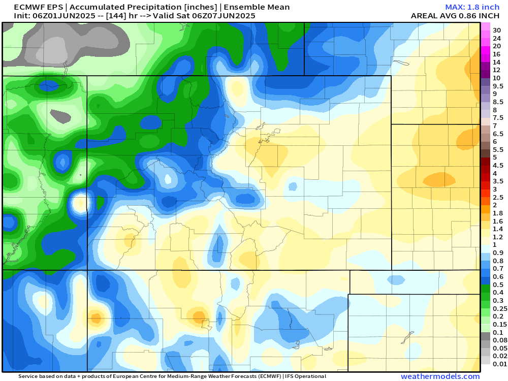
The next 6 days look promising with respect to some of the ensemble data. Widespread 1" rainfall is possible for most of the front range between now and next Saturday. With convection likely under these showers and storms, localized heavier amounts aren't out of the question!
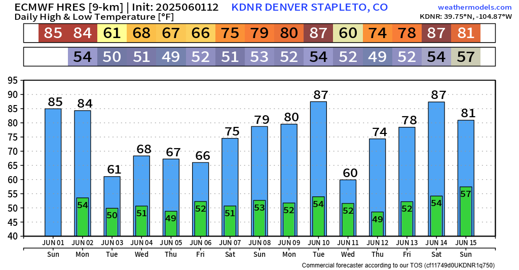
The next story: Temperatures. Big time swing as these cutoff lows move in, with 50s and 60s being the norm. We may even be able to squeeze out some mountain snowfall too!
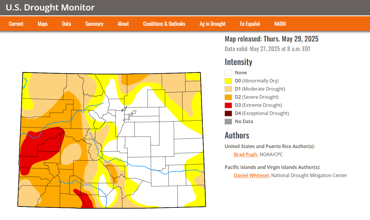
Overall this pattern should help keep eastern Colorado from developing drought through the first half of June... but you can already see what could be creeping in from out west. Once the summer ridge builds in, which looks to get strong mid-to-late month, mountain wildfires could become a concern.
For now, though, mostly good-ish news. We'll let you know if there are any changes.
Luke