
Denver Weather: Afternoon Storms Today, Then Turning Warmer and Drier This Week

In brief: Isolated storms possible Sunday afternoon across the Front Range. Expect warmer, drier conditions starting Tuesday, with highs near 90° by next weekend. To pool, or not to pool today...?
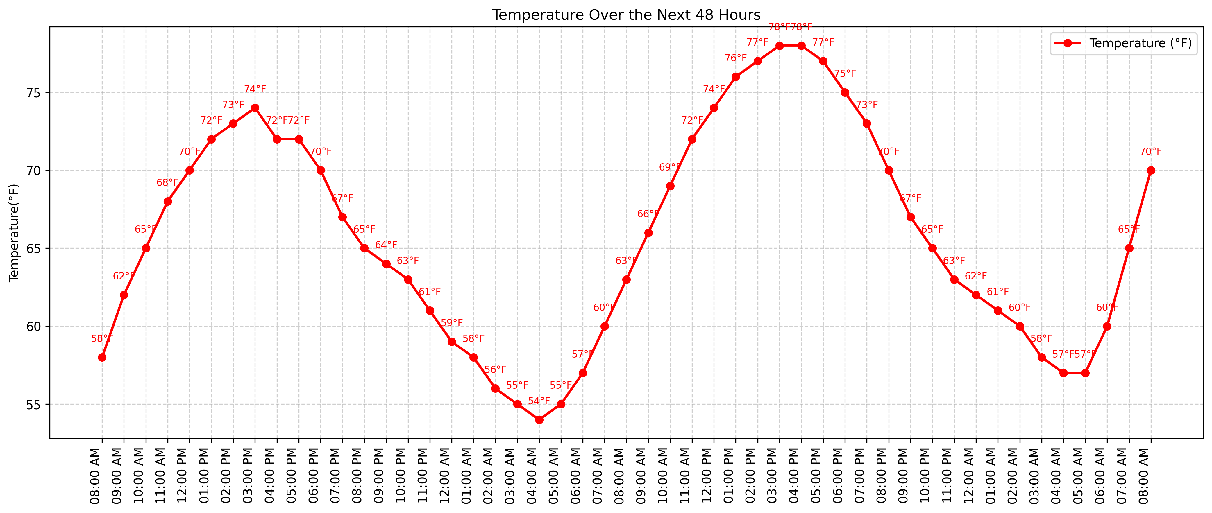
In detail: Sunday kicks off with a cooler and partly sunny day across the Front Range, including the Denver metro area. While the morning will stay quiet, by mid to late afternoon—especially after 2 p.m.—we’ll see a chance for isolated showers and thunderstorms.
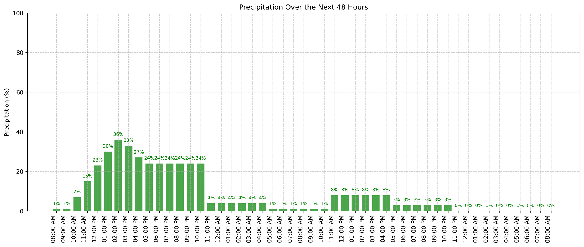
A few storms may become strong, especially near the foothills and Palmer Divide, bringing gusty winds and possibly small hail. Most activity should wind down by midnight.
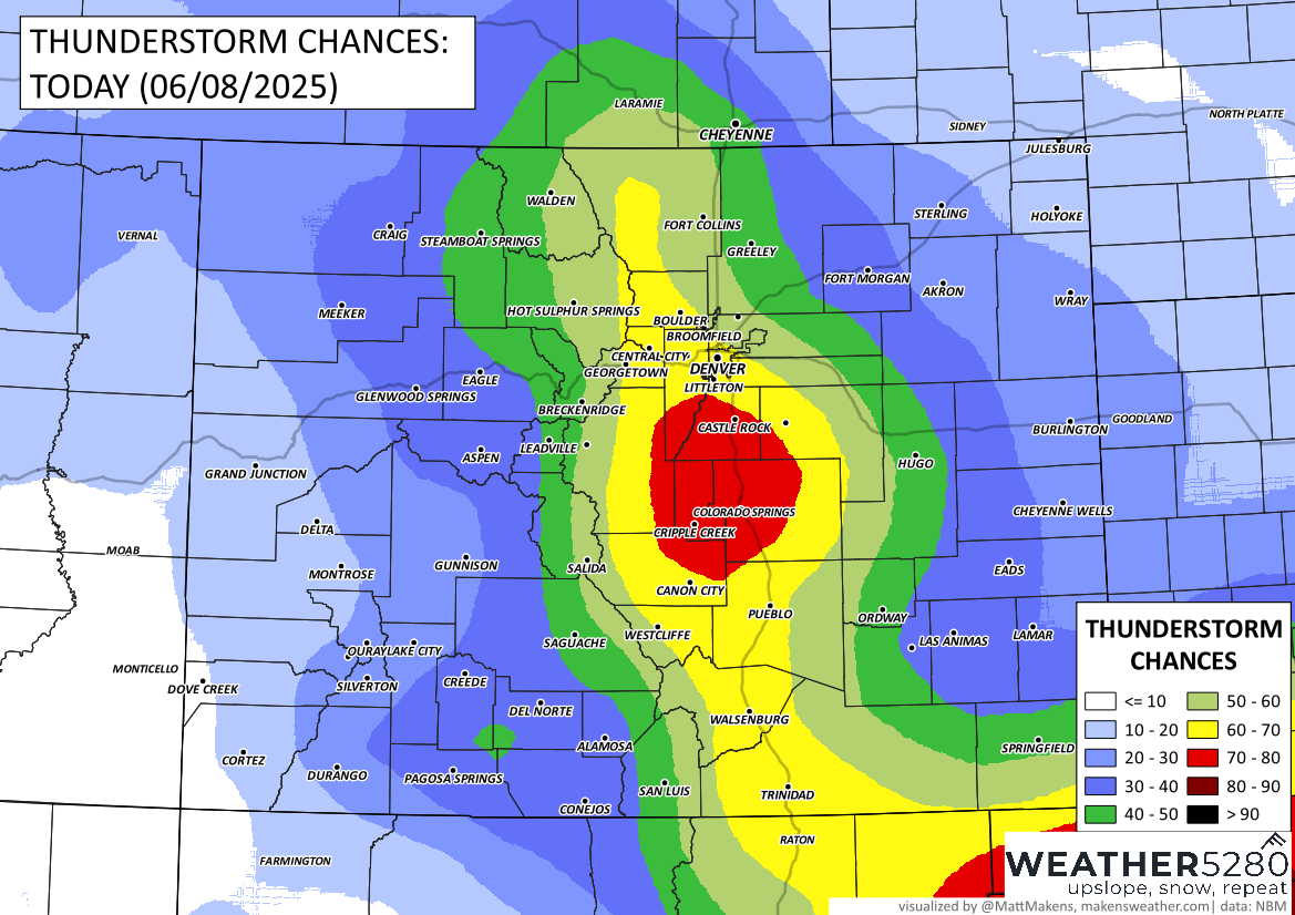
Monday looks mostly dry and comfortable, with sunshine and highs climbing into the upper 70s. While a few isolated storms could develop over the mountains and drift southeast—particularly south of I-70—most of the metro area will stay dry through the day and evening.
By Tuesday, temperatures start to rise as we head into a warmer stretch. Highs will push into the mid 80s, with only limited storm chances mainly confined to the mountains. This pattern continues through Friday, with a few afternoon storms each day, but generally low chances for widespread rain across the plains.
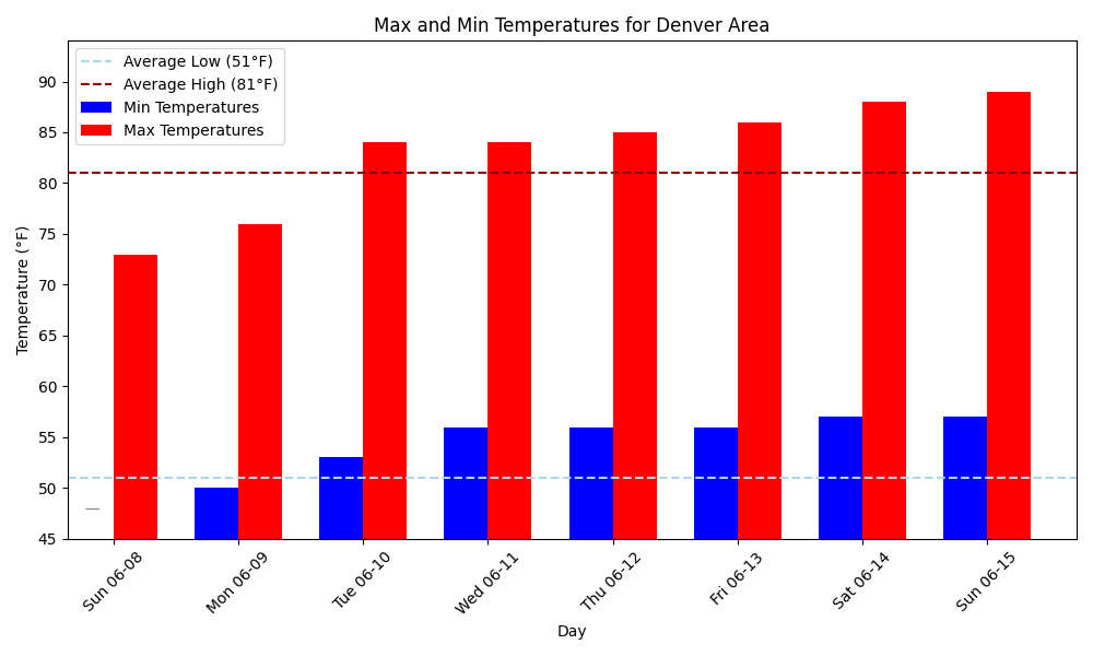
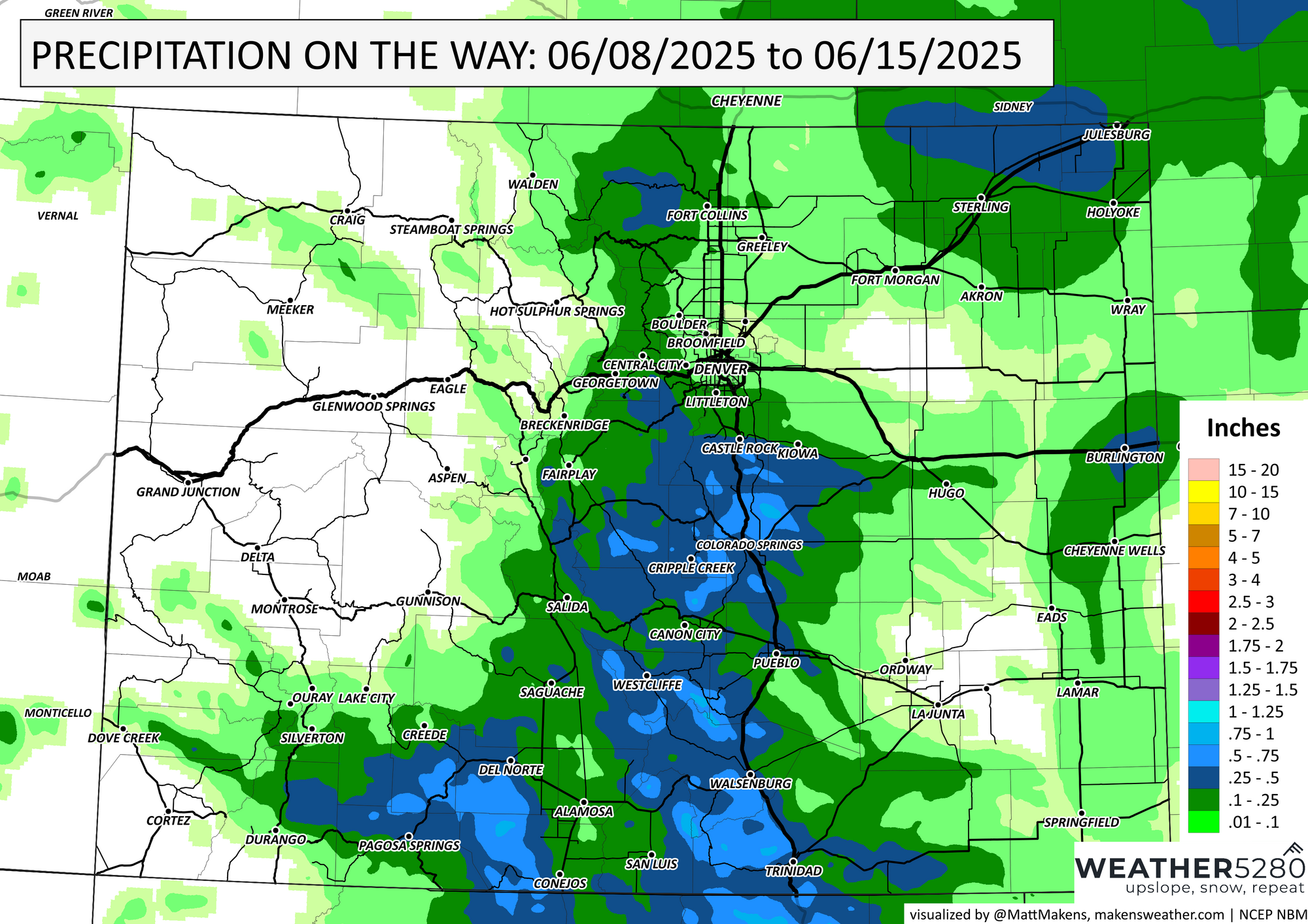
Looking ahead to next weekend, a summer-like ridge begins to build in. That means hotter, drier weather is on the way, with highs near or just above 90° likely for the Denver area and along the I-25 corridor. You may need to increase the water frequency this week, we will be drying out a bit with that summer-like heat. Here are estimated rainfall totals through the next seven days:
Have a great week, we will keep you posted on anything noteworthy to expect in the days ahead. Enjoy the day!