
Colorado Weather: Heat today, cooler Tuesday, record heat this weekend?

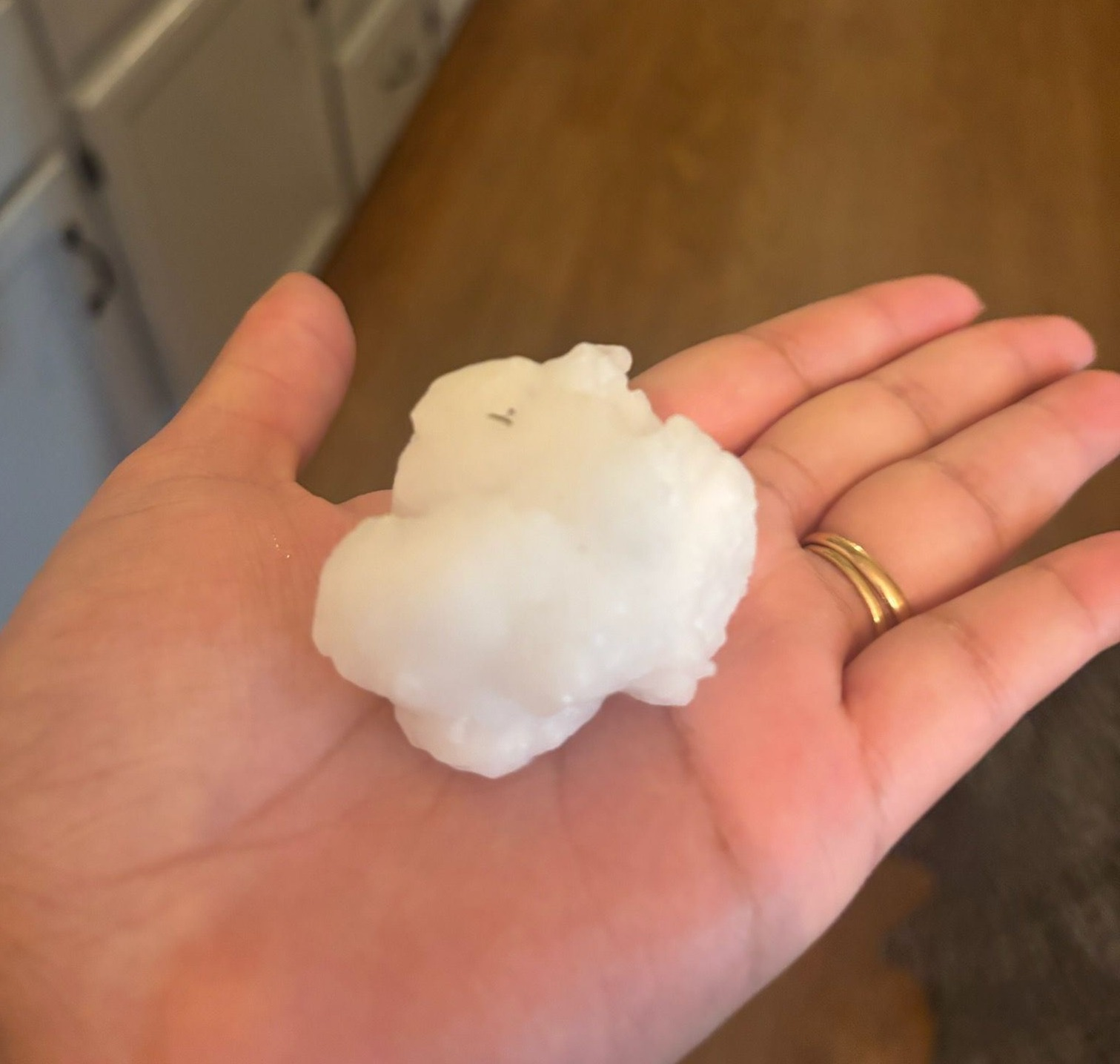
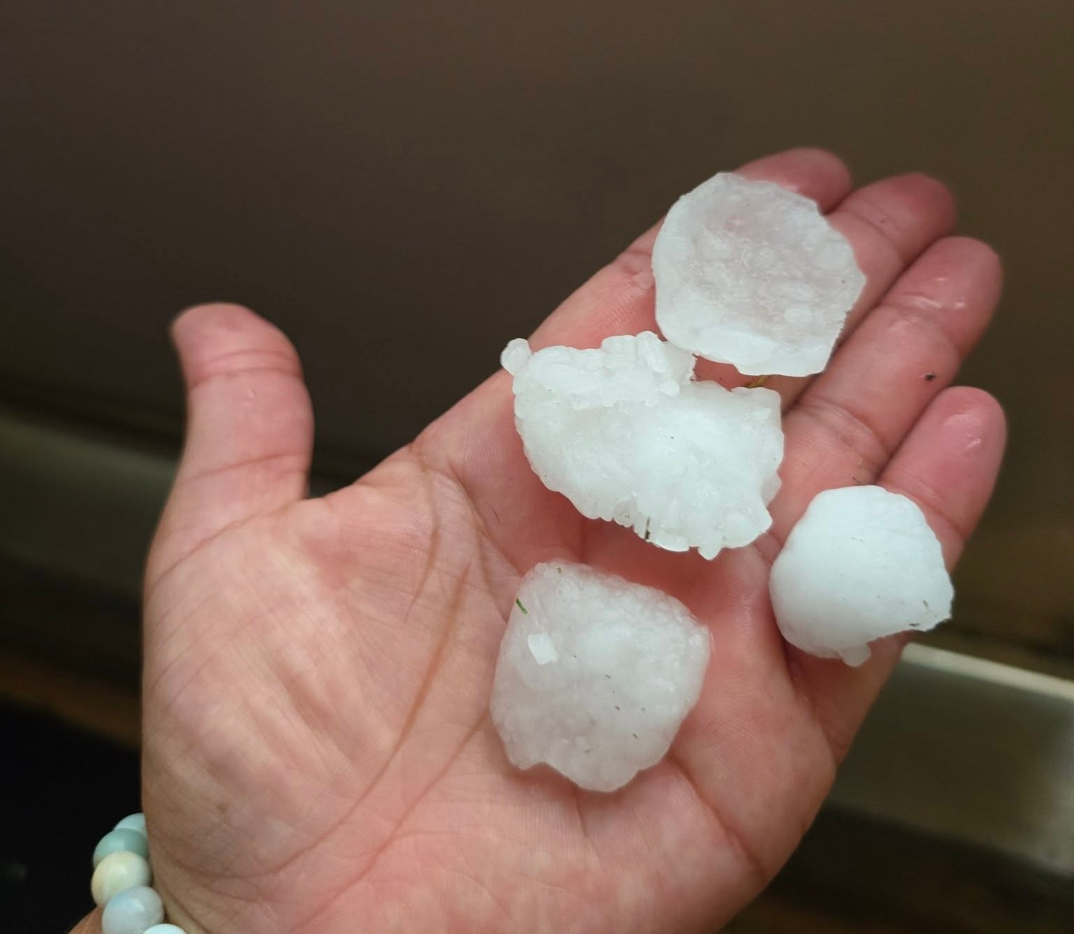
Hey everyone, hope everyone had a good Father's Day weekend. We had some of our hottest weather of the season so far here in Colorado Springs on Sunday, following by a pretty significant hail event in the evening. Below are some pictures:
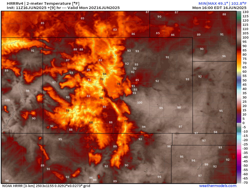
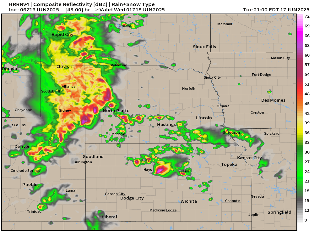
Storms should be pretty few and far between today, with the best chances later this evening over the northeast part of the state. Biggest story this afternoon is another round of heat.
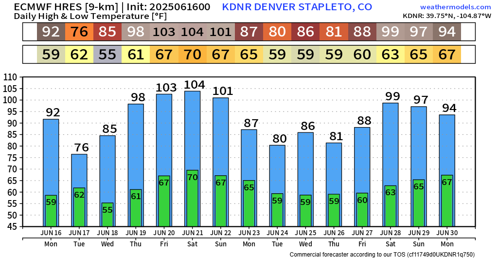
Here's potential temperatures around 2-3pm this afternoon. Plenty of heat to go around! That doesn't hold though as we move into Tuesday and Wednesday.
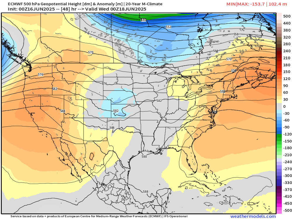
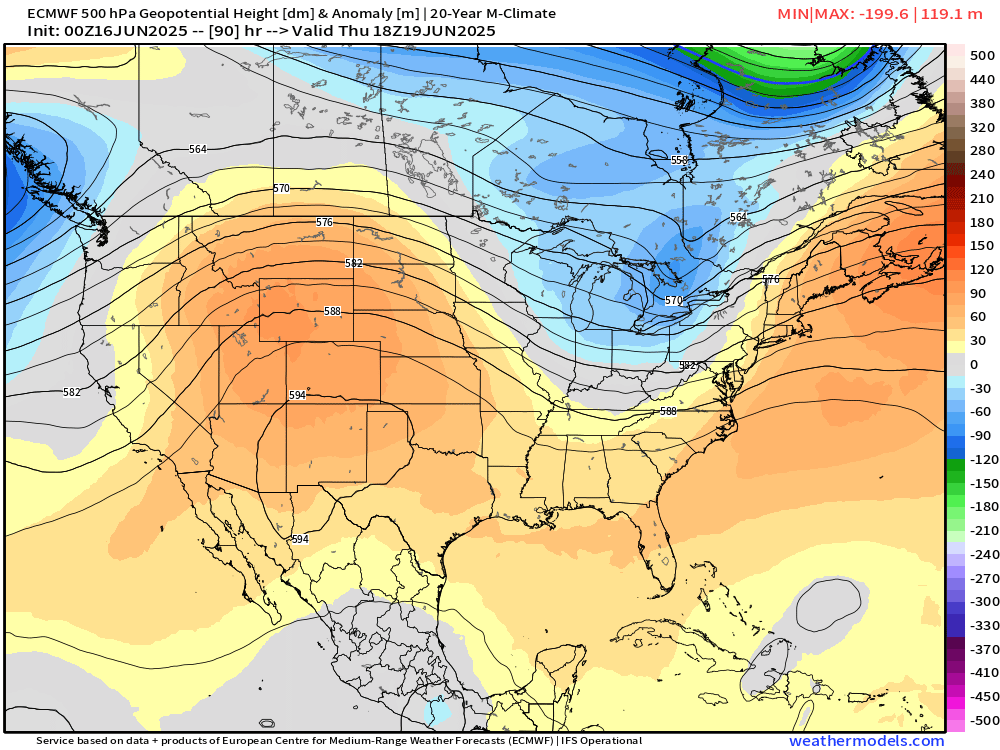
A weak disturbance will cut down some of the western ridge on Tuesday/Wednesday – you can see that little area of blue below indicating a very weak trough moving across the northern rockies, settling into the central plains.
This system doesn't have much "oomf" to work with, but there will be plenty of heat and humidity to fuel storms, especially east of Colorado.
Our best chance for storms looks to be Tuesday evening as the trough ejects east. You'll see the larger complex of storms looks to be focused over the Nebraska panhandle, but we will likely see storms stretch as far south as Colorado Springs. There should be enough ingredients in the atmosphere to sustain a couple strong to severe storms. We'll have to watch out for that potential closely – best shot as that would be further northeast in the state.
After the slight cooldown on Tuesday and Wednesday, get ready... A very stout ridge looks to build in starting Thursday, and this would likely bring us our hottest weather of the year so far. How hot you may be asking?
Uh. Yeah, I hope not. Maybe the EURO is over shooting by a few degrees. Even then, several 100° days could be in the mix by this upcoming weekend. Right on time with the official start of Summer on Friday.
Looking way off into the great beyond, after next weekend, it seems like we could be right back into the cool and stormy pattern as a fairly significant Pacific storm moves onshore. That storm has looked like it could produce significant snow for the Idaho, Montana and the Canadian Rockies.
A couple cold fronts and some storm chances is the best it looks like it would do for the front range, but it means we could get a several days break from the heat.
So... we're definitely picking things up... we'll let you know if there are any new changes in the days ahead!
Luke