Colorado Weather: Record heat sets in for the first weekend of summer

Happy Friday and first full day of Summer! (Except for the cold and snow lovers. This one is gunna stink.)
Ok, now that we've got that out of the way... what's on the ballot the next few days?
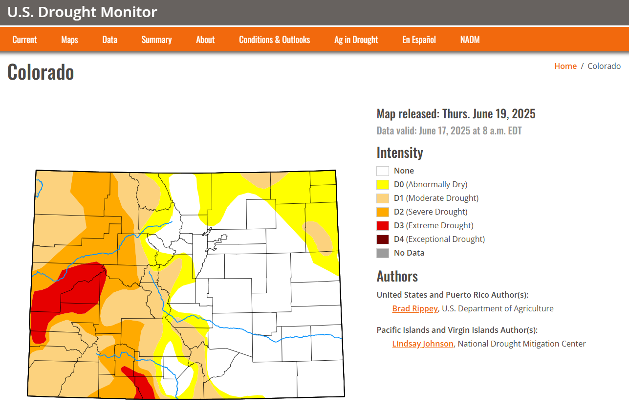
Record heat, significant mountain fire danger and a break from the rain. It's good news (mostly for the east side of the Rockies) that we've seen such beneficial moisture the last 60 days, or the fire danger would likely be high for the front range as well.
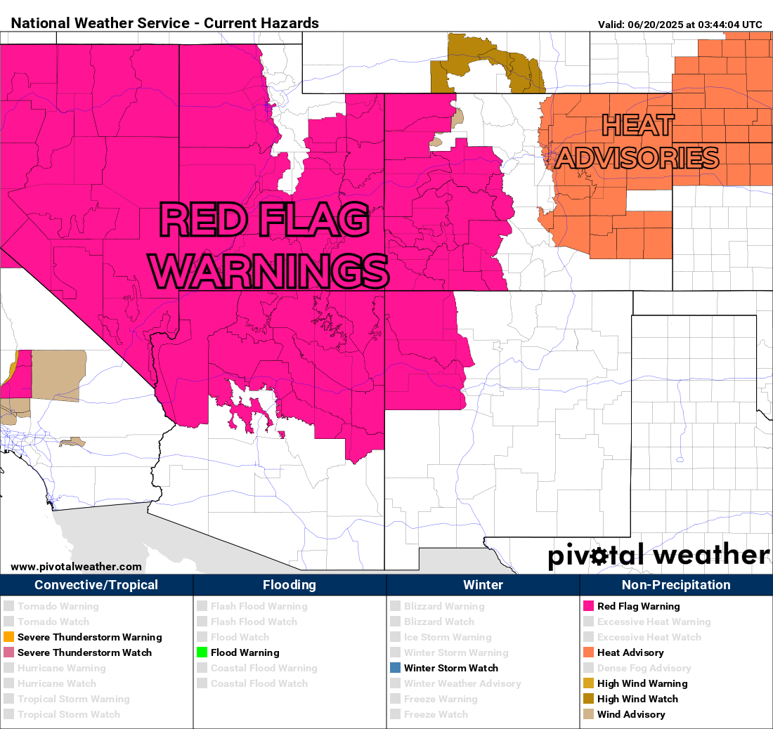
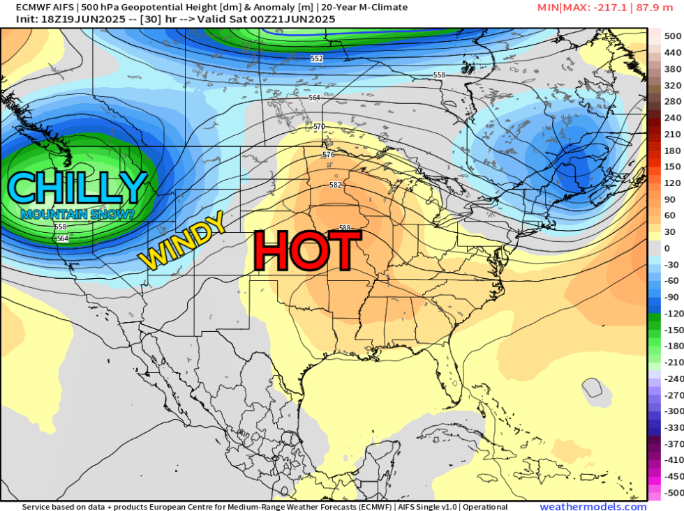
Don't get us wrong, fire risk is always a risk in the high desert, but not off the charts this weekend. A bit more concerned for the mountains and western slope as a strong trough will develop over the northwest US, causing the winds to crank in the high terrain.
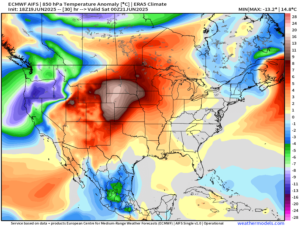
High-res data is trying to DIA to 99 Friday afternoon which would tie a 2017 record. Meanwhile for Saturday it's a touch less hot with temps in the mid-to-upper 90s. No matter which way you slice it, record or not; it's that spicy, sizzling summer heat ahead for the next several days.
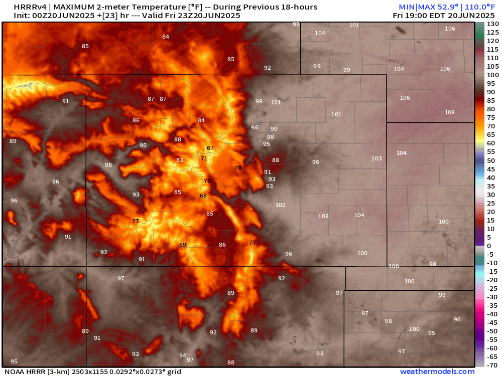
EURO data is even more generous, with a 100 for DIA and Stapleton on Friday.
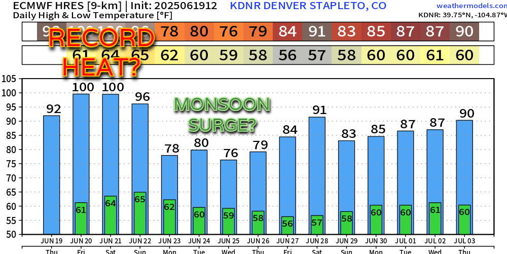
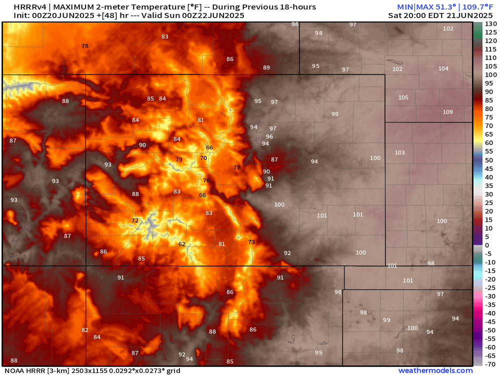
We stick with the heat on Sunday as well.
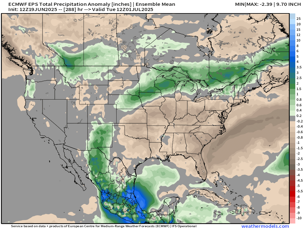
However – there's a dynamic weather story to go along with this! That big trough over the northwest is going to have a lot of "pull" with it. In time, by early next week, we should see our first big slug of monsoon moisture ATTEMP to be pulled up along the Front Range and Continental Divide. For now, the biggest moisture amounts look like they'd be over New Mexico.
For those who aren't ready for the full blast of summer, there's some good news to be had. Beyond this weekend's heat, there's really no clear re-establishment of ridge of high pressure. Much like what we've seen over the past 30-60 days, it seems like we'll see some weak ripples of low pressure to break things up every few days, potentially keeping major heat waves in check.
The problem would be the dry timber regions... the possibility of dry lightning sparking mountain fires may be something to keep a keen eye on, especially if the monsoon doesn't want to be a big producer for Colorado.
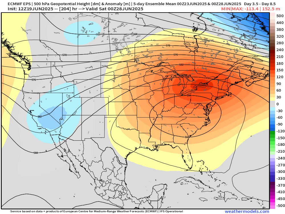
The 5-day avg 500mb charts per the EPS show the prolonged troughing over the west coast, with all the major heat centering up over the Ohio Valley and the Northeast.
Hey, we'll take that. Those types of upper-level setups keep us on the warm, but not hot side... the good kinda summer weather.
I suppose we'll see how this all shakes out as we close out June, but for now, all about the heat this weekend. Stay safe and cool out there!
Luke