Stormy Wednesday for Denver, Then a Warm and Dry Stretch Ahead

In brief: Scattered storms with hail and wind possible across the Denver metro area Wednesday afternoon. Quieter, warmer weather returns Thursday through the weekend.

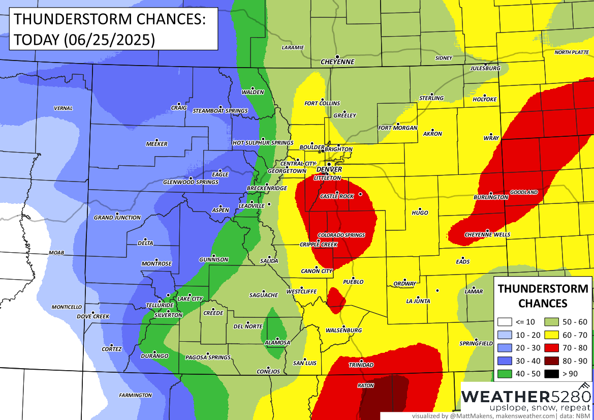
In detail: After a stormy Tuesday across parts of Colorado, Wednesday will bring another round of scattered thunderstorms to the region, including the Denver metro area. Storms are expected to develop over the mountains late morning and move into the plains by early afternoon. The main window for storms in Denver looks to be between Noon and 5 PM.
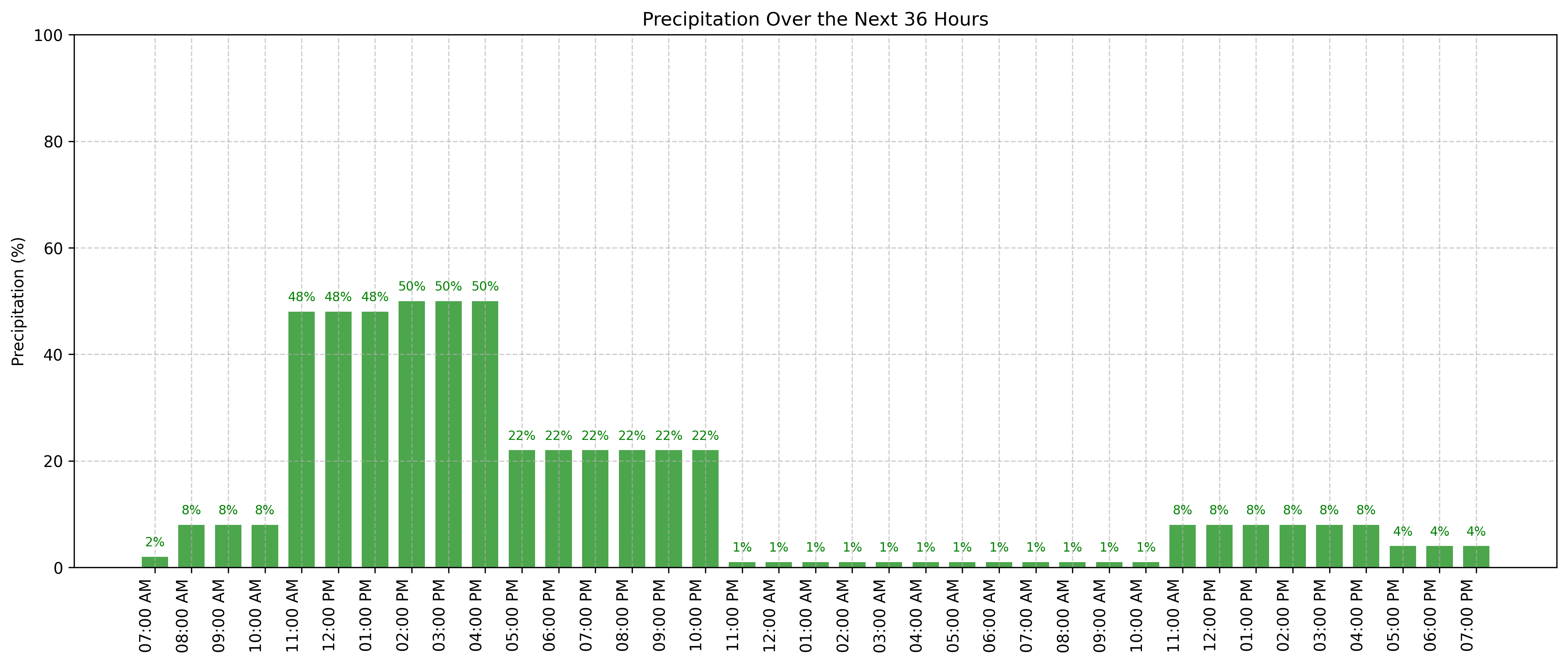
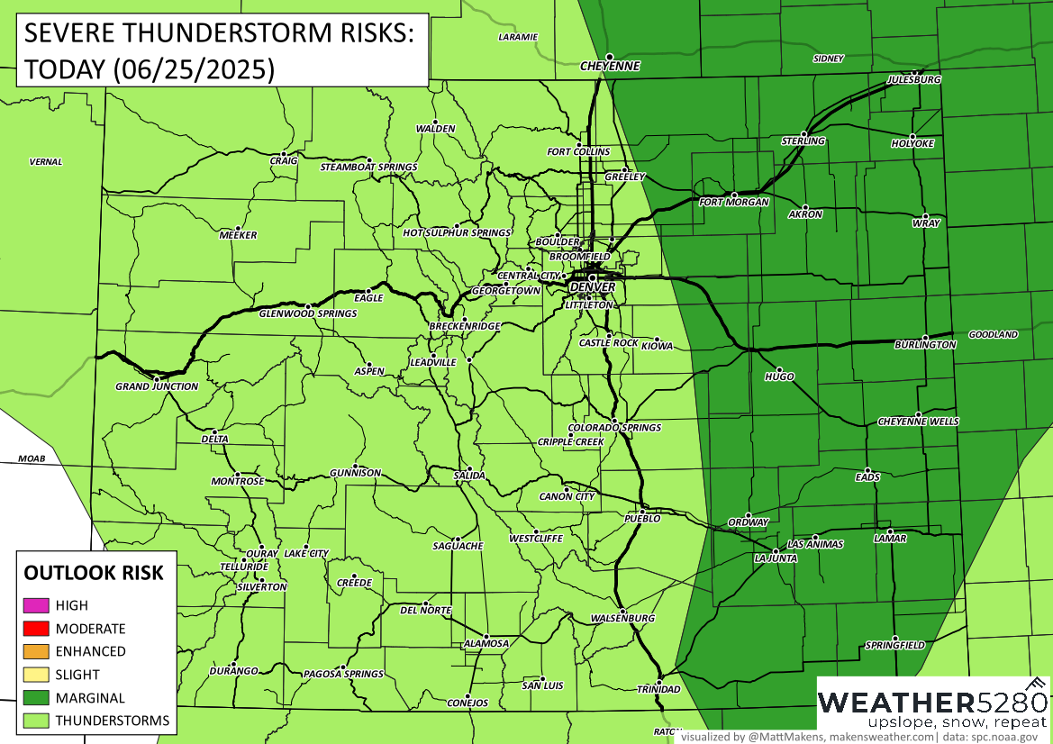
While most storms will bring brief heavy rain and lightning, a few could become strong to severe, especially east of I-25. If you're out and about this afternoon, be aware of the potential for hail up to 1 inch and gusty winds up to 60 mph. The highest risk for severe weather stretches into the southeastern plains later in the day. Keep an eye on the sky and have a way to receive alerts if you're out during the drive home.
Wednesday evening should see storms winding down from west to east, with quieter conditions overnight. Fog may develop early Thursday morning on the plains, but that will clear as the day progresses.
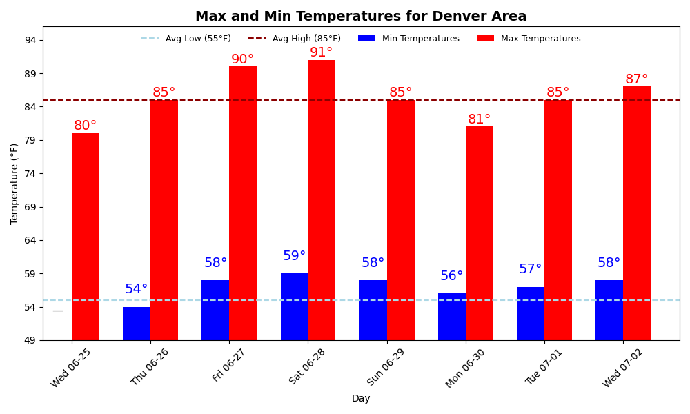
Looking ahead, a much quieter pattern takes hold from Thursday through the weekend. Expect mostly sunny skies, gradually warming temperatures, and only isolated late-day storms. Highs will climb into the upper 80s and low 90s by the weekend—great weather for any outdoor plans.
Stay weather aware this afternoon, then get ready to enjoy some classic Colorado summer warmth!