
Hot weather continues, thunderstorm chances return for July 4th weekend

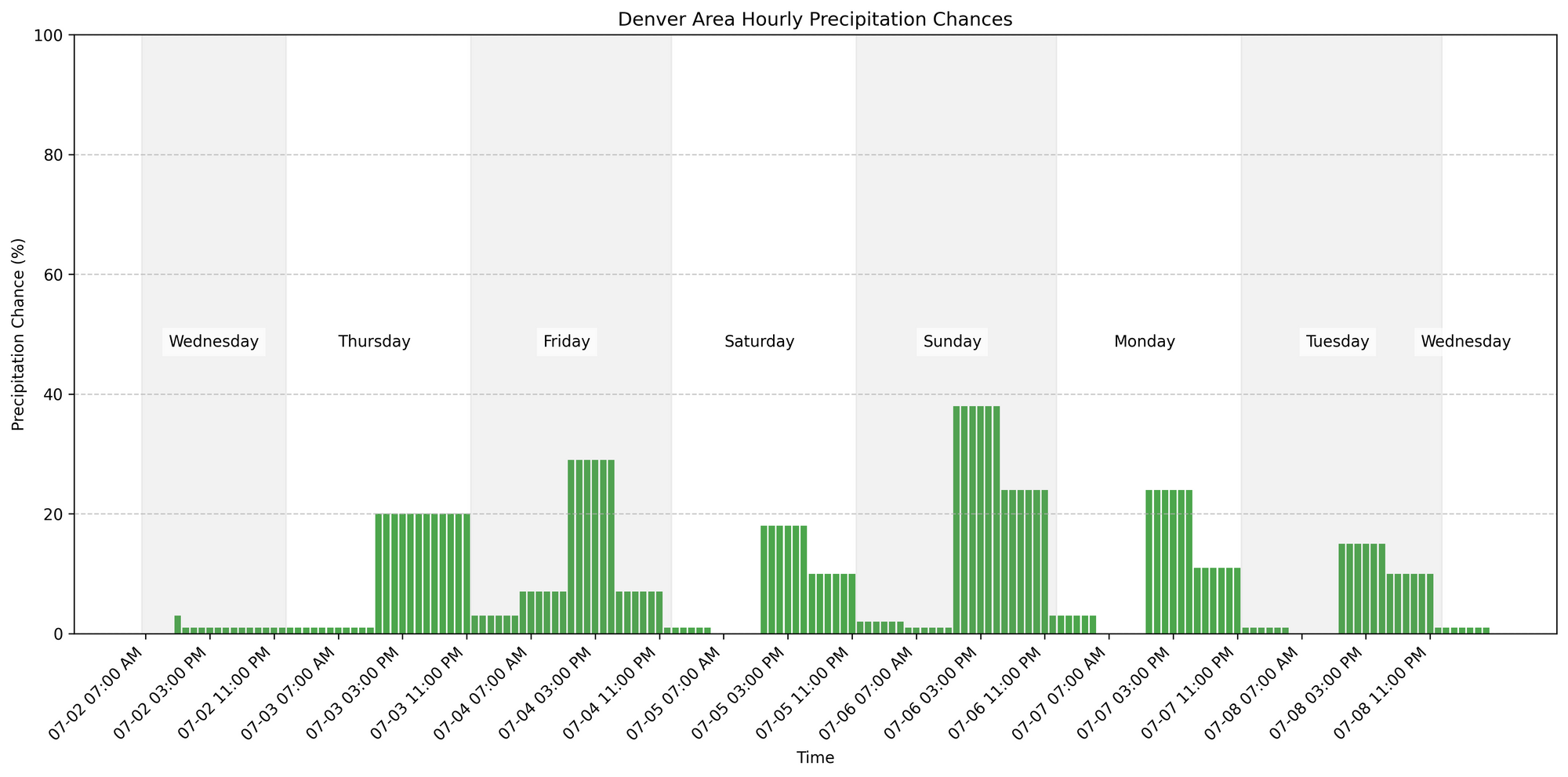
In brief: Hot and mostly dry weather continues across Denver and the Front Range through midweek. Thunderstorm chances increase Thursday and linger through the Fourth of July weekend.
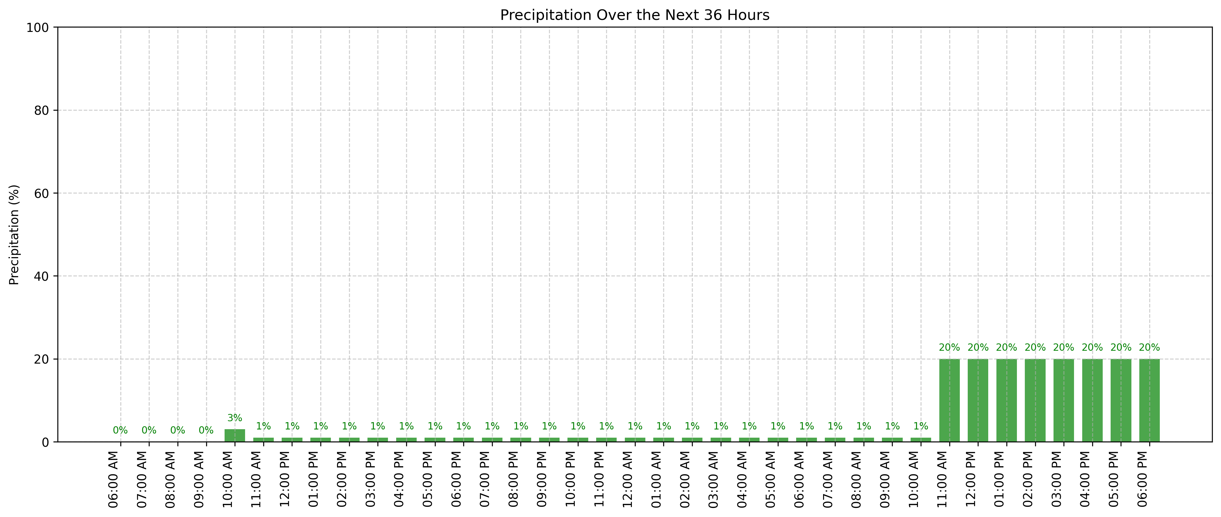
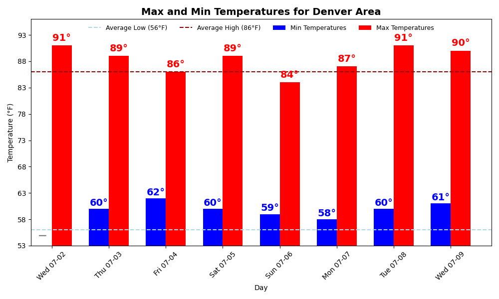
In detail: We're in for more hot weather across the Denver area today, with highs climbing into the mid-90s under sunny skies.
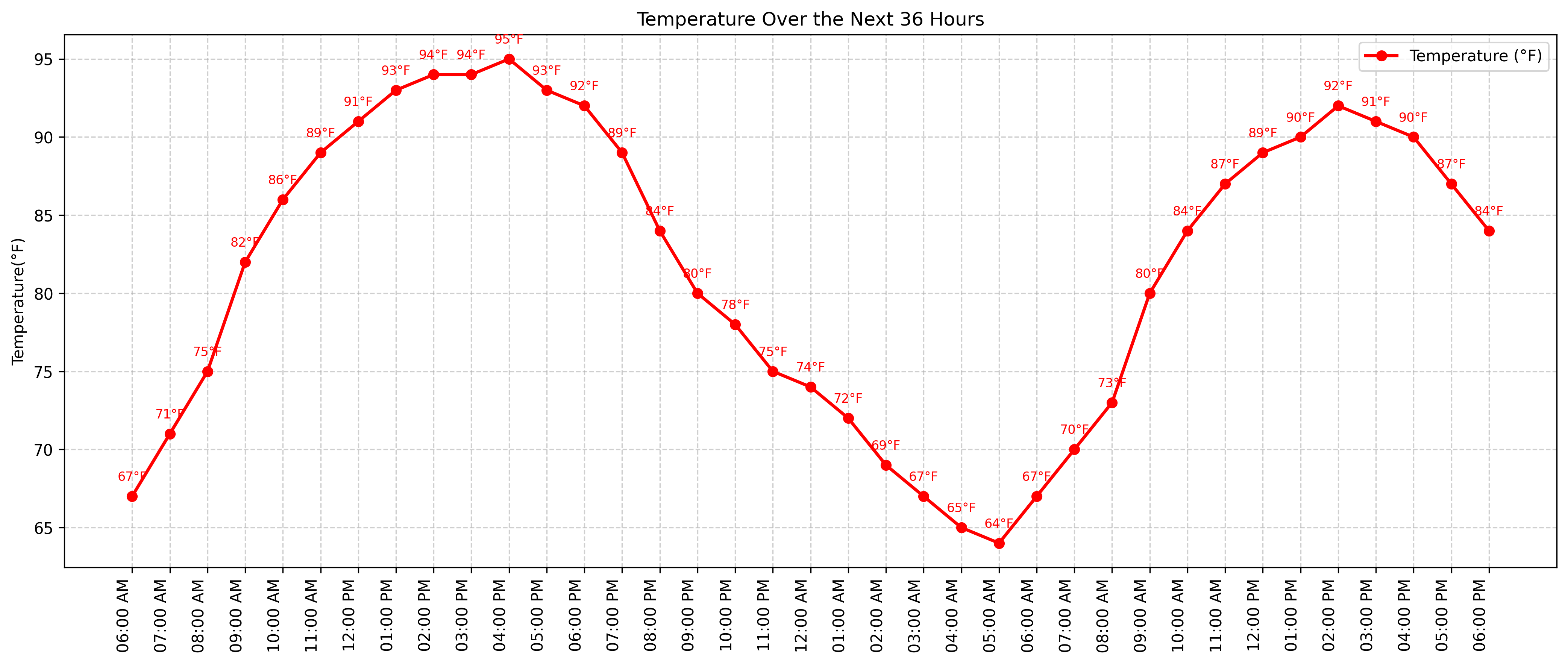
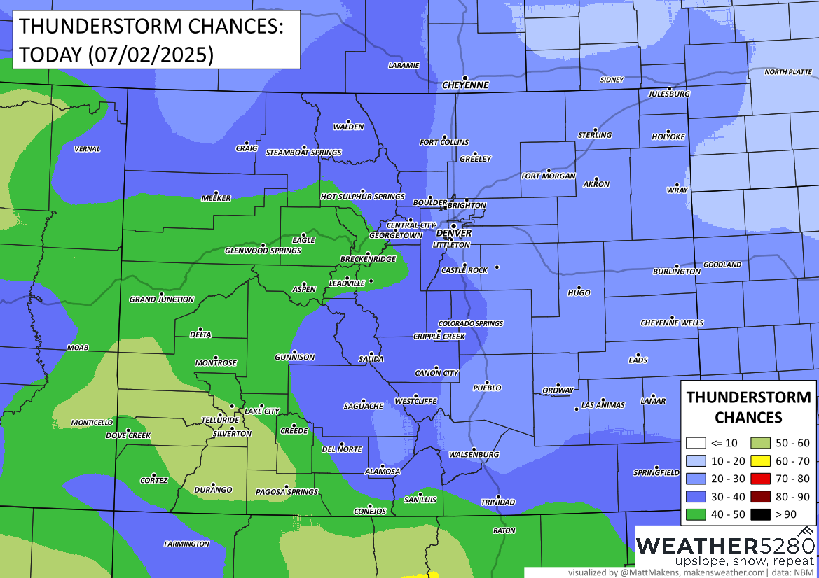
A few isolated thunderstorms may develop over the mountains and foothills by midday and could drift onto the plains by late afternoon. These storms will be spotty, but if one rolls through your area, expect gusty winds up to 50 mph, and a stronger storm over the northeast plains could push gusts even higher.
By Thursday, we see a shift. Moisture increases across the state, bringing a better chance for scattered afternoon and evening storms. Storms could become strong at times, with gusty winds and brief downpours. This uptick in activity continues into Thursday night.
Looking ahead to the Fourth of July, forecast confidence is still a bit mixed. Most models show storm chances dropping off by evening, which would be good news for fireworks plans. Still, there's a decent chance of showers and storms during the afternoon, especially along and east of I-25. Temperatures will be a bit cooler, with highs near 90.
Expect typical July weather for the weekend: warm afternoons and a few scattered storms, especially after lunchtime. Keep an eye on the sky if you’re heading outside in the afternoons and evenings, especially in the foothills or along the I-25 corridor.