Spotty storms 4th of July Weekend

Happy 4th folks! The weather remains in a bit of an identity crisis as Colorado remains warm, but not overly hot. To go along with that, we have some spotty storm chances for the holiday weekend. Let's get a quick rundown of the forecast:
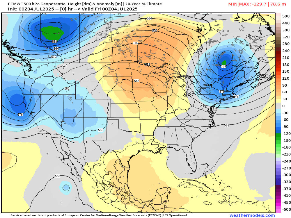
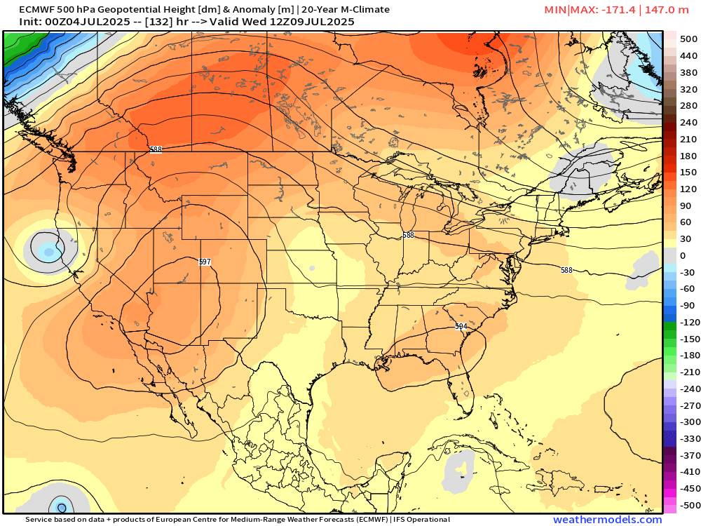
Looking at a wide view, we don't see a really dominant "summer" type weather pattern for most of the lower-48. Some weak troughing giving us the unsettled weather this weekend across the west, some ridging near the Great Lakes, and a fast moving trough over the Northeast.
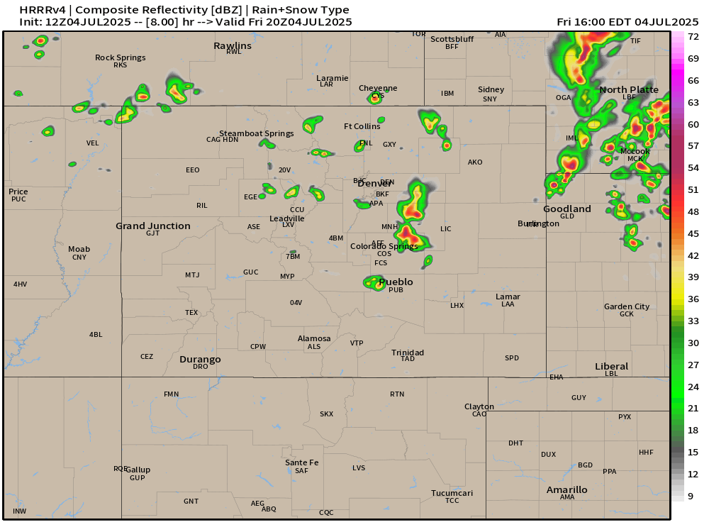
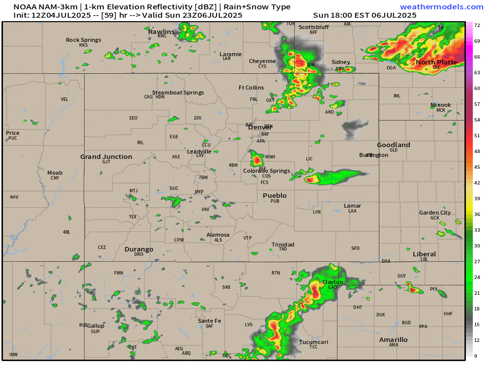
Spotty storms are expected throughout the first half of Friday afternoon... we should see things taper off around and after dinnertime.
More of the same is expected on Saturday with highs reaching the 80s and low 90s for most folks. Expect some afternoon clouds to help tamper the harsh sunshine at times. Other than that, a typical summery afternoon on Saturday is expected too.
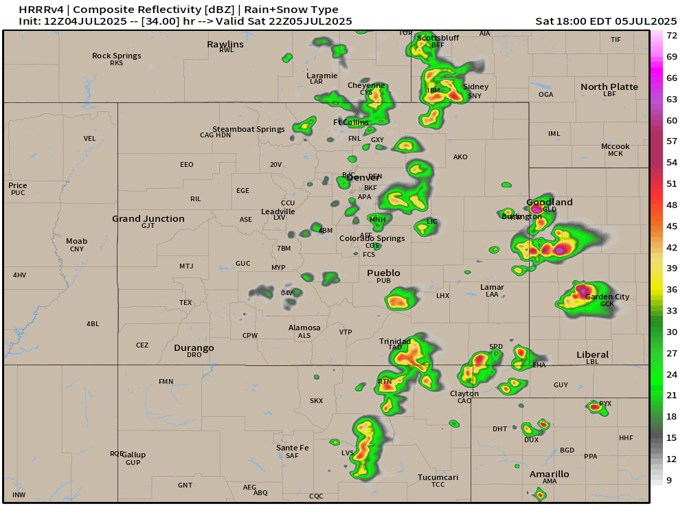
Another day of warm weather and spotty afternoon storms possible on Sunday. Mainly 80s & 90s.
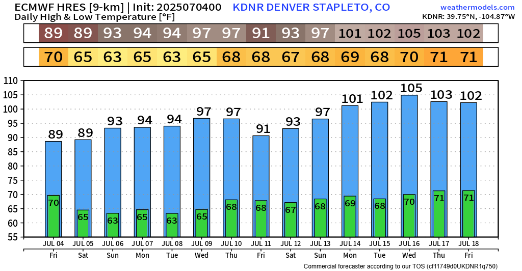
Beyond that, we begin to see a pretty stout ridge attempt to develop early next week. This should get our temps back above normal. The EURO is pretty aggressive with respect to warming over the next 7-10 days with this ridging setting up. Temp charts are below... I'll give you a chance to breath before seeing them... 😬
Yeah... uhh... let's hope that's overdone a bit. Have the potential to be in for one of our biggest heatwaves in a while if that ends up panning out!
Trying to keep this one short as many of you are probably busy, but just wanted to get a quick weekend update in for those who are planning.
Have a good one folks and enjoy the holiday!
Luke