What is the Denver Convergence Vorticity Zone?
The Denver Convergence Vorticity Zone (DCVZ) is a unique mesoscale, terrain-driven feature that occurs east of the Front Range, primarily during the warm season (May-August). The American Meteorological Society defines the DCVZ as "A mesoscale flow feature of convergent winds, 50 to 100 km in length, usually oriented north-south, just east of Denver". The location of a DCVZ can vary, however it is usually confined to areas east of I-25 and can extend as far north as Fort Morgan and as far south as Colorado Springs.
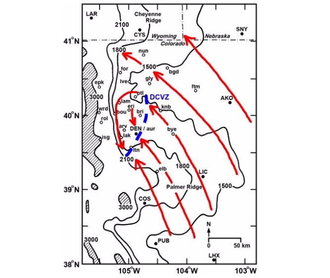
Generally speaking, a few key elements must be present in order for a DCVZ to form: Low-level stability along the Palmer Divide, low-level southeasterly flow, and a well-defined wind boundary that originates from synoptic-scale features such as the surface pressure field and the upper-level flow. If the atmosphere happens to be unstable, the surface flow will pass over the Palmer Divide and will not be influenced by the terrain barrier. The interactions between these factors is what constitutes the DCVZ.
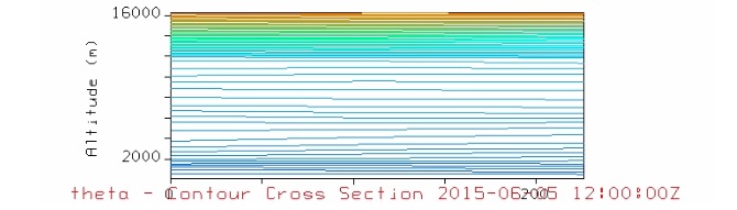
There are a few ways to diagnose the conditions necessary for the formation of a DCVZ. On a theta cross-section, areas where the isentropes are closely stacked indicates a region of stability. This is indicative of potential temperature increasing with height.
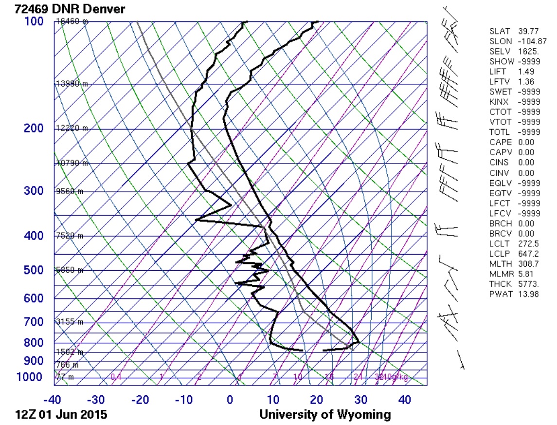
Stability can also been seen on a sounding in the form of a capping inversion, where the temperature increases with altitude. This also corresponds to an increase in potential temperature with height.
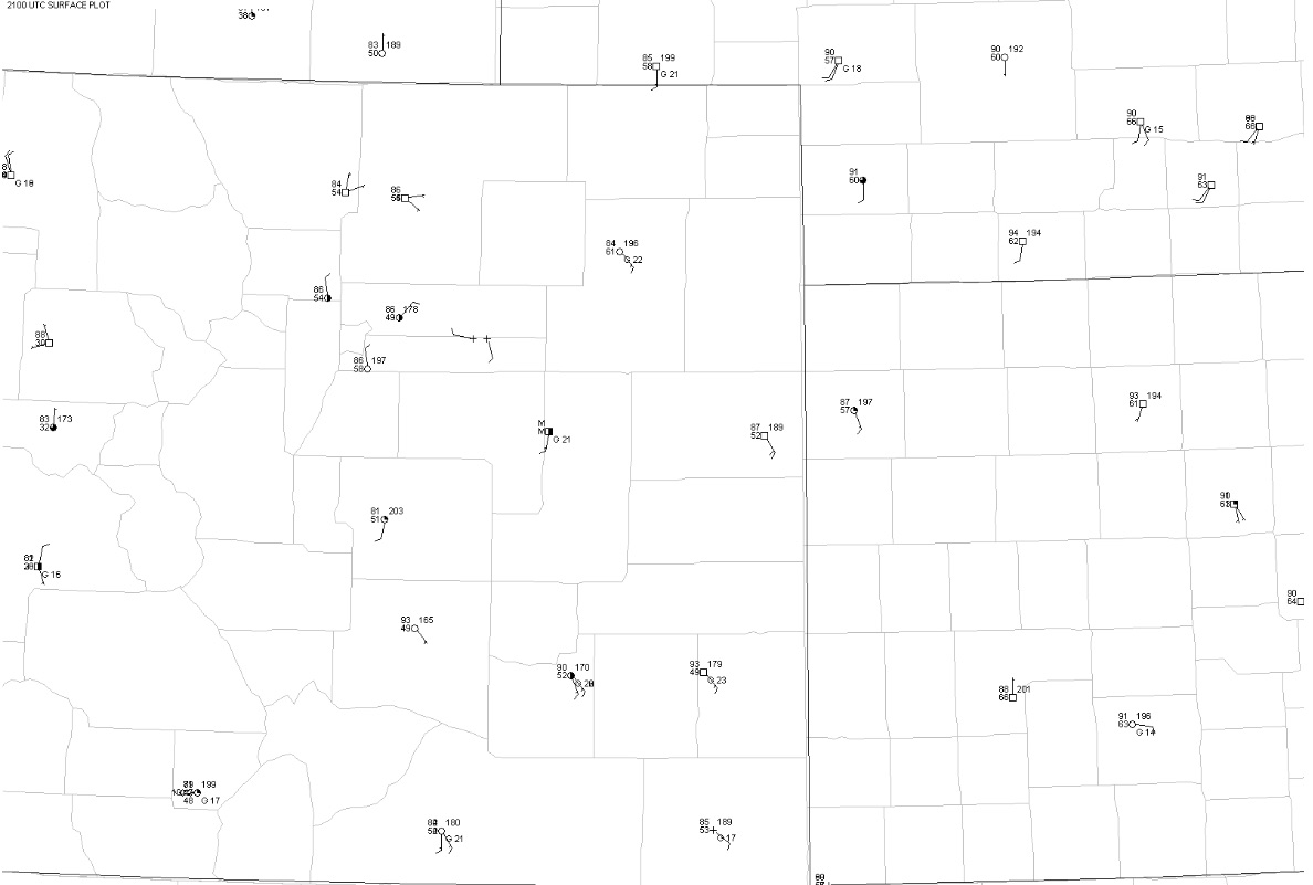
The surface wind field can be looked at using a surface plot.
It is worth mentioning that the DCVZ is not the same phenomenon as the Denver Cyclone. The Denver Cyclone is a region of counterclockwise, or cyclonic circulation. The DCVZ on the other hand, develops due to an area of low-level convergence and wind shear. Both of these phenomena can develop without the other feature being present. However, the DCVZ can sometimes be enhanced if a Denver Cyclone is present. Various researchers such as Markowski, Lee, and Pietrycha found that the westerly return flow from the cyclone can converge with the southeasterly flow, causing an area of strong low-level convergence and vorticity.
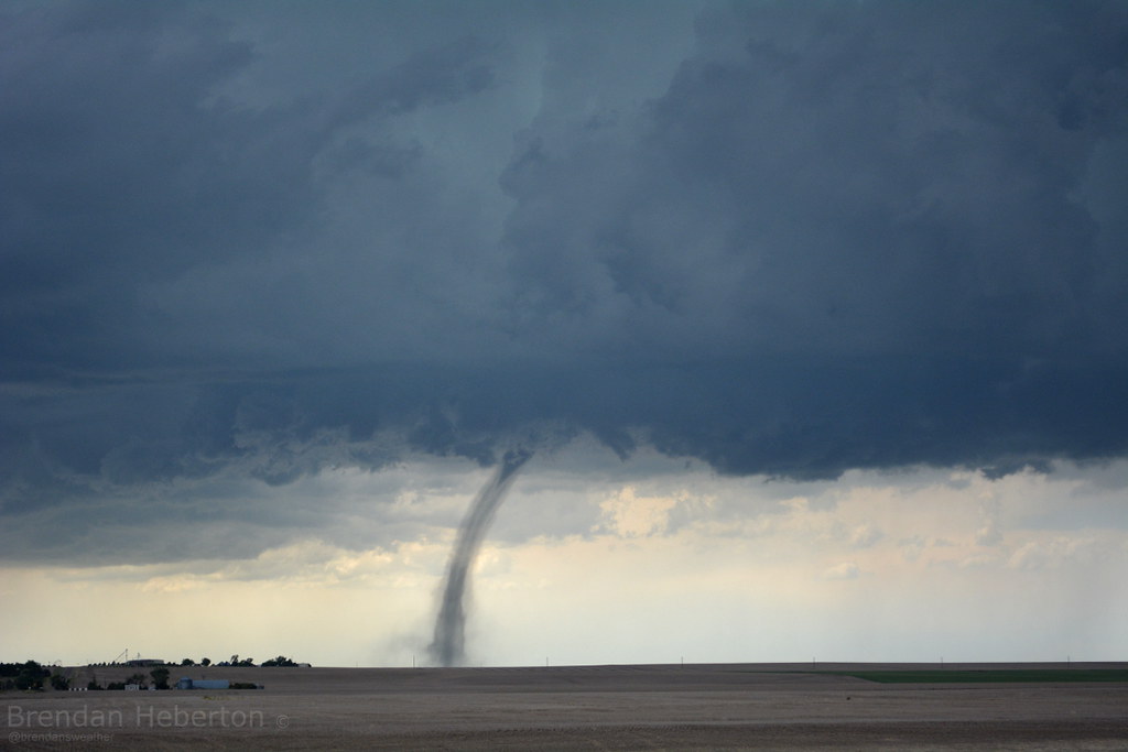
The DCVZ has been shown to play a large part in the number of tornadoes that have occurred east of the Front Range. The majority of these tornadoes are non-supercellular (NST), meaning they are not associated with thunderstorms that contain a rotating updraft, commonly known as a mesocyclone. Although these NSTs do pose a threat to life and property, they tend to be weaker than supercellular tornadoes.