The State of the Atmosphere: Sunday, October 18, 2015

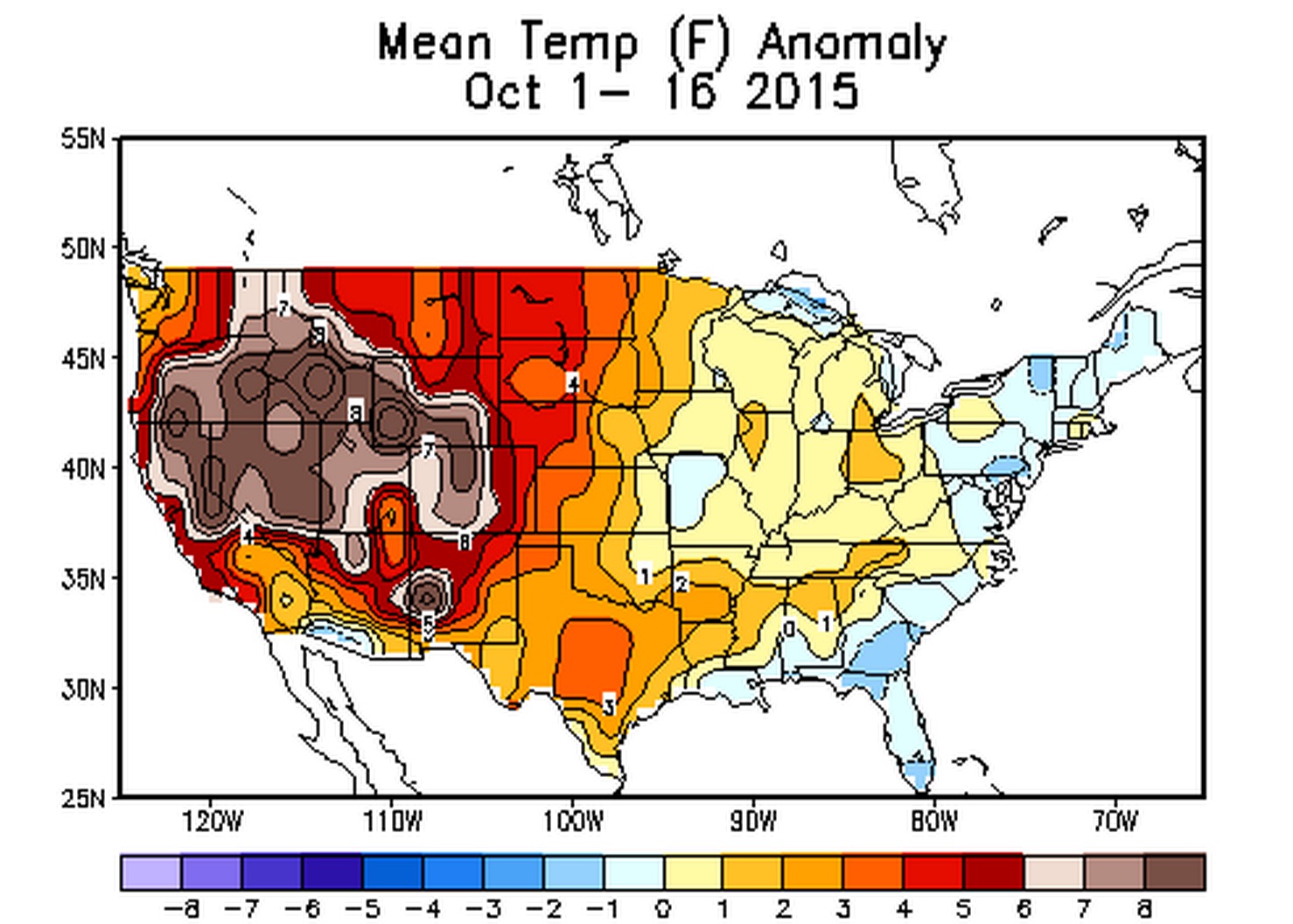
Halfway through the month of October and it should come as no surprise that temperatures have been running well above normal for the month. Denver International Airport is running a whopping 7.2° above normal through Saturday, with a mean temperature of 60.8° F. The average temperature for the month of October (entire month considered) is 50.9°, with the record warmest October occurring in 1950, with a mean temperature of 59.9° for the month. It hasn't just been hot here, but all across the west, and really much of the country at that.
The precipitation story hasn't been much better, at least for Colorado. Across the southwest we have seen at least one cutoff low bring positive precipitation anomalies to portions of southern California, Nevada, Arizona, eastern New Mexico, and western Texas:
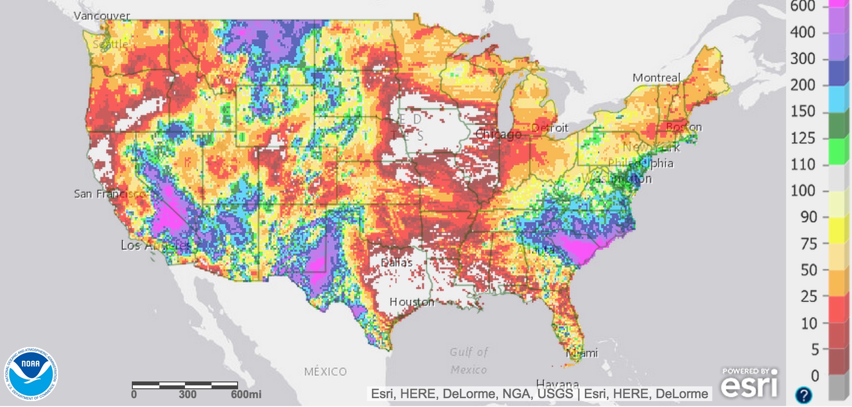
This, unfortunately, has lead to some nasty mudslides and flash flooding across the parched southwest, a theme that will likely continue with an active southern storm track. Take a look at this incredible video of a mudslide earlier this week in southern California, fortunately everyone made it out safely.
This is unbelievable. Just north of Mojave on Hwy 58 there are at least 100 cars and big-rigs stuck in heavy mud. CHP announcing "if you're in your vehicle, honk your horn." #Mudslide
Posted by Gisela Margarita Perez on Friday, October 16, 2015
The week ahead
Our weather looks to turn at least a bit more interesting over the next week, with an 'unsettled' weather pattern forecast for much of the next period.
Saturday, Brian Bledsoe discussed this pattern change, and the awakening of the MJO that may help fuel a wetter pattern for the state, at least for a time.
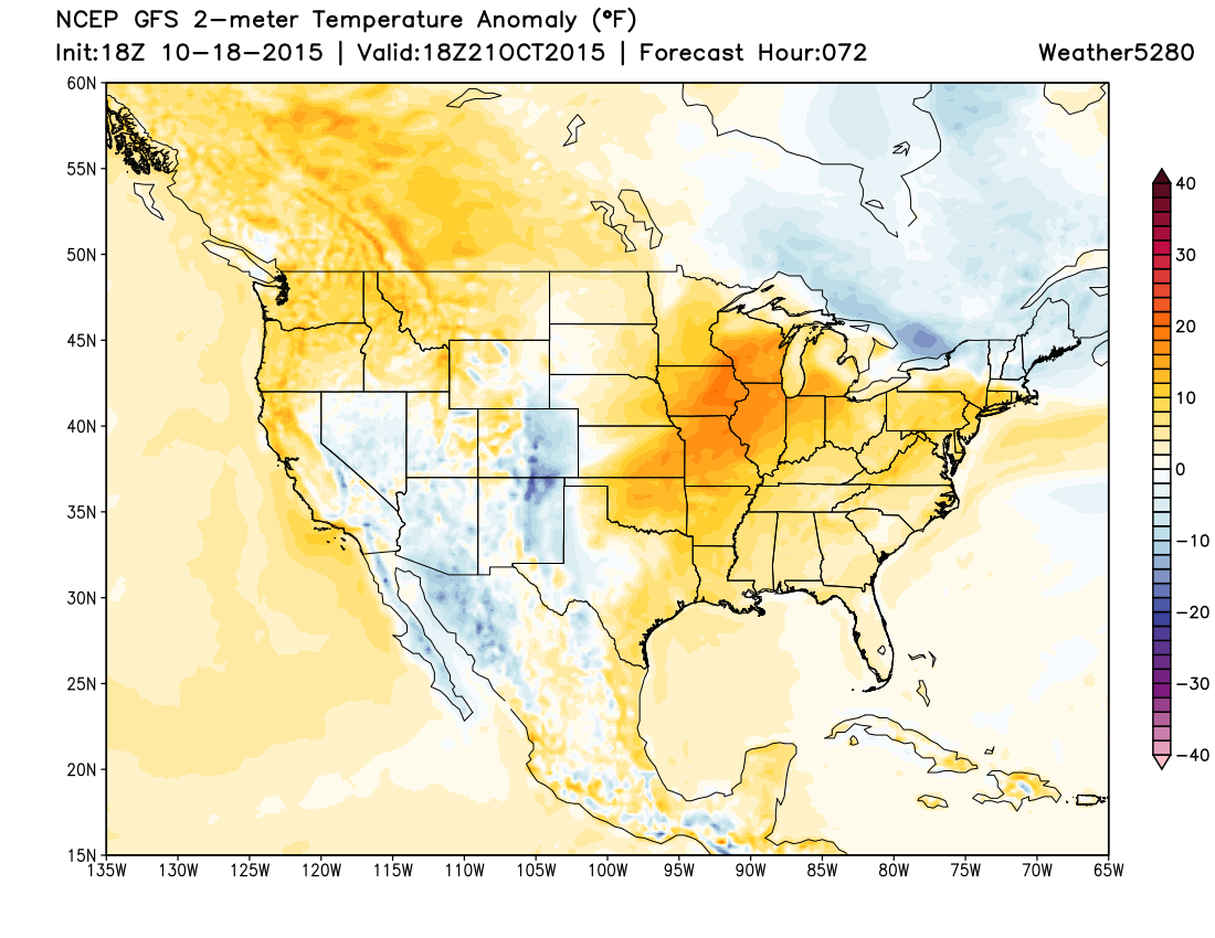
With regard to this week, the overall look is cool and wet, though the specifics are still a bit hairy. Generally speaking, it looks like rain for lower elevations, some snow for higher elevations (finally!), and greatest 'bust potential' for northern Colorado vs southern Colorado, as the storm track favors a southern solution overall.
Are you a Weather5280 subscriber? Subscribe to Weather5280 today!
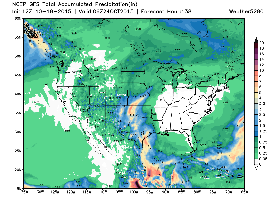
Of the three major global models, the GFS has looked the most grim for the northern metro areas with regard to precipitation this week, shunting most measurable QPF well south and east of the metro areas. The Canadian and European have been consistently wetter, though today have may have trended closer in line with the GFS. For the EURO, the 12z run was roughly half the QPF from its previous run, but also increased confidence in that it's much better aligned with its ensemble now. Through Friday, the 12z EURO deterministic and ensemble runs now produce ~0.8" QPF for KDEN.
While we may see some showers and storms already Tuesday, with much cooler temperatures forecast by Wednesday, the best chance for rain at lower elevations may come toward the end of the week as a large upper level low located over the Baja finally begins to track east.
Over the last several days the EURO and Canadian models both kept this low closed and ejected it northeast across Colorado bringing good precipitation to the northeast Plains by Thursday. Today both of these models are showing a bit more of an open trough, with the best energy/moisture staying to our south. How this ULL eventually evolves will determine if and how much rain we can expect over northeast Colorado later in the week. In the either case, it looks like southeast Colorado, eastern New Mexico, Texas, and much of Kansas will see some beneficial of rain over the next week. For northern Colorado, still plenty of time to see how things evolve over the coming days.
Beyond this week the flow looking to remain at least a bit more zonal than it has been into early next week. Models had been jumping on a stronger system by the 26th - 27th, but have since backed off a bit. Currently the operational GFS shows ridging for early next week, with the EURO still has something, though it is currently an open, unorganized trough. If this system (or possibly the one behind it toward the end of the month) can get its act together, there may be a bit more cold air to work with than what we have for this week – we'll see.
Meet up this week!
A quick reminder that our next meet up is this Thursday, October 22 at 6pm at Denver Syntax on south Broadway. Matt Makens and Brian Bledsoe will be our "formal" presentations, and of course we'll all be hanging out and chatting weather over beer, so come on down!
If you think you'll make it out let us know (or just show up), it should be a great time. With any luck at all we'll have some snow potential to talk about, not just warmth (and rain?).