End of the Week Outlook
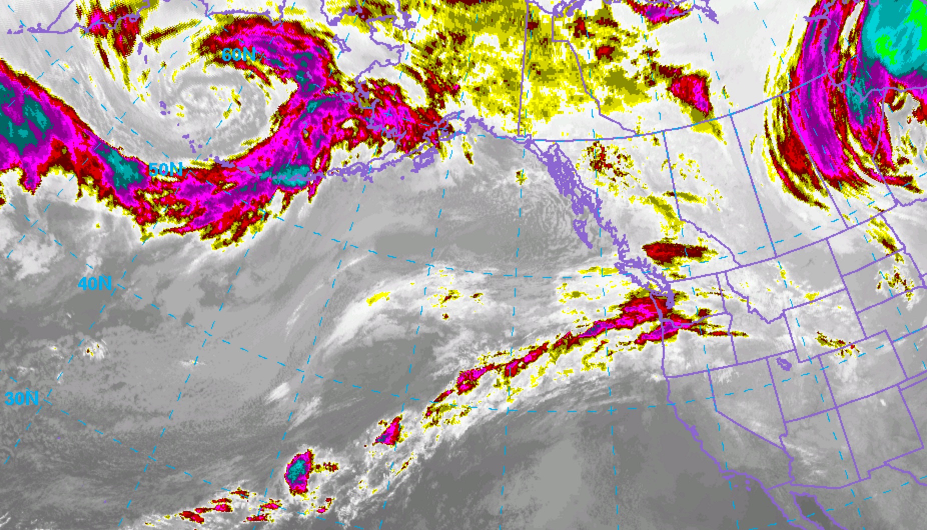
As we continue to melt away whatever remaining snow we received from our winter storm earlier this week, there is a chance that we might have another shot at seeing some light accumulations throughout the Denver Metro area on Friday. Below is an infrared satellite image which shows our system of interest bringing some rain to the Pacific Northwest and snow to the Washington Cascades.
Heading into Friday, a northwest flow aloft will continue to dominate the synoptic-scale pattern. A weak shortwave trough will dig into Wyoming and Colorado on Friday, leaving a narrow time frame for some light snow before quickly shifting off to the south and east. Mainly areas north of I-70 will be favored since this trough isn’t very deep.
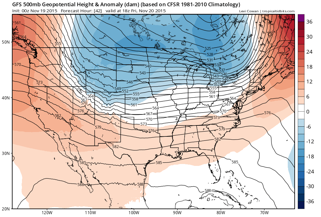
A cold front in association with the system will also slice down from the north, bringing some chillier air behind it. Behind the front, clockwise surface flow from a surface high centered over Wyoming will result in northeasterly flow over northeastern Colorado. This tends to bring upslope flow to some locations such as Fort Collins, where the orientation of the terrain barrier results in orographic lift. Upslope flow associated with a surface high, also called anticyclonic upslope, tends to result in higher snow to liquid ratios, simply because these systems track across colder source regions to the north. This colder air is more favorable for the formation of dendrites, which results in a fluffier snow, unlike the heavy, wet snow that we saw earlier in the week.
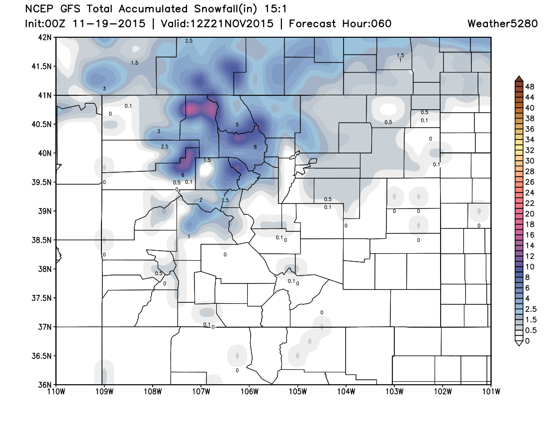
It is worth noting that these systems typically do not pack much QPF simply because they tend to be colder, and have little moisture to tap into. However due to the type of snow, these systems do have the ability to leave some light accumulations in some favorable spots. Here's the latest GFS snowfall forecast through Friday, light accumulations for the northern urban corridor:
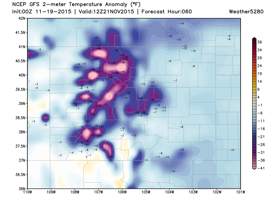
High temperatures on Friday will struggle to get out of the 30s due to cloud cover and cold air sliding down from the north. Temperatures Friday night into Saturday will likely be some of the coldest readings that we have seen so far this season, likely dipping down into the teens in most spots. In Denver, we typically see overnight lows in the low to mid 20s during this time of year.
In short, this system is certainly nothing compared to what we saw earlier in the week, however there exists the opportunity to see some light accumulations mainly to the north of Denver on Friday. Drier northwesterly flow will then continue into the weekend, bringing us slightly above-average temperatures. Typically, we see high temperatures around 50°F during this time of year.