A Look Ahead to Christmas Week: Wintry West, "Torch" East

Favorable pattern for Western U.S. snowfall continues
After another chilly day today across eastern Colorado we see ridging return to the state as we head into Friday and the weekend. This will help temperatures rebound nicely – highs in the 40s Friday, and likely 50s for Saturday, with gusty winds along the Front Range being really the only weather concern over the next few days.
The ridging will be very transient, however, and by the end of the weekend we already see troughing plowing back into the intermountain west, with the ridge reestablishing itself in the east.
This will be the pattern for most of Christmas week. A very snowy, unsettled western United States, with an abnormally warm Christmas on the way for much of the eastern United States.
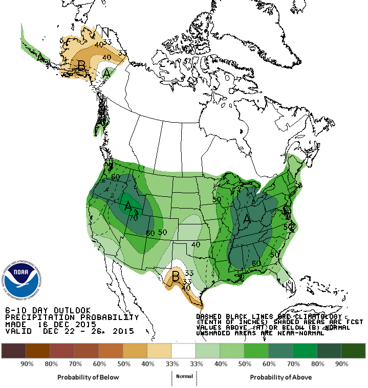
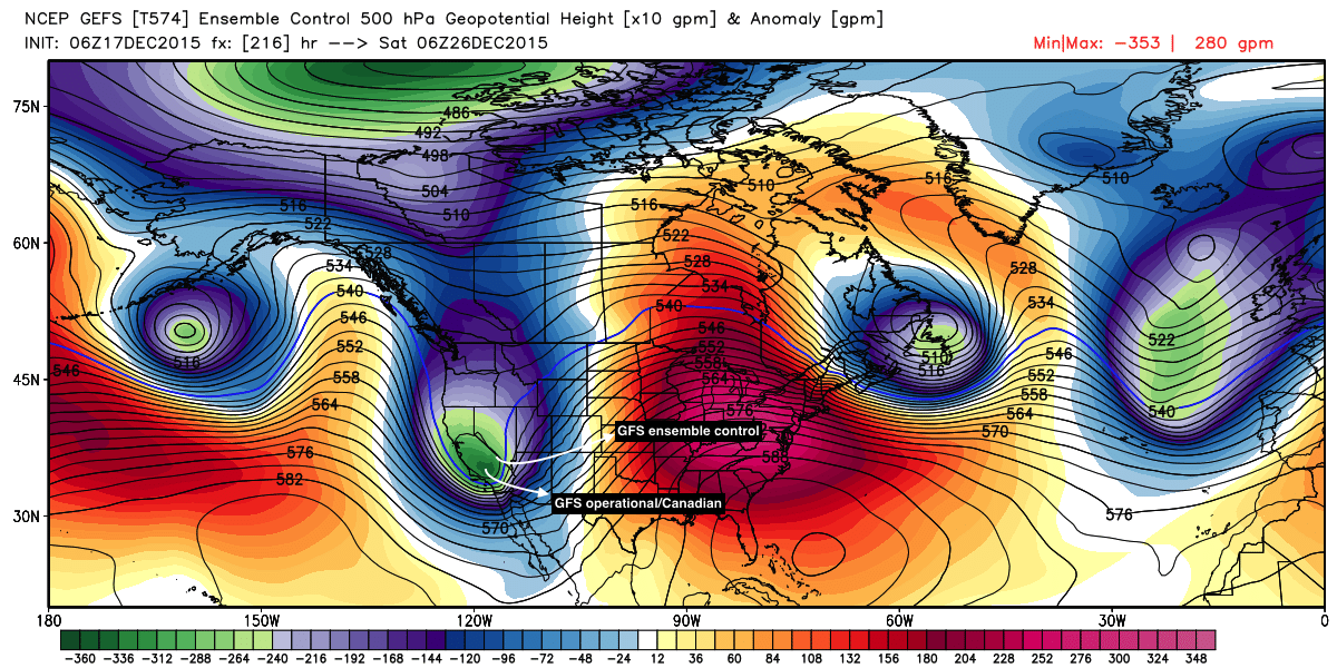
It's forecast to be a very wet week nationally. In the west this will equate to pretty epic mountain snows... while east of Colorado precipitation will largely come in the form of rain, except along the northern Plains and upper midwest which may see a decent snow by midweek, and some Lake Effect snow snow this weekend.
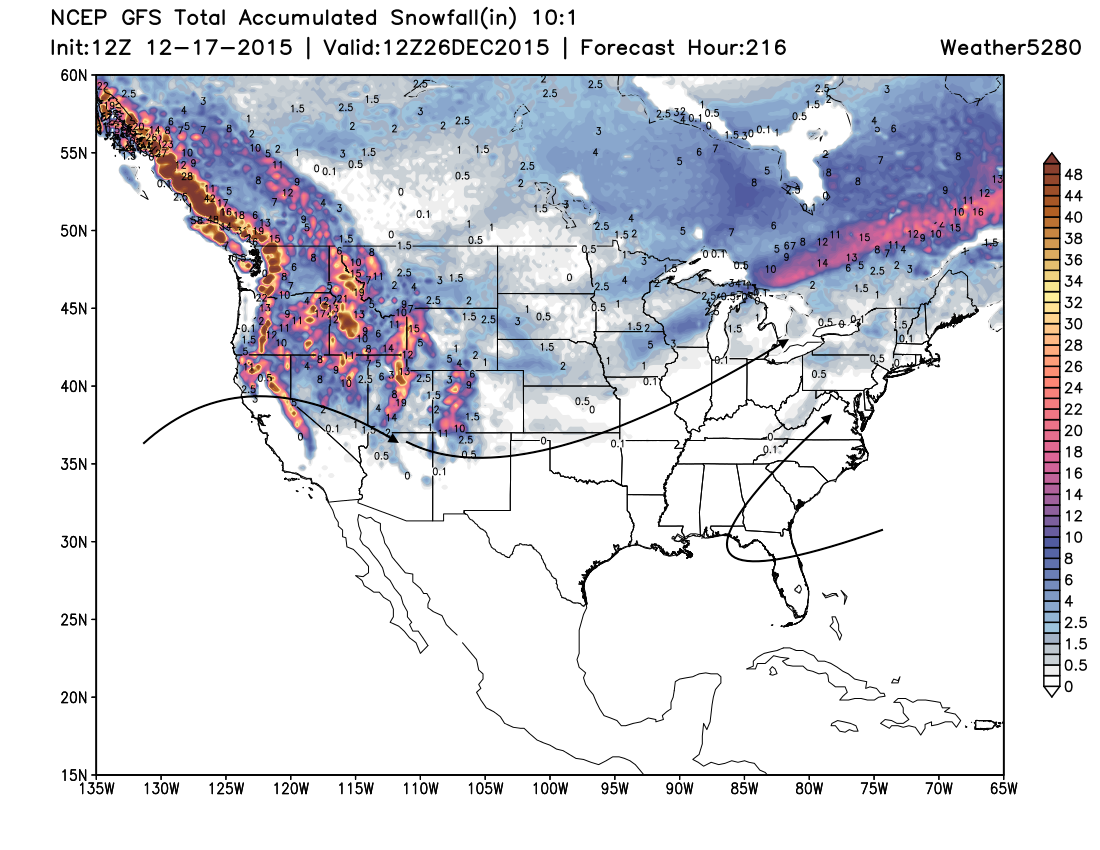
So while the west gets hammered by snow (FEET deep for most mountain locations) next week...
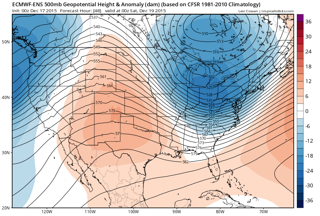
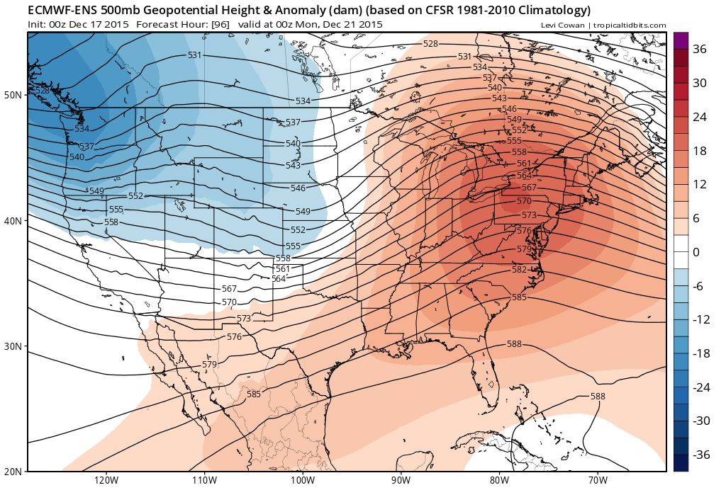
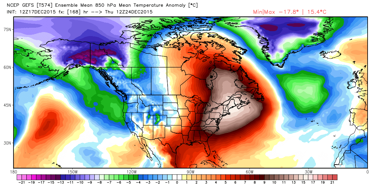
...the east will will be cooking, with temperatures of >30° above normal for some by the middle of next week:
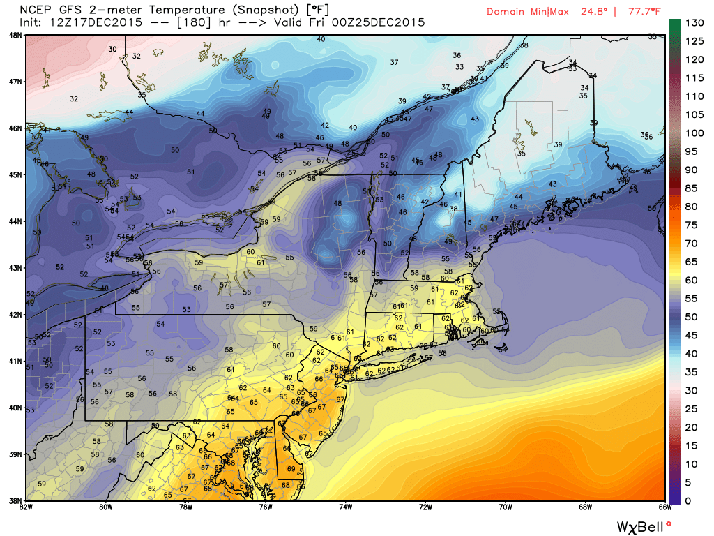
Highs in the 60s and 70s for next Thursday in New England:
As for Colorado
From where we sit today, it looks like the pattern will overwhelmingly favor the mountains for snow through the middle of next week. Pretty high confidence in seeing a strong zonal flow, with off and on heavy mountain snow Sunday - Wednesday, with temperatures near normal but mostly dry at lower elevations to the east.
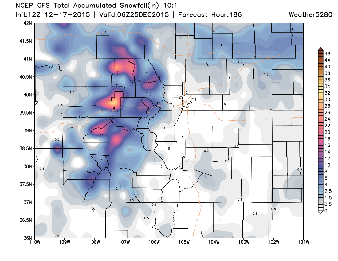
With downsloping being predominant feature for eastern Colorado our concerns for snowfall across the Plains at least through Wednesday are pretty low. There will be a handful of embedded impulses we'll need to watch, but likely any of those will favor the northern border areas and far eastern Plains over the I-25 corridor. The GFS snowfall forecast through Christmas Eve shows this pattern nicely, it should be a great week for skiing across north-central Colorado:
By Wednesday models begin to diverge at bit, with the EURO trying to pull snow east of the mountains late Wednesday into Thursday, with more unsettled weather lingering through Christmas Day and the weekend. The GFS/GEM are less convinced of this, and given the overall look of the pattern at 500mb it would suggest they have a better handle on things at this time.
For now, we'll hedge Christmas Eve and Christmas Day on the dry side for Denver. However, this is a long ways out and things could change. As it stands it looks like we'll need to watch an impulse in the Wed/Thur timeframe, then again by the weekend. Models do begin progressing what looks to be the last for a series of waves in from the west by the end of the week, and show it really deepening over the Great Basin by Friday. As we sit today this looks 1) to possibly dive too far south for big impacts for us and 2) it may hold off until next weekend if it is going to impact the state/eastern Colorado.
A faster evolution of this trough could mean a more interesting weather setup for Christmas, so you'll certainly want to keep with us as we continue to track the pattern for next week. So while no snow is imminent or certain for eastern Colorado, the pattern remains intriguing. And you all remember what happened the last time I called something intriguing. Let's enjoy a few calmer/warmer weather days heading into the weekend, and then see how the details look to be setting up for next week as we get closer.
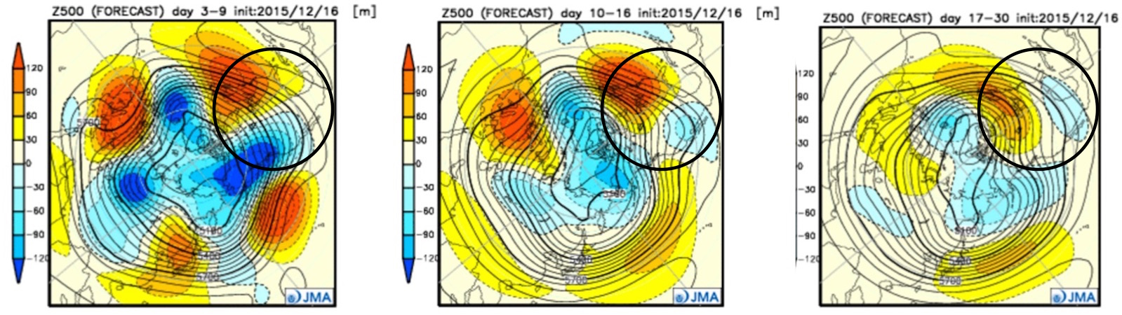
Bottom line: pattern looks to hold for awhile longer, and if you're inclined the buy the JMA, that could be another several weeks at least. Devil is in the details whether that translate to more snow east of the mountains, but a great stretch of skiing weather on the way to be sure.