Thursday PM Update: Cooler for the Weekend, Good Mountain Snow

Temperatures are again running above average across eastern Colorado today as strong downsloping winds have helped drive afternoon highs into the upper 40s and lower 50s for many across the metro area.
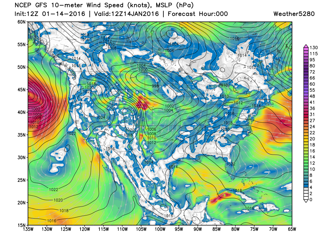
While the strongest winds were focused across the northern border and southeast Wyoming, winds across the Denver area were gusting as high as 45mph early this afternoon, with very strong winds in and along the Front Range foothills. The tight gradient across Colorado and strong winds were modeled nicely here:
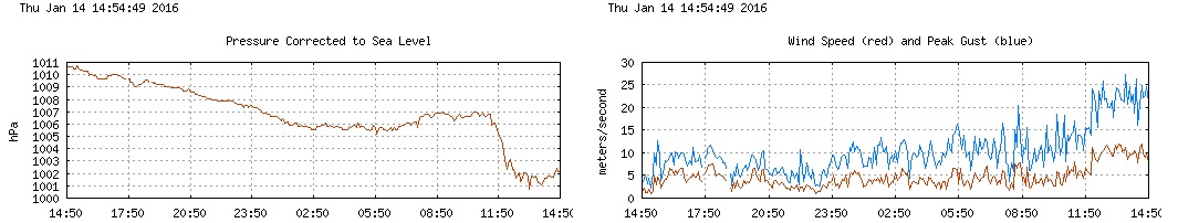
And sure enough, the winds were whipping at NCAR, with a peak gust through 3pm today of 47mph:
We'll see gusty winds continue tonight, but slowly diminish through Friday as cooler temperatures arrive across eastern Colorado, and a least a slight chance of snow too by Friday evening across the Plains.
Mountain snow
The forecast for the high country, especially north of I-70, continues to look solid through the weekend:
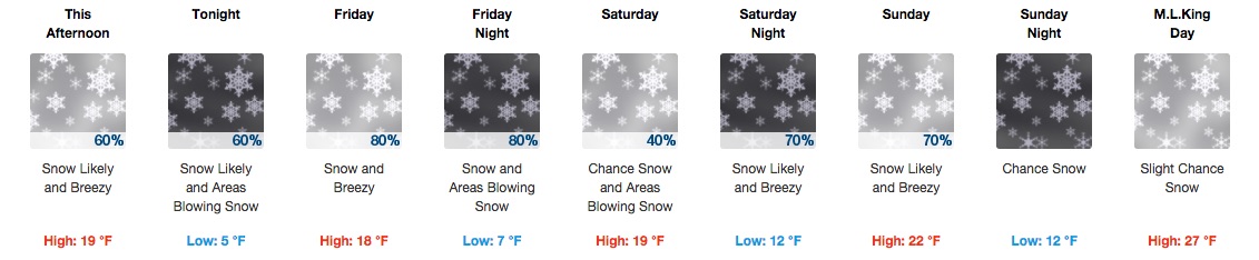
There will be a series of systems passing across the state over the next week, with two disturbances keeping snow chances going for the high country through the weekend. This will equate to 6 - 12" for many northern mountain locations, with upwards of a foot possible for snow-favored terrain by Sunday night.
Across the Plains our snow chances will be "best" Friday evening and overnight, with another chance for a snow shower or flurries by Sunday. That said, as Matt Makens as pointed out all week, neither system will do much in the way of snow east of the mountains.
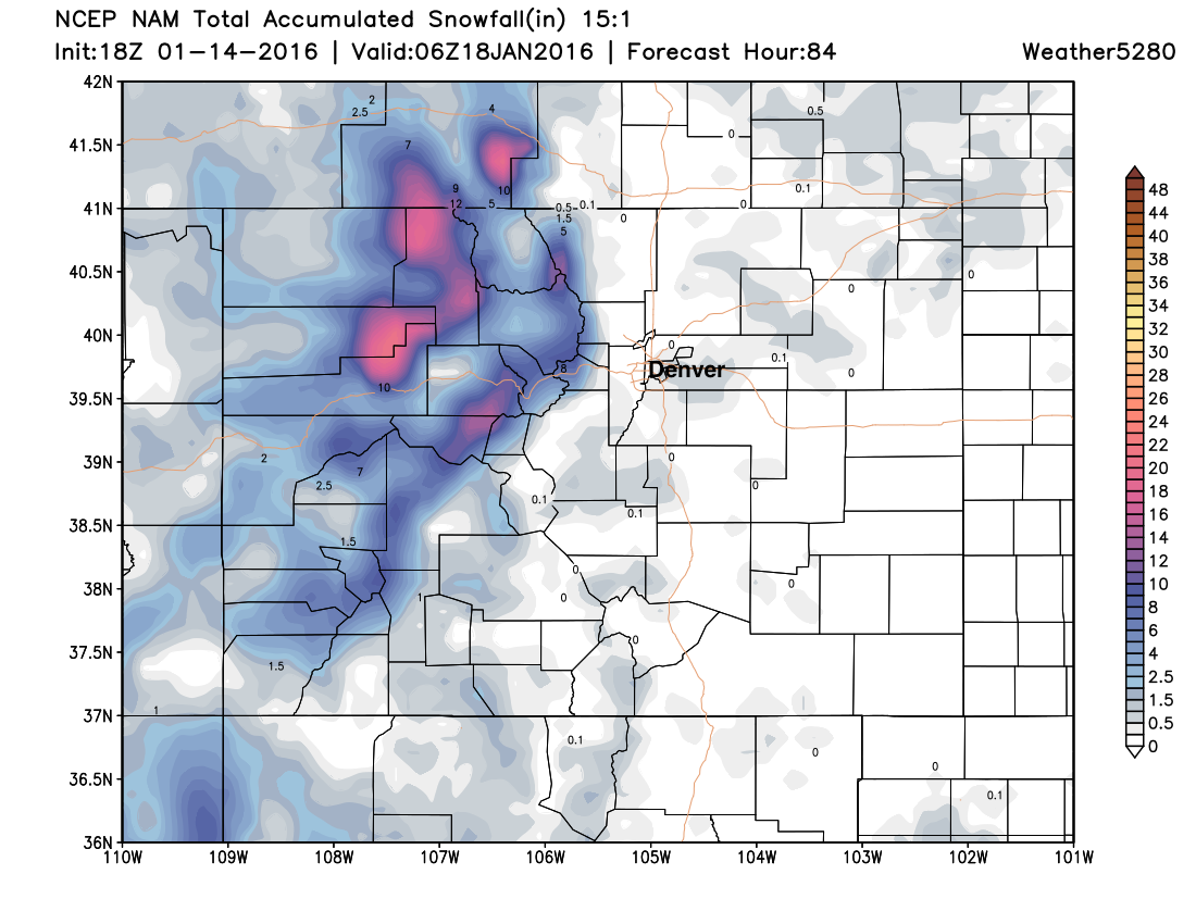
The NAM, below, has a coating to a 1/2" across northeast Colorado by Sunday evening, with the heavy snow staying west of the Divide:
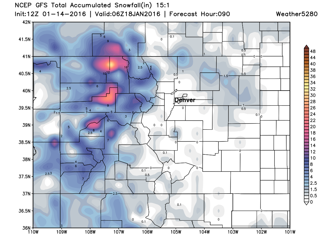
The GFS looks similar, though has a bit more snow across the Plains Friday night, especially for the northern areas (more or less nothing for Denver):
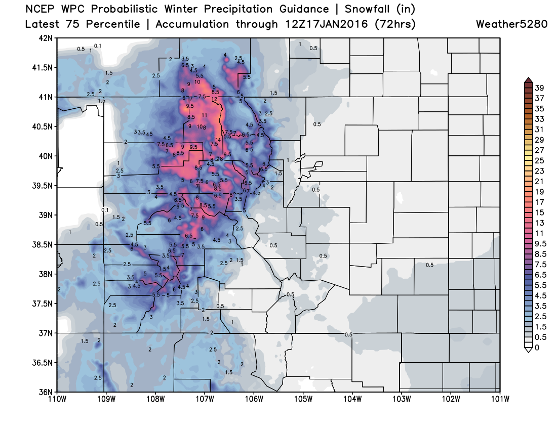
The WPC probabilistic snowfall forecast (a tool I don't often agree with) actually looks pretty reasonable through 72 hours, just a touch of snow across the I-25 urban corridor (about a 30%), and decent snow totals for the mountains:
These systems will usher in some colder air, so we'll be back in the 30s for highs Friday though the weekend, but no epic cold on the way either for this time of year. If you're going to the Broncos game, or just concerned for how weather may or may not impact the game, the forecast – as of now – looks pretty okay for game day, with highs in the upper 30s Sunday, and only a slight (10%) chance for snow.
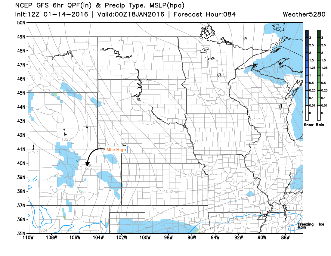
This is the current forecast from the GFS for late Sunday afternoon, a few scattered snow showers across the Plains, light mountain snow continuing, but overall not too bad for January 17th.
We'll keep an eye on Sunday and offer updates as needed. Otherwise, if you're headed to the high country this weekend please enjoy the fresh snow, but travel carefully, as winter driving conditions will be a good bet each of the next several days.