Chilly and Unsettled Across the Plains, Mountain Snow

Our storm continues to progress as expected. With that, no big changes in our thinking for snowfall across eastern Colorado during the next two days. There will be some snow but likely not much for most locations, as the core of the energy associated with this system will track too far north.
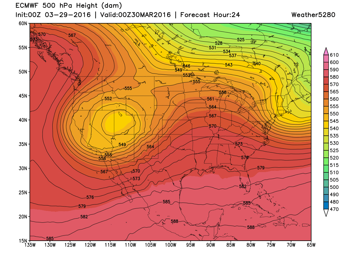
Today the Low will track across north-central Utah:
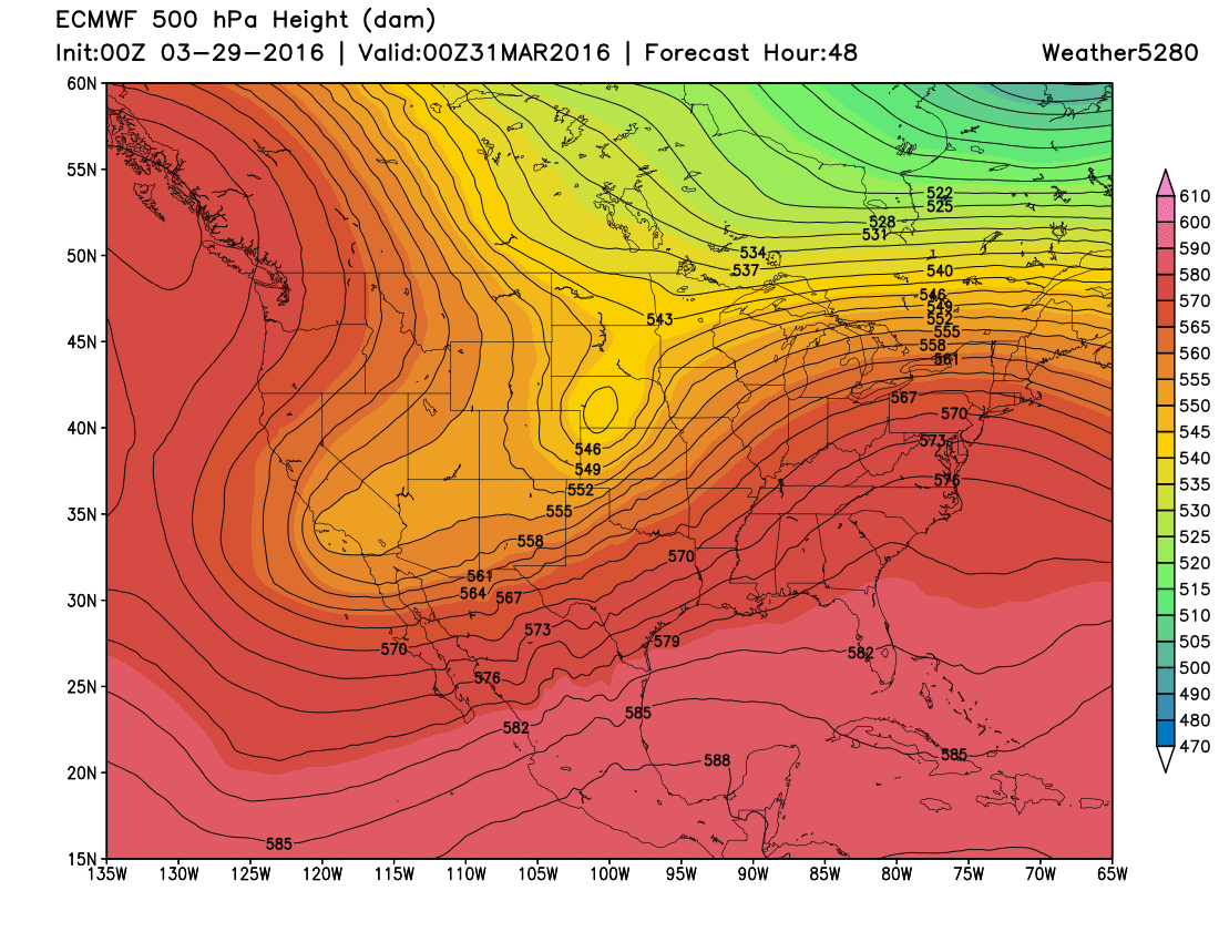
Tonight and tomorrow we see it eject a piece of energy northeast across northern Colorado and then into western Nebraska:
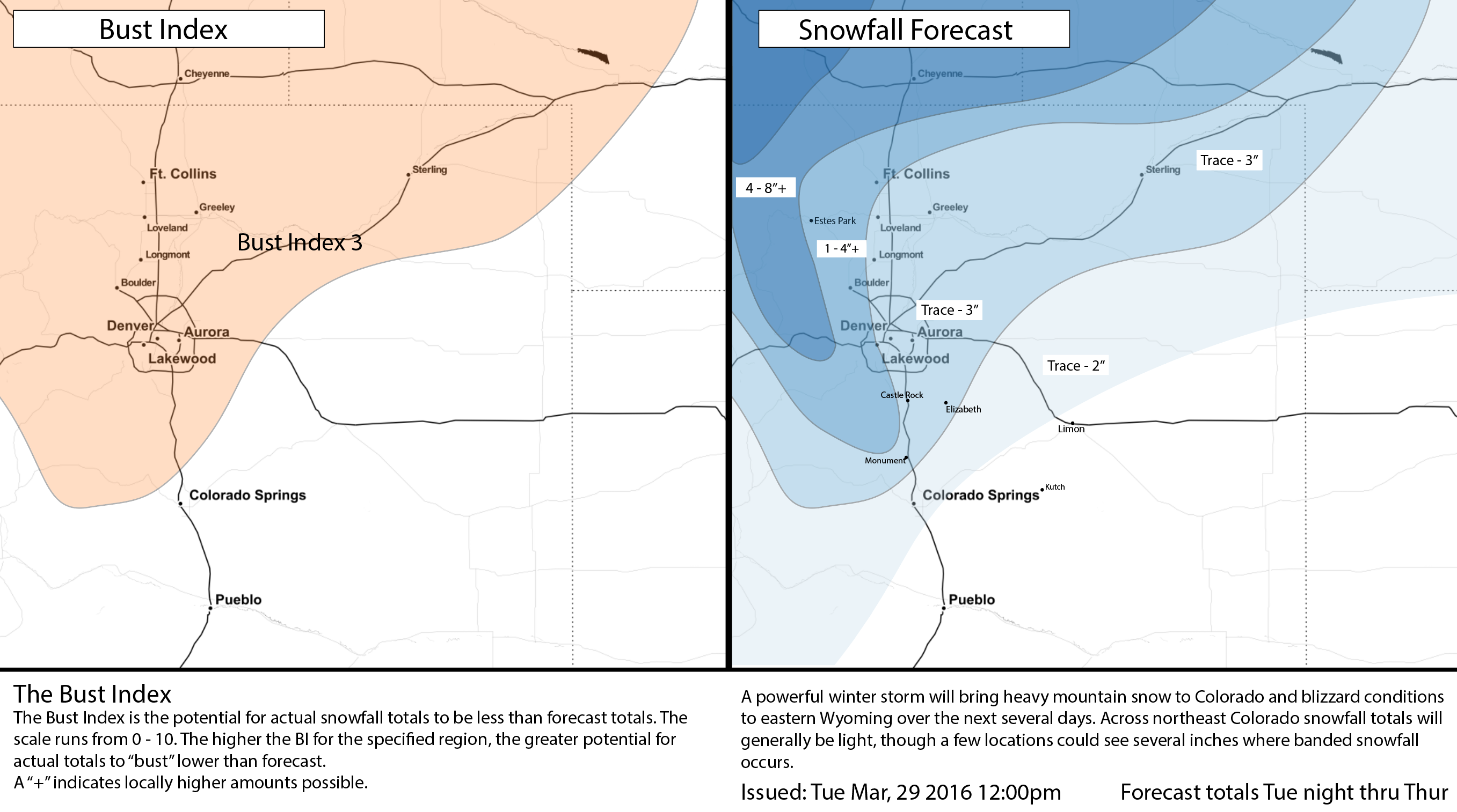
What this will equate to for us is some decent mountain snow and a few days of chilly air with rain and snow across the plains. For Denver, we'll go with a Trace - 3" from tonight through Thursday, with foothill locations seeing a bit better chance at several inches over the next few days. Heaviest snowfall associated with this system will remain locked over the northern Colorado border, across Wyoming, and across higher elevations west of the Divide where a Winter Weather Advisory has been issued. That mountain area advisory calls for 6 to 16" of snow, depending on location.
Here's a look at the 00z GFS from last night. It shows nicely where the heaviest snowfall will be centered as this system slowly moves east – a great (for snow lovers) storm for Wyoming and portions of the Colorado high country:
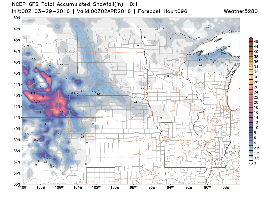
Our snowfall forecast reflects this, with heaviest totals well north and northwest of the metro area. For Fort Collins, we've gone 1 to 4" through Thursday, but it may very well be that this is a low-end event for you all too, depending on exactly where the surface low sets up. The latest 12km NAM has dried out the plains even more than previous runs, so this we'll need to keep an eye on. Overall, the theme of this system will be "unsettled" for a few days, rather than epic snows at lower elevations.
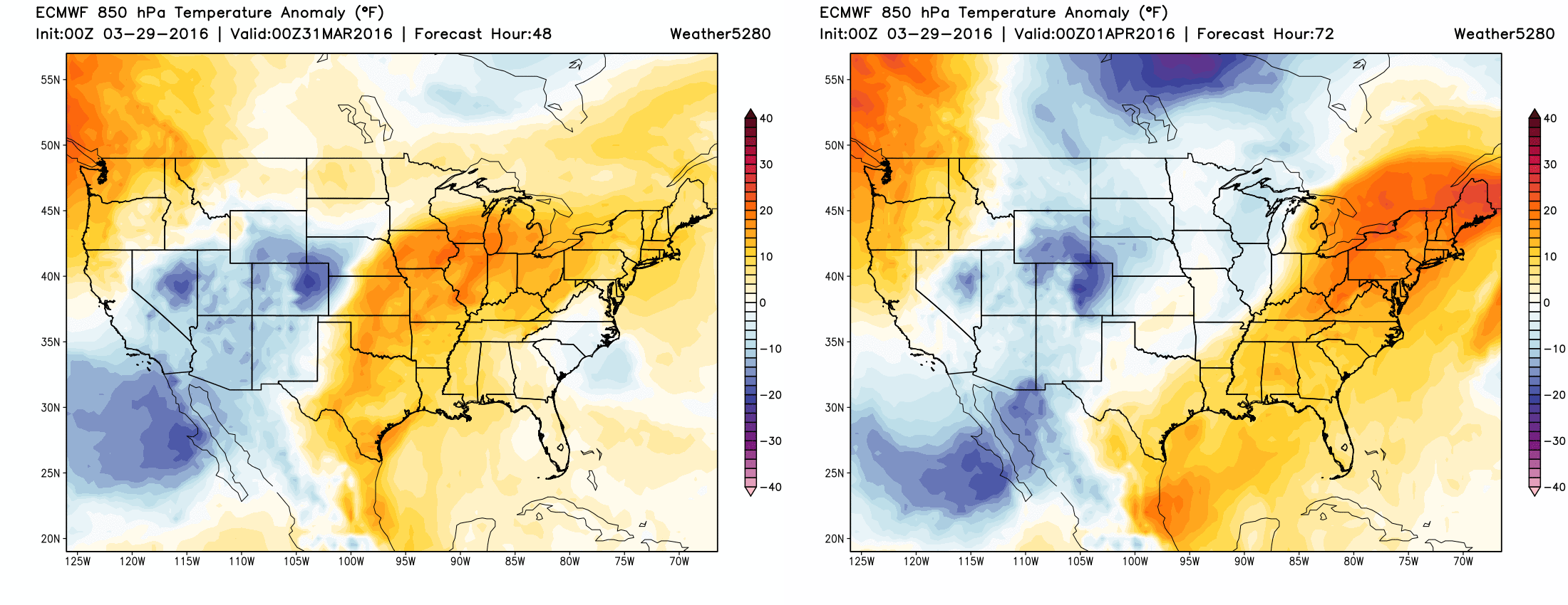
Temperatures won't be bitterly cold with this system, but cold enough for late March. Highs both Wednesday and Thursday will be in the low 40s for the Denver area, with overnight lows in the 20s. With that, over the next several days the coldest temperature anomalies (temperatures below normal) will be centered over eastern Colorado (Wed afternoon left, Thursday right), before temperatures slowly start to rebound for the weekend.
There may be a few isolated showers and storms across the plains later this afternoon, with a better chance for rain and snow developing overnight and through the day Wednesday. We'll keep the chance for rain and snow showers going through Thursday, before drying things out by Friday.