Wednesday PM Update: Cooler Days Ahead

As we discussed in this week's State of the Atmosphere, the week is getting set to finish much different than it started. First, we have to get through this afternoon, where another day of temperatures in the mid 90s is underway across the greater Denver area.
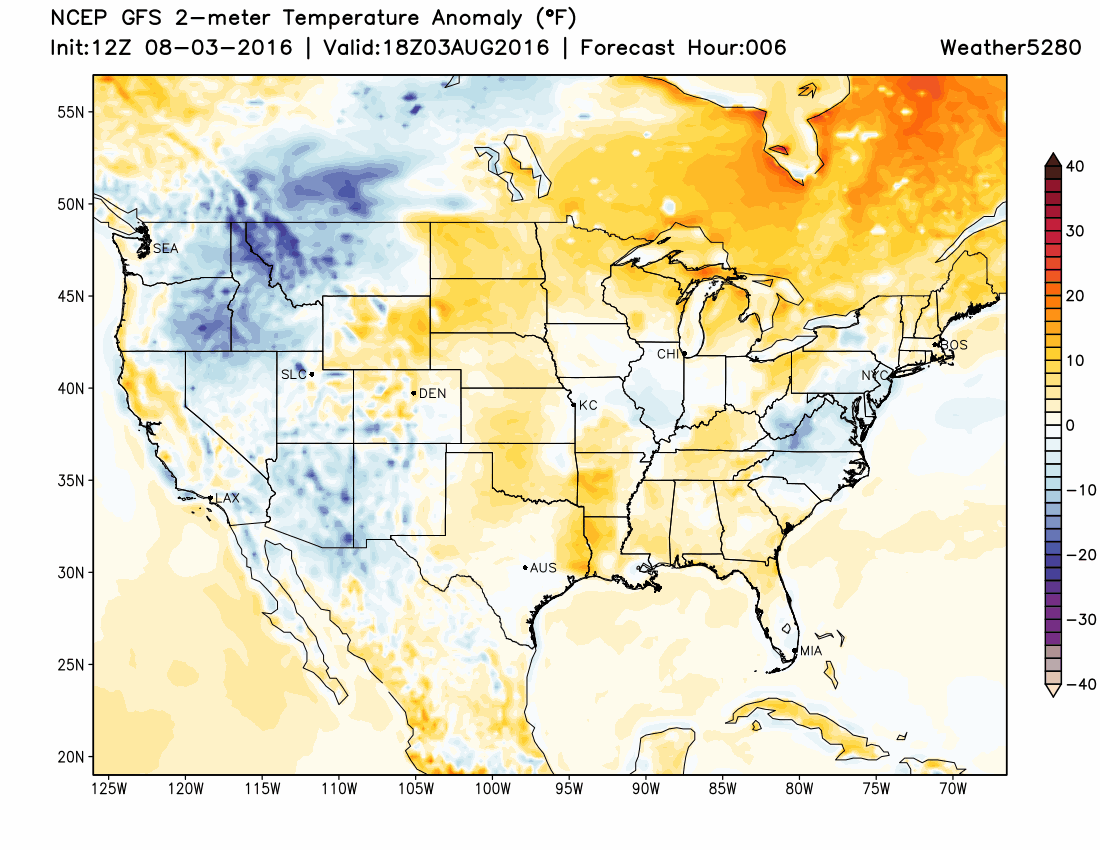
You'll notice in the map above that the oranges and reds across Colorado are replaced by blues and purples. This indicates the much cooler air that is on the way for Thursday and Friday, and to some extent on into this coming weekend.
Both the EURO and GFS are in pretty good agreement for temperatures on Thursday, with highs expected to peak about 10 to 15° coolers than today for Denver. We'll likely be another 5 to 10 degrees cooler than that for Friday, though the GFS today is even colder than that insisting we don't make it out of the 60s for highs on Friday. Wow! For now, will largely throw out the GFS and lean closer to the EURO and NAM MOS guidance for Friday, which would put daytime highs in the mid 70s for Denver – MUCH cooler than the recent stretch of 90s, nonetheless.
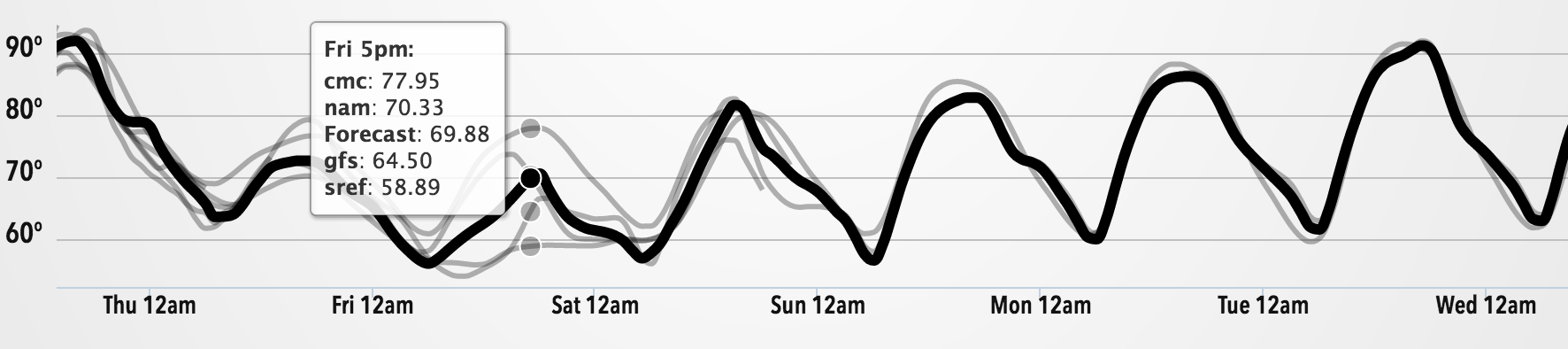
We'll warm up a bit again by the weekend, but it should still feel better than it has been with highs Saturday and Sunday in the 80s across northeast Colorado.
Precipitation
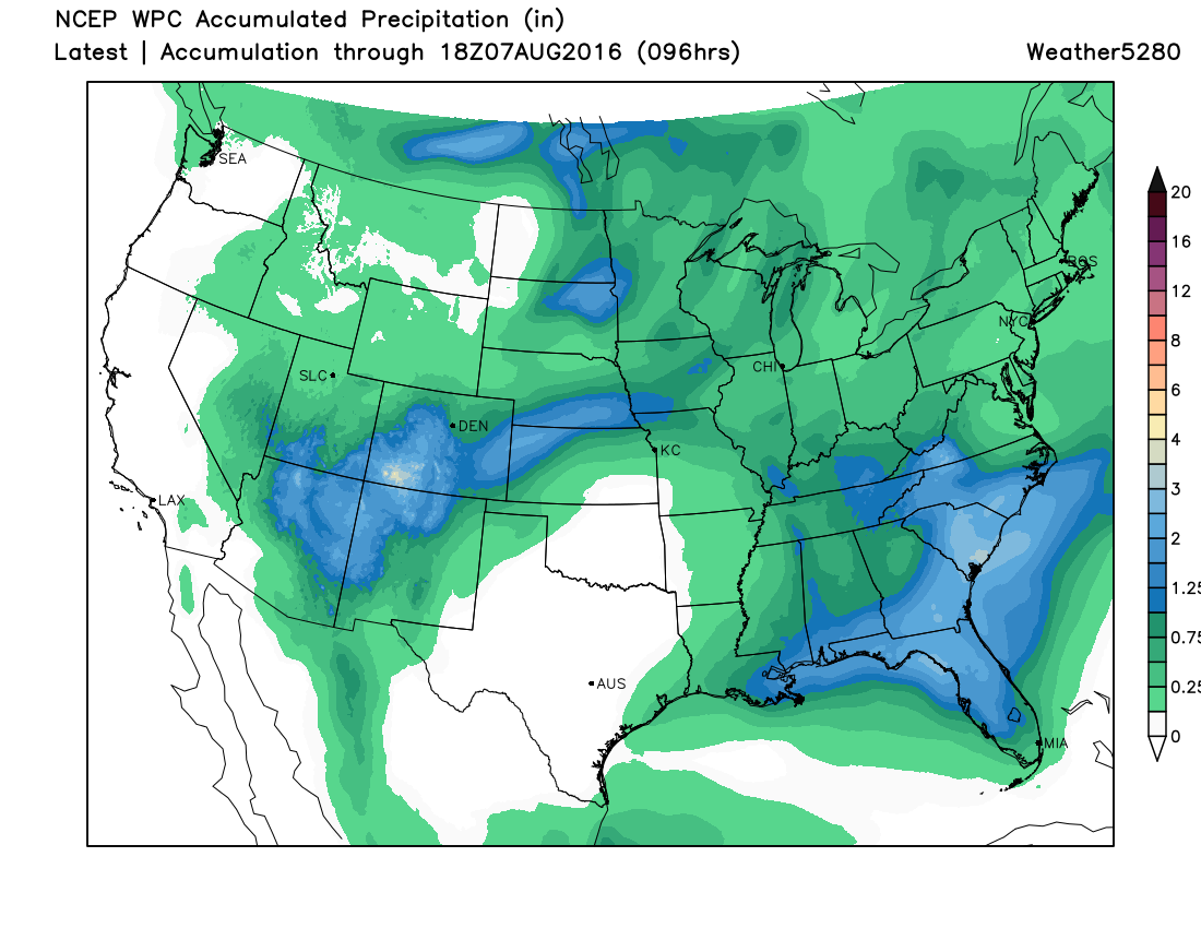
The precipitation forecast remains challenging. Latest forecast model trends tend to keep the greatest precipitation focussed across the southwestern portions of Colorado, and again south and southeast of Denver, with more questionable coverage for the northern half of the state Thursday and Friday. In fact, the EURO hits just about every part of the state except northeast Colorado with some pretty good moisture through the weekend – a similar signal showing up on other models as well.
With that, here's a look at the latest WPC precipitation forecast. A couple of things of note... the DEN (Denver) dot is just on the edge of some greater rainfall totals for the period, but overall drier across northeast Colorado as compared to southern Colorado. Also, Texas remains VERY dry, with moisture riding up and over the state...
As for precipitation chances across the urban corridor, we'll go ahead and go with about 30% chances Thursday through the weekend. With the much cooler temperatures on the way instability may be a bit of an issue in getting storms going due to an abundance of cloud-cover, but with high PWAT values, upslope, and slow storm movement, any storms that do develop will be capable of producing heavy rain and localized flooding.
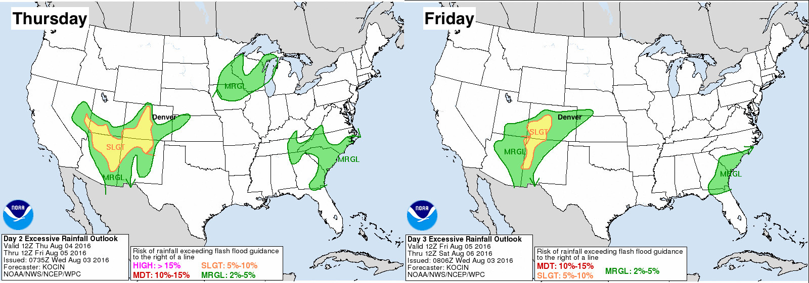
Below is the latest excessive rainfall outlook from the WPC for Thursday and Friday. Greatest flooding concerns will be across the southwest, where Flash Flood Watches are already in effect for good portions of Arizona, Utah and New Mexico, as well as western and southwestern Colorado. From Denver southeastward across the Palmer Ridge, southern I-25 corridor, and southeast plains will see a Marginal risk for excessive rainfall on these two days:
Storm coverage will become more scattered as we warm things up and dry things out a bit for the weekend. That said, we'll keep 30% chances in the forecast for now, as a bit better instability may help storm development along the Front Range and eastern Colorado these days.
Enjoy the COOLER weather! Please stay weather aware, and know that any storms that do develop will be capable of producing heavy rainfall over the next several days.