The State of the Atmosphere: Sunday, October 9, 2016

While the weather continues to be fairly quiet in Colorado, it has been far from tranquil in Haiti, the Bahamas, and along the southeastern coast of the United States this past week. Unfortunately, this monstrous storm took the lives of nearly 900 Haitians, along with 17 Americans on the East Coast.
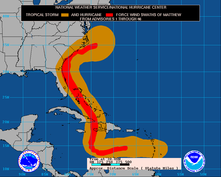
While the strongest winds remained just offshore of the United States, Matthew still caused torrential rains, destructive storm surge, flash flooding, and hurricane-force winds. Below is a map of Matthew's cumulative wind history:
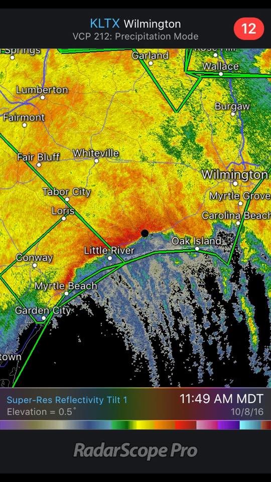
Copious amounts of rain also fell across the region, with parts of Georgia and the Carolinas receiving amounts in excess of 15 inches:
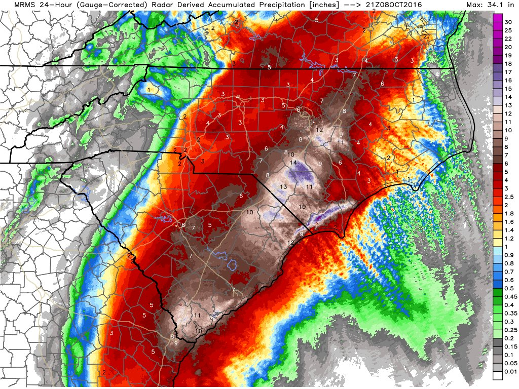
One convective band near Myrtle Beach, SC remained nearly stationary for over an hour, which is also reflected on the accumulated precipitation graphic above. Note the linear distribution of precipitation between Myrtle Beach, SC and Wilmington, NC.
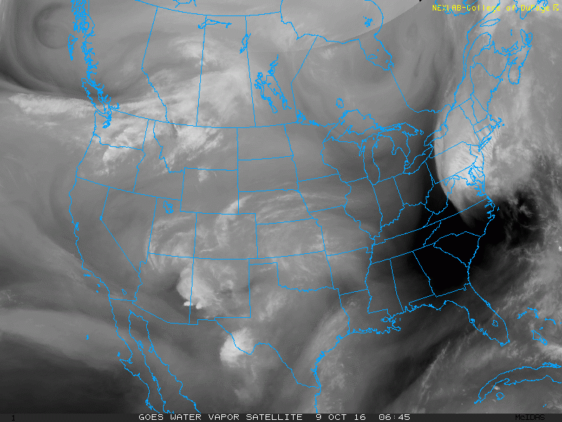
Shifting to the weather here in Colorado, the pattern has been relatively quiet. Thursday we managed to squeeze out 0.22" of rain at DIA, with daytime highs remaining in the mid-50s, however the cool down was short-lived. DIA recorded a high of 76°F on Sunday, which is 8°F above our average high for this day of 68°F. We can see the weak shortwave that brought us high clouds today on water vapor imagery. Note the swirl over the Four Corners:
Temperatures on Monday should be similar to what we saw today, as weak ridging remains in place over the state:
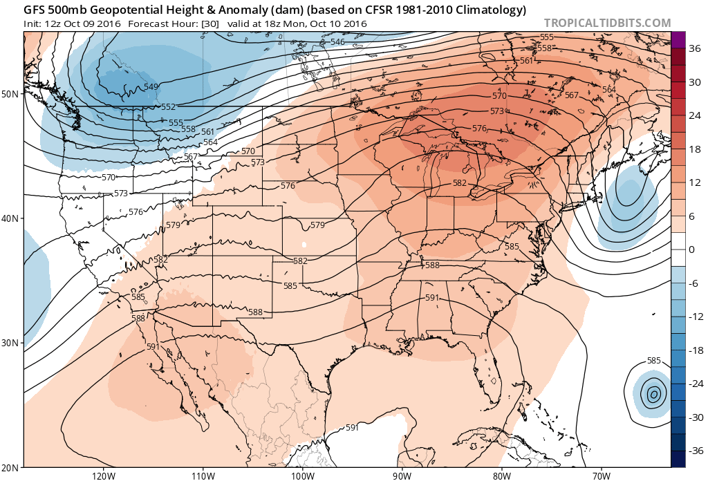
Note that the mid-level flow will remain zonal (out of the west), which results in downsloping east of the Front Range. This will allow temperatures to be a few degrees warmer than today, with some spots flirting with the 80°F mark.
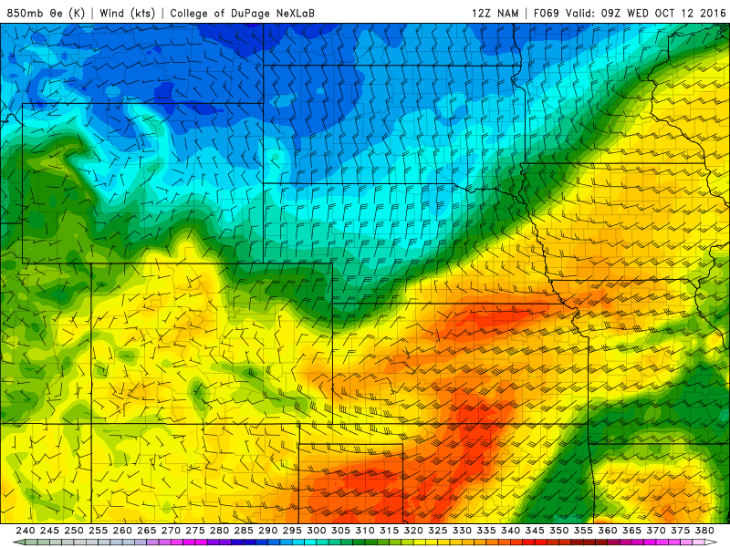
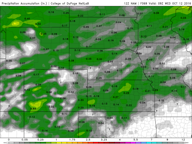
A cold front will move through Northeastern Colorado late Tuesday, with precipitation chances remaining pretty slim. The 12Z NAM is depicting 20 knot north-northeasterly upslope in the wake of the front (which is 5-10 knots stronger than the 12Z GFS). As a result, the NAM has slightly more QPF than the GFS, but precipitation won't be widespread Tuesday night. Locations such as the Palmer Divide will have the highest rain chances.
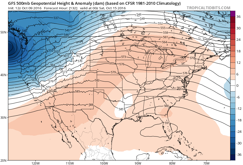
The main change that we will see here in Denver will be the cooler temperatures. We might struggle to get out of the 50s on Wednesday after the frontal passage. Similar to what we saw last week, the cooler weather won't last very long, with temperatures likely rebounding back into the 70s by the weekend as weak ridging reestablishes itself over the state. Note the lower heights (blues) are the Pacific Northwest! This will bring them some much needed moisture.