Tuesday PM Update: Thursday's Storm and Potential First Flakes of the Season for Denver

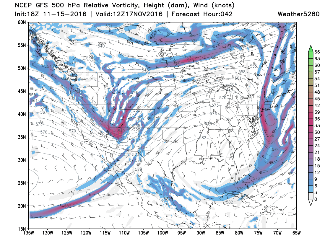
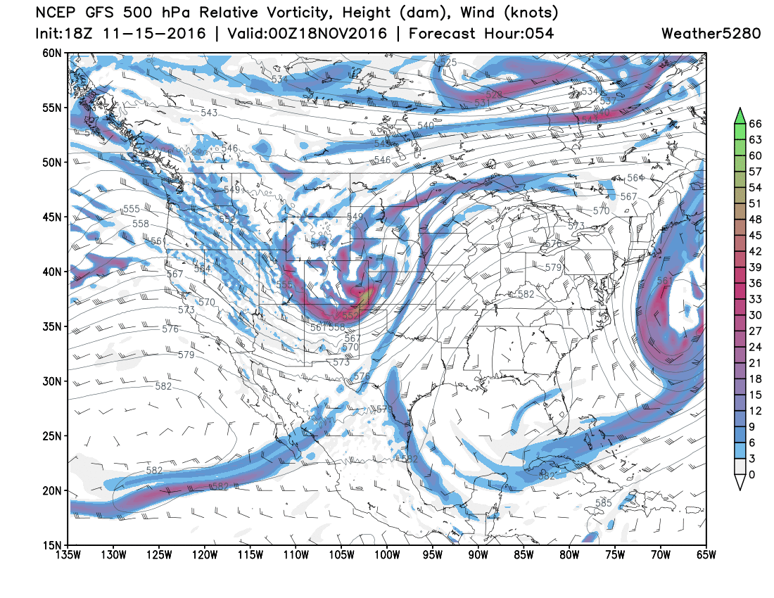
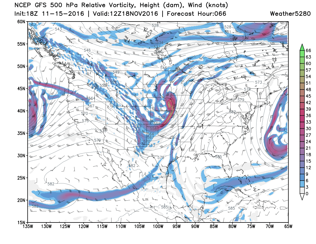
After dealing with record warmth, and serious record warmth at that, it will be nice to deal with something more November-like. While Thursday's storm won't be confused for the Storm of The Century, it will certainly offer some different weather. Here is a look at the upper level pattern from the GFS Model that will support such changes:
Thursday AM Upper Level Pattern:
Thursday PM Upper Level Pattern:
Friday AM Upper Level Pattern:
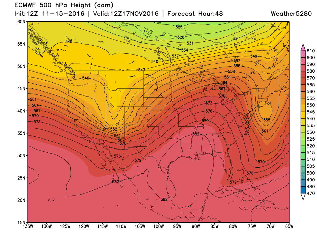
For comparison, here is a look at the upper level pattern from the EURO Model:
Thursday AM Upper Level Pattern:
Friday AM Upper Level Pattern:

The good thing is that both the GFS and EURO are showing some nice consistency and agreement with the storm track and intensity. Notice how fast the upper level storm moves through, tracking from Southern Utah early on Thursday to Eastern Nebraska just 24 hours later. These are the blues and purples you see moving across Utah and Colorado in the maps above.
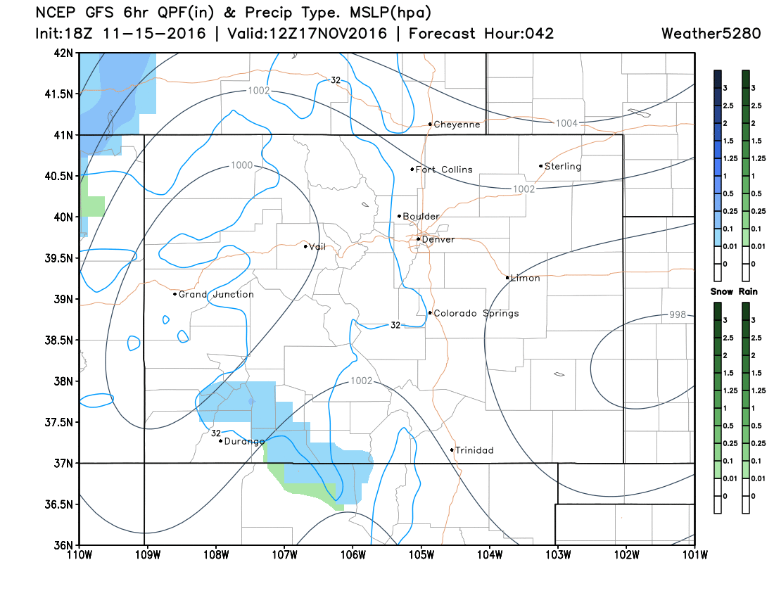
So how about our snowfall potential? How will the system evolve at the surface? Check out the output from the latest GFS (American model):
Surface Pressure, Rain/Snow Amounts & Precipitation Type
Thursday 5 AM:
Thursday 11 AM:
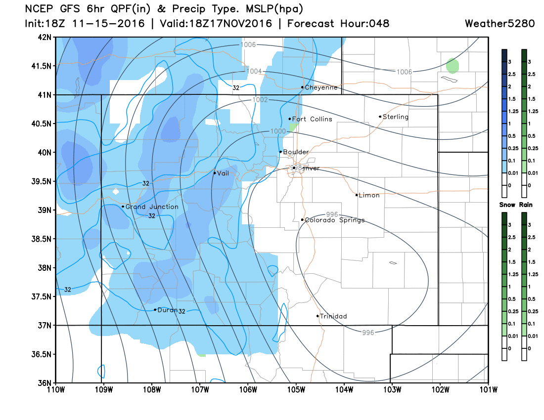
Thursday 5 PM:
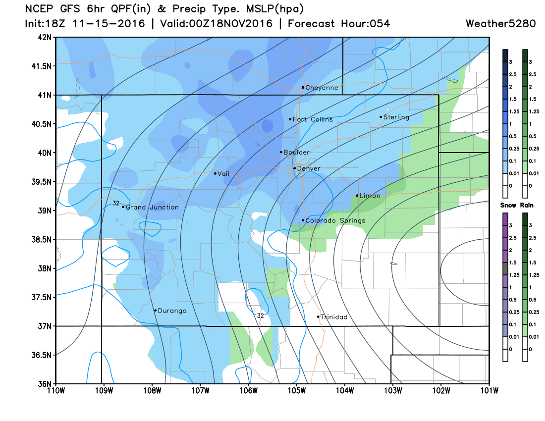
Thursday 11 PM:
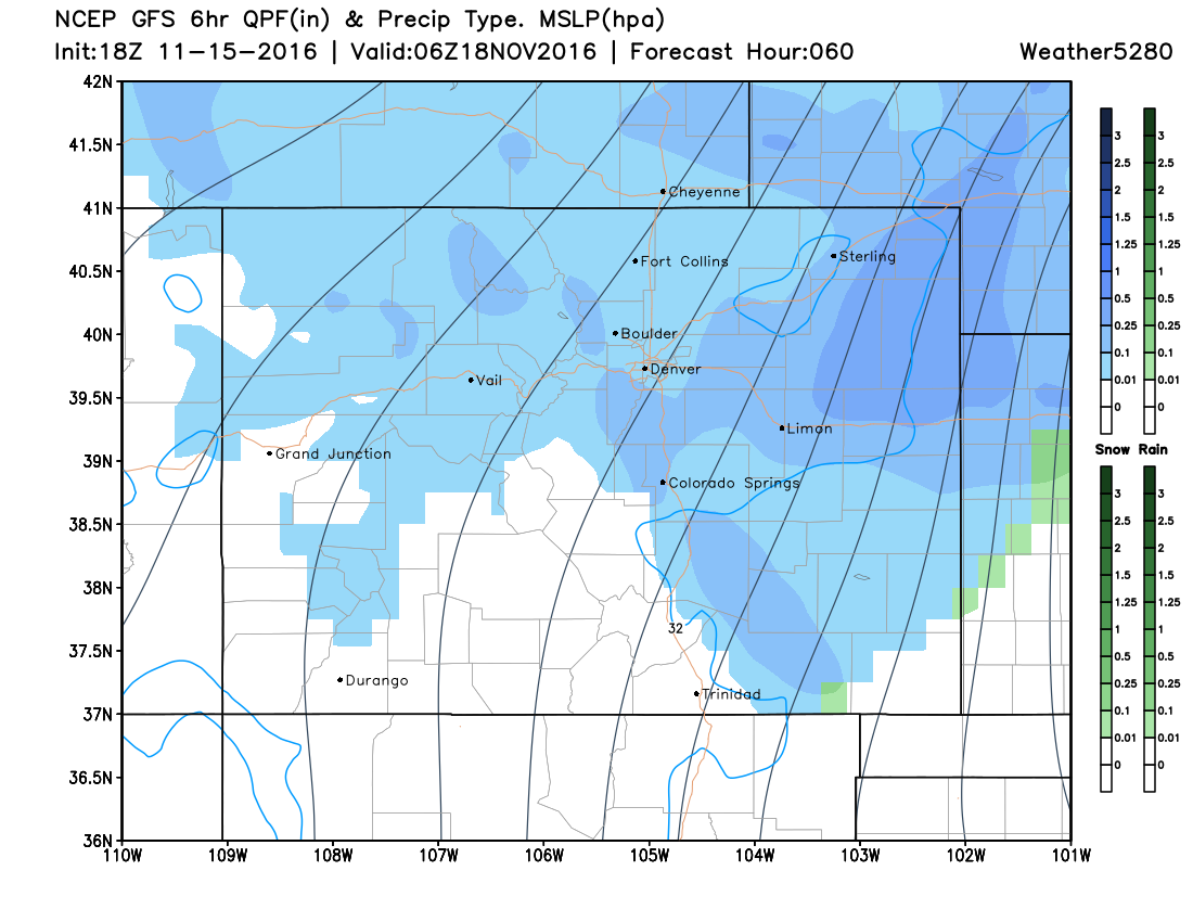
Friday 5 AM:
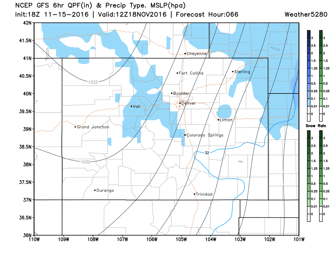
You can see that the GFS, develops a strong surface low over Southeast Colorado on Thursday afternoon. That strong low moves quickly to the east, but gives us a decent shot of rain and snow showers late Thursday afternoon and evening.
Temperatures will rapidly drop through the 40s and 30s, and likely end up in the upper 20s by evening.
Not to be left out...the wind. All of those black lines are in the maps above are isobars, which are equal lines of barometric pressure. The more lines you see, the greater the pressure changes over a short distance. Thus, the more lines you see, the stronger the wind will blow. We think gusts over 45 mph will be likely, and possibly even stronger gusts on the Southeast Plains. So, some blowing dirt will be possible... especially over Southeast Colorado.
Snowfall Potential Thursday AM-Friday AM:
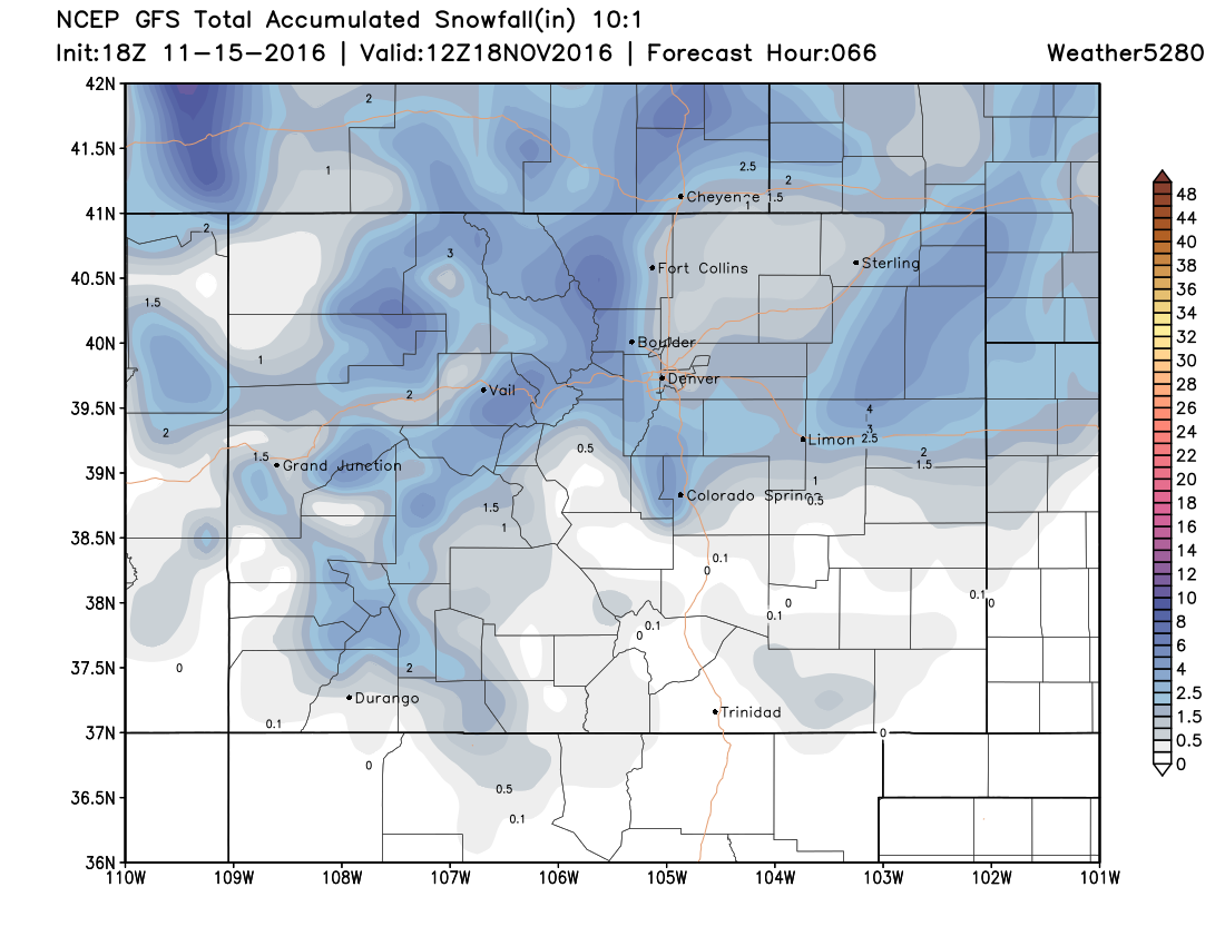
A few things about the map above:
- The mountains will see some accumulating snow.
- Due to the strong north wind that this storm will produce, the downsloping (sinking air) off of the Cheyenne Ridge will likely limit snowfall for much of Denver.
- That same north wind will produce upsloping (rising air) over the Palmer Divide, which should allow for some light accumulations.
- Conversely, once that strong north wind tops the Palmer Divide the downsloping (sinking air) effect will limit snowfall amounts from Co Springs to Pueblo.
- There could also be a secondary bullseye on the Northeast Plains, but some uncertainty exists right now about that area. Something to watch though.
Summary
-
While this storm is taking "an ok track", it is likely moving too fast to produce a huge impact on our area.
-
VERY warm ground temperatures for this time of year will likely limit the impact of whatever snow does fall. Thus, for areas outside the mountains, main roads might end up remaining wet. Secondary roads may get slick in spots, but feel those areas will likely end up to the south/southeast of Denver (away from city warmth) where temperatures will get colder more quickly. Depending on timing, this could slow the evening commute Thursday.
-
Outside of the mountains, there will likely be a period of time late Thursday afternoon and evening, where travel could become a bit tricky. We think areas between Denver and Monument and between Castle Rock and Limon will see the "worst combination" of wind and snow. Thus, visibility could be reduced and travel slowed...
-
BE PREPARED FOR THE CHANGE! When you leave the house Thursday morning, make sure you take a good coat, hat, and gloves with you. The wind and falling temperatures Thursday afternoon and evening will feel pretty nasty, when compared to the record warmth we've been feeling. Also, fill your car up with gas Wednesday night, so you don't have to do it on Thursday.
There is still some time for change with this storm, but the main elements appear to be on track. We'll be following the latest model information and be providing frequent updates on the storm's progress both here and on Twitter.